US Autumn Travel Alert: Dangerous Surf, Dense Fog, and Mountain Snow Threaten Tourist Routes

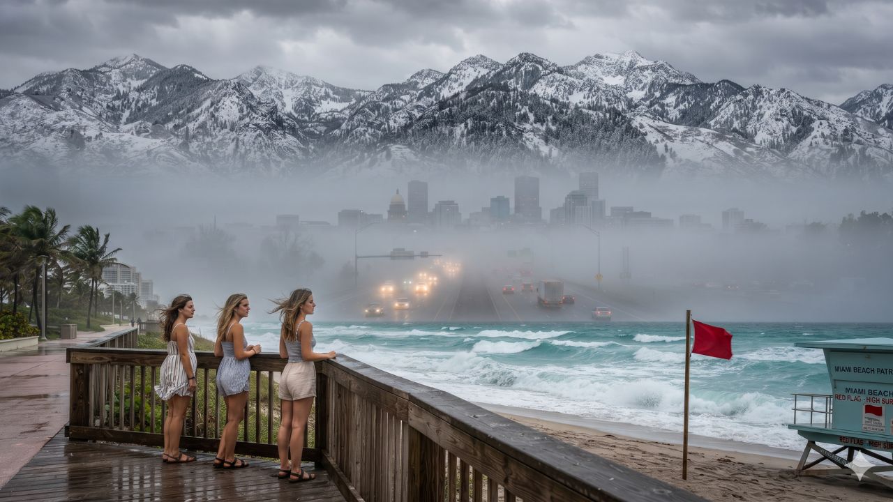
Image generated by AI
Clear, cloudless skies across South Florida often lure beachgoers into a false sense of safety, yet beneath calm sunshine, massive six- to seven-foot breaking swells and treacherous rip currents are sweeping across Atlantic beaches without a single drop of rain. On Monday, 2 November 2026, the National Weather Service issued a synchronized series of localized weather advisories spanning three distinct geographic zones across the United States. While coastal Broward and Palm Beach counties confronted punishing ocean surges and saltwater street flooding through Tuesday, 3 November, dense radiation fog choked the high plains of eastern Colorado, dropping ground visibility at Denver International Airport to roughly 0.13 miles. Simultaneously, the higher passes of Utah's Wasatch and western Uinta mountain ranges faced early-season snow squalls packing 45 mph wind gusts and up to four inches of fresh accumulation.
Autumn Weather Fault Lines: Divergent Travel Risks Across Florida, Colorado, and Utah
The onset of November frequently produces volatile transitions across North American transit corridors. Rather than a singular nationwide winter storm, the atmospheric pattern on 2 November created distinct regional hazards that tested travelers across coastal highways, metropolitan airports, and alpine recreational routes.
Along the Atlantic coast of South Florida, oceanfront communities throughout Fort Lauderdale, West Palm Beach, and neighboring barrier islands faced dual marine threats. The combination of seasonal king tides and strong onshore winds pushed ocean swells directly into coastal inlets, triggering a coastal flood advisory valid until 7 pm Eastern Standard Time on Tuesday, 3 November. Concurrently, a high rip current risk was placed in effect through Tuesday evening, following a high surf advisory that began during the pre-dawn hours of Monday. While the six- to seven-foot breaker warnings specifically targeted Broward and Palm Beach shores, visitors frequenting Miami-Dade beaches to the south were cautioned to examine localized lifeguard flags, as dangerous ocean currents routinely disregard county borders.
Over one thousand miles to the northwest, Denver experienced an abrupt nocturnal temperature drop that trapped moisture close to the ground. At 3:13 am Mountain Standard Time on 2 November, the National Weather Service activated a dense fog advisory extending until 8 am across Denver, Aurora, Greeley, Brighton, Littleton, and the perimeter of Denver International Airport. Surface visibility plummeted well below one-quarter mile, with official airfield monitors recording sightlines tightening to approximately 0.13 miles during peak morning flight bank departures.
Simultaneously in the central Rockies, high-elevation corridors in Utah transitioned rapidly into winter driving conditions. The weather advisory concentrated on the Wasatch Mountains south of Interstate 80 alongside the western Uinta range, covering outdoor recreation gateways including Alta, Brighton, Moon Lake, and the scenic Mirror Lake Highway. Between midnight and 11 am Mountain Standard Time on Monday, the system deposited two to four inches of heavy alpine snow driven by wind gusts reaching 45 mph, creating slick pavement and sudden whiteout conditions on steep canyon ascents.
| Travel Region & Corridor | Weather Hazard Identified | Forecast Conditions & Extremes | Active Advisory Window | Ground & Aviation Impact |
|---|---|---|---|---|
| Coastal Broward County, FL | Coastal flooding & rip currents | 6–7 ft breaking surf, seawater wash | Flood alert to 7 pm, rip risk to late evening 3 Nov | Low-lying streets flooded; swimming prohibited |
| Coastal Palm Beach County, FL | Coastal flooding & dangerous surf | 6–7 ft breakers, beachfront erosion | Active through Tuesday evening, 3 Nov | Waterfront road detours; ocean rescues active |
| Miami-Dade Coastal Strip, FL | Localized surf & rip current pull | Strong longshore currents, moderate swell | Ongoing assessment through 3 Nov | Beach flag restrictions; localized tidal pooling |
| Denver Metro & Plains, CO | Dense radiation fog & mist | Visibility under 0.25 miles (0.13 mi at DEN) | 3:13 am to 8:00 am MST, 2 Nov | Highway slowdowns; ground vehicle spacing |
| Wasatch Mountains South of I-80, UT | Early winter snow squalls | 2–4 inches snow, gusts to 45 mph | Valid until 11:00 am MST, 2 Nov | Canyon traction laws enforced; slick switchbacks |
| Western Uinta Mountains, UT | Alpine snow & gale-force gusts | 2–4 inches accumulation, blowing snow | Valid until 11:00 am MST, 2 Nov | High pass slowdowns; tree branch hazards |
Despite the alarming convergence of surf, fog, and snowfall alerts, transport authorities emphasized that the notices did not mandate systemic commercial flight cancelations or nationwide terminal shutdowns. Instead, the hazards remained localized, requiring travelers to manage specific ground transit segments rather than aborting overall travel itineraries.
What Makes These Autumn Atmospheric Inversions and Coastal Surges Unique
Each of these three weather events derives from unique regional topography and seasonal dynamics that frequent visitors often misunderstand.
In South Florida, coastal flooding during early November is frequently a "sunny day" phenomenon known as king tide flooding. High astronomical tides coincide with full or new moons, aligning the gravitational pull of the sun and moon. When steady easterly winds blow across the warm Gulf Stream, ocean water piles against the barrier islands. The seawater backs up through municipal storm drains and spills over low seawalls along Florida State Road A1A, inundating roads in Fort Lauderdale and Hollywood without a cloud in the sky.
In Colorado, Denver's geographic placement within the South Platte River basin creates ideal conditions for radiation fog during autumn. As evening skies clear after warm autumn afternoons, heat radiates into the upper atmosphere. The air immediately above the prairie cools rapidly, condensing moisture into a thick blanket that pools against the Rocky Mountain foothills. Because the cold air is heavier than the warm air above it, an atmospheric lid seals the metropolitan basin until daytime solar radiation breaks the inversion.
In Utah, the Wasatch Range presents an extreme orographic barrier. As moisture-laden Pacific storm fronts push eastward across the Great Salt Lake desert, the air masses are forced abruptly upward over 11,000-foot peaks. This rapid ascent cools the air, triggering intense localized snowfall in Little Cottonwood Canyon (housing Alta) and Big Cottonwood Canyon (housing Brighton) while the Salt Lake Valley floor just twelve miles away remains entirely dry.
Visitor Insider Tips: Navigating Surf Flags, Alpine Canyons, and Prairie Fog
Handling these disparate weather events requires hyper-specific local tactics rather than generic travel advice.
- South Florida Ocean Etiquette and Seawater Hazards: When visiting beaches in Fort Lauderdale, Delray Beach, or West Palm Beach, never enter the water when red flags fly. A rip current moves faster than an Olympic swimmer. If pulled outward, remain calm, tread water, and swim parallel to the shoreline until clear of the narrow channel before angling back toward the sand. On the road, never drive a rental car through standing coastal floodwater; salt water is intensely corrosive and causes immediate electrical damage.
- Denver Airport Morning Transit Workarounds: If flying out of Denver International Airport during a dense fog advisory, skip highway driving along Peña Boulevard or the E-470 tollway. Instead, take the Regional Transportation District (RTD) A Line commuter train from Denver Union Station directly to the terminal. The train runs on dedicated tracks unaffected by surface fog, guaranteeing arrival times when highway traffic slows to a crawl.
- Utah Mountain Canyon Traction Laws: Before driving up State Route 210 toward Alta or State Route 190 toward Brighton, consult the Utah Department of Transportation traffic portal. When winter weather advisories take effect, canyon traction laws become mandatory. All vehicles must be equipped with approved winter snow tires (look for the 3PMSF mountain snowflake symbol) or carry tire chains. Two-wheel-drive vehicles without proper rubber face heavy state police fines and vehicle turnarounds at canyon checkpoints.
Cultural and Environmental Context: Fragile Coastlines and Alpine Watersheds
These weather phenomena spotlight the delicate balance between high-density tourism and fragile local ecosystems.
Along the Florida coastline, persistent high surf accelerates beach erosion, chewing away dunes that protect multi-million-dollar resort corridors. Communities invest millions in sand renourishment projects to rebuild beaches that serve as critical nesting habitats for loggerhead sea turtles. Responsible visitors support conservation by respecting marked dune restoration paths and keeping off sea oat vegetation that anchors fragile coastal sandbanks.
In Utah's Wasatch Range, early snowfall marks the vital replenishment of the metropolitan watershed. The snow falling on Alta and Brighton provides over 60 percent of the drinking water for the Salt Lake Valley. Because of this direct municipal connection, both Big and Little Cottonwood Canyons are designated Protected Watershed areas under strict environmental statutes. Visiting motorists must remember that domestic pets are strictly prohibited from entering these canyons, even inside private vehicles, to prevent water supply contamination.
Colorado's plains also contend with the environmental aftermath of autumnal inversions. When dense fog traps vehicular emissions from the Interstate 25 and Interstate 70 corridors against the mountains, air quality degrades rapidly. By utilizing public transit like the RTD rail network and observing air quality advisories, travelers directly help preserve the crisp mountain atmosphere that defines Rocky Mountain tourism.
FAQ: Traveling Through US Weather Alerts November 2026
Were flights grounded at Denver International Airport during the fog advisory?
No. While runway visibility dropped to around 0.13 miles on 2 November, modern commercial airliners utilize precision instrument landing systems. Flights experienced minor arrival metering delays, but no mass cancellations occurred.
Can I swim in Florida waters during a coastal flood advisory?
No. Breaking waves reaching six to seven feet and intense rip currents make swimming dangerous even for strong swimmers. Always obey lifeguard instructions and stay out of the water when red warning flags are posted.
Are tire chains required to reach ski resorts in Utah during November snow alerts?
Yes, under Utah Department of Transportation Canyon Traction Laws, two-wheel-drive vehicles must carry chains or have approved snow tires when traversing mountain routes like SR-190 and SR-210 during winter weather advisories.
How long does king tide coastal flooding typically last in South Florida?
Coastal flooding peaks during morning and evening high tide cycles, lasting two to three hours per cycle. Waters recede as the tide ebbs, with advisories generally expiring over 24 to 48 hours as winds ease.
[Whether meeting Atlantic swells or tracking alpine squalls across the Rockies, smart travelers let local weather intelligence guide their journey.]
Related Travel Guides
US Flight Disruptions: Over 1,440 Delays and 140 Cancellations Hit Dallas, Miami, and Chicago
Florida Learjet 60 Crash and Evacuations: Palm Beach County Travel Disruptions
US Airport Construction and Road Access Updates: LAX, JFK, DEN, and IAH
This article is for informational purposes. Flight routes, passenger regulations, visa rules, and transit advisories are subject to change by airlines and aviation authorities. Readers are advised to verify schedules and travel documentation with relevant carriers and border agencies before departure.
Related Stories
USA Weather Alert 2026: Dangerous Surf in Florida, Dense Fog in Denver, and Mountain Snow in Utah

France Rail Strike Grips Paris Terminals and Shuts Regional Train Networks Ahead of Peak Autumn Travel