
10 Best Grand Canyon to Zion Road Trips Reddit Travelers Recommend in 2026
Discover 10 unforgettable Grand Canyon to Zion road trip itineraries recommended by Reddit travelers in 2026, featuring scenic byways, slot canyons, and permit tips.

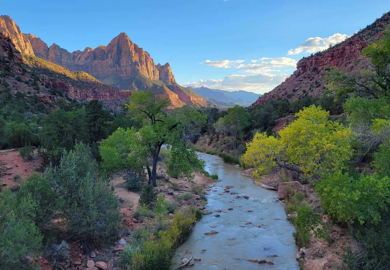
Photo of The Watchman at sunset in Zion National Park
Connecting the mile-deep chasm of the Colorado River with the towering monolithic Navajo sandstone walls of Zion Canyon, the corridor linking Grand Canyon National Park to Zion is the holy grail of American road-tripping. On paper, the direct overland journey covers roughly 250 miles and can technically be driven in under five hours. But anyone who treats this stretch of Arizona and Utah as a routine interstate commute is missing one of the densest concentrations of world-class geological wonders on the planet.
Within this arid transition zone between the Colorado Plateau and the Great Basin, you will encounter the swirling turquoise waters of Horseshoe Bend, the dizzying steel span of Navajo Bridge, the wind-rippled coral dunes of Kanab, and high-altitude alpine forests where endangered California condors roost on crimson cliffs. Veteran road-trippers universally caution that the real magic lies not in rushing between entrance gates, but in tailoring your route to your vehicle type, seasonal weather, and appetite for off-the-beaten-path adventure.
Whether you are seeking a fast, family-friendly scenic cruise or a rugged multi-day backcountry loop across public lands, here are the 10 best Grand Canyon to Zion road trips recommended by community-tested itineraries for the 2026 travel season.
Grand Canyon to Zion Road Trip Comparison
| Itinerary & Route | Distance & Drive Time | Defining Landscape Highlight | Key Permit & Practical Tip |
|---|---|---|---|
| 1. The Classic Highway 89 Corridor | 250 miles (5–7 hours with stops) | Horseshoe Bend & Zion-Mount Carmel Tunnel | Arrive at Horseshoe Bend before 9 AM; check tunnel RV dimensions |
| 2. The North Rim Alpine Plateau Shortcut | 120 miles (2.5–3.5 hours) | 8,800-ft forested rim at Point Imperial | Seasonal access only (mid-May to mid-October); lowest crowds |
| 3. Vermilion Cliffs & Marble Canyon Byway | 260 miles (1–2 days) | Historic Navajo Bridge & Colorado River gorge | Walk the historic pedestrian bridge to spot roosting condors |
| 4. The Monument Valley & Goosenecks Detour | 390 miles (2–3 days) | Iconic red sandstone mittens & San Juan goosenecks | Book Navajo tribal park tours early; watch for livestock on US-163 |
| 5. Route 66, Hoover Dam & Valley of Fire | 380 miles (2–3 days) | Historic neon towns & Aztec sandstone waves | Avoid midday summer heat in Valley of Fire (ground temps > 130°F) |
| 6. Cottonwood Canyon Road Backcountry Run | 280 miles (2–3 days) | Grosvenor Arch & yellow sandstone hoodoos | Strictly dry weather only; clay road becomes impassable when wet |
| 7. Coral Pink Sand Dunes & Kanab Adventure | 265 miles (1–2 days) | Shifting orange sand dunes & western movie history | Rent sandboards at visitor center; lower tire pressure for off-road trails |
| 8. Desert View to Antelope Canyon Corridor | 270 miles (1–2 days) | Mary Colter's stone watchtower & slot canyons | Mandatory advance booking for Antelope Canyon Navajo guided tours |
| 9. Bryce Canyon & Red Canyon Triangle Loop | 340 miles (2–3 days) | Vast amphitheater of thousands of red hoodoos | High elevation (8,000+ ft); pack warm layers even during summer |
| 10. The Arizona Strip & Toroweap Remote Rim | 310 miles (2–3 days) | Sheer 3,000-ft vertical drop to Colorado River | High-clearance true 4WD mandatory; carry 2 spare tires and extra fuel |
1. The Classic Highway 89 Corridor via Page & Horseshoe Bend
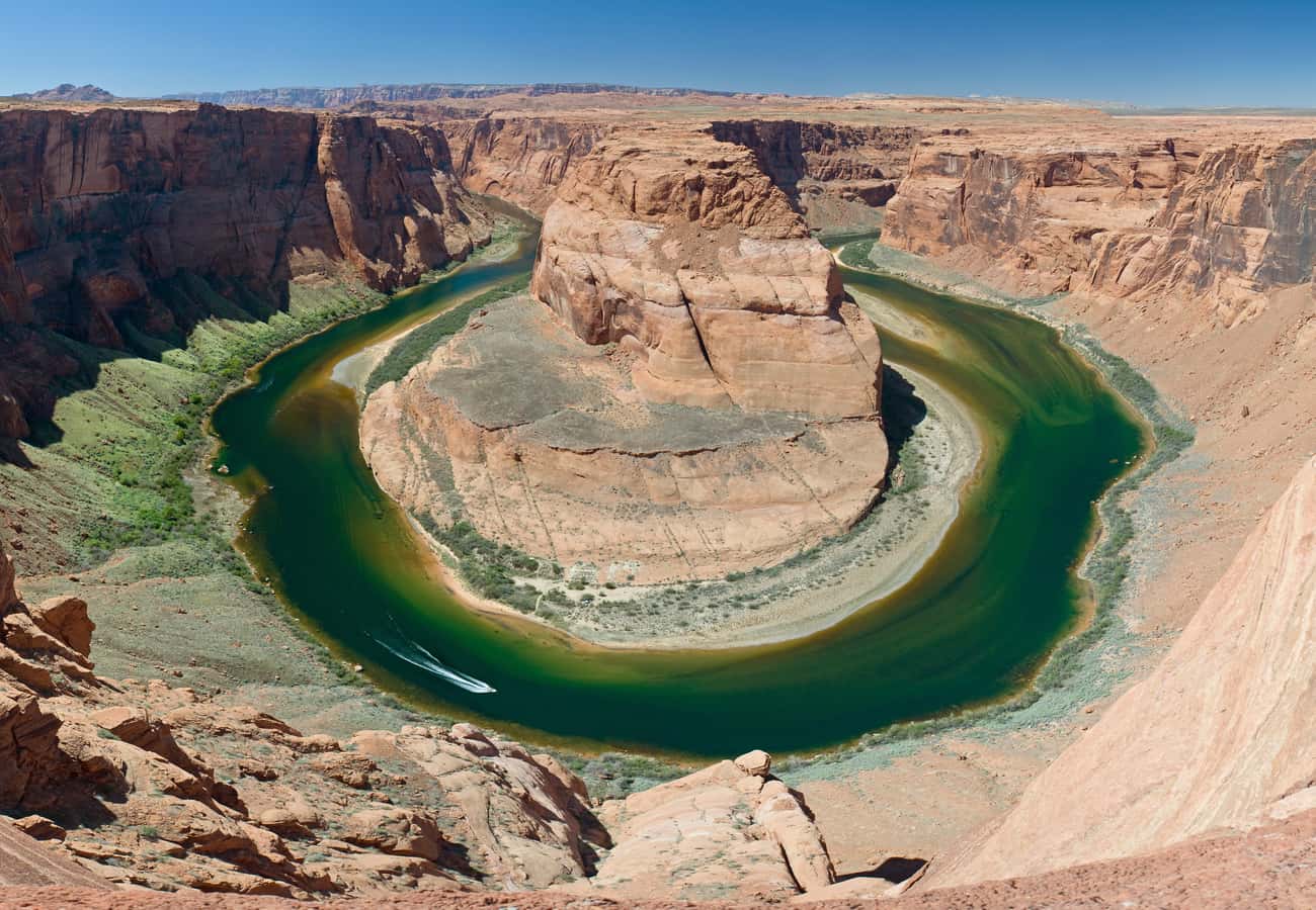
The undisputed baseline itinerary for first-time visitors, the Classic Highway 89 Corridor departs Grand Canyon South Rim via Desert View Drive, drops into the painted desert flats toward Cameron, runs north to Page, and cuts west across the Utah border through Kanab before entering Zion via Highway 9.
The headline attraction on this route is Horseshoe Bend, located just five miles south of Page along US-89. Here, the emerald-green Colorado River carves a dramatic 270-degree horseshoe curve around a colossal 1,000-foot sandstone pillar. An easy, 1.5-mile round-trip accessible path leads to the canyon rim. Because tour buses begin arriving in waves by mid-morning, seasoned road-trippers schedule this stop for early morning or golden hour.
Continuing west through Kanab, the drive reaches an unforgettable climax along the Zion-Mount Carmel Highway. The roadway curves around surreal, cross-bedded sandstone mounds before entering the 1.1-mile cliffside tunnel opened in 1930. Emerging from the tunnel into Zion Canyon reveals towering vertical cliffs like the East Temple and the Great Arch of Zion. Note that standard passenger vehicles pass freely, but RVs and campervans exceeding 11'4" tall or 7'10" wide must purchase a $15 tunnel escort permit from Zion National Park rangers.
2. The North Rim to Zion Alpine Plateau Route
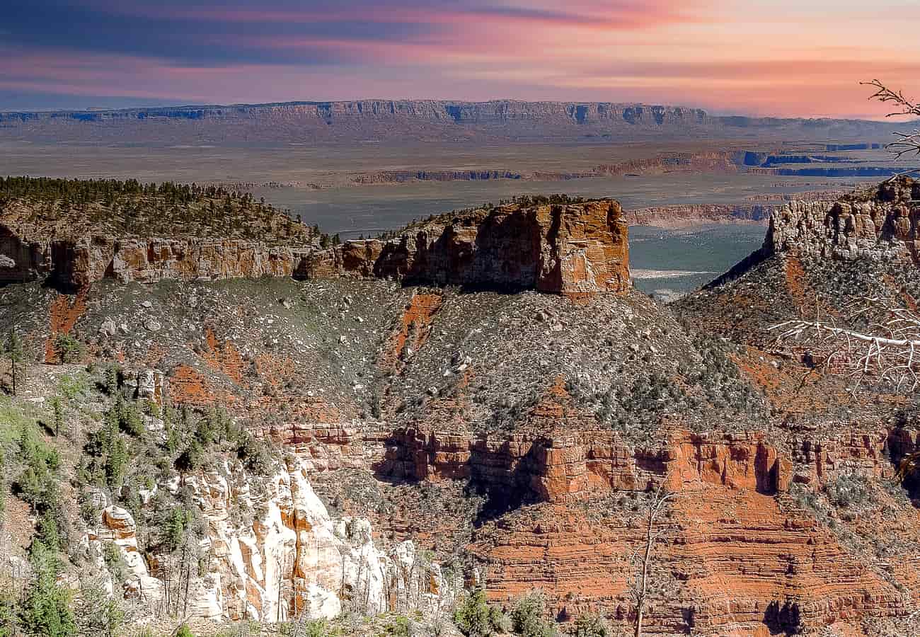
If you are traveling between mid-May and mid-October, routing your journey from the Grand Canyon North Rim to Zion cuts the driving distance down to just 120 miles while delivering a totally different Southwestern ecosystem. Sitting at an average elevation of 8,200 to 8,800 feet, the North Rim receives fewer than ten percent of total Grand Canyon visitors.
The route departs from the historic Grand Canyon Lodge along Arizona Highway 67, winding through lush meadows of the Kaibab National Forest lined with trembling aspen and blue spruce. Make a morning detour to Point Imperial, the highest point on either rim at 8,803 feet. From this dizzying perch, the canyon walls drop away into the Painted Desert and the distant crimson bands of the Vermilion Cliffs.
Descending north to Jacob Lake, stop at the historic Jacob Lake Inn for fresh baked cookies before descending via US-89A to Fredonia and Kanab. Because this route avoids the low-desert heat of Lake Powell, it remains pleasantly cool even in July and August, offering a refreshing mountain prelude to the towering red amphitheaters of Zion.
3. The Vermilion Cliffs & Marble Canyon Historic Byway
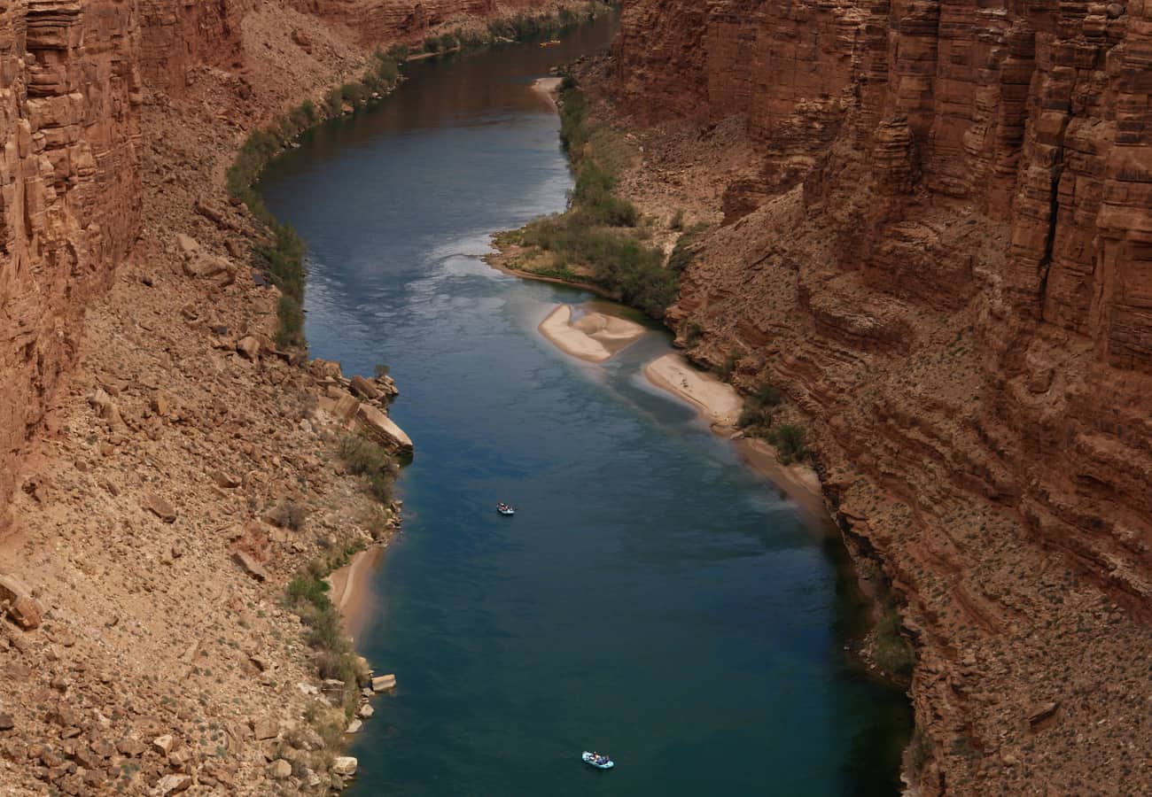
For travelers fascinated by pioneering river history and dramatic geology, branching onto US Route 89A at Bitter Springs offers an atmospheric detour skirting the foot of the 3,000-foot Vermilion Cliffs.
The signature crossing on this route is Navajo Bridge, where two steel arch spans bridge the narrow red rock gorge of Marble Canyon 467 feet above the rushing Colorado River. Walk out onto the original 1929 historic bridge, now reserved exclusively for pedestrians, and peer into the steel support trusses below. This is the premier wild release and nesting site for the critically endangered California condor; visitors frequently spot these enormous birds, boasting ten-foot wingspans, sunning themselves on the iron framework.
A short spur road from the bridge leads to Lees Ferry, the historic river crossing point established by pioneer John D. Lee in 1872 and the official launch point for all whitewater rafting expeditions entering the Grand Canyon. From Marble Canyon, the road climbs up the dramatic switchbacks of the Kaibab Plateau before connecting to Kanab and the east entrance of Zion.
4. The Monument Valley & Goosenecks Grand Detour
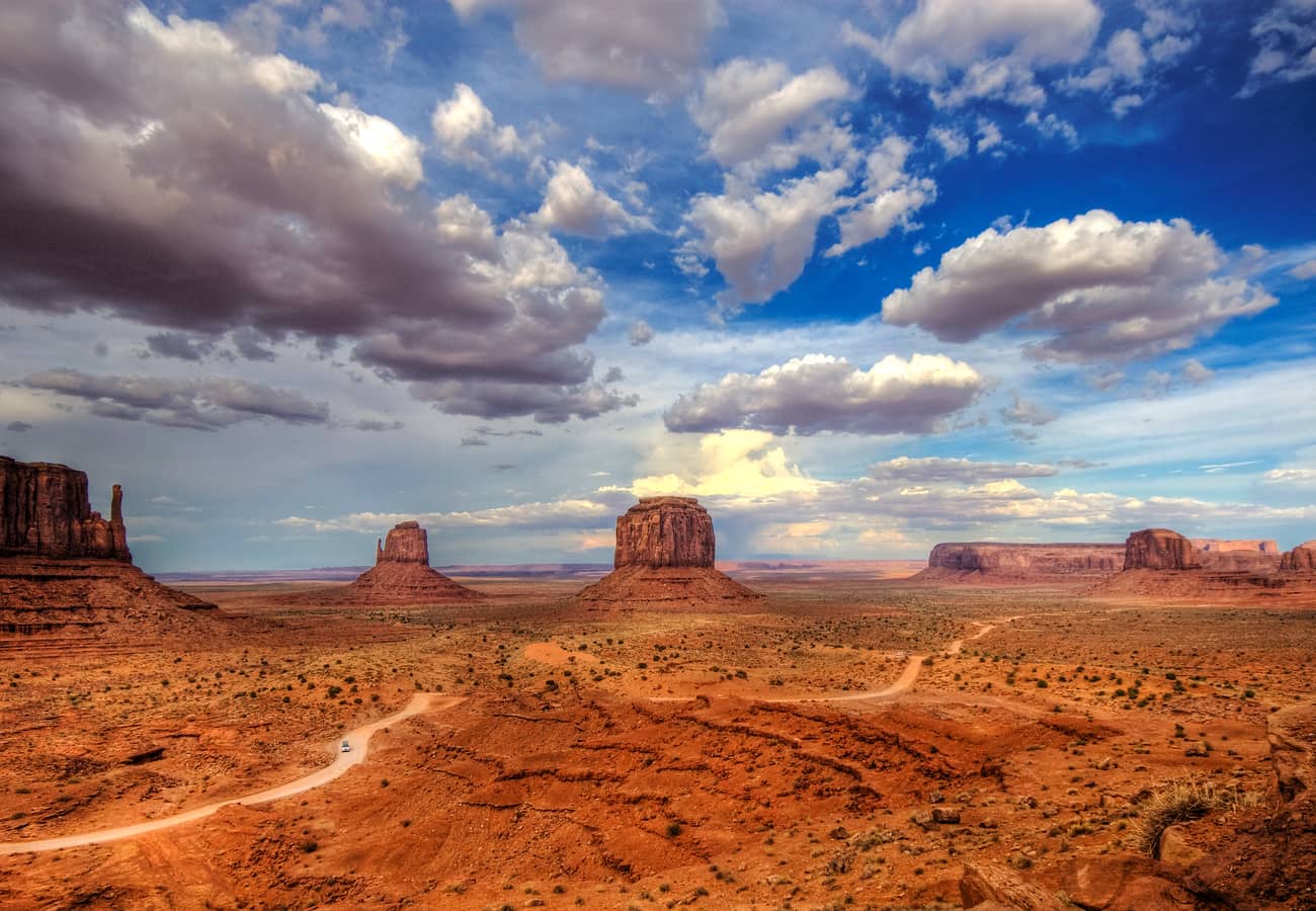
While adding approximately 140 miles to the direct trip, extending your route eastward through the Navajo Nation to Monument Valley Navajo Tribal Park transforms your journey into an iconic cinematic pilgrimage.
Driving north along US-163 toward the Utah border delivers the famous straightaway vista featured in Forrest Gump, where the East and West Mitten Buttes rise 1,000 feet straight out of the red desert floor. Motorists can self-drive the 17-mile unpaved Valley Drive or hire a local Navajo guide to access restricted backcountry arches and ancestral petroglyph panels.
Just across the Utah state line near Mexican Hat, make brief stops at Goosenecks State Park, where the San Juan River twists through a labyrinthine 1,000-foot canyon over six river miles while progressing only one linear mile, and the surreal balanced formation of Mexican Hat Rock. From there, loop back west along Utah Route 98 toward Page and continue onward to Zion.
5. The Route 66, Hoover Dam & Valley of Fire Circuit
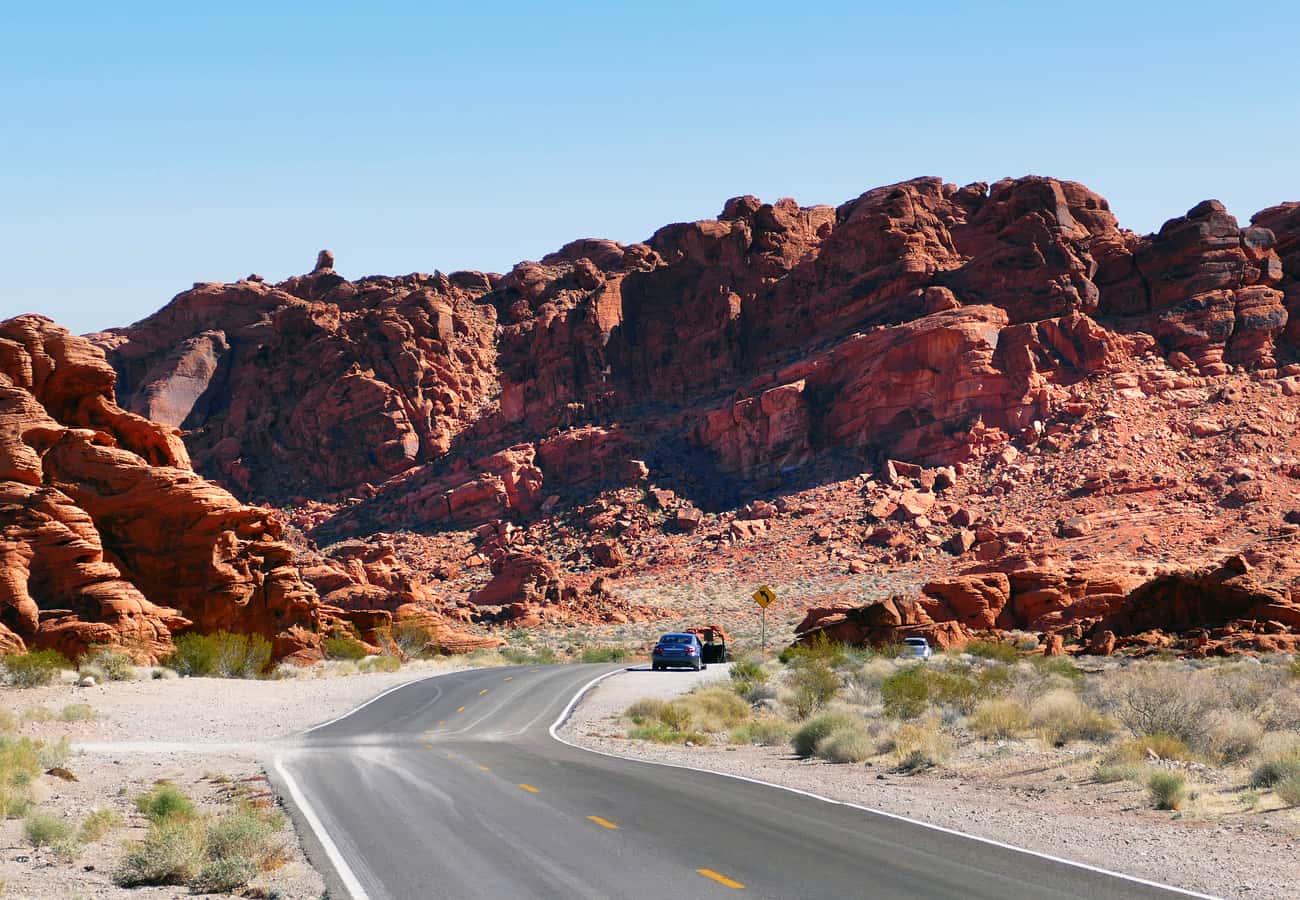
If you are starting at Grand Canyon South Rim and prefer a sweeping western loop that incorporates classic Americana, engineering marvels, and fiery desert landscapes, head west on Interstate 40 to pick up historic sections of Route 66.
Pause in Seligman, the birthplace of the Historic Route 66 revival, to browse neon-lit diners, retro gas stations, and quirky Americana gift shops. Continue west through Kingman before turning north to cross the mighty Hoover Dam, marveling at the colossal Art Deco concrete spillways holding back Lake Mead.
Before reaching Zion, take the scenic cutoff through Nevada's oldest preserve, Valley of Fire State Park. The park’s scenic drive meanders through 40,000 acres of brilliant Aztec sandstone that glows like liquid embers in the late afternoon sun. Highlights include the striped pastel ripples of the Fire Wave and ancient petroglyph panels carved into the rock at Atlatl Rock. From Valley of Fire, rejoin I-15 north toward St. George and enter Zion from the south through Springdale.
6. The Cottonwood Canyon Road Backcountry Run
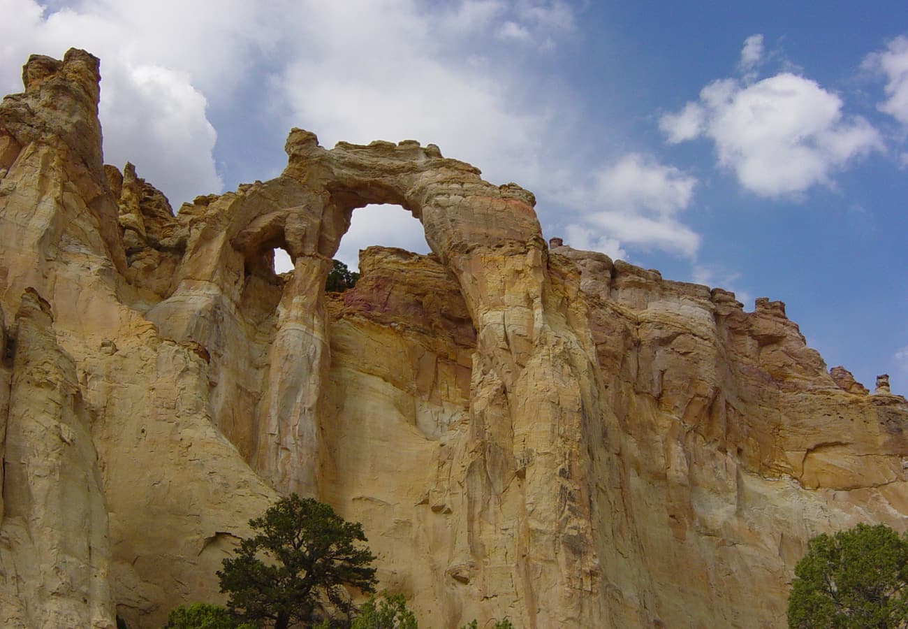
For self-reliant drivers equipped with high-clearance SUVs, Cottonwood Canyon Road (BLM Road 400) is one of the most rewarding unpaved scenic byways in the American West. Cutting 46 miles through the heart of Grand Staircase-Escalante National Monument, this dirt track connects Highway 89 near Church Wells with Highway 12 near Cannonville.
The road traces the East Kaibab Monocline (The Cockscomb), a massive geological fold where jagged layers of gray, white, and golden sandstone thrust upward at dramatic 45-degree angles. A short side trail leads to Grosvenor Arch, a rare and colossal double arch of creamy yellow sandstone soaring 150 feet above the valley floor.
Further north, the byway skirts the multi-hued sedimentary stone chimneys of Kodachrome Basin State Park before connecting to Utah Route 12, allowing drivers to explore the hoodoos of Bryce Canyon before descending Highway 89 south toward Zion. Crucial safety warning: Cottonwood Canyon Road is composed of bentonite clay that turns into slick, wheel-clogging mud when wet. Never attempt this drive during or immediately following rainstorms.
7. The Coral Pink Sand Dunes & Kanab Adventure Route
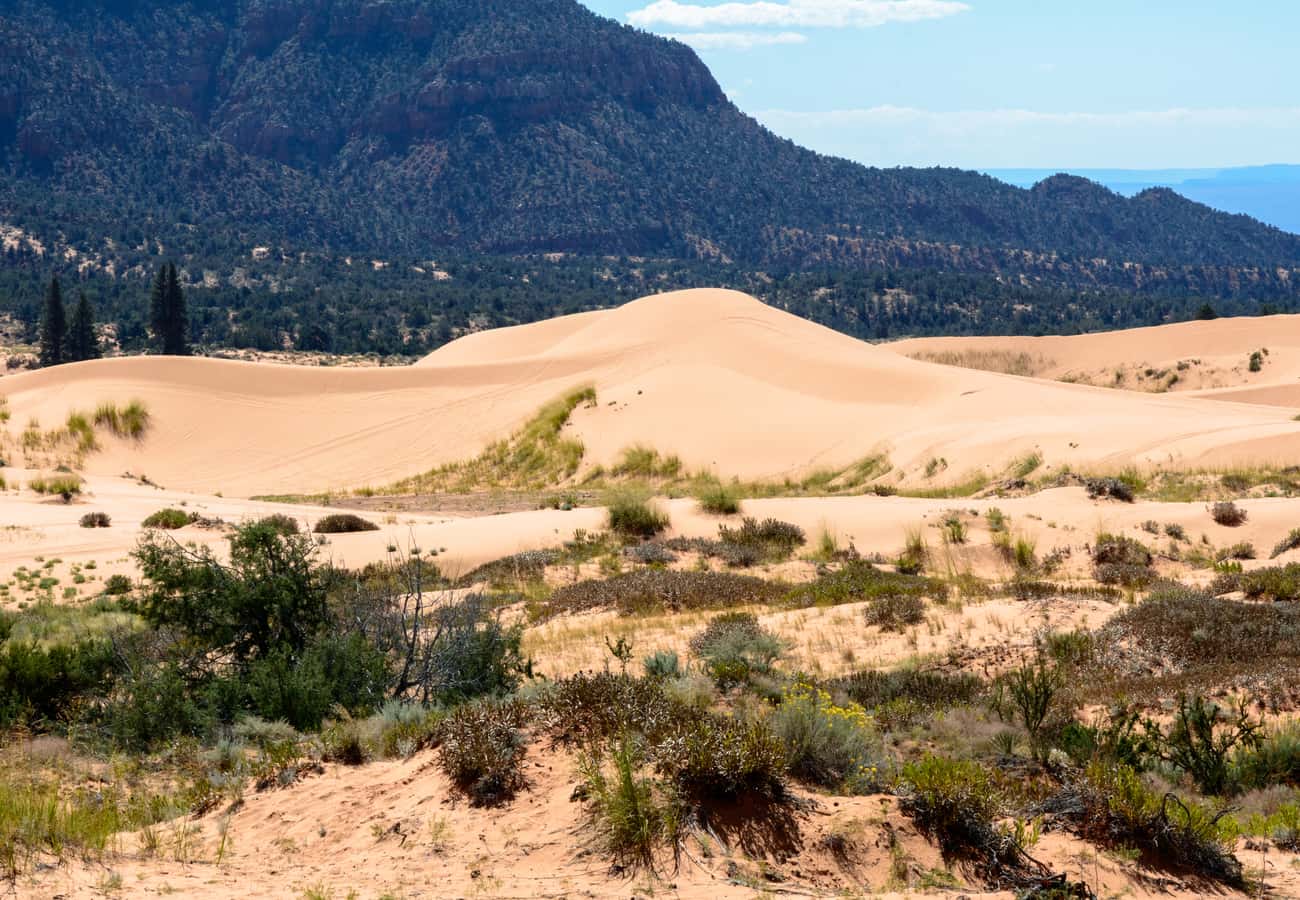
Centering your journey around the historic frontier town of Kanab, Utah—fondly nicknamed "Little Hollywood" due to the hundreds of classic westerns filmed on its red cliffs—provides an ideal base camp packed with hidden gems.
Just 12 miles outside Kanab lies Coral Pink Sand Dunes State Park, a surreal 3,730-acre expanse of shifting, fine-grained salmon-colored dunes formed by the erosion of surrounding Navajo sandstone. Rent a sandboard from the park visitor center to surf the towering 40-foot slipfaces, or explore the quiet perimeter trails on foot during sunrise when temperatures are cool and the morning light intensifies the vivid pink hues.
While in Kanab, animal lovers can tour the expansive red-canyon grounds of Best Friends Animal Sanctuary, the nation's largest no-kill animal haven. To enter Zion from Kanab, take US-89 north to Highway 9, entering through the East Gate where petrified sand dunes and bighorn sheep frequently greet drivers along the road.
8. Desert View Watchtower to Antelope Canyon Corridor
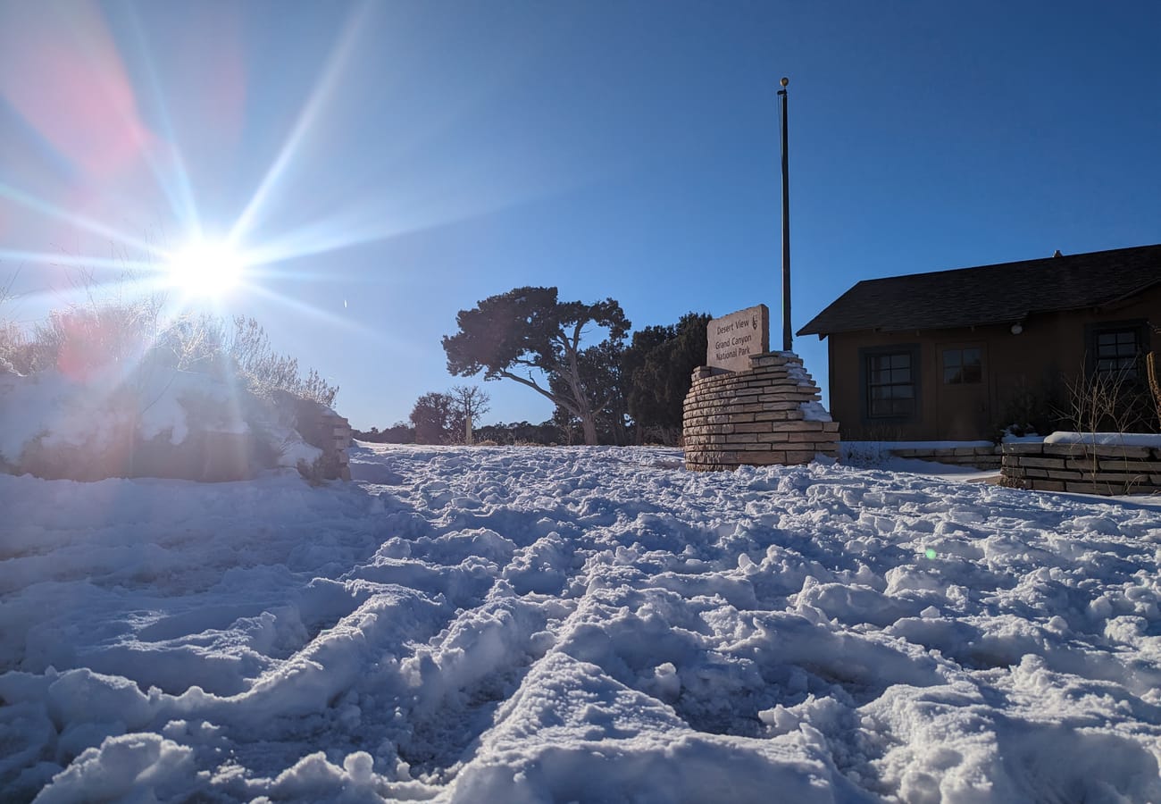
Departing Grand Canyon South Rim via Desert View Drive offers a majestic sequence of elevated canyon vistas that most tourists miss by exiting solely through the main South Entrance.
The pinnacle of this 25-mile park road is the Desert View Watchtower, designed in 1932 by architect Mary Colter. Inspired by ancestral Puebloan stone towers, this 70-foot masonry structure perches directly over the canyon edge, featuring internal observation decks adorned with murals by Hopi artist Fred Kabotie and panoramic views of the Colorado River making its sharp northward bend.
After descending to Cameron and heading north toward Page, book an afternoon excursion into Upper or Lower Antelope Canyon. Carved into subterranean sandstone by centuries of flash flooding, these narrow slot corridors channel shafts of sunlight into radiant beams that illuminate swirling purple and orange stone walls. Note that Antelope Canyon is located on sacred Navajo land and requires booking licensed guided tours weeks or months in advance.
9. The Bryce Canyon & Red Canyon Triangle Loop
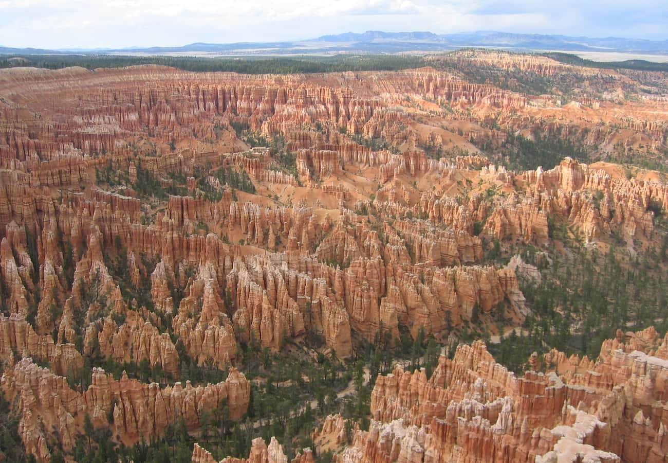
Why visit only two world-renowned parks when you can easily turn your road trip into a legendary trifecta? The Bryce Canyon Triangle Loop detours north along US-89 from Kanab, following Utah Route 12 through the crimson hoodoo arches of Red Canyon before arriving at Bryce Canyon National Park.
Unlike Zion, which is experienced from the bottom of the canyon looking up, Bryce Canyon is viewed from the high rim looking down into a vast natural amphitheater crammed with thousands of delicate, frost-carved rock spires known as hoodoos. Walk along the rim between Sunset Point and Sunrise Point, or hike the world-famous Queen’s Garden and Navajo Loop trail to walk among the towering stone pillars.
After catching the morning alpenglow at Inspiration Point, drive back southwest along scenic Highway 89 and take Route 9 straight into Zion’s east portal. Experiencing the intricate delicate hoodoos of Bryce immediately before the monolithic, colossal cliffs of Zion delivers one of the most striking geological contrasts in the world.
10. The Remote Arizona Strip to Toroweap & Kolob Canyons
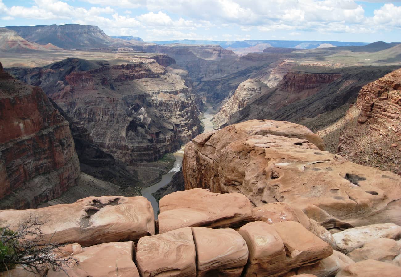
For experienced backcountry drivers seeking complete desert solitude, the journey across the untamed Arizona Strip to Toroweap (Tuweep) Overlook followed by Zion’s secluded Kolob Canyons is the ultimate adventure.
Reaching Toroweap requires navigating 60 miles of unpaved, washboard dirt roads branching off Arizona Route 389. The final three miles demand a genuine high-clearance 4WD vehicle with low range to crawl over steep slickrock steps and sharp volcanic rocks. At the rim, there are zero guardrails, commercial facilities, or tour buses—only an abrupt, vertical 3,000-foot limestone drop directly into the roar of Lava Falls Rapid on the Colorado River below. Day-use vehicle permits must be booked ahead on Recreation.gov.
After returning north to Utah, bypass the busy main canyon of Zion and head northwest along I-15 to the Kolob Canyons district. Here, a five-mile scenic drive climbs to breathtaking viewpoints overlooking massive 2,000-foot finger canyons carved into vibrant crimson Navajo sandstone, where uncrowded trails like Timber Creek Overlook offer peaceful vistas stretching into Nevada.
Practical Advice for the Grand Canyon to Zion Road Trip
- Understand the Zion-Mount Carmel Tunnel Rules: The historic tunnel on Highway 9 features tight clearances. Vehicles larger than 11 feet 4 inches tall or 7 feet 10 inches wide (including mirrors and awnings) require a $15 tunnel escort permit, during which park rangers hold oncoming traffic to let oversized rigs navigate down the center of the road.
- Master the Shuttle Systems: Both Grand Canyon South Rim (Hermit Road / Kaibab Rim) and Zion Canyon Scenic Drive operate mandatory seasonal shuttle buses to prevent gridlock. Leave your vehicle in designated visitor center parking lots early in the morning and ride the free park shuttles.
- Secure Slot Canyon & Hiking Permits Early: Highly coveted experiences like Angels Landing in Zion require lottery permits through Recreation.gov. Likewise, Upper and Lower Antelope Canyon tours in Page sell out months ahead during peak travel season.
- Respect Extreme Heat and Flash Floods: Summer daytime temperatures in Page and low-elevation desert washes regularly exceed 105°F, while monsoon season (July–September) creates sudden, life-threatening flash floods in slot canyons. Always carry at least one gallon of drinking water per person and check local flash flood forecasts before entering any canyon.
Frequently Asked Questions
How long does it take to drive from Grand Canyon to Zion?
The direct drive between Grand Canyon South Rim and Zion Canyon via US-89 takes about 4.5 to 5 hours (approximately 250 miles) without stops. However, allowing a full day (8 to 10 hours) lets you comfortably explore Horseshoe Bend, Cameron Trading Post, and the scenic overlooks along Highway 9.
Which route is better: Grand Canyon South Rim or North Rim to Zion?
The North Rim is geographically closer to Zion (only 120 miles / 2.5 hours) and offers cooler alpine temperatures with a fraction of the crowds, but it is only open seasonally from mid-May to mid-October. The South Rim is open 365 days a year and provides the classic, panoramic Grand Canyon views that first-time visitors expect.
Should I visit Grand Canyon first or Zion first?
Both directions are spectacular, but driving from the Grand Canyon north to Zion allows you to enter Zion via the dramatic Mount Carmel Highway and tunnel, providing a jaw-dropping initial descent into Zion Canyon that is widely considered the best entrance experience in the national park system.
Do I need a separate park pass for both Grand Canyon and Zion?
Individual standard vehicle entrance fees are $35 per park. If you plan to visit both parks (or add Bryce Canyon or Glen Canyon Recreation Area), purchase the $80 America the Beautiful Interagency Annual Pass at the first park gate to save money.
From the timeless silence of the Grand Canyon's ancient stone rims to the soaring cathedral walls of Zion Canyon, driving this legendary Southwest corridor proves that the open road is still the ultimate American adventure.
Related Travel Guides
Disclaimer
This article is for informational and educational purposes only. It does not constitute legal, financial, or professional advice. While we strive to provide accurate and up-to-date information, travel policies, regulations, and conditions change rapidly. Always verify information with official sources before making travel decisions. Nomad Lawyer makes no representations about the accuracy, reliability, completeness, or suitability of the information provided. Readers should consult qualified professionals for advice specific to their circumstances. The views expressed in this article are those of the author and do not necessarily reflect the views of Nomad Lawyer.
Raushan Kumar
Founder & Lead Developer
Full-stack developer with 11+ years of experience and a passionate traveller. Raushan built Nomad Lawyer from the ground up with a vision to create the best travel and law experience on the web.
Learn more about our team →