
10 Best Pacific Coast Highway Stops Reddit Travelers Say You Should Not Miss in 2026
Discover the 10 must-see Pacific Coast Highway stops recommended by Reddit travelers in 2026, from Big Sur's dramatic cliffs to hidden coves and sea elephant rookeries.

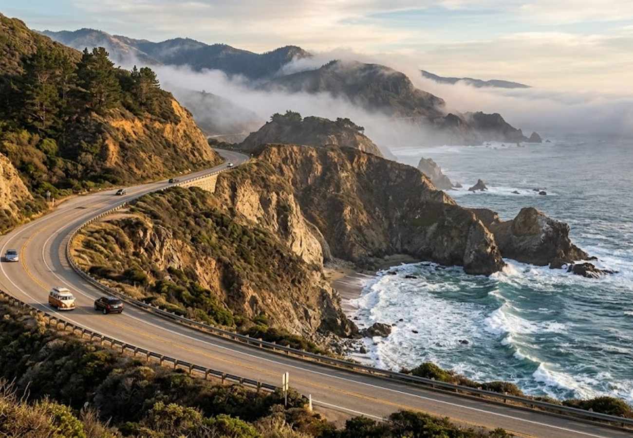
Image generated by AI
Carving along the knife-edge boundary where the Santa Lucia Mountains crash directly into the Pacific Ocean, California's Pacific Coast Highway (Highway 1) remains the undisputed gold standard of American coastal road trips. Few stretches of asphalt on earth rival the dramatic 140-mile run between Monterey and San Luis Obispo. Here, cobalt ocean swells hammer jagged sea stacks, ancient redwood groves climb misty ravines, and high-arch concrete bridges span canyons hundreds of feet above churning white surf.
Yet conquering Highway 1 in 2026 requires far more than setting a GPS and stepping on the gas. Years of severe atmospheric rivers and monumental coastal landslides—including the prolonged restoration at Regent's Slide—have fundamentally transformed how savvy motorists approach Big Sur. Seasoned road-trippers universally insist on driving strictly north-to-south to keep the ocean right at your passenger side, avoiding the agonizing frustration of turning across oncoming blind curves into crowded turnouts.
Whether you are embarking on your inaugural coastal pilgrimage or returning to witness the newly stabilized cliffs, here are the 10 essential Pacific Coast Highway stops Reddit travelers insist you cannot afford to skip in 2026.
Pacific Coast Highway Stops Comparison
| Stop & Location | Milepost / Area | Distinctive Landscape Highlight | Best Time & Crucial Access Tip |
|---|---|---|---|
| 1. Point Lobos State Natural Reserve | Carmel-by-the-Sea | Jade-green coves, harbor seals & Monterey cypress | Arrive by 8:00 AM; parking lots fill completely within 45 minutes |
| 2. Bixby Creek Bridge | Big Sur (Milepost 59.9) | 280-ft historic open-spandrel arch canyon bridge | Early morning or sunset; park at Castle Rock pullout to avoid crossing traffic |
| 3. Point Sur State Historic Park | Big Sur (Milepost 54.1) | 361-ft volcanic rock island with historic 1889 lightstation | Wednesday & weekend mornings; guided walking tours require reservations |
| 4. Pfeiffer Beach & Keyhole Rock | Sycamore Canyon | Rare purple garnet sand & glowing natural sea arch | Late afternoon; single-lane access road closes when lower lot fills |
| 5. Nepenthe Terrace | Central Big Sur | 800-ft cliffside perch with endless Pacific horizons | Mid-afternoon drinks; sit along the outdoor bleacher railing with an Ambrosia burger |
| 6. McWay Falls | Julia Pfeiffer Burns SP | 80-ft pristine tidefall waterfall dropping into a cove | Mid-day to early afternoon; beach access strictly forbidden to preserve fragile ecology |
| 7. Ragged Point | Southern Big Sur border | 300-ft sheer black cliffs & "Million Dollar View" | Late morning coffee stop; walk the portal trail to the cliff overlook |
| 8. Piedras Blancas Rookery | San Simeon | Thousands of wild elephant seals hauled out on sand | Late autumn through winter; free boardwalk access with volunteer docents |
| 9. Morro Rock & Strand | Morro Bay | 576-ft volcanic monolith & resident sea otter nursery | Golden hour sunset; harbor mouth parking lot offers front-row otter watching |
| 10. Montana de Oro Bluff Trail | Los Osos | Sculpted marine terraces, sea caves & crashing surf | Early morning; uncrowded coastal trails without Big Sur traffic bottlenecks |
1. Point Lobos State Natural Reserve (Carmel)
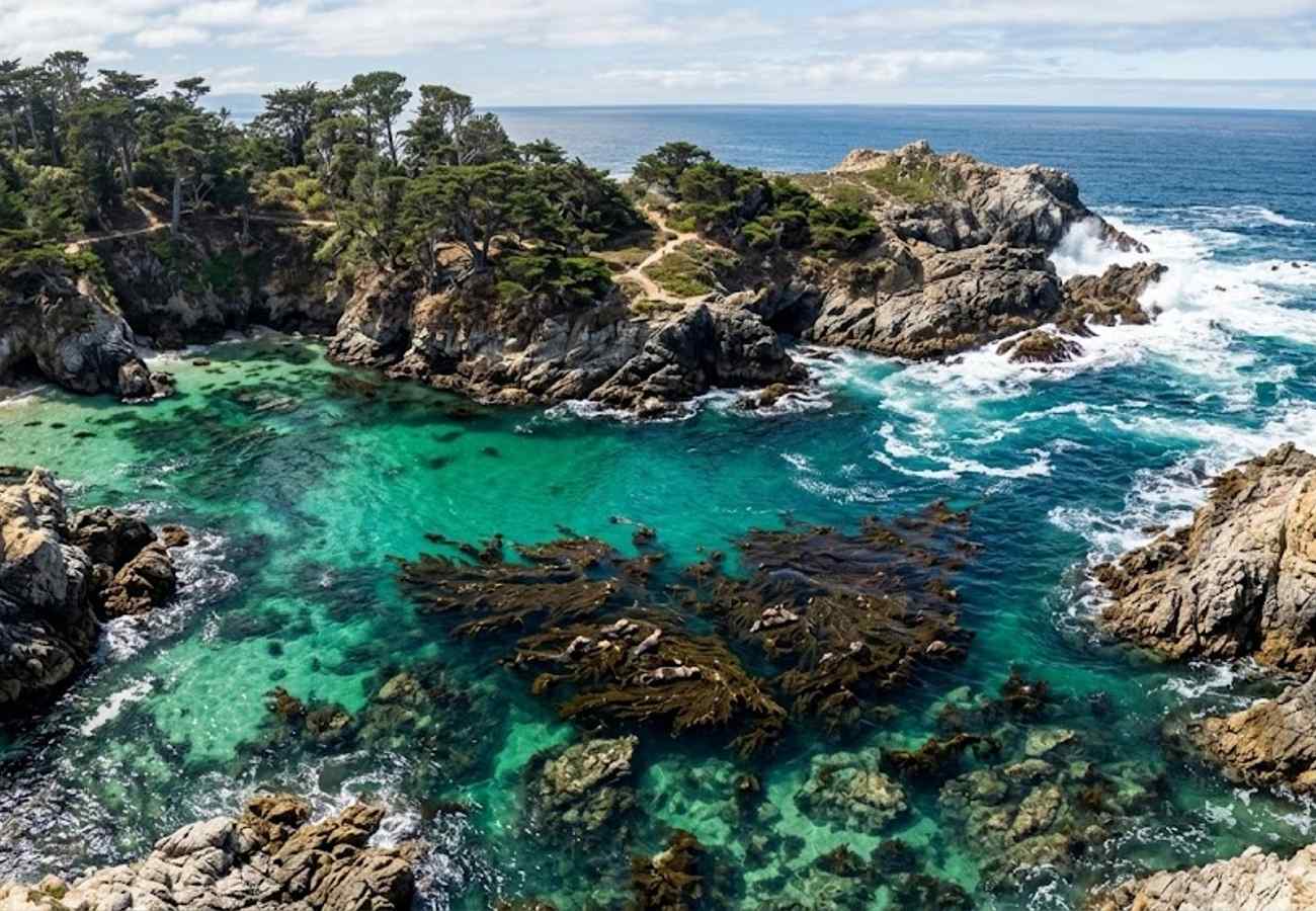
Often revered as the "crown jewel of the California State Park system," Point Lobos State Natural Reserve is located just three miles south of Carmel-by-the-Sea. Renowned landscape painter Francis McComas famously called it the "greatest meeting of land and water in the world," and few who walk its coastal trails would disagree.
The reserve protects rare terrestrial groves of Monterey cypress, clinging tenaciously to sheer granite headlands beaten by pounding ocean spray. Beneath the surface, protected marine reserves host dense kelp forests where southern sea otters float on their backs cracking sea urchins, harbor seals nurse their pups in sheltered inlets, and gray whales spout offshore during seasonal migrations.
The premier trail here is the Cypress Grove Trail, an easy 0.8-mile loop weaving through ancient twisted trees coated in velvet orange lichen. Alternatively, descend the stone staircase to China Cove, where crystal-clear emerald water laps against pristine white sand framed by a natural rock arch. Because park rangers strictly enforce vehicle capacity to prevent environmental degradation, arrive right when gates open at 8:00 AM or be prepared to park along the highway shoulder and walk in.
2. Bixby Creek Bridge (Big Sur)
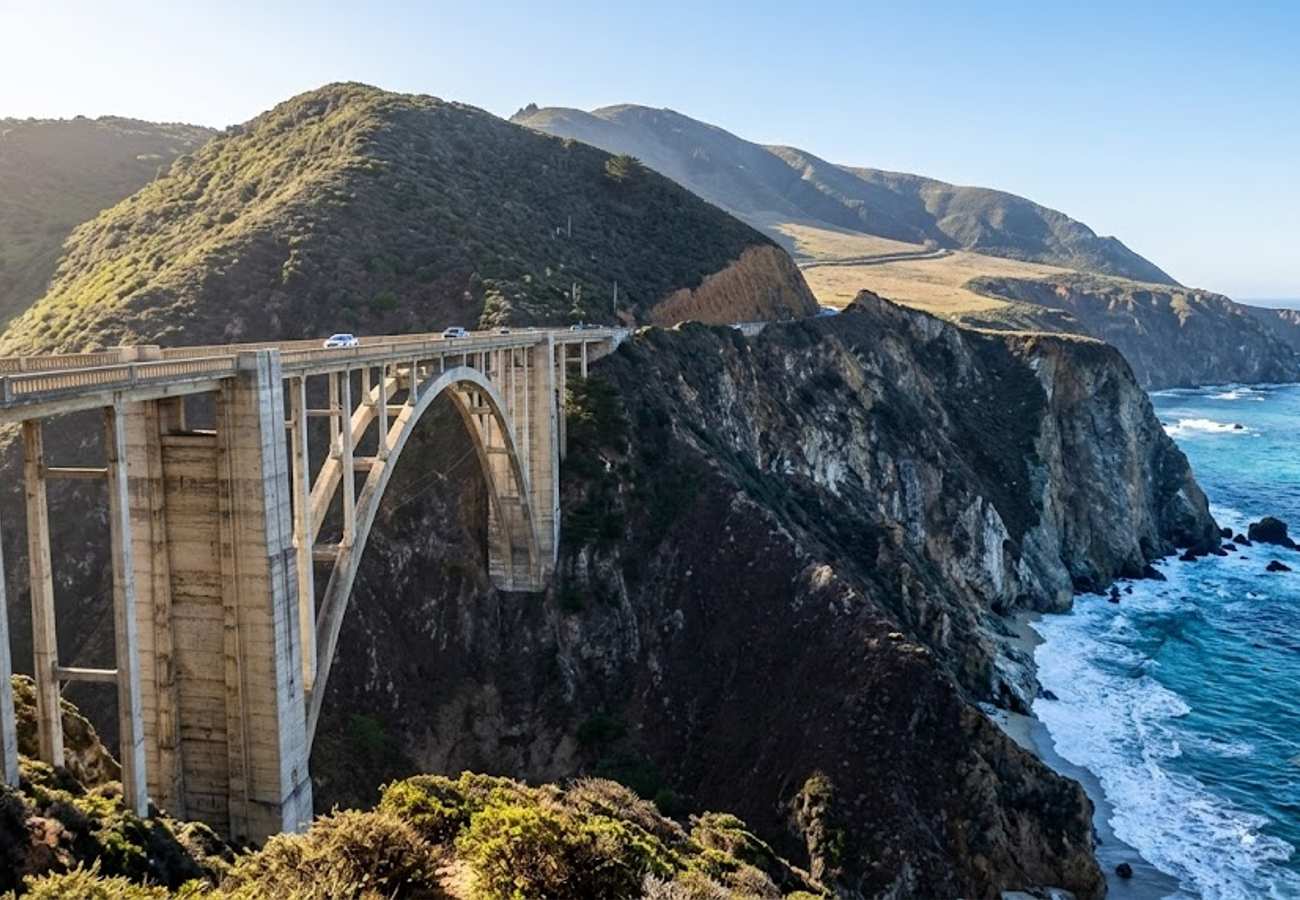
Completed in 1932 for just over $200,000, Bixby Creek Bridge is one of the most photographed bridges on the planet and the defining architectural symbol of Big Sur. Spanning 714 feet across a 280-foot-deep canyon where Bixby Creek rushes into the ocean, the elegant concrete open-spandrel arch stands as a monument to Great Depression engineering.
Before this bridge was erected, coastal travelers faced a treacherous 11-mile inland detour over Old Coast Road that was virtually impassable during winter rainstorms. Today, driving across the bridge offers heart-stopping drops into the turquoise surf on the ocean side and soaring chaparral ridges inland.
To capture the iconic postcard angle without risking your life on the highway, pull into the dirt parking turnout on the northwest side (oceanside) just before crossing if driving southbound. For an elevated perspective that escapes the selfie-stick crowds, walk carefully up the initial stretch of Old Coast Road on the inland side, where the morning sun illuminates the full arch against the turquoise sea.
3. Point Sur State Historic Park & Lighthouse
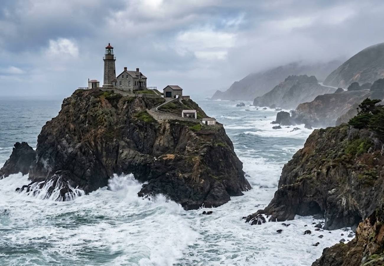
Rising like an ancient fortress from the coastal sand flats, Point Sur is a massive 361-foot-tall volcanic rock island jutting boldly into the Pacific Ocean. Since 1889, the historic Point Sur Lightstation has warned mariners away from one of the most treacherous, fog-choked navigation hazards along the California coast, where dozens of vessels met their demise in the 19th century.
Unlike typical roadside pull-offs, Point Sur is preserved as a living historic park where all the original stone lightkeeper dwellings, oil houses, and cisterns remain intact. Access is available exclusively through volunteer-led walking tours, which guide visitors up the steep half-mile paved roadway climbing the sheer rock face.
The summit provides an astonishing 360-degree vantage over the pounding Pacific breakers and the raw contours of Big Sur's northern coast. Between December and April, the lighthouse balcony serves as an elevated whale-watching platform where migrating gray whales surface right offshore. Advance tour reservations through the California State Parks portal are essential during peak summer and holiday weekends.
4. Pfeiffer Beach & Keyhole Arch (Sycamore Canyon)
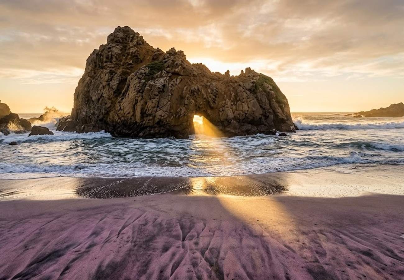
Tucked away at the end of unmarked Sycamore Canyon Road, Pfeiffer Beach is Big Sur’s most enchanting and geologically unique coastline. Managed by the U.S. Forest Service, this wind-carved shore is famous for two distinct natural wonders: purple sand and the monumental Keyhole Arch.
The iridescent violet hues streaking the northern stretches of the beach are created by manganese garnet deposits eroding from the steep metamorphic cliffs above after winter downpours. Just offshore sits Keyhole Rock, a colossal sea stack with a natural square opening carved through its center. During late afternoon, heavy ocean swells rush through the portal with explosive force, throwing up glowing halos of backlit sea mist.
Reaching Pfeiffer Beach requires navigating a narrow, two-mile single-lane road riddled with blind curves. Because the lower parking area holds fewer than 65 vehicles, rangers shut the gate at Highway 1 once capacity is reached. Plan to visit either before 10:00 AM or after 4:00 PM for the best shot at admission, and carry cash or card for the standard day-use fee.
5. Nepenthe Terrace & Coast Gallery
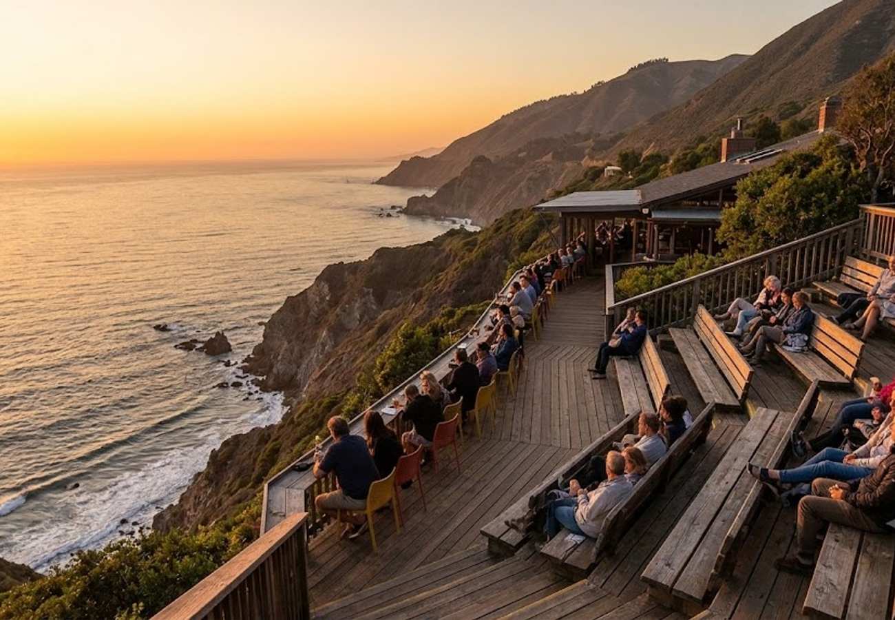
Perched 800 feet above the crashing waves in the heart of Big Sur, Nepenthe has served as the social and spiritual crossroads of Highway 1 since 1949. Originally built around a rustic cabin purchased by Orson Welles and Rita Hayworth, the restaurant was designed by Rowan Maiden, an apprentice of Frank Lloyd Wright, using native redwood and local river rock.
The name "Nepenthe" derives from the ancient Greek word for a potion that banishes grief and sorrow—a promise fully realized the moment you step onto its expansive open-air deck. From the terrace bleachers, the entire southern Big Sur coastline unfurls before you, with steep Santa Lucia headlands disappearing into coastal fog banks.
While dining at the main restaurant often commands significant waits, road-trippers in the know order the legendary Ambrosia Burger, grab a glass of local Monterey County Pinot Noir, and relax on the redwood benches overlooking the abyss. Before heading south, make a brief stop just down the road at Coast Gallery Big Sur, an artistic sanctuary built inside two repurposed redwood water tanks showcasing handcrafted coastal pottery and local paintings.
6. McWay Falls at Julia Pfeiffer Burns State Park
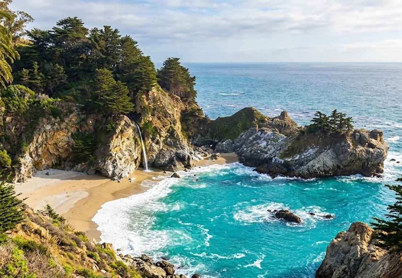
McWay Falls is one of only two "tidefalls" in California—waterfalls that tumble directly into the ocean. Fed by year-round McWay Creek, this immaculate 80-foot ribbon of freshwater cascades off a granite cliff directly onto the untouched golden sands of McWay Cove, meeting the azure Pacific waters below.
Interestingly, prior to the massive 1983 coastal landslides that dumped millions of tons of debris into the ocean, McWay Falls plunged straight into open seawater at high tide. The resulting coastal drift accumulated into the pristine crescent beach seen today.
The viewpoint is accessed via an easy, wheelchair-accessible 0.5-mile path starting from the Julia Pfeiffer Burns State Park parking lot, passing through a tunnel beneath Highway 1. Visitors must stay strictly on the designated boardwalk trail. Clambering down the cliffs into McWay Cove is illegal, extremely hazardous due to loose shale, and carries a mandatory $1,000 fine enforced by state park rangers.
7. Ragged Point & The Southern Gateway Cliffs
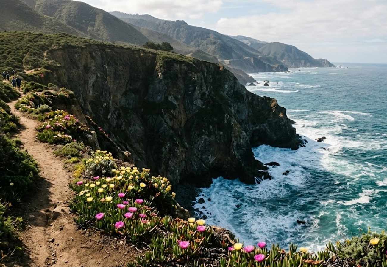
Serving as the dramatic southern threshold of Big Sur, Ragged Point marks the geological transition from the gentle grazing plains of San Luis Obispo County to the precipitous, razor-sharp cliffs of the Santa Lucia Range. Known colloquially as the "Million Dollar View," this windswept promontory drops a sheer 300 vertical feet into churning ocean surf.
The Ragged Point Inn grounds offer a welcoming rest oasis with artisan coffee, fuel pumps, and beautifully landscaped gardens filled with blooming coastal succulents. A wooden walkway meanders out to the edge of the headlands, providing an unobstructed panorama looking north into the heart of Big Sur's untamed ramparts.
For adventurous drivers with sturdy footwear, the Ragged Point Cliff Trail offers a steep, rigorous scramble down to a secluded black sand beach. While the trek back up will test your quads, walking along the isolated shore beneath towering coastal waterfalls is an unforgettable reward.
8. Piedras Blancas Elephant Seal Rookery (San Simeon)
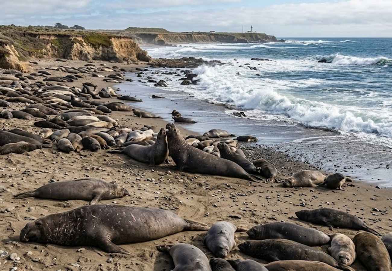
Just four miles north of Hearst Castle in San Simeon, the Piedras Blancas Elephant Seal Rookery offers one of the most astonishing wildlife spectacles on the North American continent. Once hunted to the brink of extinction with fewer than 100 individuals remaining in the late 1800s, northern elephant seals have staged a historic recovery, establishing this six-mile stretch of beach as their primary terrestrial sanctuary.
Today, over 25,000 seals visit this shoreline every year. Depending on when you visit, you will witness colossal 4,000-pound alpha bulls battling for breeding territory with thunderous chest-slams, mother cows nursing newborn pups, or thousands of adolescents lounging in the sun flipping cool sand over their backs.
The viewing experience here is completely free and exceptionally well-maintained, featuring wide wooden boardwalks that run along the cliff bluffs within arm's reach of the resting giants. Knowledgeable volunteer docents from Friends of the Elephant Seal patrol the paths daily to explain seal behaviors, vocalizations, and the deep oceanic diving habits monitored across the Monterey Bay National Marine Sanctuary.
9. Morro Rock & Morro Bay Strand
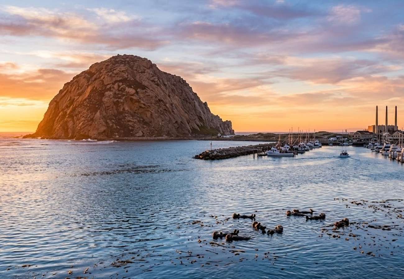
Rising 576 feet abruptly out of the ocean at the mouth of Morro Bay harbor, Morro Rock is the most famous of the "Nine Sisters"—a chain of extinct volcanic peaks stretching across San Luis Obispo County. First named El Morro by Spanish navigator Juan Rodríguez Cabrillo in 1542, this colossal volcanic plug is revered as a sacred site by the local Salinan and Chumash tribes.
The rock serves as an important nesting sanctuary for endangered peregrine falcons, meaning climbing the formation is strictly prohibited. However, driving right to the base via Coleman Drive provides a breathtaking sense of its gargantuan scale.
The sheltered water channel between the rock and the Embarcadero serves as a permanent marine sanctuary for a thriving colony of southern sea otters. Stand along the harbor barrier or rent a kayak to watch rafted mothers wrap their pups in giant kelp fronds just yards away from fishing dories. Cap your afternoon by heading into town along the Embarcadero for steaming sourdough bowls of fresh clam chowder.
10. Montana de Oro State Park & Bluff Trail (Los Osos)
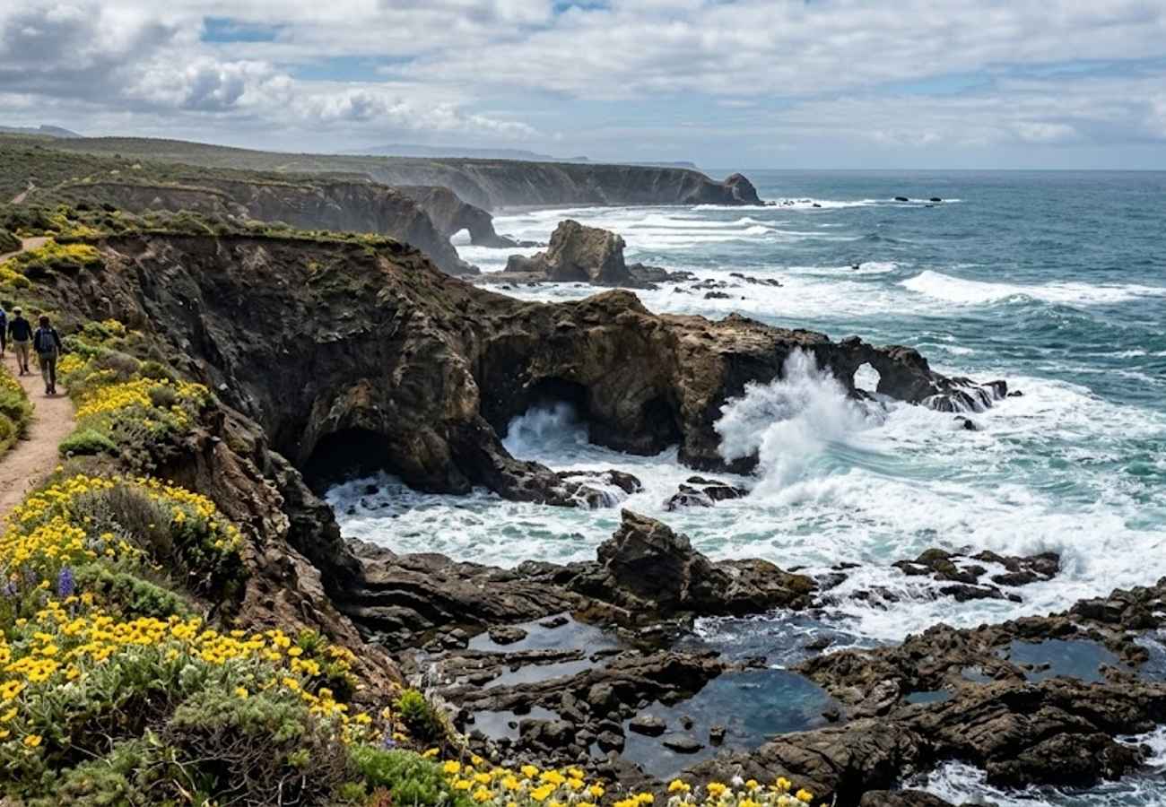
Located just south of Morro Bay at the terminus of Pecho Valley Road, Montana de Oro State Park ("Mountain of Gold") is one of California’s most criminally overlooked coastal preserves. Named for the wild golden mustard flowers that carpet the hillsides every spring, this 8,000-acre park offers rugged wilderness without the bumper-to-bumper tourist congestion of central Big Sur.
The highlight of the park is the Bluff Trail, a gentle 3.4-mile flat pathway tracing the undulating contours of uplifted marine terraces. Along the route, massive Pacific breakers crash violently against intricately folded shale and sandstone formations, carving deep sea chasms, blowholes, and secluded pebble coves.
At low tide, the rocky platforms at Coon Creek and Spooner’s Cove reveal incredible tide pools teeming with ochre sea stars, giant green anemones, and scurrying hermit crabs. With free admission, ample roadside parking, and sweeping views of the Pacific horizon, it provides the ultimate peaceful conclusion to a Highway 1 road trip.
Practical Advice for Driving Highway 1 in 2026
- Always Check Real-Time Road Closures: Big Sur's fragile terrain is prone to spontaneous rockslides following rainstorms. Before departing, verify that Highway 1 is completely open by checking Caltrans QuickMap or calling the Caltrans Highway Information Network (1-800-427-7623).
- Drive North to South (Southbound): Driving from Monterey toward San Luis Obispo places your car directly in the oceanside lane. This provides unobstructed views of the cliffs and lets you pull into scenic turnouts smoothly without cutting across oncoming high-speed traffic.
- Download Offline Maps in Advance: Cellular service completely drops out for approximately 60 consecutive miles between Carmel Highlands and San Simeon. Download Google Maps or Apple Maps offline areas before leaving your hotel.
- Fuel Up Early and Avoid Price Shocks: Gas stations inside Big Sur (such as Gorda or Big Sur Village) often charge upwards of $9 to $11 per gallon due to remote delivery logistics. Fill your fuel tank in Carmel, Monterey, or Cambria where normal municipal prices prevail.
- Heed Turnout Etiquette: Highway 1 is a winding, narrow mountain road. California law requires slower vehicles to pull into designated roadside turnouts whenever five or more vehicles are queued behind them. Let faster locals and commercial delivery trucks pass safely.
Frequently Asked Questions
Is California Highway 1 fully open all the way through Big Sur in 2026?
Caltrans has completed extensive stabilization and structural bridge work across historic slide zones, including the massive Regent's Slide reconstruction. However, because winter storms can cause temporary overnight closures or single-lane traffic controls, always check Caltrans QuickMap for live conditions before setting out.
How long does it take to drive the Pacific Coast Highway through Big Sur?
Without stopping, driving the 90 miles between Carmel and San Simeon takes about 2.5 to 3 hours due to the winding 25–45 mph speeds. However, with scenic viewpoints, short trail walks, lunch at Nepenthe, and wildlife viewing, plan for a full 8 to 10-hour day trip.
What is the best time of year to drive Highway 1?
Late spring (April through May) and autumn (September through November) provide the clearest skies, lowest risk of winter road closures, and comfortable temperatures. Mid-summer (June through August) frequently brings heavy morning marine fog ("June Gloom") that obscures coastal cliff views until mid-afternoon.
Are campervans and RVs allowed on Big Sur's Highway 1?
Yes, standard campervans and RVs are permitted. However, driving oversized motorhomes or vehicles towing long travel trailers is stressful and physically demanding due to tight switchbacks, steep grades, and narrow cliff shoulders. If traveling in a large rig, take advantage of pull-outs frequently to allow trailing vehicles to pass.
From towering redwood canyons to windswept headlands where wild elephant seals roar into the Pacific surf, the Pacific Coast Highway remains the quintessential American road trip where the journey itself is the destination.
Related Travel Guides
Disclaimer
This article is for informational and educational purposes only. It does not constitute legal, financial, or professional advice. While we strive to provide accurate and up-to-date information, travel policies, regulations, and conditions change rapidly. Always verify information with official sources before making travel decisions. Nomad Lawyer makes no representations about the accuracy, reliability, completeness, or suitability of the information provided. Readers should consult qualified professionals for advice specific to their circumstances. The views expressed in this article are those of the author and do not necessarily reflect the views of Nomad Lawyer.
Raushan Kumar
Founder & Lead Developer
Full-stack developer with 11+ years of experience and a passionate traveller. Raushan built Nomad Lawyer from the ground up with a vision to create the best travel and law experience on the web.
Learn more about our team →