
Yosemite Wildfire Surges to 100 Acres: Dome Fire Triggers Chilnualna Falls Backcountry Closures
The Dome Fire expands to 100 acres near Wawona, prompting the National Park Service to close the Chilnualna Falls Trail through September 23, 2026.

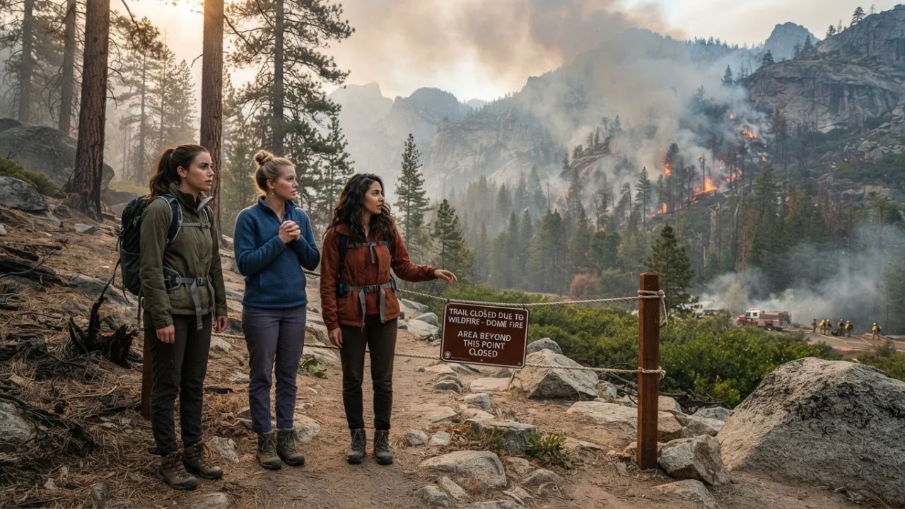
Image generated by AI
While the vast majority of Yosemite National Park's four million annual visitors crowd into the seven square miles of Yosemite Valley, the tranquil southern gateway of Wawona has long served as a peaceful refuge where hikers trace multi-tiered granite waterfalls and ancient giant sequoias away from bumper-to-bumper shuttle traffic. That backcountry serenity encountered a sharp disruption on September 15 and 16, 2026, when the Dome Fire ignited north of Wawona Dome near the Chilnualna Falls Trailhead, exploding from five acres on Tuesday morning to twenty acres by afternoon, and surging to 100 acres with zero percent containment by Wednesday morning. Burning through dense wilderness fuels including timber, brush, and cured grasses, the blaze prompted the National Park Service (NPS) to enact an emergency safety closure sealing the Chilnualna Falls Trail and connecting routes toward Buena Vista and Crescent Lakes through at least September 23, 2026. With over 511,200 visitors arriving in September alone—accounting for roughly 13 percent of the park's annual visitation—the incident highlights the delicate balance between idyllic autumn hiking and rapid wildfire response in the High Sierra.
The Dome Fire Ignition: Anatomy of a Sierra Wilderness Blaze
The operational escalation of the Dome Fire demonstrates how swiftly late-season fires can move through Sierra Nevada wilderness terrain. First discovered on the morning of September 15, the incident began north of Wawona Dome in steep backcountry terrain above the South Fork of the Merced River basin. By late afternoon, CAL FIRE and National Park Service incident commanders reported the blaze had quadrupled from five to twenty acres. By September 16, the fire stood at 100 acres with zero percent containment, fed by an abundance of dry summer fuels including chaparral brush, standing dead timber, and dense forest duff.
To protect backcountry travelers and provide wildland firefighting crews with unobstructed operational access, the National Park Service issued a formal safety closure order covering the entire Chilnualna Falls Trail corridor, alongside connecting wilderness routes branching from the waterfall crest toward Buena Vista Lake and Crescent Lake. The emergency order remains in effect until 11:59 pm on September 23, 2026, unless extended by subsequent park superintendent determinations.
Park rangers and fire personnel emphasize that the danger zone extends well beyond visible open flames. The closure area contains significant post-fire hazards, including standing dead trees (snags) with root systems burned out, falling tree limbs, burning logs, concealed stump holes filled with superheated ash, and rolling boulders dislodged from steep granite slopes. Furthermore, shifting winds can push thick smoke into low-lying canyon pockets, creating hazardous breathing conditions and drastically reducing visibility.
Importantly for travelers holding park reservations, officials confirmed that the fire currently poses no immediate threat to structures or developed residential areas in Wawona. Yosemite National Park remains open across all other sectors, though standard fire regulations apply, including seasonal fire restrictions in effect below 8,000 feet. Real-time updates provided through the National Park Service conditions portal remain essential for any visitor traveling along Highway 41.
What Makes Wawona and Southern Yosemite Different: Between Victorian History and Granite Cascades
To appreciate the significance of the Wawona corridor, one must look beyond the sheer, glacier-carved cliffs of El Capitan and Half Dome. Wawona represents Yosemite’s historic threshold. Centered on the gentle waters of the South Fork of the Merced River, the area preserves the historic Victorian-style Wawona Hotel, whose broad white verandas and rolling green lawns have welcomed travelers since the nineteenth century, alongside the Pioneer Yosemite History Center and its authentic covered wooden bridge.
Just south of Wawona stands the Mariposa Grove of Giant Sequoias, an ancient sanctuary protecting more than 500 mature Sequoiadendron giganteum trees, including the 3,000-year-old Grizzly Giant and the California Tunnel Tree. For experienced hikers, the Chilnualna Falls Trail serves as the premier backcountry alternative to the crowded Mist Trail in Yosemite Valley. Instead of climbing concrete steps alongside hundreds of day-trippers, hikers on the Chilnualna trail scale unpaved granite switchbacks alongside a series of five distinct cascades tumbling over massive granite benches into crystalline pools.
Because Wawona sits in a deeply carved river valley, local atmospheric dynamics dictate how visitors experience wildfire activity. During the night and early morning, cool mountain air drains down from higher elevations, temporarily pooling smoke in river basins and valley floors. By midday, intense solar radiation heats the granite cliffs, generating strong thermal updrafts that disperse surface smoke toward the high peaks. Official travel information curated by Visit California highlights how understanding these daily airflow cycles allows travelers to schedule outdoor activities during optimal morning and afternoon windows.
Visitor Insider Tips: Navigating Yosemite During Active Fire Operations
Experiencing Yosemite safely during an active wildfire requires strategic route adjustments, gear preparation, and real-time awareness:
Alternative Hikes Outside the Closure Zone: With the Chilnualna Falls Trail closed through September 23, redirect your hiking plans to unaffected southern and south-rim trails. In the Wawona area, hike the Mariposa Grove Trail to Wawona Point for sweeping, uncrowded panoramas of the southern Sierra. Alternatively, take Glacier Point Road to hike the Sentinel Dome and Taft Point loop, which offers dramatic views of Yosemite Valley and the Clark Range with minimal trail congestion.
Air Quality and Smoke Timing Hacks: Download the AirNow or EPA Fire and Smoke mobile application before driving into the mountains. Canyon inversions often trap smoke near ground level between dawn and 9:30 AM. Schedule strenuous uphill hikes for late morning or early afternoon (between 11:00 AM and 4:00 PM), when thermal winds break the inversion and clear the air around mid-elevation granite domes.
Backcountry Stove and Fire Regulations: Heed the active park-wide fire restrictions below 8,000 feet. Open wood campfires and charcoal grills are strictly prohibited in wilderness areas below this elevation. Backcountry backpackers and campers may use portable pressurized gas backpacking stoves equipped with an emergency shutoff valve for hot meals and coffee.
Local Provisions and Dining Stops: Skip the long cafeteria lines in Yosemite Valley. Pick up fresh picnic supplies at the historic Wawona Store or enjoy an evening meal on the dining porch of the Wawona Hotel. For travelers staying west along the Highway 140 corridor in El Portal, local riverside cafes provide hearty sandwiches, locally brewed craft beer, and comfortable indoor seating where you can relax away from afternoon haze.
High Sierra Day Trips: If smoke settles heavily into the south entrance corridor along Highway 41, pivot your itinerary toward the High Sierra along Tioga Road (Highway 120). Elevations in Tuolumne Meadows exceed 8,500 feet, where cool subalpine air, crystal-clear alpine lakes, and granite summits like Lembert Dome offer pristine hiking conditions before autumn snowstorms close the high mountain passes for the winter.
Cultural and Environmental Context: Fire Ecology in the Giant Sequoia Realm
The Dome Fire highlights an essential ecological truth: wildfire is not an unnatural invader in the Sierra Nevada, but an ancient evolutionary partner. For thousands of years prior to European settlement, Indigenous Southern Sierra Miwuk and Paiute tribes practiced deliberate cultural burning. They set low-intensity surface fires in autumn to clear brush, stimulate the growth of basketry plants like deer grass and redbud, encourage black oak acorn production, and safeguard their villages from catastrophic conflagrations.
During the twentieth century, aggressive total fire suppression policies disrupted this natural balance, allowing dense thickets of shade-tolerant white fir and incense cedar to crowd out native forest floors. This unnatural accumulation of forest fuels turned what historically were beneficial, low-severity ground fires into catastrophic crown fires. Giant sequoias and ponderosa pines rely directly on periodic fire: the heat of ground flames opens serotinous cones, clears duff, and exposes nutrient-rich mineral soil where tiny sequoia seeds can take root.
As a premier natural sanctuary recognized by the UNESCO World Heritage Centre, Yosemite balances visitor access with wilderness preservation. The park employs managed wilderness fire, mechanical thinning, and prescribed burns to restore natural forest resilience. When hikers honor safety closures around the Dome Fire, they protect delicate recovering soils, prevent trail erosion, and allow fire managers to steer the blaze safely without risking personnel on emergency backcountry rescues.
FAQ: Visiting Yosemite During Fire Season 2026
Is Yosemite National Park closed because of the Dome Fire? No. Yosemite National Park remains open, including Yosemite Valley, Mariposa Grove, Glacier Point, and Tuolumne Meadows. Only specific trail sections around the Dome Fire north of Wawona are closed for visitor safety.
Which specific trails are closed around Wawona? The National Park Service closed the Chilnualna Falls Trail and trails leading from the waterfall crest toward Buena Vista Lake and Crescent Lake through at least 11:59 pm on September 23, 2026.
Are historic buildings or campgrounds in Wawona threatened? No immediate threats have been reported to structures, commercial facilities, or developed campgrounds in Wawona. However, visitors should expect localized smoke, haze, and active emergency vehicles on regional roads.
What fire restrictions are currently enforced in the park? Fire restrictions are in effect below 8,000 feet. Wood campfires and charcoal grills are banned in wilderness areas below this elevation, though portable gas stoves with on/off valves remain permitted for cooking.
In the shadow of ancient granite domes, respecting the ancient role of wildfire ensures that the wild heart of the Sierra remains untamed for generations to come.
Related Travel Guides
Disclaimer
This article is for informational and educational purposes only. It does not constitute legal, financial, or professional advice. While we strive to provide accurate and up-to-date information, travel policies, regulations, and conditions change rapidly. Always verify information with official sources before making travel decisions. Nomad Lawyer makes no representations about the accuracy, reliability, completeness, or suitability of the information provided. Readers should consult qualified professionals for advice specific to their circumstances. The views expressed in this article are those of the author and do not necessarily reflect the views of Nomad Lawyer.
Preeti Gunjan
Contributor & Community Manager
A passionate traveller and community builder. Preeti helps grow the Nomad Lawyer community, fostering engagement and bringing the reader experience to life.
Learn more about our team →