US East Coast Storm Alert: Virginia and North Carolina Face 12-Foot Waves and Coastal Flooding

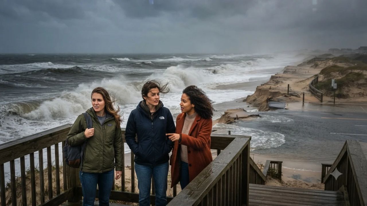
While rapid tropical systems often sweep past barrier islands in under twenty-four hours, an upper-level low stalling along the Eastern Seaboard from 24 to 28 September 2026 threatens to lock coastal communities into five continuous days of punishing onshore gales and 12-foot waves. Compounding the hazard, an approaching full moon will supercharge astronomical high tides, driving Atlantic waters into low-lying coastal corridors across Virginia, North Carolina, Maryland, Delaware, and New Jersey. This extended duration means barrier island roads and seaside towns face repeated tidal cycles that prevent floodwaters from draining, significantly heightening beach erosion risks.
Forecasters at the National Oceanic and Atmospheric Administration Weather Prediction Center have identified a persistent synoptic setup where an upper-level circulation stalls over the Mid-Atlantic and Northeast, spinning up a surface low over the western Atlantic. Because this weather system is not currently classified as a fast-moving tropical cyclone, its primary danger stems from relentless northeasterly winds blowing directly ashore for nearly a week. Coastal travelers along popular oceanfronts must prepare for deteriorating marine conditions, severe rip currents, and localized access cutoffs.
Prolonged Stalled Low Pressures the Mid-Atlantic Seaboard
The five-day weather window between Thursday, 24 September, and Monday, 28 September 2026, presents an uncommon early-autumn challenge for coastal vacationers and maritime operators. As the surface low sits offshore, steady northeasterly gales ranging between 25 and 35 mph will continuously push surface waters toward the coastline.
Unlike standard squall lines that pass quickly, the multi-day persistence of onshore flow stacks ocean water against beaches and bays. The timing directly coincides with the late-September lunar cycle, creating peak king tides that hinder natural water runoff. Coastal roads including sections of North Carolina Highway 12 on the Outer Banks and Sandbridge Road in Virginia Beach face high vulnerability to ocean overwash and standing water during high-tide cycles.
| Coastal Region | Forecast Surf Peak | Peak Wind Speeds | Primary Local Disruption |
|---|---|---|---|
| Outer Banks (Currituck County, NC) | 9–12 feet (Thursday) | Northeast 35 mph | Dune overwash, NC-12 closures, extreme rip currents |
| Virginia Beach & Sandbridge (VA) | 8–12 feet (Thursday) | Northeast 35 mph | Boardwalk inundation, low-lying access flooding |
| Virginia Eastern Shore (Chincoteague, VA) | 8–12 feet (Thursday) | Northeast 35 mph | Barrier island inundation, beach access closures |
| Ocean City & Assateague Island (MD) | 7–11 feet (Wed–Thu) | Northeast 35 mph | Overwash at national seashore, inlet navigation hazards |
| Delaware & New Jersey Coastlines | 6–10 feet (Friday) | North/Northeast 30 mph | Gale conditions, back-bay tidal flooding |
Regional forecasters note that while heavy rainfall remains subject to small track shifts, enhanced precipitation will target eastern North Carolina on Thursday before spreading toward coastal New England by Friday and Saturday.
Why Multi-Day Onshore Gales Threaten Barrier Islands
The vulnerability of barrier island geography lies in the fragile equilibrium between sand dunes, ocean tides, and shallow back-bays. Along the protected shores managed by the National Park Service at Cape Hatteras National Seashore and Assateague Island National Seashore, beaches act as shock absorbers for oceanic energy. When heavy surf strikes over multiple consecutive tidal cycles, protective sand dunes experience structural failure.
In Virginia Beach, the marine forecast tracks surf building from 2 to 4 feet on Monday and 3 to 5 feet on Tuesday, before surging to 8 to 11 feet on Wednesday and peaking at 8 to 12 feet on Thursday with 35 mph winds. North on the Virginia Eastern Shore around Wallops Island and Chincoteague, similar 12-foot breakers will batter exposed shorelines. Further north along Ocean City and Assateague in Maryland, surf will hold between 7 and 11 feet Wednesday through Thursday with high rip-current advisories.
When wave action stays elevated for four to five consecutive days, back-bays like Pamlico Sound, Currituck Sound, and Chincoteague Bay become trapped by wind-driven water, preventing inland creeks and marshes from emptying into the Atlantic. This phenomenon generates severe back-bay flooding even in neighborhoods that sit miles away from the open oceanfront.
Visitor Insider Tips for Surviving Early-Autumn Coastal Storms
Navigating coastal Mid-Atlantic destinations during an extended autumn storm requires distinct tactical preparation and local awareness.
- Time Barrier Island Travel Around Low Tide Windows: If driving along North Carolina Highway 12 or crossing low bridges into Chincoteague, time all vehicle movements strictly during astronomical low tide. Consult tide tables for your specific inlet, as high tide can submerge access ramps under salt water two hours before and after the official peak.
- Reroute Vehicles Away from Oceanfront Parking Lots: Move passenger cars to inland multi-story garages or elevated driveways in Virginia Beach, Ocean City, and Cape May. Saltwater storm surges quickly flood street-level asphalt along Atlantic Avenue and oceanfront hotel lots.
- Heed Red-Flag Beach Closures and Avoid Shoreline Fishing: Ocean currents during 12-foot surf events generate extreme lateral sweeps and structural undertows. Stay off ocean piers and avoid walking near steep dune drop-offs where rogue waves can sweep pedestrians off wet berms.
- Pack Battery Lighting and Non-Perishable Provisions: Coastal storms carrying persistent 35 mph wind gusts frequently knock down power lines across sandy soils and remote island causeways. Maintain full fuel tanks and keep physical map backups should digital navigation systems lose cellular connectivity.
Barrier Beach Ecology and Coastal Preservation
The ongoing development of early-autumn storms highlights the urgent balance between coastal tourism economies and fragile coastal ecosystems. Destinations promoted by Virginia Tourism Corporation rely heavily on shoulder-season travel during September, when warm waters and lighter crowds typically draw visitors to heritage fishing villages and seaside resorts.
However, prolonged wave action accelerates long-term beach erosion, threatening wild pony habitats on Assateague and maritime forest sanctuaries in North Carolina. Coastal engineers emphasize that artificial dune replenishment projects require time to settle; early-season gales strip away hundreds of thousands of cubic yards of newly placed sand, exposing municipal drainage infrastructure. Understanding these natural barrier island migration patterns helps travelers respect temporary access closures and support conservation initiatives designed to protect vulnerable coastlines for future seasons.
FAQ: Mid-Atlantic Coastal Travel September 2026
Which specific dates carry the highest coastal storm risk? The most hazardous conditions span from Thursday, 24 September, through Monday, 28 September 2026, with surf peaking at 12 feet on Thursday and Friday.
Are major airports like Norfolk and Richmond cancelling flights? No widespread airport closures or mass flight cancellations are currently confirmed. Travelers should verify individual flight statuses with their airlines prior to departing for regional terminals.
Can vehicles safely travel along North Carolina Highway 12? Highway 12 across Hatteras and Ocracoke islands is highly susceptible to ocean overwash and sand accumulation during peak high tides. Check local Department of Transportation road condition updates before attempting transit.
Is swimming or surfing permitted during this weather event? Swimming is strongly discouraged and prohibited in areas under red-flag warnings due to life-threatening rip currents, rough seas, and waves reaching 8 to 12 feet.
Respecting ocean power and monitoring astronomical tide cycles ensures coastal travelers remain safe during severe Atlantic storms.
Related Travel Guides
- United States Issues Urgent Health Warning as Record Dengue Surge Threatens International Travelers and Coastal Communities: New Travel Alert
- Iceland Joins Spain, Italy, and Japan in Enforcing Radical Overtourism Travel Regulations with Visitor Caps, Tourist Fees, and Rental Controls: What Every Traveller Must Know
- Singapore Changi Airport Issues Urgent Disruption Warning as Sudden Flight Cancellation Severs Key Bali Travel Corridor, Stranding Hundreds of Southeast Asia Tourists: New Travel Alert
This article is for informational purposes. Flight routes, passenger regulations, visa rules, and transit advisories are subject to change by airlines and aviation authorities. Readers are advised to verify schedules and travel documentation with relevant carriers and border agencies before departure.
Related Stories

Malaysia Enters Northeast Monsoon Season as AirAsia Issues Urgent KLIA Terminal 2 Travel Advisory

Odyssey Residential Cruise Strands 203 Passengers in Sihanoukville Cambodia as Fourfold Fuel Inflation Triggers Vessel Lay-Up