
Magnitude 6.7 Earthquake Strikes Central Peru: Andes Road Corridors Cleared as Airports Maintain Normal Flights

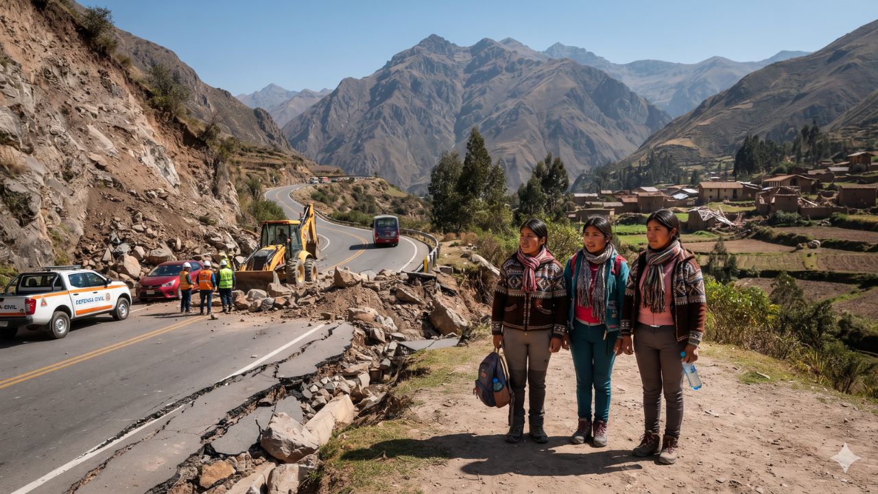
Although a potent magnitude 6.7 earthquake ruptured the central Andes with shaking felt hundreds of kilometers away in metropolitan Lima, its deep focal depth of 129 kilometers prevented catastrophic surface destruction and kept Peru’s primary international aviation gateway fully operational.
The seismic event struck on Friday, 20 November 2026, at precisely 7:09:19 PM local time. According to official instrumentation analyzed by the Instituto Geofísico del Perú (IGP), the epicenter was pinpointed approximately 30 kilometers northwest of the highland district of Junín, reaching a maximum ground intensity of level V on the Modified Mercalli scale. While the intermediate depth spared coastal cities from tidal or structural devastation, the temblor triggered rockfalls along critical Andean highways, damaged historic religious structures in Huánuco, and disrupted municipal power grids across three departments.
Casualties, Displaced Residents, and Infrastructure Impact
Emergency assessments published by the Instituto Nacional de Defensa Civil (INDECI) in Complementary Report No. 16257 (released at 18:00 on 21 November) confirmed one fatality and 16 injuries across the affected sierra. Beyond medical emergencies, the tremor created significant residential displacement: civil protection authorities registered 853 individuals categorized as damnificados (residents whose homes were destroyed or rendered uninhabitable) and an additional 531 people classified as afectados (individuals suffering localized damage or service disruption).
Building inspections across the Andean departments of Junín, Pasco, and Huánuco identified 152 residences classified as structurally uninhabitable, with another 157 homes sustaining repairable damage. In urban areas of Lima and Callao, tremors caused localized cracking in residential zones such as Comas, Independencia, San Juan de Lurigancho, Mi Perú, and Ventanilla. Municipal inspectors evacuated three educational centers in Lima after detecting visible wall fissures during initial evaluations.
Healthcare infrastructure absorbed notable physical stress. Regional health directors confirmed that 15 medical facilities sustained varying degrees of structural damage across Junín, Huánuco, and Lima. However, all 15 clinics maintained continuous patient operations, supported by mobile medical teams deployed to peripheral mountain communities around Pichanaqui and Tarma.
Emergency Assessment Data and Departmental Breakdown
The following data matrix synthesizes official assessments compiled across the affected Andean and coastal departments through 21 November.
| Assessment Category | Confirmed Metric / Count | Primary Departments Impacted | Operational Recovery Status |
|---|---|---|---|
| Earthquake Magnitude & Time | M 6.7 (Depth: 129 km) | Epicenter 30 km NW of Junín | Occurred 20 Nov 2026 at 19:09:19 local |
| Confirmed Casualties | 1 death, 16 injured | Junín (provinces of Junín & Tarma) | Emergency medical triage active |
| Displaced Residents | 853 damnificados / 531 afectados | Junín, Huánuco, Pasco | Temporary emergency shelter mobilized |
| Residential Structural Damage | 152 uninhabitable, 157 damaged | Junín, Huánuco, Pasco, Lima | Municipal engineering reviews ongoing |
| Healthcare Facilities Affected | 15 medical centers damaged | Junín, Huánuco, Lima | All 15 centers remain fully operational |
| Electrical Power Outages | 92,906 users disconnected | Satipo, Carhuamayo, Pasco, Zapallal | Zapallal restored; Andean grid repair underway |
| Heritage Architecture Damage | 2 historic colonial churches | Ambo (Carmen) and Huánuco (San Francisco) | Heritage preservation inspections initiated |
| Airport Operational Status | Jauja, Huánuco, Callao (Lima) | CORPAC monitored facilities | 100% operational; no runway damage |
Electrical grids suffered substantial interruptions immediately following the tremor. Over 92,906 utility customers lost power as safety relays tripped 13 transmission feeders. In Junín, automatic disconnections at the Satipo substation blacked out the communities of Satipo, Río Negro, Coviriali, and Pampa Hermosa, while a secondary failure severed the Carhuamayo substation. In Pasco, outages darkened Huachón, Paucartambo, and Chaupimarca. In Lima, utility crews fully restored power to 3,500 affected customers in Zapallal within 24 hours.
Status of Andean Road Corridors and Aviation Gateways
For travelers moving between the Pacific coast and the central cloud forests, road stability along the Andes mountain passes became an urgent concern. Steep terrain between Huánuco and Pasco experienced rockfalls, blocking the national highway between Tomaykichwa and Ambo. Road maintenance contractors mobilized heavy earthmoving machinery, successfully clearing debris and restoring vehicular transit by the evening of 21 November.
Along the vital Central Highway (Carretera Central), highway concessionaire DEVIANDES completed rockfall removal across the railway and road corridors at Tornamesa, Surco, and Matucana, confirming the highway remains open and passable. Additionally, authorities reported zero damage along national routes PE-20A and PE-20C.
Air transport remained unaffected by the seismic event. The national airport corporation, CORPAC, verified that Francisco Carlé Airport in Jauja (the primary air gateway for the Mantaro Valley), Alférez FAP David Figueroa Fernandini Airport in Huánuco, and Jorge Chávez International Airport in Callao sustained zero structural or navigational damage. International and domestic flights continue to operate on standard schedules. In metropolitan Lima, the urban transport authority reported that the Metropolitano bus rapid transit system, complementary transit lines, and Metro Lines 1 and 2 operated normally.
Visitor Insider Tips for Travel in Central Peru
While primary transport networks are operating, moving through the central Andes in the days following a major tremor requires measured planning:
- Confirm Mountain Highway Passes Before Leaving Lima: Before driving or boarding long-distance buses toward Tarma, Chanchamayo, or Oxapampa, verify real-time road conditions with highway concessionaire DEVIANDES. Heavy rainfall combined with post-earthquake geological instability can trigger secondary slope failures along steep river canyons.
- Check Heritage Site Closures in Huánuco and Ambo: The Ministry of Culture has placed temporary safety cordons around two significant heritage landmarks: the Temple of Our Lady of Carmen in Ambo and the Church of San Francisco in Huánuco. Respect structural barricades and avoid approaching cracked colonial masonry.
- Verify Boutique Lodge Services in Coffee Valleys: If traveling to eco-lodges in the Chanchamayo Valley, Oxapampa, or the Austro-German settlement of Pozuzo, contact your hosts directly to confirm backup generator status and fresh water supply, as remote regional substations continue localized repairs.
- Utilize Official Travel Information Channels: Consult verified travel updates published through PROMPERÚ and iPerú tourist assistance offices (available via WhatsApp and phone 24/7). Avoid relying on unverified social media rumors regarding road blockages or airport closures.
Geological Context of Subduction Along the Pacific Ring of Fire
The seismic mechanics behind this magnitude 6.7 event stem from the active subduction of the oceanic Nazca Plate plunging eastward beneath the continental South American Plate. Because the rupture occurred at an intermediate depth of 129 kilometers within the descending slab, high-frequency surface shockwaves dissipated through the thick continental crust. This deep focal geometry explains why building collapse was restricted to unreinforced adobe residences in mountain hamlets, avoiding the widespread destruction seen in shallow crustal earthquakes.
Despite the localized recovery efforts required in rural Junín and Pasco, Peru's major tourist corridors—including Cusco, Machu Picchu, Lake Titicaca, and the Arequipa canyons—remain hundreds of kilometers south of the seismic zone and operate under entirely normal conditions.
Frequently Asked Questions
Where was the epicenter of the Peru earthquake on 20 November 2026?
The magnitude 6.7 earthquake was centered 30 kilometers northwest of the district of Junín in the central Peruvian Andes, rupturing at an intermediate depth of 129 kilometers.
Are flights operating normally at Lima and regional airports?
Yes. State airport authority CORPAC confirmed that Jorge Chávez International Airport in Lima/Callao, Jauja Airport, and Huánuco Airport suffered zero damage and remain fully operational.
Is the Central Highway (Carretera Central) open to vehicle traffic?
Yes. Highway maintenance teams and concessionaire DEVIANDES cleared rockfalls around Tornamesa, Surco, and Matucana, fully restoring vehicle access across primary corridors.
Remaining aware of regional mountain road conditions ensures your journey through Peru's breathtaking Andean passes remains safe and on schedule.
Related Travel Guides
This article is for informational purposes. Flight routes, passenger regulations, visa rules, and transit advisories are subject to change by airlines and aviation authorities. Readers are advised to verify schedules and travel documentation with relevant carriers and border agencies before departure.
Related Stories

Canada Issues Mexico Travel Warning as New Law Mandates Proof of Child Guardianship at Hotels

Asian Aviation Gridlock: Over 7,400 Flight Delays Strike Tokyo, Delhi, and Regional Hubs