
US Gulf Coast Tropical Storm Travel Guide: Navigating Hidden Flight and Road Delays

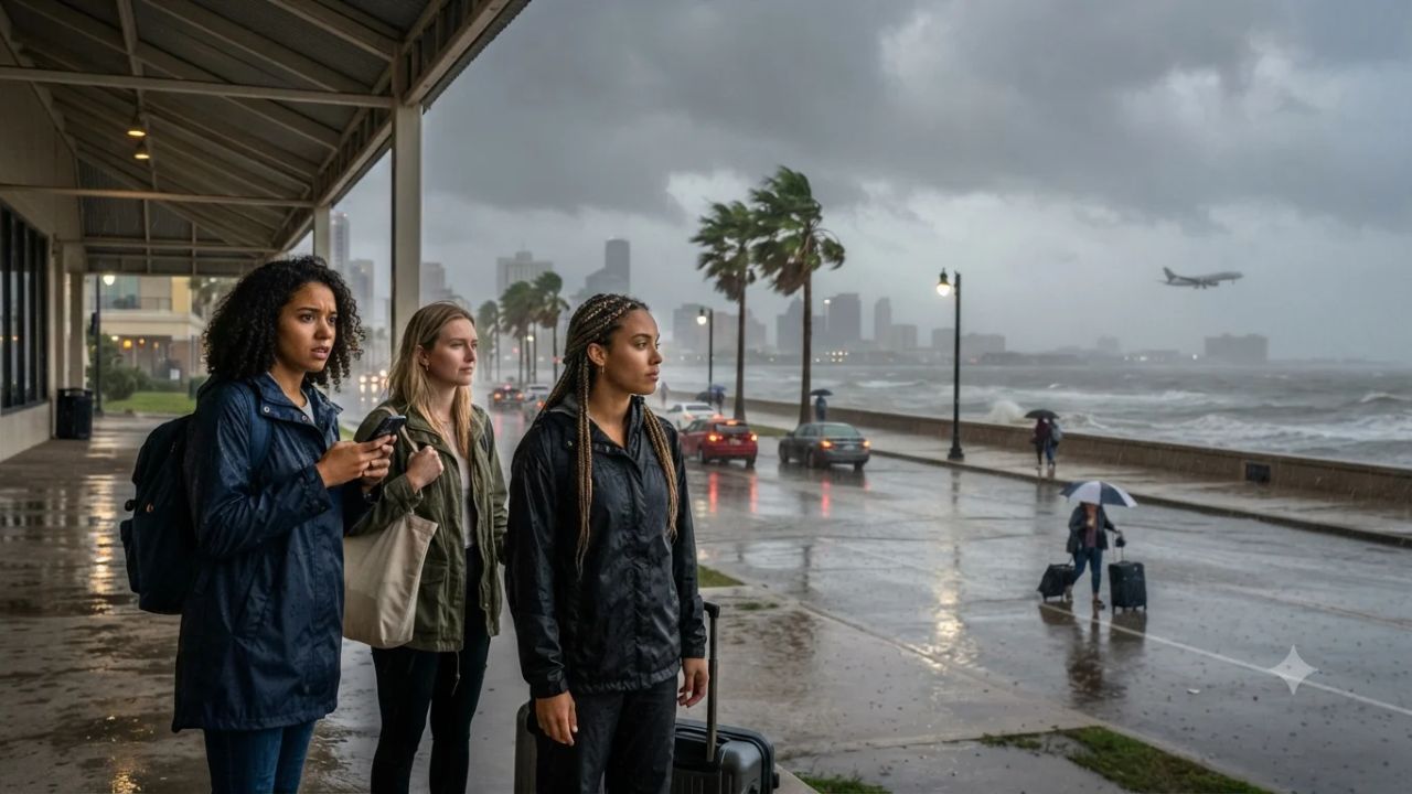
Although the 2026 Atlantic hurricane season has logged six named storms through late September without a single system reaching hurricane status, the apparent meteorological calm masks widespread transportation disruptions across the Gulf Coast. Systems like Tropical Storm Edouard and Tropical Storm Bertha have triggered ground stops at major aviation hubs like Houston, flooded coastal highway arteries, and forced structural bridge closures in eastern Texas. This paradoxical season demonstrates that tropical systems do not require Category 1 wind speeds to derail flight schedules, swamp low-lying coastal roads, and reshape vacation itineraries from Texas to the Azores.
Official data compiled by the National Hurricane Center reveals that while accumulated cyclone energy across the Atlantic basin remains well below historical baselines, moderate tropical depressions and compact tropical storms carry immense volumes of precipitable moisture. When these slow-moving systems interact with continental moisture channels, municipal drainage systems across the Gulf South quickly become overwhelmed, leaving travelers facing unexpected airport delays and washed-out beach corridors.
The Six-Storm Progression and Gulf Coast Transportation Impacts
The 2026 season opened with Tropical Storm Arthur on 17–18 June, which peaked at 40 knots (46 mph) near the Texas coastline. While short-lived, Arthur saturated soil across Texas, Louisiana, and Mississippi, generating hazardous rip currents that forced municipal beach access restrictions. In July, Tropical Storm Bertha made landfall along south-east Louisiana with 50-knot (58 mph) sustained winds, generating widespread flight delays across Louis Armstrong New Orleans International Airport (MSY) that disrupted conventions and musical festivals.
In late August, mid-Atlantic systems Cristobal (40 knots / 46 mph on 12–13 August) and Dolly (35 knots / 40 mph on 27–28 August) remained over open ocean, requiring maritime rerouting without direct land disruption. However, the season's heaviest travel impact arrived between 31 August and 2 September with Tropical Storm Edouard. Packing 50-knot (58 mph) winds, Edouard made landfall near Johnson Bayou, Louisiana, spreading torrential rain across Beaumont, Port Arthur, Lake Charles, and Houston. The storm forced FAA ground stops at George Bush Intercontinental Airport (IAH) and William P. Hobby Airport (HOU) and triggered an emergency bridge closure in Orange County, Texas.
| Storm Identifier | Active Dates | Peak Velocity | Landfall / Track Focus | Primary Travel Impact |
|---|---|---|---|---|
| Arthur | 17–18 June 2026 | 40 kt / 46 mph | Texas Coast / Gulf Region | Highway flash flooding, dangerous surf |
| Bertha | 19–23 July 2026 | 50 kt / 58 mph | South-East Louisiana | New Orleans (MSY) flight delays, squalls |
| Cristobal | 12–13 August 2026 | 40 kt / 46 mph | Open Atlantic Basin | Offshore marine precautions only |
| Dolly | 27–28 August 2026 | 35 kt / 40 mph | Central Atlantic (East of Leewards) | Cruise track adjustments, open swell |
| Edouard | 31 Aug–2 Sept 2026 | 50 kt / 58 mph | Johnson Bayou, LA (TX border) | Houston airport ground stops, bridge closure |
| Fay | 19–21 Sept 2026 | 60 kt / 69 mph | North Atlantic (SW of Azores) | Azores marine swells, whale tour cautions |
The sixth storm, Tropical Storm Fay, developed on 19 September south-west of the Azores with peak winds of 60 knots (69 mph), just shy of hurricane threshold. While remaining over open water, Fay generated rough seas that prompted localized marine precautions across Portugal's Atlantic archipelago.
Why Moderate Tropical Systems Cripple Gulf Coast Logistics
The vulnerability of the Gulf Coast transport network stems from its delicate coastal topography. Cities like Houston, Lake Charles, and New Orleans sit barely above sea level, surrounded by bayous, salt marshes, and interconnected shipping channels. When a 50-mph tropical storm like Edouard stalls over the coastline, it drops between 6 and 12 inches of localized rainfall in hours.
At major hub airports, air traffic control towers must implement ground delay programs when low visibility and lightning cells cluster across approach corridors. Because Houston and New Orleans serve as key east-west transit hubs for domestic air networks, a three-hour ground stop creates ripple cancellations that cascade across North America.
On the ground, highway infrastructure across coastal counties relies on low-elevation bridges and causeways. Saltwater storm surges pushed inland by persistent onshore winds prevent inland bayous from draining, leading to water accumulation along Interstate 10 and regional state highways. Structural bridge closures, such as the emergency detour instituted in Orange County during Edouard, add hours to road-trip transit times between Texas and Louisiana.
Visitor Insider Tips for Navigating Gulf Coast Weather Disruptions
Traveling through the Gulf Coast between June and the official end of the Atlantic season on 30 November requires strategic contingency planning and local logistical savvy.
- Schedule Early-Morning Connecting Flights Through Houston: Convective storm activity and tropical rain bands typically intensify in the afternoon as solar heating builds over the Gulf of Mexico. Book connecting flights through IAH or HOU that arrive before 11:00 AM to minimize risk of afternoon ground stops.
- Track Local Drainage Telemetry in New Orleans and Houston: When driving rental vehicles during intense rainbands, consult real-time municipal street-flood maps rather than relying solely on commercial GPS navigation. In New Orleans, avoid low-lying railroad underpasses along Carrollton Avenue and Canal Boulevard where floodwaters rise rapidly.
- Base in Pedestrian-Friendly Cultural Quarters: If visiting New Orleans during unsettled weather, base your accommodations in the French Quarter or the Arts/Warehouse District. These historic riverfront ridges sit on higher natural ground and allow you to explore world-class dining, jazz clubs, and museums promoted by New Orleans & Company entirely on foot.
- Monitor Marine Swells Before Booking Island and Bay Tours: In destinations like Galveston, coastal Louisiana, or the Azores during active tropical swells, verify tour operating statuses directly with boat captains. While skies may appear partly cloudy inland, offshore wave chop and rip currents often cause legitimate morning cancellations for fishing charters and wildlife excursions.
- Maintain Emergency Highway Detour Kits: When driving along the I-10 corridor between Houston and Baton Rouge, keep extra drinking water, mobile power banks, and non-perishable snacks in your vehicle. Rural detours around closed coastal bridges can redirect traffic onto secondary two-lane roads with limited fuel and dining services.
Coastal Wetland Loss and Community Resilience
The recurring travel disruptions caused by non-hurricane tropical systems underscore the ongoing environmental challenges facing the Gulf Coast basin. Decades of canal dredging, sea-level rise, and barrier island erosion have diminished the natural wetland buffers that historically absorbed storm surges before they reached inland infrastructure.
Agencies coordinated under the National Oceanic and Atmospheric Administration and local conservation initiatives emphasize that restoring coastal marshes and living shorelines is essential for safeguarding tourism economies. When travelers visit heritage communities along the Cajun Coast, Galveston Bay, or the Mississippi Gulf Coast, supporting locally owned seafood markets, eco-tourism operators, and historic preservation societies directly aids community resilience against changing climate realities.
FAQ: Gulf Coast Tropical Season Travel 2026
When does the Atlantic tropical season officially conclude? The Atlantic hurricane and tropical storm season officially runs through 30 November 2026.
Why do tropical storms without hurricane status cause major flight delays? Moderate tropical storms produce extensive low cloud ceilings, wind shear, and persistent lightning, forcing aviation authorities to issue mandatory ground stops at major hubs like Houston.
How can drivers verify road closures during Gulf storms? Motorists should consult state transportation department portals, such as Texas DriveTexas (drivetexas.org) and Louisiana 511, for real-time flood warnings and detour routes.
Did Tropical Storm Fay cause major land damage in the Azores? No. Tropical Storm Fay remained several hundred miles south-west of the Azores over open water, generating elevated marine swells without triggering hotel evacuations or airport closures.
Understanding that storm intensity is measured by rainfall and duration rather than wind speed alone allows travelers to navigate the Gulf Coast with confidence.
Related Travel Guides
Disclaimer
This article is for informational and educational purposes only. It does not constitute legal, financial, or professional advice. While we strive to provide accurate and up-to-date information, travel policies, regulations, and conditions change rapidly. Always verify information with official sources before making travel decisions. Nomad Lawyer makes no representations about the accuracy, reliability, completeness, or suitability of the information provided. Readers should consult qualified professionals for advice specific to their circumstances. The views expressed in this article are those of the author and do not necessarily reflect the views of Nomad Lawyer.
Raushan Kumar
Founder & Lead Developer
Full-stack developer with 11+ years of experience and a passionate traveller. Raushan built Nomad Lawyer from the ground up with a vision to create the best travel and law experience on the web.
Learn more about our team →