
US Flash Flood Threats Sweep Kansas, Missouri and Arizona as Heavy Rain Imperils Tourist Routes
US Flash Flood Threats Sweep Kansas, Missouri and Arizona as Heavy Rain Imperils Tourist Routes

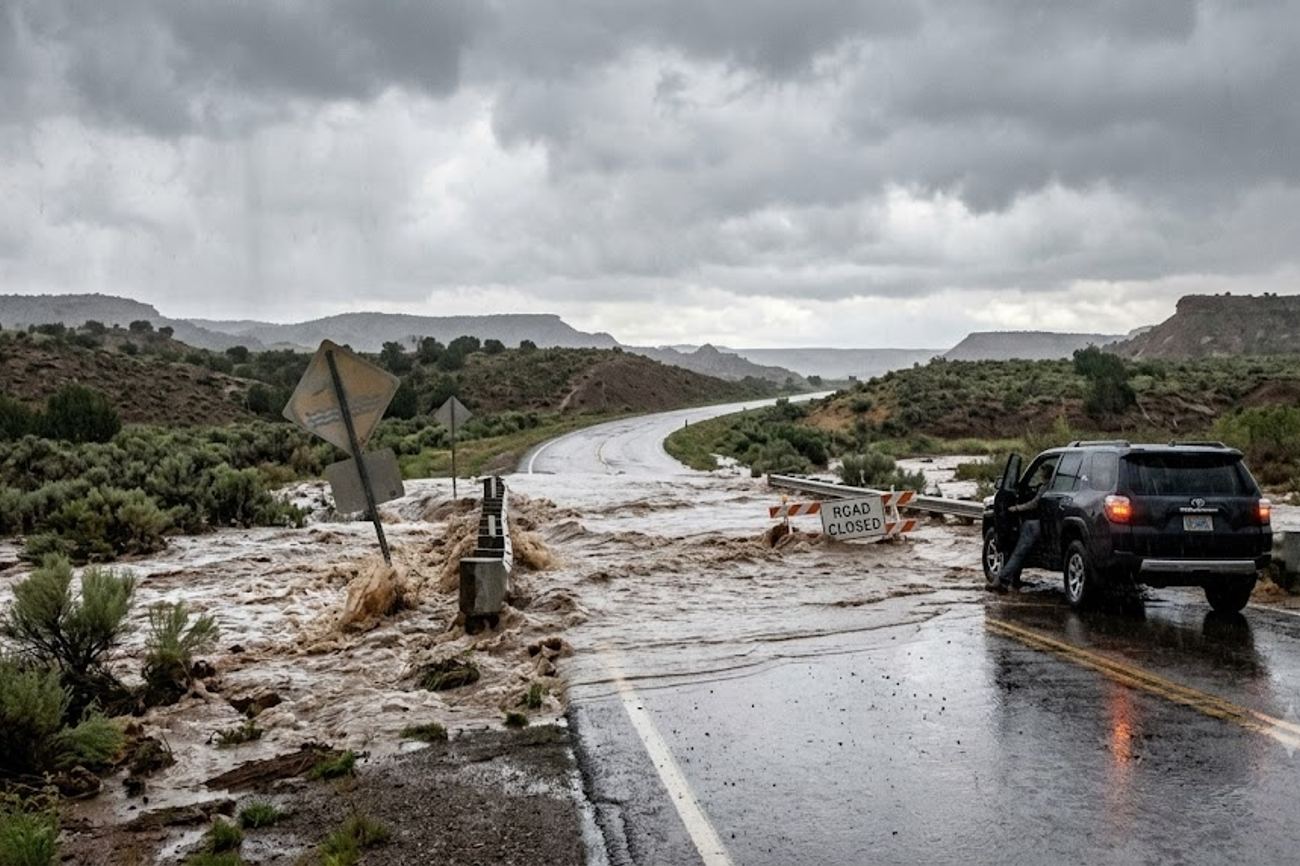
Image generated by AI
A single storm cell in the American Midwest can dump several inches of rain on one street while the next block remains bone dry. This erratic pattern of "repeated thunderstorms" creates a lethal lottery for road travelers, where a route that looked clear ten minutes ago can suddenly become an impassable river.
The Volatility of the American Heartland
Right now, a slow-moving frontal boundary is rewriting the travel map across the north-central Plains and the Missouri Valley. For those navigating the corridors between Kansas City, Wichita, and northern Missouri, the environment has shifted from predictable highways to high-risk zones. The National Weather Service’s Weather Prediction Center has flagged northeastern Kansas and northwestern Missouri as Moderate Risk areas for excessive rainfall during the September 16 to September 17 window.
This isn't just about getting wet; it is about the structural failure of the journey. In the Midwest, the primary danger is the "training" effect, where storms follow each other like railcars on a track, hitting the same patch of land repeatedly. This leads to rapid accumulation that overwhelms drainage systems in minutes. When you are driving through the heart of the country, the scale of the geography often masks how localized and intense these cells are. You might be traveling through a region of unsettled weather, but the actual danger is concentrated in specific, shifting pockets.
The Desert Paradox of the Southwest
While the Midwest deals with saturation, the Southwest—specifically Arizona, New Mexico, Utah, and parts of Texas—is facing a different, more deceptive version of the same threat. In cities like Tucson, Santa Fe, and Cedar City, the risk is not always where the rain is falling.
In the Four Corners region, moisture creates a phenomenon where heavy precipitation in the highlands sends a wall of water rushing through dry washes, arroyos, and low-water crossings miles away from the actual storm. A traveler can be standing under a clear blue sky and still be swept away by a flash flood triggered by a storm twenty miles upstream. This makes the desert landscape an illusion of safety. The recent activity in Tucson, which necessitated multiple water rescues, serves as a stark reminder that urban desert environments can turn into riverbeds in an instant.
Visitor Insider Tips
Navigating these regions during high-risk weather windows requires a shift in mindset from "tourist" to "navigator."
Timing and Visibility Avoid driving after sunset during these alerts. In both the Plains and the Southwest, darkness hides the depth of floodwaters and masks road erosion. If you see water across a highway, the only rule is to turn around. Most vehicles lose contact with the road in just twelve inches of moving water.
Regional Navigation Hacks If you are basing yourself in Kansas City or Chicago to connect to other Midwestern hubs, do not rely solely on flight status apps. Check the National Weather Service for ground-level alerts. A flight may be on time, but the access roads to the terminal could be submerged or blocked by fallen trees.
The Southwest Survival Kit When exploring National Park Service lands in the Southwest, never camp in a dry wash or a canyon bottom during the monsoon or heavy rain seasons. Always have a physical map; cellular service is non-existent in the very arroyos where flash floods are most dangerous.
Local Etiquette and Safety In rural Kansas and Missouri, do not obstruct emergency vehicles or local crews clearing debris. Wind gusts in the Plains have recently hit 70 to 83 miles per hour, meaning power lines and massive limbs are likely blocking secondary roads. Be patient with local authorities who may close roads that "look" fine—they are often managing invisible structural damage to the pavement.
Cultural and Environmental Context
The intersection of tourism and extreme weather in the US highlights a growing tension between the desire for "road trip" freedom and the reality of a changing climate. In the Midwest, the infrastructure is built for steady rain, not the concentrated bursts now being seen. When tourism businesses in Wichita or northern Missouri face repeated flooding, it isn't just a lost weekend of revenue; it is a strain on local emergency services that are already stretched thin.
In the Southwest, the environmental challenge is one of education. Many visitors arrive with a romanticized view of the desert as a static, dry place. They lack the cultural context of the "monsoon" rhythm. This gap in knowledge leads to preventable tragedies in washes and arroyos. Preservation efforts for these fragile landscapes are often hampered when off-road tourists, trying to avoid flooded main roads, drive into protected crusts or sensitive habitats, causing long-term ecological damage.
FAQ: Visiting the US Interior 2024
What is the best time to visit the Southwest? To avoid the highest flash flood risks, visit between November and March. If visiting in summer, stay vigilant about "monsoon" patterns and avoid canyon floors during afternoon thunderstorms.
How do I get from Kansas City to Wichita safely? Use major interstates and monitor real-time traffic via state DOT apps. During excessive rainfall alerts, avoid secondary rural roads which are more prone to flash flooding and debris.
Is it safe for solo travelers to drive the Plains during storms? It is risky. High winds (up to 83 mph) can destabilize smaller vehicles, and flooding can isolate you on rural roads. Always share your GPS location with a contact.
Do I need a special permit for desert hiking? While most trails don't require permits, some backcountry areas in Utah and New Mexico do. Always check the specific UNESCO or National Park site for current weather closures.
When the road disappears beneath the water, the only way forward is to turn back.
#KansasTravel #MissouriValley #SouthwestUSA #USRoadTrip2024 #FlashFloodSafety #FourCornersTravel
Related Travel Guides
Disclaimer
This article is for informational and educational purposes only. It does not constitute legal, financial, or professional advice. While we strive to provide accurate and up-to-date information, travel policies, regulations, and conditions change rapidly. Always verify information with official sources before making travel decisions. Nomad Lawyer makes no representations about the accuracy, reliability, completeness, or suitability of the information provided. Readers should consult qualified professionals for advice specific to their circumstances. The views expressed in this article are those of the author and do not necessarily reflect the views of Nomad Lawyer.
Kunal K Choudhary
Co-Founder & Contributor
A passionate traveller and tech enthusiast. Kunal contributes to the vision and growth of Nomad Lawyer, bringing fresh perspectives and driving the community forward.
Learn more about our team →