
US Flash Flood Threats Sweep Kansas, Missouri, and Arizona: How Heavy Rains Are Paralyzing Autumn Travel Routes
The National Weather Service issues Moderate Risk excessive rainfall warnings across Kansas and Missouri, alongside severe flood alerts and water rescues in Arizona.

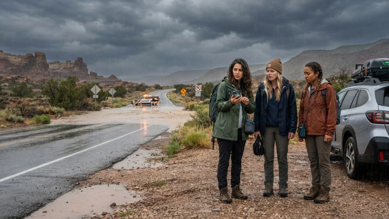
Image generated by AI
In the baked arroyos around Tucson, Arizona, and the low-lying river crossings of northwestern Missouri, less than six inches of swift-moving water can knock an adult off their feet, while a mere twelve inches can float a full-sized vehicle completely off the highway. That dangerous reality gripped travelers on September 16, 2026, as the National Weather Service Weather Prediction Center (WPC) placed northeastern Kansas and northwestern Missouri under an elevated Moderate Risk of excessive rainfall, with hazardous precipitation corridors extending across Arizona, New Mexico, Utah, and parts of Texas through September 17. Following severe storms that tore through the Plains with destructive 70 to 83 mile-per-hour winds and triggered urgent water rescues in downtown Tucson, independent road-trippers and outdoor travelers face severe environmental hazards that can transform dry roads into raging torrents in minutes.
Atmospheric Collision: Midwest Deluges and Southwest Desert Washes
The widespread rainfall threat stems from two distinct atmospheric mechanisms colliding across the American interior. In the north-central Plains and the Missouri Valley, a slow-moving frontal boundary has stalled directly over the convergence of Kansas, Nebraska, and northwestern Missouri. This stationary front acts as an atmospheric conveyor belt, triggering repeated "training" thunderstorms where individual storm cells repeatedly traverse the same geographic footprint. Because late-summer soils across northeastern Kansas and northern Missouri are already dense, saturated clay, excess precipitation cannot percolate into the ground, leading to immediate sheet runoff that overwhelms local creek basins, rural farm-to-market highways, and urban arterials connecting Kansas City and Wichita, with rain risks pushing east into Illinois.
Compounding the flooding threat, the current frontal boundary follows a wave of violent thunderstorms that blasted Kansas, Iowa, and Nebraska with extreme wind gusts between 70 and 83 miles per hour. These gale-force squalls toppled mature trees, brought down utility poles, and littered interstate highways with debris, leaving road networks compromised before the heaviest rainfall even commenced.
Simultaneously, a separate plume of subtropical moisture is circulating through the Four Corners region, fueling intense afternoon convection over the arid Southwest. In Arizona, heavy downpours accompanied by high winds in Tucson prompted emergency water rescues, demonstrating how rapidly urban street basins and desert washes turn hazardous. The threat extends through desert and mountain corridors surrounding Santa Fe, New Mexico, and Cedar City, Utah, where outdoor recreation and highway travel face sudden disruption. Official forecast bulletins from the National Weather Service warn that these multi-state weather hazards will persist through Wednesday and Thursday, requiring elevated caution across both prairie and canyon country.
What Makes Flash Floods Different Across Regions: Prairies Versus Red Rocks
Understanding how to travel safely during excessive-rainfall events requires recognizing that water behaves in vastly different ways depending on regional geography. In the Midwest, flooding is a creeping, saturating crisis. Across Kansas, Missouri, and Illinois, hours of steady downpours saturate agricultural topsoil until river valleys, drainage ditches, and highway underpasses slowly drown under brown water. On major transit arteries like Interstate 35 and Interstate 70, driving rain reduces visibility to zero, while hydroplaning turns high-speed highway travel into an extreme hazard. After sunset, the danger multiplies exponentially: standing floodwater conceals structural road collapse, submerged culverts, and washed-away bridges, making night driving on rural roads exceptionally hazardous.
In the desert Southwest, flash flooding presents a radically different, violent phenomenon. Here, water does not soak in; the sun-baked desert crust acts like cured concrete. Intense rain generates rapid surface runoff that funnels into narrow slot canyons, arroyos, and dry washes with terrifying speed. Most dangerously, a traveler standing under clear blue skies can be caught completely off-guard by a flash flood triggered by a thunderstorm taking place ten to fifteen miles upstream. Within minutes, a bone-dry creek bed can transform into a roaring wall of red mud, boulders, and tree trunks moving at highway speed.
These regional hydrology differences directly impact tourism activities. In the Plains, flooding disrupts scenic road trips through historic agricultural towns and Route 66 heritage corridors. In the Southwest, floodwaters threaten backcountry hikers, campers, and outdoor adventurers visiting national monuments and parks managed by the National Park Service, where escape routes out of deep canyons are non-existent once water levels begin to rise.
Visitor Insider Tips: Navigating Storm Corridors and Flood Zones
Protecting your journey when severe weather strikes requires strict adherence to flood safety protocols, practical highway adjustments, and localized destination knowledge:
The Absolute Commandment of Low-Water Crossings: Memorize and obey the federal guidance: Turn Around, Don't Drown. Never attempt to drive through standing or flowing water across a roadway, even if the depth appears negligible. The roadway beneath the water may have been completely eroded, creating a deep submerged chasm that will swallow your vehicle. If barricades are placed across a highway, never drive around them; find an alternate route or return to the nearest town.
Airport Buffer Windows: For travelers connecting through major regional aviation hubs like Kansas City International Airport (MCI) or Chicago O'Hare and Midway (ORD/MDW), build at least two additional hours into your airport transit schedule. While commercial flights may depart on schedule, perimeter access roads and terminal highway connectors are notorious for flooding or experiencing gridlock during severe convective storms. Rental car returns and shuttle transfers can also face major logistical slowdowns.
Southwest Camping and Arroyo Precautions: When exploring public lands or camping near Tucson, Sedona, or the southern Utah parks, never park your vehicle or pitch a tent inside a dry wash, creek bed, or low drainage basin. Even if skies are clear at your campsite, storms miles away can send a torrent through your camp while you sleep. Always establish campsites on elevated terrain at least fifty feet vertically above the high-water line of any drainage channel.
Inclement Weather Cultural Pivots: If severe storms halt road travel in Kansas City, divert your itinerary toward celebrated indoor cultural institutions. Spend the afternoon exploring the American Jazz Museum and the Negro Leagues Baseball Museum in the historic 18th & Vine District, or seek out authentic Kansas City barbecue at iconic neighborhood smokehouses where indoor dining lets you wait out the squalls in comfort. In Tucson, pivot indoors to explore the Arizona-Sonora Desert Museum's sheltered exhibits or admire the historic mission architecture of San Xavier del Bac.
Emergency Communications in the Field: Severe thunderstorm winds of 70 to 83 miles per hour routinely take out local cell towers in rural counties. Never rely solely on live streaming navigation apps. Always carry a physical state highway roadmap in your glove compartment, pack a battery-operated NOAA weather radio, and download offline satellite maps to your smartphone before traveling through rural Missouri or isolated desert valleys.
Cultural and Environmental Context: Climate Volatility Across Fragile Watersheds
The widening footprint of extreme precipitation events across the United States underscores the growing fragility of rural watersheds and regional communities. In Midwestern agricultural corridors along the Missouri and Mississippi river basins, late-summer flash floods drown harvest-ready crops, degrade precious topsoil, and place severe financial stress on multi-generational family farming communities that anchor local economies.
In the desert Southwest, long periods of historic drought exacerbate flash flood violence. The soil forms an impervious layer known as caliche, preventing natural moisture absorption and converting rain into immediate runoff. Torrential flash floods violently reshape desert creek ecosystems, scouring endangered native fish habitats and damaging delicate riparian cottonwood forests.
Sustainable tourism during severe weather cycles requires environmental respect and ethical restraint. Tourism resources from Visit Arizona remind travelers that venturing onto waterlogged desert trails damages fragile biocrust soils and causes severe trail erosion that takes decades to recover. Furthermore, ignoring road closure barriers or attempting to drive through flooded washes unnecessarily endangers local volunteer search-and-rescue teams, who must risk their lives conducting swift-water rescues that could have been prevented through basic travel caution.
FAQ: Navigating US Flash Flood Risks in 2026
Where are the most serious flash flood risks located right now? The most critical threat centers on northeastern Kansas and northwestern Missouri under a Moderate Risk of excessive rainfall, with dangerous secondary flooding threats active across Arizona, New Mexico, Utah, and Texas.
What is the safest response when encountering water covering a road? Follow the official National Weather Service guidance: Turn Around, Don't Drown. Never drive through flooded roads or bypass official barricades. Just twelve inches of moving water can float a vehicle away.
Can a flash flood strike when it isn’t raining at my location? Yes. In the Southwest, heavy rainfall miles upstream can travel rapidly through dry washes and slot canyons, unleashing sudden walls of mud and debris upon dry areas under sunny skies.
How does severe weather affect airport transfers in Kansas City and Chicago? While flights may operate, perimeter highways and access roads around Kansas City and Chicago airports often experience severe flooding and traffic gridlock. Travelers should allow two extra hours for airport journeys.
In the quiet seconds before an arroyo roars or a prairie creek overflows, listening to the warnings of the land is the only compass that counts.
Related Travel Guides
- Northeast I-95 Flooding Crisis: How Severe Storms Paralyzed Travel Across New York, Connecticut, and New Jersey
- Kansas Route 66 Centennial: Why the Shortest 13.2-Mile Mother Road Stretch Delivers the Biggest Road Trip Experience
- The Desert Monsoon Road Trip: Navigating Arizona and Utah Flash Flood Season Like an Expert
Disclaimer
This article is for informational and educational purposes only. It does not constitute legal, financial, or professional advice. While we strive to provide accurate and up-to-date information, travel policies, regulations, and conditions change rapidly. Always verify information with official sources before making travel decisions. Nomad Lawyer makes no representations about the accuracy, reliability, completeness, or suitability of the information provided. Readers should consult qualified professionals for advice specific to their circumstances. The views expressed in this article are those of the author and do not necessarily reflect the views of Nomad Lawyer.
Raushan Kumar
Founder & Lead Developer
Full-stack developer with 11+ years of experience and a passionate traveller. Raushan built Nomad Lawyer from the ground up with a vision to create the best travel and law experience on the web.
Learn more about our team →