Nepal Suspends Restricted-Area Trekking Permits as Himalayan Snowstorms and Cyclone Arnab Threaten Autumn Treks

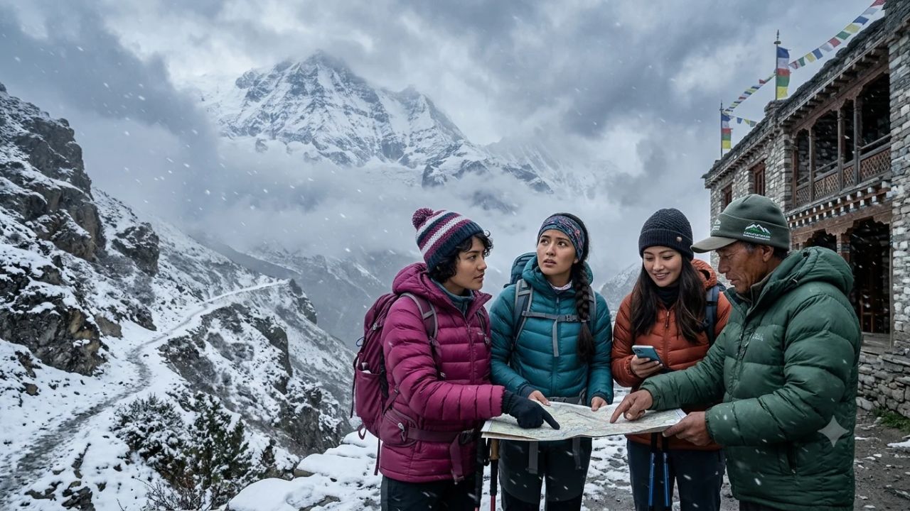
Nepal's Department of Immigration suspends restricted-area trekking permits through October 31 as severe Himalayan snowstorms and Cyclone Arnab create hazardous conditions
[KATHMANDU, Oct 30, 2026] — Nepal’s Department of Immigration has halted the issuance of restricted-area trekking permits across designated high-altitude Himalayan territories from October 29 through October 31, 2026, as disaster management authorities and the Department of Hydrology and Meteorology issue emergency warnings for severe snowstorms, blizzards, and heightened avalanche risks fueled by Cyclone Arnab over the Bay of Bengal.
[!NOTE] Emergency Operational Status and Key Advisories: The Department of Immigration (DoI) has suspended all permit issuance for designated restricted trekking regions—including Upper Mustang, Upper and Lower Dolpa, Manaslu, Tsum Valley, Humla, and Manang—covering the active storm period between October 29 and October 31, 2026. Concurrently, the Department of Tourism (DoT) has issued an expanded high-altitude advisory urging travelers to avoid high Himalayan regions from October 28 through November 1, 2026. The severe weather system, generated by atmospheric moisture from Cyclone Arnab interacting with western disturbances, brings intense snowfall, whiteouts, and gale-force winds above 3,500 meters, alongside heavy rain, flash floods, and landslides in Koshi, Madhesh, Bagmati, Gandaki, and Lumbini provinces. Official emergency helplines have been activated: 1155 (Weather Forecast Information), 1234 (Disaster Management Assistance), and 1144 (Tourist Police).
NEPAL HIMALAYAN EMERGENCY WEATHER & PERMIT ARCHITECTURE
| Column 1 |
|---|
| [ REGULATORY INTERVENTIONS ] [ METEOROLOGICAL DRIVERS ] |
| - Department of Immigration: Permit freeze Oct 29-31 - Cyclone Arnab over Bay of Bengal |
| - Department of Tourism: High-altitude advisory to Nov 1 - Influx of intense maritime moisture |
| - Enforced by Nepal Police & Armed Police checkposts - Heavy snowfall & gale-force winds |
| +----------------------------+-----------------------------+ |
| v v |
| [ HIGH-RISK RESTRICTED CORRIDORS ] [ PROVINCIAL WEATHER ALERTS ] |
| - Manaslu Circuit & Tsum Valley (Larkya La Pass: 5,106m) - Gandaki: Severe snow in Annapurna |
| - Upper Mustang (Lo Manthang high-altitude desert plateaus)- Bagmati: Heavy rain & road hazards |
| - Upper & Lower Dolpa (Shey Phoksundo, Numa La, Baga La) - Koshi & Madhesh: Flash flood risks |
| - Humla & Simikot (Northwestern high alpine valleys) - Lumbini: Inundation & slope slips |
| +----------------------------+-----------------------------+ |
| v |
| [ ACTIONABLE SAFETY & RESCUE PROTOCOLS ] |
| - Strict shelter-in-place order for trekkers currently in high-altitude tea houses |
| - Cancellation of visual flight rules (VFR) for STOL flights (Lukla, Jomsom, Simikot) |
| - Emergency Hotline Integration: 1155 (Weather), 1234 (Disaster Assistance), 1144 (Police) |
The Regulatory Freeze: Halting Permits to Protect Lives
The decision by the Government of Nepal to suspend restricted-area trekking permits during the final days of October represents an urgent, preventative intervention aimed at preventing mass-casualty events in remote mountain wildernesses. Autumn—specifically the months of October and November—stands as Nepal’s premier peak trekking season. Tens of thousands of international mountaineers, high-altitude trekkers, and cultural explorers arrive in Kathmandu annually during this window, drawn by traditionally stable post-monsoon weather, crystalline blue skies, and dry mountain trails.
However, the Department of Immigration’s sudden freeze on permit issuance underscores how quickly high-altitude conditions can shift from scenic perfection to life-threatening exposure. The suspension applies directly to territories designated under Nepal's restricted-area framework. Unlike mainstream trekking corridors such as the Everest Base Camp route or the lower Annapurna Sanctuary, restricted areas require specialized government permits, compulsory accompaniment by licensed government-registered trekking guides, a minimum group size of two foreign travelers, and the payment of premium daily royalties.
These restricted zones encompass some of the most geographically isolated and rugged alpine landscapes in the world, including Upper Mustang, Manaslu, Tsum Valley, Upper and Lower Dolpa, and Humla. In these remote valleys, human settlements are separated by multi-day walking distances over mountain passes exceeding 5,000 meters (16,400 feet). Basic tea-house infrastructure is sparse, road connectivity is non-existent, and cellular telecommunications are intermittent or completely absent.
When a catastrophic blizzard strikes these isolated sectors, emergency mountain search-and-rescue operations become virtually impossible. Cloud cover and gale-force turbulence ground rescue helicopters in Kathmandu and Pokhara, while deep snowdrifts bury unmarked trails, blinding hikers in disorienting whiteout conditions. By cutting off permit issuance before international teams crossed the final police checkpoints, the Department of Immigration acted decisively to keep travelers in lower, sheltered elevations.
REGULATORY PERMIT SUSPENSION PARAMETERS
| Column 1 |
|---|
| Administrative Dimension Official Mandate Operational Scope |
| -------------------------------------------------------------------------------------------- |
| Enforcing Agency Department of Immigration (DoI)Immigration & border checkpoint police |
| Permit Freeze Period October 29 to October 31, 2026 Halts issuance of new restricted passes |
| DoT Precautionary Advisory October 28 to November 1, 2026 Urges evacuation from high altitudes |
| Target Destinations Designated Restricted CorridorsUpper Mustang, Manaslu, Dolpa, Humla |
| Mandatory Directive Shelter in place / Postpone Adherence required for licensed guides |
Meteorological Dynamics: Cyclone Arnab and the Himalayan Snowstorm
The catastrophic weather system that triggered the government shutdown is not a typical winter frontal passage. Instead, it is the product of an unseasonal, volatile meteorological collision between tropical maritime moisture and high-altitude Himalayan winds.
According to bulletins published by the Department of Hydrology and Meteorology (DHM), the primary catalyst behind the storm is Cyclone Arnab, a powerful cyclonic system centered over the Bay of Bengal. As the cyclone gathered intensity over warm oceanic waters, its counter-clockwise circulation pumped massive plumes of warm, humid, tropical maritime air northward across eastern India and Bangladesh, channeling it directly into the topography of the Indian subcontinent and Nepal.
When this moisture-laden air mass collided with the sheer geological barrier of the Himalayas, it was forced rapidly upward in a process known as orographic lifting. As the air rose over the high ridges of the Mahabharat range and the Greater Himalayas, it cooled rapidly, condensing into massive storm clouds.
Simultaneously, an upper-level westerly trough carrying cold, dry air from Central Asia intercepted the cyclone's tropical moisture directly above Nepal. The collision of these two contrasting air masses generated an explosive meteorological phenomenon across distinct elevation bands. At elevations below 3,000 meters, the storm unleashed relentless, torrential rain, saturating fragile mountain hillsides and triggering flash flooding across river valleys. At elevations between 3,500 meters and 5,500 meters—precisely where high-altitude trekking routes, base camps, and mountain passes are located—temperatures plunged well below freezing, converting the intense atmospheric moisture into heavy snowfall, howling blizzards, and zero-visibility whiteouts. Wind speeds across exposed ridges and high passes reached sustained gale-force velocity, generating wind-chill temperatures cold enough to cause rapid frostbite and hypothermia within minutes of direct exposure.
Meteorologists noted painful historical parallels between the current atmospheric setup and the deadly disaster of October 2014, when Cyclone Hudhud in the Bay of Bengal dumped meters of unpredicted snow across the Annapurna Circuit, triggering devastating avalanches around Thorong La and claiming the lives of over forty trekkers, guides, and porters. The timely permit suspension for Cyclone Arnab reflects lessons learned from past tragedies, utilizing modern satellite meteorology to intervene before disaster strikes.
CYCLONE ARNAB HIMALAYAN METEOROLOGICAL MECHANISM
| Column 1 |
|---|
| [ 1. BAY OF BENGAL: CYCLONE ARNAB ] |
| - Warm, moisture-saturated tropical air mass pushed rapidly northward toward Nepal |
| v |
| [ 2. OROGRAPHIC LIFTING OVER THE HIMALAYAS ] |
| - Moisture collides with 7,000m - 8,000m peaks; forced upward into sub-zero upper atmosphere |
| v |
| [ 3. COLLISION WITH WESTERLY JETSTREAM TROUGH ] |
| - Cold Central Asian air triggers rapid freezing, condensation, and severe pressure drops |
| +----------------------------+-----------------------------+ |
| v v |
| [ BELOW 3,000 METERS: HEAVY RAINFALL ] [ ABOVE 3,500 METERS: BLIZZARD ] |
| - Torrential downpours across valleys - Heavy snow accumulations (1-2m) |
| - Saturated soil & riverbank erosion - Sustained gale-force winds & chill |
| - Flash flooding & road-severing landslides - Zero visibility & avalanche hazard |
Detailed Breakdown of Affected Restricted Trekking Zones
To understand the geographical scope of the permit suspension, travelers must examine the specific restricted regions governed by the Department of Immigration’s order:
1. The Manaslu Circuit and Tsum Valley
Located in the Gorkha district of Gandaki province, the Manaslu Circuit circumnavigates Mount Manaslu, the eighth-highest mountain in the world at 8,163 meters. The trek’s ultimate obstacle is the crossing of the Larkya La pass, sitting at an altitude of 5,106 meters (16,752 feet). The approach to Larkya La involves an exposed traverse over glacial moraines without intermediate shelter between Dharamsala and Bimthang. During a heavy blizzard, trail cairns are rapidly submerged, leaving trekkers vulnerable to crevasse falls and fatal hypothermia. Branching northeast toward the Tibetan border, the sacred Tsum Valley features sheer gorge paths carved into vertical cliff faces. Torrential rain and heavy wet snow destabilize these cliffs, creating severe rockfall hazards that can completely sever the only walking route out of the valley.
2. Upper Mustang: The Walled Kingdom of Lo
Extending northward into the Tibetan Plateau behind the rain shadow of the Annapurna and Dhaulagiri massifs, Upper Mustang is traditionally renowned for its arid, desert-like climate. However, because Upper Mustang sits in a rain shadow, its mud-brick architecture, trail infrastructure, and local populations are ill-equipped for massive snowstorms. Trekking north to the historic walled capital of Lo Manthang requires traversing a succession of barren mountain passes between 3,800 and 4,200 meters. When cyclonic storms overcome the rain shadow, bitter freezing winds sweep across the treeless plateau, creating blinding ground blizzards that obscure landmarks and paralyze vehicle transport along the rough dirt track to Jomsom.
3. Upper and Lower Dolpa: Remote Mountain Isolation
Dolpa represents the largest, least developed, and most remote district in Nepal, situated in the northwestern Karnali province. Treks through Shey Phoksundo National Park and onward to the mystical Shey Gompa require crossing high alpine passes, including Numa La (5,309 meters) and Baga La (5,169 meters). In Dolpa, there are no medical outposts capable of treating advanced frostbite or pulmonary edema. A trekker stranded by snow in Upper Dolpa faces a minimum five-to-seven-day walk to the nearest rough airstrip at Juphal, making unassisted survival during a multi-day blizzard nearly impossible.
4. Humla and the Far-West Border Corridors
Humla, situated in Nepal’s extreme northwest, serves as the historic pilgrimage route leading through the high border pass of Hilsa into Tibet toward Mount Kailash. Access to Humla is tethered entirely to the high-altitude mountain runway at Simikot. Severe weather grounds all fixed-wing aircraft connecting Simikot with Nepalgunj, cutting off food supplies, emergency medical evacuations, and passenger departures.
RESTRICTED HIMALAYAN SECTORS: OPERATIONAL VULNERABILITY
| Column 1 |
|---|
| Restricted Region Highest Route Elevation Primary Weather Hazard |
| -------------------------------------------------------------------------------------------- |
| Manaslu Circuit (Gorkha) Larkya La Pass (5,106m) Glacial moraine whiteout & avalanches |
| Tsum Valley (Gorkha) Mu Gompa (3,700m) Gorge rockfalls & trail washouts |
| Upper Mustang (Mustang) Lo Manthang Passes (4,200m) Sub-zero gale winds & road blockages |
| Upper Dolpa (Karnali) Numa La & Baga La (5,300m+) Total wilderness entrapment |
| Humla (Far-West Karnali) Nara La Pass (4,580m) Simikot air link closure & isolation |
Provincial Travel Warnings: Landslides and River Swells Across the Country
While the permit freeze specifically targets high-altitude restricted territories, the Nepal Tourism Board (NTB) has issued a nationwide travel alert emphasizing that Cyclone Arnab’s convective weather system poses severe hazards across lower elevations and popular road corridors.
The alert highlights moderate to heavy rainfall, thunderstorms, and high winds across five of Nepal’s seven provinces: Koshi, Madhesh, Bagmati, Gandaki, and Lumbini. In these provinces, torrential downpours present distinct dangers for domestic and international travelers:
Slope Destabilization Along Mountain Arteries
Nepal’s steep, geologically young topography makes its highway network highly susceptible to mudslides and debris flows during intense rainfall. Key overland transit corridors face severe disruption:
- The Prithvi Highway: The vital lifeline connecting Kathmandu with Pokhara and Chitwan passes through deep river valleys flanking the Trishuli River. Saturated hillsides along this route routinely collapse, stranding tourist buses and private vehicles for tens of hours.
- The Tribhuvan Highway and BP Highway: Southern mountain routes connecting the capital to the plains of Madhesh province are prone to devastating slope failures, as demonstrated during late-monsoon storms earlier in the year.
- The Mugling–Narayanghat Corridor: This critical commercial chokepoint frequently experiences spontaneous rockfalls that can crush vehicles or block transit indefinitely.
River Swells and Flash Flooding
Heavy precipitation rapidly engorges major river systems feeding down from the Himalayan glaciers, including the Marsyangdi, the Kali Gandaki, the Bhotekoshi, and the Koshi River basin. Riverside campsites, rafting expeditions, and trekking trails traversing low suspension bridges face immediate flash-flood risks. The Nepal Tourism Board has explicitly instructed travelers to stay away from swollen riverbanks and refrain from attempting to cross low-lying bridges during periods of intense rainfall.
PROVINCIAL RISK PROFILE: CYCLONE ARNAB IMPACT MATRIX
| Column 1 |
|---|
| Province Primary Geographic Feature Identified Travel Hazards |
| -------------------------------------------------------------------------------------------- |
| Gandaki Province Annapurna & Manaslu Massifs Blizzards in peaks; Pokhara road slips |
| Bagmati Province Kathmandu Valley & Langtang High urban rain; highway blockages |
| Koshi Province Everest & Kanchenjunga foothillsFlash floods in lower river basins |
| Lumbini Province Terai Plains & Hilly Borders Severe thunderstorms & inundation |
| Madhesh Province Low-Lying Southern Plains Waterlogging & localized flooding |
Aviation Impacts: Mountain Airstrips and Helicopter Groundings
Aviation represents the indispensable logistical backbone of mountain tourism in Nepal. With overland journeys requiring days of grueling travel across unpaved mountain roads, trekking itineraries rely heavily on Short Takeoff and Landing (STOL) aircraft and commercial charter helicopters.
The arrival of Cyclone Arnab’s cloud canopy and storm front has paralyzed mountain aviation operations:
The Constraints of Visual Flight Rules (VFR)
Most domestic mountain airstrips in Nepal—including Tenzing-Hillary Airport in Lukla, Jomsom Airport in Mustang, Talcha Airport in Rara, and Simikot Airport in Humla—are strictly classified as Visual Flight Rules (VFR) facilities. Because these airfields are carved into narrow mountain canyons surrounded by towering peaks, aircraft cannot land using instrument landing systems (ILS). Pilots must maintain visual contact with the runway and surrounding terrain at all times.
When low cloud decks, thick fog, blowing snow, and heavy rainfall obscure mountain valleys, aviation authorities immediately suspend flights. During the peak storm window of October 30 and 31, dozens of scheduled flights between Kathmandu, Pokhara, Lukla, and Jomsom were canceled, leaving hundreds of tourists stranded at departure terminals or mountain lodges.
Helicopter Evacuation Limitations
Many adventure travelers hold the misconception that a private charter helicopter can rescue them from any mountain hazard at a moment’s notice. In reality, rescue helicopters are severely constrained by atmospheric conditions:
- Zero-Visibility Flying: Helicopter pilots cannot fly through dense clouds or blinding snowstorms where mountain peaks and high-voltage transmission lines become invisible.
- Turbulence and Rotor Icing: Severe convective winds and freezing atmospheric temperatures cause ice accumulation on helicopter rotor blades, altering aerodynamic lift and creating catastrophic flight safety risks.
- Altitude Limits in Thin Air: Operating at elevations above 4,500 meters pushes helicopters toward their maximum operating ceilings. Thin air combined with unpredictable storm downdrafts makes high-altitude hovering or landing on unpaved snow-covered terrain exceptionally perilous.
Consequently, trekkers trapped by heavy snowfall cannot rely on instant helicopter evacuation. They must be prepared to shelter in place until weather systems dissipate and clear skies return.
MOUNTAIN AVIATION CONSTRAINTS DURING STORM FRONTS
| Column 1 |
|---|
| Aviation Category Operating Parameter Storm Failure Dynamic |
| -------------------------------------------------------------------------------------------- |
| STOL Fixed-Wing (Lukla) Visual Flight Rules (VFR) Instant grounding by low cloud ceiling |
| Helicopter Rescue Charters Visual navigation & clear windsGrounded by blizzard winds & rotor ice |
| Emergency Evacuation Window Variable; weather dependent Multi-day delays during cyclonic front |
| Mountain Airstrip Runways Short asphalt or gravel strips Surface snow accumulation & ice freeze |
Emergency Mountain Medicine: The Dangers of Inaction at High Altitude
The intersection of severe weather and high altitude creates compounding medical emergencies that can turn minor health concerns into fatal conditions.
Acute Mountain Sickness (AMS) and Severe Hypothermia
At elevations above 3,500 meters, the effective oxygen content of the atmosphere is significantly reduced. Trekkers ascending toward high passes like Larkya La (5,106m) or Thorong La (5,416m) already face physiological strain as their bodies acclimatize.
When a blizzard hits, ambient temperatures plummet to between -15°C and -25°C (5°F to -13°F). High winds strip heat rapidly from human bodies through convective cooling. If a trekker’s clothing becomes soaked with sweat or precipitation, hypothermia can set in within thirty to sixty minutes. As body core temperature drops, cognitive reasoning deteriorates, leading to confusion, exhaustion, and the inability to navigate treacherous terrain.
Simultaneously, extreme physical exertion combined with cold, dry air exacerbates altitude-related illnesses:
- High Altitude Pulmonary Edema (HAPE): Fluid accumulates in the lungs, causing persistent coughing, severe breathlessness at rest, blue lips, and rapid physical collapse.
- High Altitude Cerebral Edema (HACE): Swelling of the brain tissue leads to loss of physical coordination (ataxia), hallucinations, coma, and death unless immediate descent occurs.
Medical Outposts and Treatment Realities
The Department of Tourism has highlighted the presence of specialized high-altitude medical outposts operated by the Himalayan Rescue Association (HRA) and volunteer medical clinics in hubs like Manang, Pheriche, and Machhermo.
However, medical personnel emphasize that the primary, definitive treatment for severe AMS, HAPE, or HACE is immediate descent to lower altitude. During a blinding blizzard, descending several thousand vertical feet over snow-covered passes or icy rocky cliffs may be physically impossible. Trekkers trapped in high tea houses must rely on portable hyperbaric chambers (Gamow bags), supplemental bottled oxygen, and prescription medications like acetazolamide (Diamox) or dexamethasone until trails become passable.
HIGH-ALTITUDE ENVIRONMENTAL MEDICAL RISK PROFILE
| Column 1 |
|---|
| Medical Hazard Pathological Trigger Field Action Required |
| -------------------------------------------------------------------------------------------- |
| Hypothermia Freezing winds & wet clothing Dry clothing, sleeping bag, hot fluids |
| Acute Mountain Sickness Rapid ascent & low oxygen Rest, hydration, acetazolamide (Diamox) |
| High Altitude Pulm. Edema Fluid in lungs at altitude Immediate descent, oxygen, Gamow bag |
| High Altitude Cereb. Edema Brain swelling at altitude Emergency descent, dexamethasone |
| Frostbite Freezing of extremities Gradual re-warming; avoid refreezing |
Protocols for Trekkers Currently on Trail: Shelter in Place
For international trekking groups, solo travelers, and expedition crews currently stationed in mountain lodges across the Himalayas, government disaster management authorities have issued clear, non-negotiable instructions: remain sheltered and suspend all forward movement.
1. The Fallacy of the Valid Permit
A common psychological trap in adventure travel is the belief that holding a prepaid permit or hiring an expensive private expedition entitles a traveler to push forward regardless of weather. Authorities have cautioned that possessing a previously approved restricted-area permit does not grant permission to enter hazardous mountain passes during an active storm alert. Trekking permits grant access to geographic regions; they do not override emergency civil protection directives or basic survival logic.
2. Defer to Licensed Guides and Local Wisdom
Trekking in Nepal’s restricted areas legally mandates the accompaniment of a licensed trekking guide certified by the Nepal Tourism Board and the Trekking Agencies' Association of Nepal (TAAN).
- Travelers must respect the professional judgment of their lead guide (Sirdar). If a guide advises staying in a lodge rather than attempting to cross an exposed pass, clients must comply without argument.
- Local lodge owners and mountain inhabitants possess deep generational knowledge of local microclimates, avalanche paths, and snow conditions. When local elders declare that a pass is impassable, travelers should heed their warning implicitly.
3. Maintain Digital Satellite Communications
In remote mountain valleys where local cellular towers lose power during severe storms, standard smartphones become useless. Trekking teams should carry active satellite communication messengers (such as Garmin inReach, ZOLEO, or Iridium satellite phones).
- Send scheduled daily check-in messages to your trekking agency’s operations desk in Kathmandu.
- Preserve device battery life by keeping electronics warm inside sleeping bags and using portable power banks sparingly.
- Share your exact GPS coordinates when sheltering in a tea house, allowing rescue coordinators to map your location if post-storm assistance is required.
SHELTER-IN-PLACE ACTION CHECKLIST FOR TREKKERS
| Column 1 |
|---|
| Action Priority Tactical Implementation Survival Benefit |
| -------------------------------------------------------------------------------------------- |
| Immediate Halting Stop trekking; secure lodge Eliminates trail exposure & whiteout |
| Guide Authority Follow Sirdar recommendations Prevents hazardous pass attempts |
| Satellite Check-In Broadcast coordinates via GPS Alerts Kathmandu base to safe status |
| Thermal Preservation Layer clothing & stay dry Prevents onset of hypothermia |
| Resource Management Conserve battery & ration food Prepares for multi-day storm delays |
The Outlook Beyond October 31: Trail Reopening and Assessment
While the Department of Immigration’s explicit permit freeze covers the three-day window ending October 31, 2026, travelers and tour operators must not assume that normal mountain trekking will immediately resume on November 1.
The Department of Tourism’s broader safety advisory explicitly extends through November 1, reflecting the operational reality of the post-storm recovery phase:
1. Post-Storm Avalanche Hazard Assessments
Fresh snowfall measured in meters does not stabilize immediately after clouds disperse. When the sun emerges following a massive cyclonic blizzard, solar radiation warms upper snow layers, creating heavy, unstable wet-slab snowpack. High mountain passes and steep valley walls become prime avalanche zones for forty-eight to seventy-two hours after snowfall ceases. Mountain routes cannot be declared safe until regional trekking associations, Armed Police Force mountain rescue units, and local trail committees conduct physical slope assessments.
2. Trail Clearing and Snowdrifts
Deep snow drifts—frequently stacked two to three meters deep in wind-scoured hollows—completely obliterate walking paths across Larkya La, Thorong La, and high Dolpa passes. Porters carrying heavy client baggage and pack animals (mules and yaks) cannot navigate deep, uncompacted snow. Local trail crews and guides must physically break trails, dig out buried prayer-flag markers, and test ice bridges before commercial trekking groups can safely proceed.
3. Communications and Itinerary Flexibility
Tourists planning departures for early November must contact their Kathmandu-based destination management companies (DMCs) to verify whether specific trailheads have reopened. Tour operators will need to exercise flexible rescheduling, rerouting travelers toward lower-altitude cultural circuits (such as the Kathmandu Valley Cultural Trail, the Helambu circuit, or the lower Annapurna foothills) if high-altitude restricted passes remain blocked by snow.
POST-STORM HIMALAYAN TRAIL REOPENING TIMELINE
| Column 1 |
|---|
| Phase / Date Field Operation Safety Milestone |
| -------------------------------------------------------------------------------------------- |
| Phase 1: Oct 29 - 31 Active Storm & Permit Freeze Full sheltering; zero trail movement |
| Phase 2: Nov 1 Storm Dissipation & Inspection Aerial surveys & slope stability scan |
| Phase 3: Nov 2 - 3 Trail Breaking & Rescue Checks Clearing drifts on high passes |
| Phase 4: Nov 4 Onward Conditional Permit Resumption Gradual reopening of inspected routes |
Essential Emergency Contact Numbers and Travel Precautions
For international travelers, trekking operators, concerned family members, and consular officials seeking verified real-time information during this emergency weather disruption, the Government of Nepal and the Nepal Tourism Board have established centralized emergency communication channels:
NEPAL EMERGENCY DIRECTORY FOR ADVENTURE TRAVELERS
| Column 1 |
|---|
| Organization / Emergency Entity Direct Dial Number Operational Service |
| -------------------------------------------------------------------------------------------- |
| Department of Hydrology (DHM) 1155 (Toll-Free) Real-time weather & flood warnings |
| National Emergency Operations (NEOC)1234 (Toll-Free) National disaster & rescue coordination |
| Nepal Tourist Police Headquarters 1144 (Toll-Free) Tourist safety, tracking, & assistance |
| Nepal Tourism Board Crisis Desk +977-1-4256909 Official visitor advisory updates |
| Trekking Agencies' Assoc. (TAAN) +977-1-4440920 Guide network & trail status reports |
| Himalayan Rescue Association (HRA) +977-1-4445588 High-altitude medical consultation |
Critical Insurance Due Diligence for Himalayan Trekkers
Before resuming any suspended trekking activity or embarking on an altered itinerary, travelers must re-examine the terms of their comprehensive travel insurance policies:
- Verify Altitude Ceilings: Many standard travel insurance policies enforce strict altitude exclusions, terminating coverage above 3,000 meters or 4,000 meters. Trekkers in Nepal must possess specialized adventure riders providing coverage up to 6,000 meters.
- Explicit Helicopter Evacuation Inclusion: Ensure your policy explicitly includes emergency helicopter search, rescue, and medical evacuation without requiring pre-authorization from claims adjusters in situations where communication is severed.
- Coverage for Natural Disaster Delay and Rerouting: Confirm whether your insurance reimburses non-refundable expenses (such as missed international return flights, unutilized hotel reservations, or additional tea-house accommodation days) incurred due to government-mandated permit suspensions or natural weather disasters.
Strategic Outlook: Balancing Himalayan Adventure with Precautionary Safety
Nepal’s decisive decision to suspend restricted-area trekking permits in the face of Cyclone Arnab demonstrates a mature, safety-first evolution in national tourism governance.
While temporary trail freezes inevitably cause disappointment, itinerary cancellations, and commercial disruptions for trekking agencies, they preserve the most valuable asset in adventure travel: human life. The Himalayas represent an awe-inspiring, majestic wilderness, but they are governed by unforgiving natural forces that demand respect.
By monitoring verified meteorological forecasts, adhering strictly to government directives, respecting the guidance of local Sherpa guides, and remaining patient while storm systems pass, international travelers can navigate this autumn disruption safely, ensuring that their Himalayan journey remains an extraordinary, life-affirming adventure.
Frequently Asked Questions (PAA)
Why did Nepal suspend trekking permits in restricted areas in late October 2026?
Nepal’s Department of Immigration temporarily suspended the issuance of restricted-area trekking permits from October 29 to October 31, 2026, as a precautionary safety measure. The decision was prompted by emergency meteorological warnings of heavy snowfall, snowstorms, zero-visibility blizzards, and elevated avalanche hazards across high-altitude Himalayan territories, driven by Cyclone Arnab in the Bay of Bengal.
Which trekking areas are affected by the permit suspension?
The permit suspension specifically affects designated restricted trekking regions governed by the Department of Immigration, including Upper Mustang, Upper Dolpa, Lower Dolpa, the Manaslu Circuit, Tsum Valley, Humla, and parts of Manang. It does not apply to every low-altitude trail in Nepal, though broader travel warnings cover adjacent high-altitude passes.
When will restricted-area trekking permits resume in Nepal?
The immediate permit freeze was designated to cover the severe weather window ending on October 31, 2026. However, the Department of Tourism’s precautionary advisory continues through November 1, 2026. Resumption of permits depends on post-storm slope stability evaluations, snowpack clearance on high passes, and formal announcements from the Department of Immigration and local district administrations.
What should trekkers already in the mountains do during the blizzard alert?
Trekkers currently stationed in high-altitude regions must halt all forward movement and shelter in place at secure tea houses or lodges. They should avoid attempting to cross exposed mountain passes, follow the instructions of licensed trekking guides, maintain communication with their agencies via satellite messengers or local phones, and stay away from landslide-prone slopes and flooded riverbanks.
What emergency telephone numbers should tourists call in Nepal during severe weather?
Travelers in Nepal can utilize three primary toll-free emergency numbers: dial 1155 for real-time weather forecasts and flood information from the Department of Hydrology and Meteorology; dial 1234 for disaster management assistance through the National Emergency Operation Centre; and dial 1144 for immediate help from the Nepal Tourist Police.
Related Travel Guides
This article is for informational purposes. Flight routes, passenger regulations, visa rules, and transit advisories are subject to change by airlines and aviation authorities. Readers are advised to verify schedules and travel documentation with relevant carriers and border agencies before departure.
Related Stories

Middle East Flight Disruptions: Over 880 Delays and 70 Cancellations Hit Dubai, Doha, and Saudi Airports

France Riots Travel Alert: Lyon, Nice, Paris, and Marseille Face Tourism Uncertainty as Hotel Bookings Slow in October 2026