
Norway and More European Countries Turn Dangerous Holiday Routes Into Intelligent Travel Networks

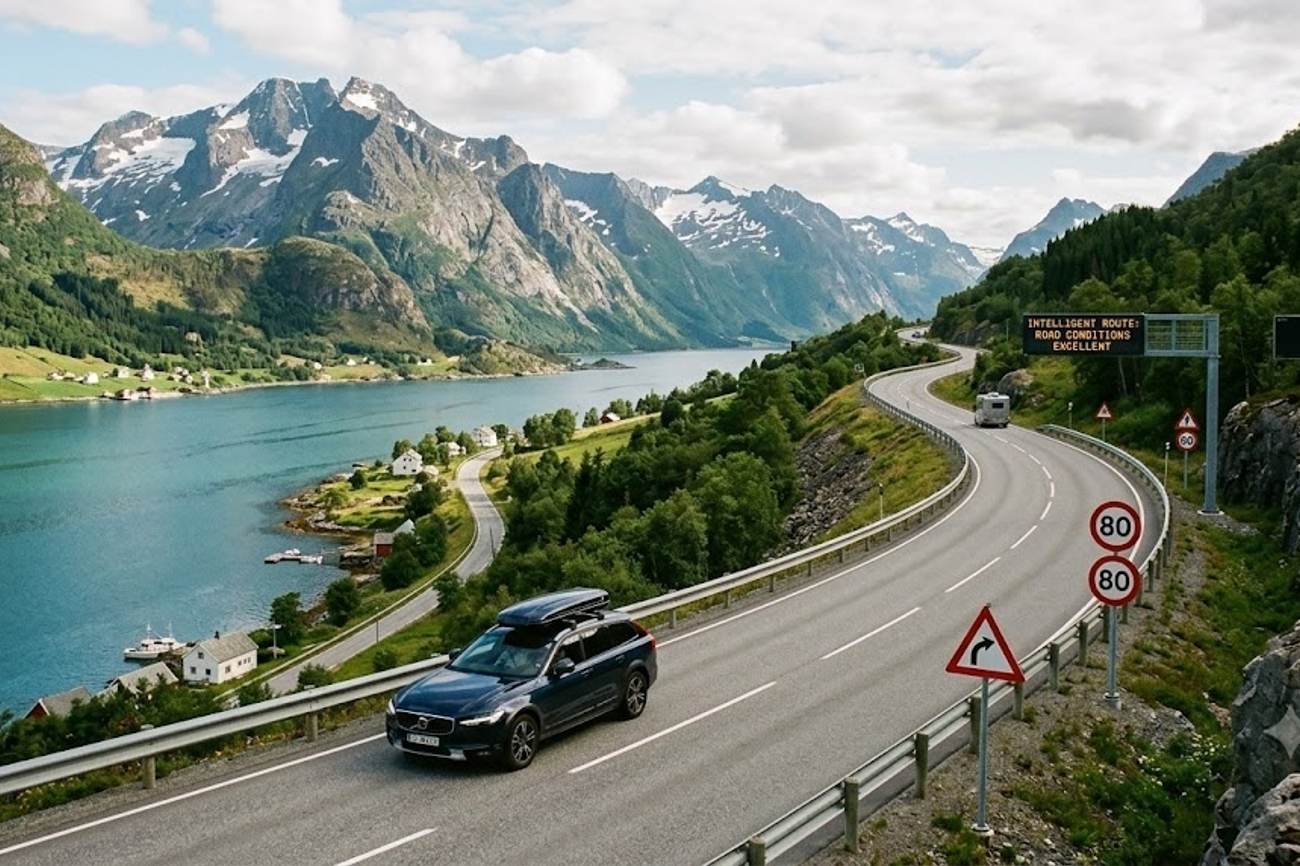
Image generated by AI
EU road fatalities on secondary single-carriageway roads currently account for 53% of all fatal collisions, a stark contrast to the 8% recorded on controlled-access motorways. This data reveals a profound "Rural Vulnerability Gap," where the most scenic corridors—the primary draw for international self-drive tourists—are statistically the most lethal segments of the European transport network.
The Rural Vulnerability Gap in Numbers
The structural disparity in European road safety is not a matter of traffic volume, but of road geometry and driver familiarity. According to consolidated data from the European Commission and the Community database on Accidents on the Roads in Europe (CARE), the European Union records between 19,400 and 19,900 road fatalities annually. When these figures are disaggregated by road type, the danger is concentrated heavily in non-urban environments.
Rural, secondary single-carriageway roads are the epicenter of this crisis, absorbing 53% of all fatal accidents. In comparison, urban street networks account for 38%, and motorways—despite their higher speed limits—represent only 8% of total fatalities. For the international traveler, this means the "quintessential" driving experience through coastal loops and high-altitude passes carries a disproportionately higher risk profile than highway transit.
The danger is compounded by specific structural deficiencies inherent to these routes:
- Lack of central physical dividers.
- Severe drop-offs on unforgiving verges.
- Sharp horizontal and vertical curvature.
- High seasonal congestion blending international tourists with agricultural transport and cyclists.
This data indicates that human error is more likely to result in a fatal outcome on a secondary road than on a motorway, primarily because the infrastructure lacks the "forgiving" design elements found in controlled-access networks.
Comparative Risk Analysis: Road Network Classification
The following table breaks down the crash dynamics and specific risk factors across the three primary EU road classifications based on official collision registries.
| Road Network Classification | Share of Total EU Fatalities | Primary Structural Crash Dynamics | Predominant Tourist Risk Factor |
|---|---|---|---|
| Rural / Secondary Single Carriageways | 53% | Head-on collisions, roadway departure, tree/rock impacts | Unfamiliarity with road geometry, misjudged overtaking |
| Urban Road Networks | 38% | Vehicle-to-vulnerable road user impacts | Complex junction navigation, micro-mobility interactions |
| Motorways / Controlled Access | 8% | High-speed rear-end impacts, multi-vehicle pile-ups | Driver fatigue, high differential travelling speeds |
When comparing these figures to regional benchmarks, Northern Scandinavia presents a unique case study in extreme environmental risk. In Norway, where annual road deaths range between 110 and 120, over 65% of severe crashes involving non-resident motorists occur on non-urban fjord and Arctic highways. While Sweden maintains a global safety benchmark of approximately 20 road deaths per million inhabitants, the prevalence of single-carriageway run-off crashes in remote northern expanses remains the primary barrier to achieving "Vision Zero" targets.
Practical Traveler Advisory and Strategic Insights
The data suggests that the highest risk period for a traveler is not the transit between cities, but the exploration of the periphery. If you are planning a self-drive tour of Europe, specifically in the Nordic regions or the Alps, the following data-backed precautions are essential:
- Prioritize Vehicle Specification over Insurance: Traditional rental insurance covers the financial loss after a crash, but it does not mitigate the 53% fatality risk on secondary roads. In Northern Norway and Sweden, ensure your rental is equipped with studded tires or high-grade winter rubber, as unfamiliarity with low-friction dynamics is a leading cause of non-resident collisions.
- Audit Your Route Geometry: When planning trips via the Lofoten Scenic Route (E10), the Atlantic Ocean Road, or the E4 Arctic corridor, allocate 30% more time than GPS estimates. The high rate of "misjudged overtaking" on single-carriageways suggests that rushing through narrow corridors significantly increases the probability of a head-on collision.
- Account for Wildlife Corridors: In Scandinavia, the high center of gravity of moose (Alces alces) and reindeer (Rangifer tarandus) means collisions often result in roof or windscreen collapse. Avoid driving these secondary corridors during dawn, dusk, or polar night when visibility is restricted and animal activity peaks.
- Monitor Real-Time Telematics: Use apps linked to IATA or national transport authorities like Statens vegvesen to track "black ice" alerts, as maritime temperature swings create invisible hazards on bridge decks and coastal causeways.
The Shift Toward Predictive Infrastructure
The European regulatory framework is moving away from reactive repairs toward predictive risk mitigation. This is codified in Directive (EU) 2019/1936, which amended Directive 2008/96/EC. This shift expands the scope of Road Infrastructure Safety Management beyond the Trans-European Transport Network to include all primary non-urban roads funded by European or national instruments.
This regulatory evolution means that secondary corridors are now being classified into risk tiers based on historical crash density and proactive design evaluations. The goal, as stated by European Commissioner for Sustainable Transport and Tourism Apostolos Tzitzikostas, is a trajectory toward zero road deaths by 2050.
The industry is currently deploying a "Vision Zero" safety network that integrates:
- Connected Telematics: Real-time data transmission between vehicles and infrastructure.
- Intelligent Roadside Sensors: Detection of black ice and wildlife movement.
- Predictive Hazard Warnings: Digital alerts sent to drivers before they encounter blind mountain curves or bottlenecks.
For further data on global road safety standards and the impact of infrastructure on fatality rates, refer to the World Tourism Organization (UNWTO) or the World Travel & Tourism Council (WTTC).
FAQ: European Rural Road Safety 2024
Are scenic roads more dangerous than motorways? Yes. Data shows rural secondary roads account for 53% of EU road fatalities, compared to just 8% on motorways. The lack of physical dividers and sharper curves make human error more likely to be fatal.
Which regions have the highest risk for international drivers? Northern Scandinavia (Norway and Sweden) is particularly high-risk due to black ice and wildlife. In Norway, over 65% of severe non-resident crashes occur on non-urban fjord and Arctic highways.
Is standard rental insurance enough for a rural road trip? No. Insurance is reactive. To reduce risk, travelers should focus on vehicle specifications (winter tires) and real-time hazard alerts, as infrastructure on secondary roads is less forgiving than on highways.
What is the "Vision Zero" goal? It is a coordinated European effort to eliminate all road deaths by 2050 through a combination of predictive digital oversight, connected telematics, and physical infrastructure improvements.
The data is clear: the beauty of the European backcountry is matched only by its volatility, making predictive technology the new essential travel companion.
Tags: EU-Road-Fatality-Rate-2024, Vision-Zero-2050, Scandinavia-Arctic-Driving-Risk, Directive-EU-2019-1936, Rural-Transport-Safety-Data
Related Travel Guides
- UK Surpasses France and More Markets to Fuel Spain’s Tourism Growth as Hotel Overnight Stays Increase 1.4% in August 2026
- Portugal Teams Up With Romania And More Countries Across Europe Facing Canada Immigration Hurdles As Atlantic Rules Tighten
- Birmingham Launches New Hotel Investment Model To Attract More Visitors And Events
This article is for informational purposes. Flight routes, passenger regulations, visa rules, and transit advisories are subject to change by airlines and aviation authorities. Readers are advised to verify schedules and travel documentation with relevant carriers and border agencies before departure.
Related Stories

European Mass Protests Disrupt Travel Across France, Italy, Belgium, and Turkey in 2026
The Best Things to Do in Vero Beach with Family: A Local Parent & Traveler's Guide