
Nepal Travel Alert: Landslide Triggers 20-Metre Highway Collapse on Siddhicharan Highway, Blocking Kathmandu-Solukhumbu Access

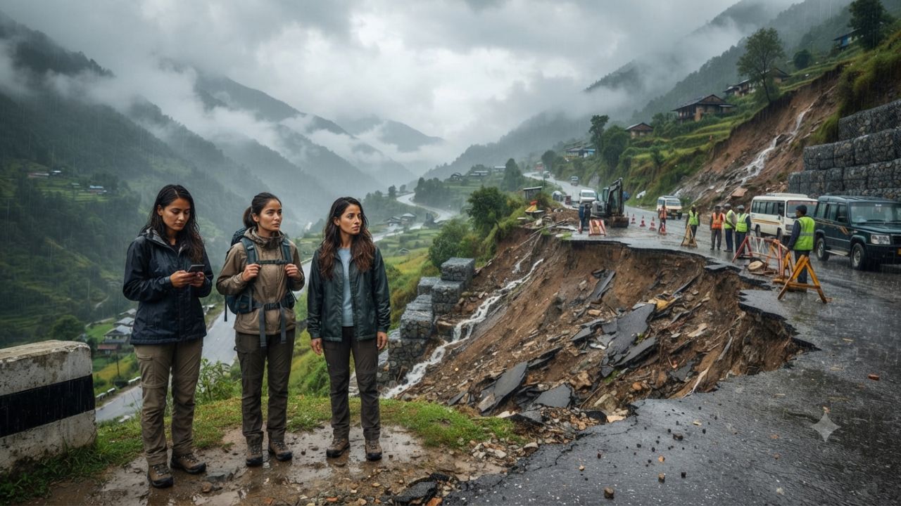
Image generated by AI
Trekking and passenger transport across Nepal’s Solukhumbu region face major disruption after heavy monsoon rain triggered a 20-metre road collapse on the Siddhicharan Highway, severing the primary road corridor to Kathmandu.
[KATHMANDU, Nepal] — Travelers, mountain guides, and local transport operators in eastern Nepal are experiencing severe travel disruptions following a major highway failure along the primary road connecting Solukhumbu district with Kathmandu. Official reports confirmed on September 27, 2026, that a 20-metre section of the Siddhicharan Highway collapsed at Sinner, located in Solududhkunda Municipality-11, completely blocking vehicle movement between the Himalayan region, Koshi Province, and the federal capital.
The road failure occurred after days of continuous rainfall saturated the steep mountain terrain. Initial clearing operations attempted to remove landslide debris from the carriageway, but weakened subsoil conditions caused the roadside embankment to give way entirely, halting all surface transport and essential supply convoys.
Quick Summary: Incident & Disruption Highlights
- Location of Damage: Sinner section, Solududhkunda Municipality-11, Solukhumbu District, Koshi Province, Nepal.
- Highway Affected: Siddhicharan Highway (primary arterial road connecting Solukhumbu with Kathmandu).
- Extent of Collapse: 20-metre stretch of highway pavement and embankment completely gave way.
- Primary Trigger: Prolonged heavy monsoon downpours saturating steep slope foundations.
- Engineering Response: Repair crews deploying wire-mesh gabion retaining walls to stabilize the cliffside and rebuild damaged road bed.
- Travel Impact: All surface vehicular transit, passenger buses, and cargo convoys between Kathmandu and Solukhumbu suspended indefinitely.
Context: Siddhicharan Highway Collapse at Sinner, Solududhkunda
The Siddhicharan Highway serves as the sole ground transport spine linking Solukhumbu district with lower valleys, Koshi Province, and Kathmandu. The district houses the gateway hubs for Everest region trekking itineraries, including Phaplu, Salleri, and overland routes heading toward Lukla and the Khumbu Valley.
The collapse at Sinner occurred along a narrow mountain ledge. Heavy rain initially triggered a slope failure, depositing boulders and mud onto the carriageway. Heavy machinery deployed by local road division authorities attempted to clear the blockage, but the weight of earth-moving equipment combined with waterlogged subgrade led to a catastrophic structural failure, carrying a 20-metre segment of the road surface down the precipitous mountain slope.
| Incident Parameter | Official Technical Specification |
|---|---|
| Highway Corridor | Siddhicharan Highway (Kathmandu – Solukhumbu Link) |
| Specific Collapse Site | Sinner, Solududhkunda Municipality-11 |
| Linear Road Damage | 20-metre continuous road bed collapse |
| Administrative Zone | Solukhumbu District, Koshi Province, Nepal |
| Primary Operational Risk | Active slope instability & ongoing rain saturation |
Incident Specifications: 20-Metre Road Structural Failure
Mountain highways in Nepal built across fragile geological formations are susceptible to slope destabilization during prolonged precipitation. The 20-metre collapse at Sinner requires heavy civil engineering reconstruction rather than routine debris clearance.
Because the entire road subgrade collapsed into the ravine below, engineers must construct vertical earth-retention structures to rebuild the carriageway foundation from the bedrock level up.
| Damage Category | Incident Assessment & Restoration Scope |
|---|---|
| Pavement Collapse | 20 metres of asphalt and gravel sub-base washed away |
| Slope Stability | Underlying mountain embankment compromised by groundwater saturation |
| Engineering Technique | Stacked wire-mesh gabion baskets filled with stone to reinforce slope base |
| Traffic Condition | Closed to all light vehicles, heavy buses, and freight trucks |
Impact on Himalayan Trekking and Local Supply Logistics
The highway closure creates immediate logistical hurdles for autumn season trekking and local municipal operations:
- Trekker & Backpacker Transit: Independent travelers and guided groups utilizing budget land transport from Kathmandu to Salleri or Phaplu are stranded or forced to cancel overland itineraries.
- Supply Line Constraints: Freight trucks delivering food grains, fuel, building materials, and commercial supplies to Solududhkunda and surrounding rural municipalities cannot cross the Sinner breach.
- Overburdened Air Links: With ground transport severed, pressure has shifted to domestic air services operating between Kathmandu (KTM) / Ramechhap (RCH) and Phaplu Airport (PPL) or Lukla Tenzing-Hillary Airport (LUK).
Engineering Restoration Strategy: Gabion Walls and Detour Routes
Department of Roads officials and local municipal engineers have initiated emergency stabilization measures to reopen the corridor:
- Slope Base Reinforcement: Construction crews are assembling heavy-gauge wire gabion baskets filled with quarried stone along the ravine base to form a stable retaining wall for the reconstructed 20-metre road segment.
- Water Diversion Channels: Drainage channels are being cut above the slide scar to divert mountain surface runoff away from the exposed soil face.
- Alternative By-pass Surveying: Technical teams are surveying narrow rural dirt tracks across Solududhkunda Municipality to determine if light 4WD vehicles can bypass the Sinner breach via high-altitude ridge detours.
| Engineering Milestone | Technical Implementation Strategy | Operational Goal |
|---|---|---|
| Gabion Wall Erection | Tiered wire-mesh stone baskets stacked along ravine slope | Establish structural foundation for 20-metre road bed |
| Subsoil Drainage | Cut-off ditches and culvert channels above slide face | Prevent groundwater saturation of newly laid fill material |
| Rural Detour Assessment | Evaluating local agricultural dirt tracks around Sinner | Provide temporary emergency 4WD access for essential supplies |
Traveler Logistics Guide: Navigating Solukhumbu and Everest Access
Travelers with upcoming itineraries targeting the Solukhumbu district or Everest Base Camp trail should adjust travel plans accordingly:
- Reconfirm Domestic Flights: Passengers booked on overland jeep or bus trips from Kathmandu to Salleri should attempt to convert bookings to domestic flights operating into Phaplu (PPL) or Lukla (LUK).
- Avoid the Sinner Highway Sector: Motorists are strictly advised by Nepal Police not to approach the Sinner section of the Siddhicharan Highway, as active landslips pose severe aquaplaning and rockfall risks.
- Build Buffer Days into Itineraries: Autumn season travelers in Nepal should maintain 2 to 3 flexible buffer days in Kathmandu to accommodate monsoon-related road closures or flight delays.
Broader Context: Infrastructure Vulnerabilities Across Mountain Highways
The Siddhicharan Highway failure reflects broader infrastructure challenges across Nepal's high-altitude transport routes. Steep slope cuts, extreme seasonal rainfall, and climate-induced precipitation intensity frequently disrupt vital highway arteries, impacting mountain tourism economies across Koshi and Gandaki provinces.
Looking Ahead: Reopening Timeline and Safety Protocols
Full restoration of the 20-metre collapsed section at Sinner is expected to require several days of continuous engineering work, contingent on stable weather conditions. Local administration officials will perform load-testing before permitting heavy passenger buses or commercial trucks to resume transit along the rehabilitated corridor.
Frequently Asked Questions: Solukhumbu Highway Disruption 2026
Where did the Siddhicharan Highway collapse occur?
The road collapse occurred at Sinner in Solududhkunda Municipality-11, Solukhumbu district, Koshi Province, Nepal.
How extensive is the road damage on the Siddhicharan Highway?
A 20-metre stretch of the highway completely collapsed down the mountain slope following heavy rain and initial landslide clearing operations.
How can trekkers reach Solukhumbu while the highway is closed?
Trekkers are advised to utilize domestic flights from Kathmandu or Ramechhap to Phaplu Airport or Lukla's Tenzing-Hillary Airport until the road corridor reopens.
What engineering methods are being used to repair the highway?
Engineers are constructing tiered gabion retaining walls (stone-filled wire baskets) to reinforce the cliffside and rebuild the 20-metre road bed.
Related Travel Guides
Sri Lanka Hatton-Bogawantalawa Landslide Closes Primary Hill Country Transit Routes
Coolcation Tourism Trends: High-Altitude Escapes in Almaty, Sapporo, and Sapa
The 10 Best Himalayan Trekking Routes in Nepal, According to Travelers
This article is for informational purposes. Flight routes, passenger regulations, visa rules, and transit advisories are subject to change by airlines and aviation authorities. Readers are advised to verify schedules and travel documentation with relevant carriers and border agencies before departure.
Related Stories

Thanksgiving 2026 Highway Travel Survival Guide: California, Texas, Florida, and New York Routes

US State Department Tightens Holiday Travel Advisories for Americans Abroad in 2026