
Mustang Travel Guide 2026: Pokhara-Jomsom Flights, Muktinath Pilgrimage, and Kali Gandaki Overland Routes

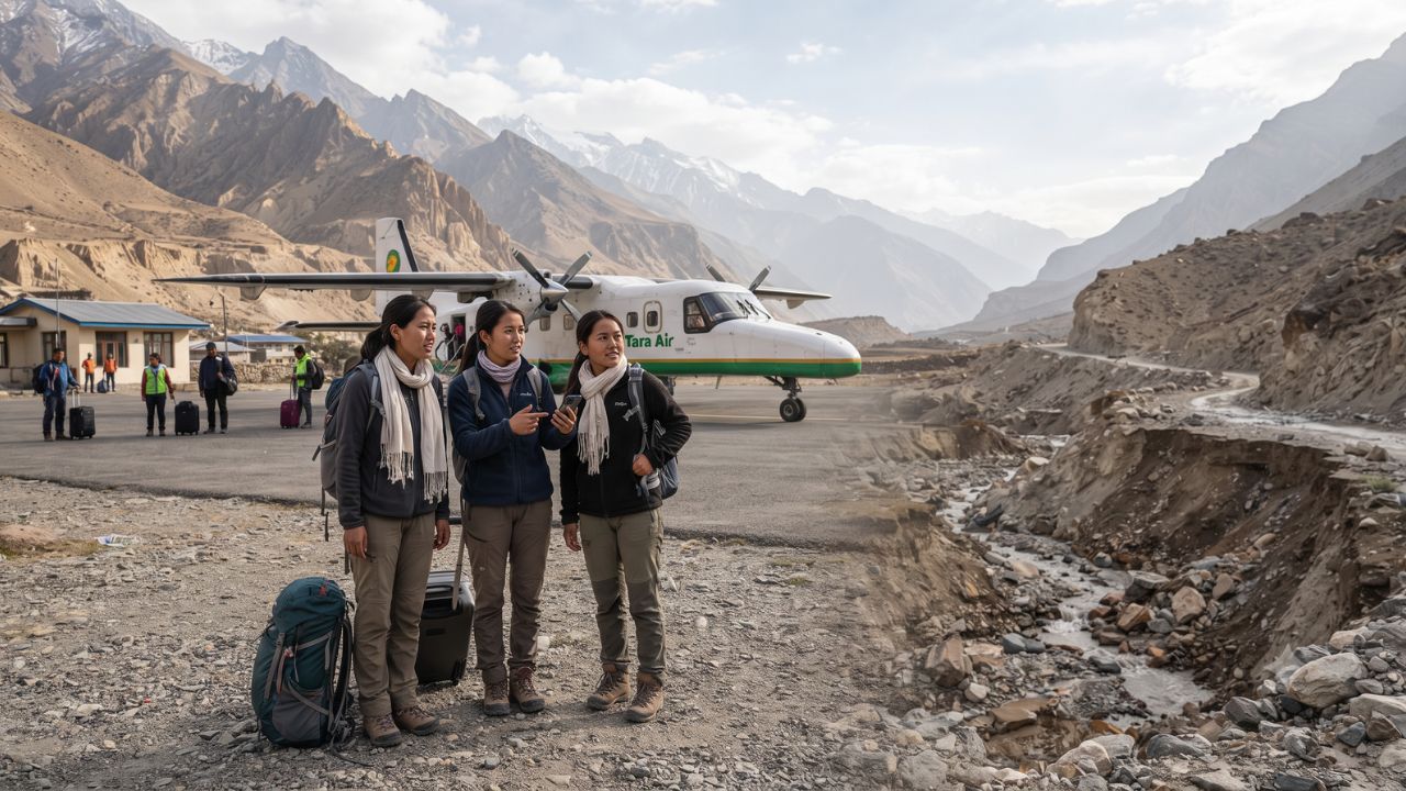
Rising from Pokhara's subtropical lakeside at 820 meters to the arid Himalayan rain shadow of Jomsom at 2,743 meters in just twenty minutes, the mountain flight through the Kali Gandaki Gorge navigates between the towering 8,000-meter massifs of Annapurna and Dhaulagiri. As monsoon floods and seasonal landslides continue to disrupt the rugged Beni–Jomsom overland highway, Tara Air has scheduled its autumn mountain flight operations from Pokhara to Jomsom between 13 September and 15 December 2026, providing a critical aviation bridge for international trekkers and pilgrims bound for the sacred shrine of Muktinath at 3,800 meters.
Traveling into Lower and Upper Mustang requires an appreciation of dynamic mountain logistics. In the trans-Himalayan desert of Mustang, a published flight schedule is merely the beginning of the journey. Powerful thermal winds rush through the world's deepest gorge by mid-morning, while high-altitude road transfers demand careful acclimatization and flexible contingency planning. Understanding how local weather patterns, jeep unions, and conservation permits intersect ensures a safe and deeply meaningful pilgrimage through one of Nepal's most sacred regions.
The Aviation Lifeline: Navigating the Autumn Pokhara–Jomsom Flight Window
According to operational notices verified by the Civil Aviation Authority of Nepal (CAAN), Tara Air resumed scheduled seasonal flights connecting Pokhara Airport (PKR) with Jomsom Airport (JMO) for the autumn trekking window running through 15 December 2026. Operating small Twin Otter aircraft designed for short takeoff and landing (STOL) mountain runways, flights depart exclusively between 6:15 AM and 10:30 AM before violent south-to-north valley gales develop along the riverbed.
While the seasonal flight notice provides a dependable window, travelers must distinguish between scheduled operation periods and real-time mountain clearances. Mountain pilots fly under strict Visual Flight Rules (VFR), meaning morning fog in the Pokhara basin or cloud cover at the southern mouth of the gorge can trigger multi-hour delays or weather cancellations.
For travelers intending to continue onward to Muktinath or the walled capital of Lo Manthang in Upper Mustang, landing in Jomsom solves only the first leg of transit. The subsequent 22-kilometer ascent from Jomsom (2,743 meters) to Muktinath (3,800 meters) requires local four-wheel-drive jeeps, hired mountain motorbikes, or a six-hour trek along the ancient salt trading trail through Kagbeni.
MUSTANG TRANSIT MODES & ITINERARY PLANNING MATRIX
| Entity / Facility | Delays | Cancellations | Details |
|---|---|---|---|
| Route Segment | Transport Mode | Operating Window / Duration | Key Travel Protocol |
| Pokhara to Jomsom | STOL Flight (Tara) | 13 Sep–15 Dec 2026 (20 min) | Morning departures |
| Beni to Jomsom Highway | 4WD Mountain Jeep | 8–12 hours (Weather-prone) | Monsoon landslide risk |
| Jomsom to Muktinath | Local 4WD / Trek | 1.5 hours drive / 6h hike | Climb to 3,800 meters |
| Kagbeni Checkpost | Foot / Vehicle | Daily permit inspections | ACAP / RAP checks |
| Annapurna Circuit Link | Trekking Route | Multi-day crossing | Thorong La Pass route |
What Makes Mustang and the Sacred Shrine of Muktinath Distinct
Regulated under the guidance of the Nepal Tourism Board (NTB), the Kali Gandaki corridor holds immense spiritual and geographic significance. Positioned in the rain shadow of the central Himalayas, Mustang receives minimal annual precipitation, presenting a dramatic landscape of eroded sandstone flutes, cliffside cave dwellings, and ancient Tibetan Buddhist gompas.
At an altitude of approximately 3,800 meters (12,467 feet), Muktinath—known to Buddhists as Chumig Gyatsa (The Place of Hundred Waters)—is a revered pilgrimage destination for both Hindus and Buddhists. The sacred temple complex houses 108 stone water spouts carved in the shape of sacred boars, alongside a natural underground methane gas seep that fuels an eternal flame burning perpetually beside a natural spring inside the Jwala Mai temple.
Pilgrims and trekkers on the world-famous Annapurna Circuit cross the grueling 5,416-meter Thorong La pass before descending into the Muktinath valley. For travelers arriving by air via Jomsom, the rapid elevation gain from Pokhara (820 meters) to Muktinath (3,800 meters) presents acute altitude sickness risks. Proper acclimatization requires spending at least one night in Jomsom or Kagbeni (2,800 meters) before ascending to the temple shrine.
MUSTANG ALTITUDE & LOGISTICAL TRAVEL BENCHMARKS
| Entity / Facility | Delays | Cancellations | Details |
|---|---|---|---|
| Landmark / Hub | Elevation (Meters) | Elevation (Feet) | Critical Context |
| Pokhara (Departure City) | 820 meters | 2,690 feet | Subtropical start |
| Jomsom Airport (JMO) | 2,743 meters | 9,000 feet | STOL mountain runway |
| Kagbeni Village | 2,804 meters | 9,200 feet | Upper Mustang gateway |
| Muktinath Temple Shrine | 3,800 meters | 12,467 feet | Sacred 108 spouts |
| Thorong La High Pass | 5,416 meters | 17,769 feet | Annapurna Circuit top |
Visitor Insider Tips
- Morning Flight Booking Priority: When reserving Pokhara-Jomsom flights, secure seats on the first departure flight of the day (typically between 6:15 AM and 7:00 AM). First-wave flights experience the highest on-time departure rates before thermal valley winds ground later mid-morning operations.
- Buffer Days for International Connections: Never schedule a Jomsom-Pokhara return flight on the same day as an international departure from Kathmandu. Build at least a 48-hour buffer in Pokhara to absorb mountain weather delays or road diversions.
- Mandatory Conservation Permits: Before leaving Pokhara, obtain your Annapurna Conservation Area Project (ACAP) permit and Trekkers' Information Management System (TIMS) card through the Department of National Parks and Wildlife Conservation. If venturing north of Kagbeni into Upper Mustang, secure a mandatory Restricted Area Permit (RAP).
- Overland Route Contingency: If flights are grounded by weather, local 4WD jeeps operate along the Beni–Jomsom road. Verify with local transit unions in Pokhara or Beni whether river crossings at Tatopani and Ghasa are passable following seasonal rain events.
Cultural and Environmental Context
Mustang's unique heritage is rooted in ancient Tibetan Buddhist traditions and traditional Thakali hospitality. The Thakali people of the lower valley have hosted trade caravans for centuries along the salt route connecting Tibet with lowland Nepal, famous for preparing Thakali thali (steamed rice, mountain lentil dal, wild buckwheat bread, and spiced dried yak meat).
Simultaneously, the delicate Kali Gandaki river basin faces ecological challenges from climate change and seasonal road construction. The Annapurna Conservation Area Project (ACAP) enforces strict waste-management rules, bans single-use plastic water bottles in select villages, and mandates that trekkers use filtered water stations. By staying in family-run teahouses, hiring licensed local guides, and respecting sacred prayer walls (mani walls) by walking to their left, travelers support indigenous mountain communities and protect Mustang’s fragile trans-Himalayan ecosystem.
FAQ: Visiting Jomsom & Muktinath 2026
What are the operational dates for Tara Air's Pokhara–Jomsom flights?
Tara Air operates scheduled autumn flights between Pokhara and Jomsom from 13 September through 15 December 2026, with morning departures subject to mountain weather clearance.
How do travelers get from Jomsom Airport to Muktinath?
From Jomsom, travelers can hire a local four-wheel-drive jeep (approximately 1.5 hours) or trek on foot via Kagbeni and Jharkot (approximately 5 to 6 hours) to reach the Muktinath temple at 3,800 meters.
What permits are required to visit Muktinath?
All foreign travelers require an Annapurna Conservation Area Project (ACAP) permit and a registered TIMS card. If traveling north of Kagbeni into Upper Mustang, a separate Restricted Area Permit (RAP) is mandatory.
Is altitude sickness a concern when flying into Jomsom?
Yes. Flying directly from Pokhara (820m) to Jomsom (2,743m) and driving to Muktinath (3,800m) involves significant elevation gain. Travelers should spend a night in Jomsom or Kagbeni to acclimatize and stay well-hydrated.
Flying between snow-capped Himalayan giants into the windswept canyon of Jomsom reveals a spiritual gateway where ancient prayer flags and rugged mountain endurance endure.
Related Travel Guides
Disclaimer
This article is for informational and educational purposes only. It does not constitute legal, financial, or professional advice. While we strive to provide accurate and up-to-date information, travel policies, regulations, and conditions change rapidly. Always verify information with official sources before making travel decisions. Nomad Lawyer makes no representations about the accuracy, reliability, completeness, or suitability of the information provided. Readers should consult qualified professionals for advice specific to their circumstances. The views expressed in this article are those of the author and do not necessarily reflect the views of Nomad Lawyer.
Raushan Kumar
Founder & Lead Developer
Full-stack developer with 11+ years of experience and a passionate traveller. Raushan built Nomad Lawyer from the ground up with a vision to create the best travel and law experience on the web.
Learn more about our team →