
Mount Sinabung Erupts in North Sumatra with 3.5km Ash Cloud and Level III Alert

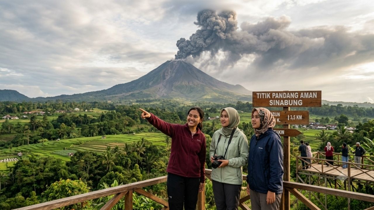
Image generated by AI
Indonesian volcanology authorities have raised the alert status of Mount Sinabung to Level III (Siaga) after a major eruption sent a dense ash cloud 3.5 kilometers into the atmosphere above North Sumatra.
[KARO REGENCY, Indonesia, Aug. 31, 2026] — Mount Sinabung erupted violently in Karo Regency, North Sumatra, on August 31, 2026, generating a massive 3.5-kilometer (11,500-foot) ash plume that drifted across eastern and southeastern sectors of the province. Following an intense surge in subterranean seismic activity—including 85 volcanic earthquakes and sustained harmonic tremors—the Center for Volcanology and Geological Hazard Mitigation (PVMBG) officially elevated the volcano's threat level to Level III (Siaga) and expanded exclusion zones around the summit.
While major North Sumatra tourist gateways such as Kualanamu International Airport in Medan and the Lake Toba resort district remain operational, regional authorities are urging extreme caution for travelers navigating the Karo Highlands. Tour operators, local transport providers, and outdoor guides have adjusted excursion routes to prevent exposure to heavy ashfall and pyroclastic hazards.
Subterranean Seismic Surge Preceded 3.5-Kilometer Volcanic Plume
The August 31 eruption was preceded by a sharp escalation in subterranean pressure beneath Karo Regency. Volcanological monitoring stations recorded 85 distinct volcanic earthquakes, accompanied by continuous harmonic tremors and low-frequency seismic signals indicating rapid magma movement toward the surface crater.
The resulting explosion ejected a dense, dark grey column of volcanic ash approximately 3.5 kilometers high above the crater rim. Driven by prevailing upper-level winds, the ash cloud swept east and southeast, depositing fine volcanic particles across agricultural villages, roads, and outdoor leisure areas in Karo Regency.
State monitoring teams continue tracking real-time seismic signals, gas emissions, and ground deformation. Volcanologists warn that high internal reservoir pressure maintains the risk of secondary explosive events, rockfalls, and hot pyroclastic flows descending the mountain's steep flanks.
Official Level III (Siaga) Alert Maintains Strict Exclusion Zones
Following the 3.5-kilometer ash emission, Indonesian emergency management agencies reinforced strict exclusion perimeters surrounding Mount Sinabung to prevent human casualties:
- Summit Exclusion Zone: All public entry, hiking, and agricultural work remain strictly prohibited within a multi-kilometer radius of the main crater.
- Southeastern & Eastern Danger Sectors: Restricted access zones have been extended along downwind valleys to guard against pyroclastic density currents and sudden ash flows.
- River Channel Hazard Warnings: Local residents and tourists are warned to stay clear of river beds descending from the volcano, which pose severe risks of secondary lahar (volcanic mudflow) events during heavy rainstorms.
Local emergency management coordinators have distributed protective face masks to residents in affected Karo Regency villages, urging travelers passing through the highlands to wear N95-grade respirators to avoid inhaling abrasive silica particles.
Comprehensive Data Breakdown: Volcanic Event Parameters and Safety Status
The table below outlines the key volcanic activity indicators, alert metrics, and emergency parameters recorded during the August 31 eruption:
| Event Metric Category | Recorded Value / Official Status | Operational & Safety Impact |
|---|---|---|
| Eruption Date | August 31, 2026 | Immediate activation of emergency response protocols |
| Ash Cloud Height | 3.5 Kilometers (11,500 Feet) above summit | Dispersed east and southeast across Karo Regency |
| Seismic Activity Count | 85 Volcanic Earthquakes & Harmonic Tremors | Signaled rapid subterranean magmatic pressure surge |
| Official Alert Status | Level III (Siaga) | Heightened threat level requiring mandatory exclusion zones |
| Geographic Location | Karo Regency, North Sumatra, Indonesia | Volcanic highlands near Berastagi travel corridor |
| Primary Hazards | Heavy ashfall, pyroclastic flows, rain-triggered lahars | Restricted access along summit & river channels |
The table below details the operational status of major North Sumatra destinations and transport hubs:
| North Sumatra Destination Hub | Distance from Mount Sinabung | Operational Status & Travel Advisory |
|---|---|---|
| Karo Highlands / Berastagi | ~15 to 25 Kilometers | Open with Caution: Ashfall reported; mask usage advised |
| Lau Kawar Lake & Campgrounds | Immediate Base of Volcano | Closed: Located inside mandatory danger exclusion zone |
| Medan (Capital City) | ~70 Kilometers North | Fully Operational: Normal urban business & transit |
| Kualanamu International Airport (KNO) | ~85 Kilometers Northeast | Fully Operational: Flight schedules monitored for ash drift |
| Lake Toba & Samosir Island | ~90 Kilometers South | Fully Operational: Zero disruption to lake ferry operations |
Regional Travel Logistics and Aviation Contingency Measures
Despite the visual scale of the eruption, North Sumatra's broader tourism infrastructure has demonstrated structural resilience. The primary entry point for international travelers, Kualanamu International Airport (KNO) near Medan, continues normal flight operations, though aviation authorities maintain continuous ash-tracking advisories for airlines operating in regional airspace.
Highland transit between Medan and Berastagi remains accessible by road, though drivers are cautioned against reduced visibility and slick road surfaces caused by wet volcanic ash accumulation. Local authorities recommend that tour operators check hourly geological bulletins before dispatching vehicles through highland passes.
For international travelers visiting North Sumatra, popular destinations such as Parapat, Samosir Island, and Lake Toba are situated well outside the active ash-fall vector, allowing cultural and water-based tourism to proceed normally.
Why This Matters: Essential Safety Protocols for Outbound Travelers
For independent travelers, tour groups, and travel agencies planning trips to North Sumatra during active volcanic alerts, this incident establishes clear operational rules:
- Strict Exclusion Zone Compliance: Travelers must respect all official barriers and signage. Attempting to hike or photograph restricted slopes near Mount Sinabung violates Indonesian law and poses extreme life safety risks.
- Respiratory Protection: Travelers visiting Berastagi or the Karo Highlands should carry high-efficiency N95 masks to protect respiratory tracts from fine volcanic ash during unexpected wind shifts.
- Pre-Trip Route Verification: Always consult real-time updates from the Indonesian Geological Agency (PVMBG) and local tour operators before booking highland excursions or volcano trekking itineraries.
- Comprehensive Travel Insurance: Verify that international travel insurance policies include coverage for natural disaster disruptions, trip delays, and medical evacuation riders in active volcanic zones.
Frequently Asked Questions
What is the current alert level for Mount Sinabung following the August 31 eruption?
Indonesian authorities have established a Level III (Siaga) alert status for Mount Sinabung, indicating high volcanic unrest and mandatory exclusion perimeters.
Are flights to Kualanamu International Airport (Medan) affected by the eruption?
Flights operating into Kualanamu International Airport (KNO) remain operational, though aviation authorities actively monitor high-altitude ash drift vectors.
Is Lake Toba open for tourists during the Mount Sinabung activity?
Yes, Lake Toba and Samosir Island are located approximately 90 kilometers south of the volcano and remain fully open for international and domestic tourism.
Which areas are strictly closed to visitors in Karo Regency?
All areas within the official summit exclusion zone, including Lau Kawar Lake and immediate downwind river valleys in Karo Regency, are closed to public access.
Related Travel Guides
Disclaimer
This article is for informational and educational purposes only. It does not constitute legal, financial, or professional advice. While we strive to provide accurate and up-to-date information, travel policies, regulations, and conditions change rapidly. Always verify information with official sources before making travel decisions. Nomad Lawyer makes no representations about the accuracy, reliability, completeness, or suitability of the information provided. Readers should consult qualified professionals for advice specific to their circumstances. The views expressed in this article are those of the author and do not necessarily reflect the views of Nomad Lawyer.
Raushan Kumar
Founder & Lead Developer
Full-stack developer with 11+ years of experience and a passionate traveller. Raushan built Nomad Lawyer from the ground up with a vision to create the best travel and law experience on the web.
Learn more about our team →