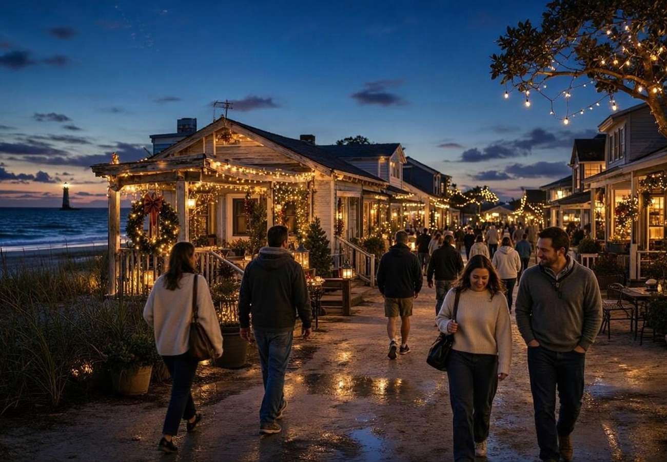
Europe's Calm Coastal Refuges: Six Slow-Travel Alternatives to Overtourism Across Portugal, Spain, Greece, Albania, and the Baltics

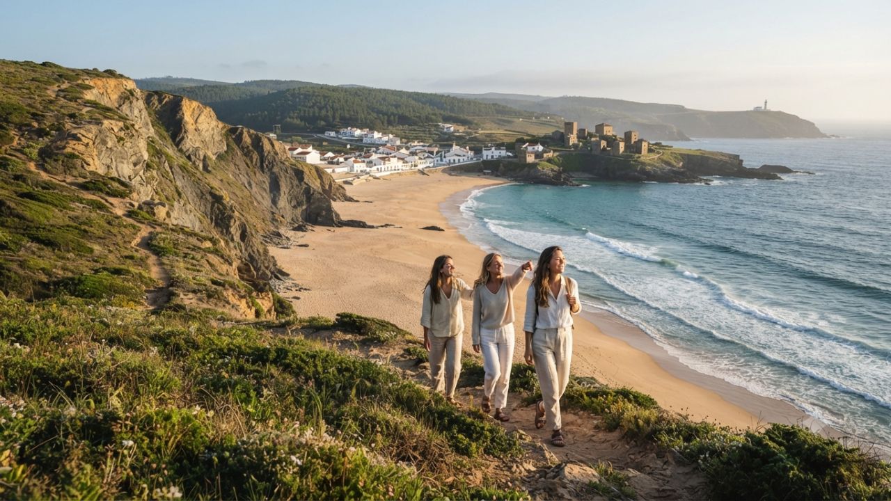
As overcrowding and municipal visitor restrictions reshape holidays across the Mediterranean, travelers are turning toward Europe’s unhurried coastal frontiers for wild seascapes, cultural heritage, and ecological preservation.
Across traditional holiday corridors—from the packed beach clubs of the French Riviera and Ibiza to the cruise-congested ports of Santorini and Dubrovnik—the European summer vacation has reached an environmental and social reckoning. In response to rising municipal visitor levies, anti-tourism demonstrations, and strained infrastructure, an increasing demographic of international travelers is embracing slow-travel principles. Rather than pursuing pre-packaged resort corridors, these travelers are seeking regions where strict conservation laws, remote geography, or rural community traditions preserve the authentic rhythm of coastal life.
From the gale-swept Atlantic bluffs of Portugal’s Alentejo to the emerald coves of northern Spain, the stone tower bastions of the southern Peloponnese, the mountain-flanked hamlets of the Albanian Riviera, and the tranquil island archipelagos of the Baltic and Nordic seas, Europe retains magnificent coastal sanctuaries. Exploring these six destinations outside peak summer months provides an antidote to overtourism, redirecting economic benefits to family-owned guesthouses, artisanal fisheries, and municipal conservation reserves.
EUROPE'S CALM COASTAL REFUGES: STRATEGIC REGIONAL BASELINE
| Entity / Route | Metrics | Operational Status |
|---|---|---|
| Coastal Destination | Sovereign Nation & Body of Water | Defining Geographical Character |
| Costa Vicentina | Portugal (Atlantic Ocean) | Wind-sculpted cliffs, wild dunes, |
| Protected Natural Park | Rota Vicentina hiking corridors | |
| Asturias Green Coast | Spain (Cantabrian Sea) | Emerald meadows meeting rocky coves, |
| Picos de Europa coastal strip | inland sinkhole beaches & geology | |
| Mani Peninsula | Greece (Ionian & Aegean Seas) | Fortified stone tower hamlets, deep |
| Southern Peloponnese mainland | sea caves, ancient submerged ruins | |
| Qeparo & Riviera | Albania (Ionian Sea) | Two-tiered stone mountain village, |
| Ceraunian coastal mountain wall | unpaved olive groves, pebble bays | |
| Hiiumaa Island | Estonia (Baltic Sea) | UNESCO Biosphere reserve, historic |
| Moonsund Archipelago | lighthouses, deserted pine shores | |
| Turku Archipelago | Finland (Archipelago Sea) | 20,000+ granite skerries, car-free |
| Saaristomeri National Park | cycling paths, wooden sauna culture |
The Paradigm Shift: Why Coastal Slow Travel Matters
For five decades, European beach tourism operated on an industrial volume model. Concentrated charter flights delivered millions of vacationers to narrow Mediterranean strips, resulting in high-rise hotel development, privatized sand concessions, and severe summer water shortages.
Today, that model faces structural resistance:
- Environmental Limits: Unchecked development strips sand dunes, pollutes marine habitats, and displaces local fishing fleets.
- Economic Inequity: All-inclusive multinational resorts extract maximum revenue while leaving municipal councils with the financial burden of waste management and road repairs.
- The Traveler Experience: Overcrowding diminishes the very serenity travelers seek, replacing ocean sounds with traffic horns and crowded restaurant queues.
The six coastal refuges profiled here offer an alternative philosophy: low-density, place-based travel. By distributing visitor spending into family-run tavernas, village bakeries, and regional nature reserves, travelers help protect the cultural and ecological integrity of Europe’s living shorelines.
THE SLOW COASTAL TRAVEL PHILOSOPHY
[Conventional Mass Resort Tourism]                  [Slow Coastal Travel Framework]
- High-rise concrete beach hotels                   - Low-impact stone guesthouses & eco-lodges
- Privatized sunbed concessions                     - Wild, public, dune-protected beaches
- Peak July-August congestion                       - Spring & autumn shoulder season exploration
- Extractive all-inclusive economics               - Direct spending with family tavernas & artisans
- Overburdened municipal grids                     - Low-density walking, cycling & public ferries
1. Portugal: Costa Vicentina and the Wild Southwest Alentejo
While millions of summer tourists congregate along the resort-lined bays of the central Algarve, Portugal’s southwestern flank tells a dramatically different story. Protected under the Southwest Alentejo and Vicentina Coast Natural Park (Parque Natural do Sudoeste Alentejano e Costa Vicentina), this 110-kilometer coastal corridor stretches from São Torpes in the Alentejo down to Burgau on the southern coast.
COSTA VICENTINA TRAVEL PROFILE (PORTUGAL)
| Category / Entity | Details / Impact |
|---|---|
| Key Anchor Towns | Porto Covo, Vila Nova de Milfontes, Zambujeira do Mar, Odeceixe |
| Trail Infrastructure | Rota Vicentina: Fishermen's Trail (226 km) & Historical Way (263 km) |
| Ecological Highlights | Cape Sardão white storks, fossilized red sand dunes, estuary bird colonies |
| Best Visiting Months | April to June, September to late October (Avoid midsummer heat) |
| Practical Transport | Rental vehicle required for beach hopping; long-distance buses connect hubs |
The Shield of Natural Park Status
Strict environmental legislation has prevented the construction of sprawling resort complexes or beachfront golf courses along the Costa Vicentina. Building codes dictate that tourist accommodations must conform to traditional single- or double-story whitewashed architecture, preserving the visual tranquility of the rural landscape.
The coastline is sculpted by the relentless energy of the Atlantic Ocean:
- Porto Covo: A postcard fishing hamlet built around an eighteenth-century square designed under the direction of the Marquis of Pombal, where cobblestone lanes lead directly to small coves framed by dark schist cliffs.
- Vila Nova de Milfontes: Positioned where the Rio Mira meets the Atlantic, this town provides both sheltered river beaches for swimming and wild ocean surf breaks at Praia do Malhão.
- Almograve and Cape Sardão: Known for its dramatic red dunes and black slate cliffs. At Cape Sardão (Cabo Sardão), visitors can witness a rare biological phenomenon: white storks (Ciconia ciconia) that build their large stick nests directly onto sheer, sea-battered cliff stacks over the crashing Atlantic waves.
The Rota Vicentina Walking Network
For hikers, the region is traversed by the Rota Vicentina, an internationally celebrated hiking network. The standout segment is the Fishermen’s Trail (Trilho dos Pescadores), a 226-kilometer single-track path that hugs the cliff edge, tracing routes used for centuries by local anglers to access perilous fishing perches. Walking this trail in spring rewards travelers with blooming wild rockrose (Cistus ladanifer), sea thrifts, and dramatic ocean panoramas.
2. Spain: Asturias and the Emerald Cantabrian Coast
In northern Spain, where the limestone peaks of the Picos de Europa rise behind the Bay of Biscay, the autonomous community of Asturias offers a lush, temperate alternative to the arid Mediterranean south. Known as part of España Verde (Green Spain), Asturias features more than 200 beaches sheltered between dramatic headlands and rolling emerald pastures.
ASTURIAS COAST TRAVEL PROFILE (SPAIN)
| Category / Entity | Details / Impact |
|---|---|
| Key Anchor Towns | Cudillero, Llanes, Ribadesella, Luarca, Lastres |
| Geological Marvels | Playa de Gulpiyuri (inland beach), Playa de La Griega (dinosaur tracks) |
| Culinary Specialties | Natural cider (sidra), Cabrales blue cheese, fresh hake, fabada stew |
| Best Visiting Months | May to June, September to early October (Cool, temperate maritime climate) |
| Practical Transport | FEVE narrow-gauge rail connects coastal towns; car recommended for coves |
Strict Coastal Zoning: The POLA Framework
Asturias avoided the intense real-estate speculation that affected southern Spain thanks to the Plan de Ordenación del Litoral de Asturias (POLA). Enacted in the early 2000s, this municipal planning framework created a mandatory 500-meter protected buffer from the high-tide line, prohibiting residential construction and commercial concessions along virtually the entire coastline.
As a result, Asturian beaches remain wild and publicly accessible, backed by green hills and grazing dairy cattle rather than concrete apartment towers.
Unique Coastal Geology
The limestone geology of the Cantabrian coast creates some of the most unusual coastal formations in Europe:
- Playa de Gulpiyuri: Situated near Llanes, Gulpiyuri is an extraordinary geological curiosity: a fully formed sandy beach located 100 meters inland inside a collapsed limestone sinkhole (doline). Saltwater from the Cantabrian Sea flows through an intricate network of subterranean rock tunnels, creating gentle tides on a beach surrounded by green meadows and cows.
- Playa de La Griega: Near Colunga, low tide exposes massive fossilized sauropod dinosaur footprints embedded in the limestone shelf, allowing visitors to walk alongside 150-million-year-old paleontological trackways before swimming in the cove.
- Cudillero and Lastres: Traditional fishing harbors where brightly painted houses are stacked like amphitheaters around narrow inlets, where fishing trawlers unload fresh hake, monkfish, and spider crabs daily.
3. Greece: The Mani Peninsula’s Stone Bastions and Deep Coves
While tourists crowd the narrow streets of Oia in Santorini and Mykonos town, travelers seeking timeless Greek maritime culture head south to the Mani Peninsula, the central finger of the Peloponnese.
MANI PENINSULA TRAVEL PROFILE (GREECE)
| Category / Entity | Details / Impact |
|---|---|
| Key Anchor Towns | Areopoli, Limeni, Gythio, Kardamyli, Gerolimenas, Vathia |
| Architectural Icons | Fortified stone tower houses (pyrgospita), Byzantine cliffside chapels |
| Archaeological Sites | Pavlopetri (submerged Bronze Age city), Diros subterranean cave system |
| Best Visiting Months | May to June, September to October (Avoid midsummer heat spikes) |
| Practical Transport | Private rental car essential; steep, winding two-lane mountain passes |
The Fierce Independence of the Maniot Bastions
Bounded by the imposing Taygetos mountain range, Mani was historically so rugged and impenetrable that its inhabitants, the Maniots, remained semi-autonomous throughout the four centuries of Ottoman rule in Greece.
The landscape is defined by fortified stone tower houses (pyrgospita), built between the seventeenth and nineteenth centuries during periods of intense inter-clan warfare. In villages like Vathia, clusters of multi-story stone towers stand atop coastal ridges overlooking the deep blue waters of the Messenian Gulf, resembling miniature medieval fortresses.
Coastal Exploration from Areopoli to Elafonisos
- Areopoli and Limeni: Areopoli serves as the historic gateway to Deep Mani, featuring limestone-paved alleys and historic churches. Just below lies Limeni, a stunning coastal inlet where traditional stone houses sit directly at the water’s edge, allowing visitors to step from their terrace directly into crystalline turquoise waters.
- The Caves of Diros (Spilaia Dirou): Located south of Areopoli, this vast underground river system allows visitors to board small wooden punts piloted by local boatmen through cavernous chambers filled with ancient stalactites and stalagmites before emerging onto a secluded pebble bay.
- Pavlopetri and Elafonisos: Further southeast, near the tip of the peninsula, travelers can visit Pavlopetri, widely recognized by marine archaeologists as the world’s oldest submerged city. Dating back over 5,000 years to the Early Bronze Age, the foundations of stone buildings, courtyards, and tombs are clearly visible to snorkelers in four meters of clear water. A short ten-minute ferry ride connects to the island of Elafonisos, home to the sweeping white sands of Simos Beach.
MANI PENINSULA EXPLORATION CORRIDOR
[Kalamata Airport / Gateway]
            |
            | (1.5h Scenic Coastal Drive past Kardamyli)
            v
[Areopoli: Historic Stone Capital]
            |
            +---> [Limeni: Turquoise Sea-Level Tavernas]
            |
            +---> [Diros Caves: Subterranean Boat Route]
            |
            v
[Deep Mani: Tower Village of Vathia & Cape Tenaro (Southernmost Point of Mainland Greece)]
            |
            v
[East Coast: Neoclassical Harbor of Gythio & Ancient Sunken Pavlopetri]
4. Albania: Qeparo and the Upper Ionian Riviera
Over the past five years, the southern Albanian Riviera around Sarandë and Ksamil has seen a dramatic construction boom. Yet travelers willing to venture north along the dramatic curves of the Ceraunian coastal mountain range discover Qeparo, a village that preserves the tranquil character of the historic Ionian coast.
QEPARO & UPPER RIVIERA TRAVEL PROFILE (ALBANIA)
| Category / Entity | Details / Impact |
|---|---|
| Key Geographical Split | Lower Qeparo (Coastal beach strip) vs. Upper Qeparo (Perched stone village) |
| Historical Fortresses | Ali Pasha’s Fortress at Porto Palermo, Himara Castle |
| Coastal Highlights | Borsh Beach (7 km pebble shore), secluded Kakomë Bay, crystal Ionian sea |
| Best Visiting Months | May to June, September to early October (Warm water, minimal crowds) |
| Practical Transport | Rental car from Tirana (3.5h via Llogara Tunnel) or Corfu ferry to Sarandë |
The Two Halves of Qeparo
What distinguishes Qeparo is its striking dual topography:
- Lower Qeparo (Qeparo Fushë): A relaxed seaside settlement running along a broad pebble beach, lined with family-run tavernas serving grilled sea bass, village salads, and local olive oil.
- Upper Qeparo (Qeparo Fshat): Perched high on the rocky slope of Mount Gjivash at an elevation of 300 meters, this ancient stone hamlet was founded centuries ago to guard against pirate incursions. Accessible via a narrow, twisting mountain road, Upper Qeparo features stone archways, historic olive-oil presses, and narrow cobblestone footpaths accessible only on foot.
From the terrace of Upper Qeparo’s stone guesthouses, visitors take in sweeping vistas across the Ionian Sea toward the northern tip of the Greek island of Corfu. In recent years, local families and international preservation architects have restored abandoned stone villas into boutique heritage guesthouses, creating a model for heritage-led rural regeneration.
Exploring the Ceraunian Coastline
Qeparo serves as a peaceful base to explore the upper Riviera:
- Porto Palermo Bay: Just four kilometers north lies a semi-circular natural harbor dominated by a triangular stone fortress constructed in the early nineteenth century by Ali Pasha of Tepelena. Surrounded by pine trees and clear waters, the bay remains free of large commercial developments.
- Borsh Beach: Extending southward for seven kilometers, Borsh represents the longest continuous coastal strip in Albania, bordered by sprawling centuries-old olive groves and mountain streams.
5. Estonia: Hiiumaa Island and the Baltic Biosphere
For travelers who value vast horizons, pristine air, and quiet solitude over Mediterranean warmth, Hiiumaa—Estonia’s second-largest island—represents one of northern Europe’s most tranquil coastal refuges. Located in the Baltic Sea’s Moonsund archipelago, Hiiumaa is an integral part of the UNESCO West Estonian Archipelago Biosphere Reserve.
HIIUMAA ISLAND TRAVEL PROFILE (ESTONIA)
| Category / Entity | Details / Impact |
|---|---|
| Maritime Monuments | Kõpu Lighthouse (1531), Tahkuna Lighthouse (1874), Ristna Lighthouse |
| Protected Landscapes | Käina Bay bird sanctuary, Luidja sand dunes, Kõpu peninsula pine forests |
| Outdoor Activities | Bicycle touring, sea kayaking, seal-watching cruises, coastal foraging |
| Best Visiting Months | June to late August (Long daylight hours, midnight twilight, warm breeze) |
| Practical Transport | Ferry from Rohuküla on mainland Estonia (75 mins); rental car or touring bike |
The Legacy of Kõpu and the Northern Lights of Summer
Hiiumaa has been shaped by centuries of maritime history. The island's undisputed icon is Kõpu Lighthouse (Kõpu tuletorn):
- Consecrated in 1531, Kõpu stands as one of the three oldest continuously operating lighthouses in the world. Built on the island's highest elevation (67 meters above sea level) out of massive limestone boulders, its light has guided merchant mariners navigating treacherous Baltic shoals for nearly five centuries.
- On the island's northern tip stands Tahkuna Lighthouse, an elegant cast-iron tower designed by French engineers in the 1870s following the system devised by Gustave Eiffel.
Nature and Low-Impact Exploration
With a resident population of fewer than 10,000 people spread across 1,000 square kilometers, Hiiumaa never feels crowded, even during midsummer:
- Wild Sands: Beaches at Tõrvanina and Luidja feature pale sands backed by fragrant scots pine forests. At Ristna, strong Baltic winds create surf waves and wash up small pieces of natural amber.
- Cycling Culture: The island’s completely flat terrain, well-maintained asphalt roads, and network of forest tracks make it a haven for long-distance bicycle touring. Travelers can cycle from village to village, stopping at wooden smokehouses to taste smoked Baltic herring (räim) and freshly baked dark rye bread.
6. Finland: The Turku Archipelago’s Thousand-Island Wilderness
In southwestern Finland, the mainland transitions into the Turku Archipelago (Saaristomeri), recognized as the world’s largest archipelago by the sheer volume of its islands. Numbering more than 20,000 granite islands, islets, and rocky skerries, the region is protected within the Archipelago National Park (Saaristomeren kansallispuisto).
TURKU ARCHIPELAGO TRAVEL PROFILE (FINLAND)
| Category / Entity | Details / Impact |
|---|---|
| Key Island Hubs | Pargas, Nagu (Nauvo), Korpo (Korppoo), Houtskär, Kökar |
| Trail Infrastructure | Archipelago Trail (Saariston Rengastie - 250 km circular road/bike route) |
| Cultural Pillars | Traditional wood-fired sauna culture, smoked whitefish, wooden boatbuilding |
| Best Visiting Months | June to late August (Midsummer midnight sun; services open across islands) |
| Practical Transport | Yellow public road ferries (lossi - free of charge); bikes & sea kayaks |
The Archipelago Trail (Saariston Rengastie)
The definitive way to experience this watery labyrinth is the Archipelago Trail, a 250-kilometer circular route beginning and ending in the historic cathedral city of Turku:
- The route connects major populated islands via a series of scenic bridges, causeways, and free municipal yellow roll-on/roll-off ferries (lossi) operated by the Finnish transport agency.
- Bicyclists and motorists island-hop across Pargas, Nagu, Korpo, and Houtskär before boarding inter-island passenger vessels back to the mainland.
The Art of the Finnish Archipelago Summer
Life in the archipelago revolves around water, wood, and quiet contemplation:
- Nagu Harbor: A charming maritime village where traditional wooden sailing craft dock alongside modern yachts, lined with seasonal bakeries, artisan pottery shops, and waterside restaurants serving smoked vendace and new potatoes with dill.
- Sauna Rituals: Across the archipelago, guesthouses and rustic rental cabins (mökki) feature private wood-fired saunas built directly on granite rocky shores. The daily ritual—heating the sauna with birch logs, steaming with aromatic löyly, and plunging directly into the brackish Baltic Sea under the soft amber glow of the midnight sun—epitomizes Finnish wellness culture.
THE TURKU ARCHIPELAGO CIRCUIT (SAARISTON RENGASTIE)
[Turku Mainland Gateway]
           |
           v (Bridge)
[Pargas: Limestone Quarry & Island Town]
           |
           v (Free Yellow Ferry - Lossi)
[Nagu (Nauvo): Vibrant Guest Marina & Historic Stone Church]
           |
           v (Free Yellow Ferry)
[Korpo (Korppoo): Maritime Nature Centre & Bare Granite Skerries]
           |
           v (Free Ferry / Passenger Vessel)
[Houtskär / Iniö: Outer Traditional Swedish-Speaking Fishing Hamlets]
           |
           v (Return Ferry to Mainland)
[Naantali & Turku Return]
Comparative Analysis: Matching Travelers to the Right Coastal Refuge
Each of these six European coastal regions provides a distinct blend of geography, climate, and cultural heritage.
STRATEGIC DESTINATION COMPARISON & TRAVEL MATCHING
| Entity / Facility | Delays | Cancellations | Details |
|---|---|---|---|
| Destination | Ideal Traveler Type | Physical Demands | Key Transport |
| Costa Vicentina (PT) | Long-distance hikers, wild surfers, | Moderate to High | Car + Hiking |
| nature lovers, botanical fans | (Cliff trail walks) | boots | |
| Asturias (ES) | Gastronomes, families, geology buffs | Low to Moderate | Rental car or |
| who prefer cooler summer weather | (Gentle cove walks) | narrow train | |
| Mani Peninsula (GR) | History enthusiasts, independent | Moderate | Rental car |
| drivers, snorkelers, solitude seekers | (Mountain roads) | mandatory | |
| Qeparo (AL) | Heritage architecture admirers, | Moderate | Car or local |
| adventurous budget-minded explorers | (Steep stone paths) | private driver | |
| Hiiumaa (EE) | Bicyclists, lighthouse chasers, | Low to Moderate | Touring bike |
| birdwatchers, off-grid campers | (Flat gravel/asphalt | or rental car | |
| Turku Archipelago (FI) | Kayakers, cycle tourists, wellness | Low to High | Bicycle, ferry |
| travelers seeking sauna culture | (Choose route pace) | or sea kayak |
Practical Guide: Principles for Responsible Slow Coastal Travel
To preserve the delicate ecological and social balance of Europe's quieter coastal regions, international travelers should integrate these sustainable travel practices:
RESPONSIBLE SLOW COASTAL TRAVEL PROTOCOLS
| Entity / Route | Metrics | Operational Status |
|---|---|---|
| Operational Principle | Recommended Traveler Action | Environmental & Community Benefit |
| 1. Seasonal Shifting | Travel during May–June or Sept–Oct | Alleviates midsummer water stress; |
| rather than peak July and August | extends seasonal income for locals | |
| 2. Stay Concentration | Book minimum 4 to 7 nights in one | Cuts vehicle carbon emissions; |
| base rather than daily town-hopping | builds genuine local relationships | |
| 3. Local Patronage | Patronize family-owned tavernas, | Prevents economic leakage; |
| village bakeries, and local guides | supports artisanal regional producers | |
| 4. Dune & Path Respect | Remain strictly on marked wooden | Prevents coastal erosion; protects |
| boardwalks and designated paths | endangered shorebirds and flora |
Essential Field Recommendations
-
Avoid Midsummer When Possible:
- The Mediterranean and southern Atlantic refuges (Costa Vicentina, Asturias, Mani, Qeparo) reach their peak appeal in late spring (May and June) and early autumn (September and October). Temperatures are pleasantly mild, ocean waters remain warm enough for swimming, and village tavernas offer unhurried service.
- For Baltic and Nordic destinations (Hiiumaa and the Turku Archipelago), the summer window of mid-June to mid-August is optimal. These months offer extended daylight hours and fully operating ferry networks, while mosquito activity subsides along breezy coastal bluffs.
-
Dune and Cliff Safety:
- In coastal national parks like Portugal’s Costa Vicentina and Spain’s Asturias, sand dunes are fragile living ecosystems anchored by delicate marram grass and sea daffodil root systems. Walking across dunes destabilizes sand structures, causing rapid wind erosion. Always use designated raised wooden boardwalks.
- Along Atlantic and Cantabrian cliffs, sudden ocean wind gusts and crumbly shale or limestone edges make walking too close to the drop-off hazardous. Stay well behind warning markers.
-
Supporting Local Infrastructure:
- Small island and coastal communities often operate on delicate municipal resources. Be mindful of freshwater consumption, particularly on the arid Mani Peninsula and throughout southern Albania.
- Shop at local open-air farmers’ markets and municipal fish markets rather than large supermarket chains along major highways, ensuring your travel expenditures directly support local fishermen and agricultural cooperatives.
Frequently Asked Questions
What makes Costa Vicentina different from the rest of Portugal's Algarve?
Unlike the central and eastern Algarve, which is heavily developed with high-rise hotels, golf courses, and resort marinas, the Costa Vicentina is protected by the Southwest Alentejo and Vicentina Coast Natural Park. Large commercial developments are prohibited, preserving wild Atlantic cliffs, secluded beaches, and traditional fishing villages like Porto Covo and Odeceixe.
Why is Asturias in Spain known as an alternative to Mediterranean beach resorts?
Asturias is part of España Verde (Green Spain) along the northern Cantabrian Sea. Instead of crowded, arid beach strips, Asturias combines green mountain meadows, limestone cliffs, and cooler maritime summer temperatures. Strict coastal protection laws (POLA) prohibit construction within 500 meters of the coastline, keeping over 200 beaches wild and unbuilt.
How do I get to Upper Qeparo in Albania, and what is its history?
Upper Qeparo (Qeparo Fshat) sits at an elevation of 300 meters above the coastal beach of Lower Qeparo. Visitors can reach it via a narrow, paved mountain road by car or through a 45-minute uphill walking path through ancient olive groves. The village was built on a fortified ridge centuries ago to defend residents against maritime pirates and features restored historic stone houses overlooking the Ionian Sea toward Corfu.
What is the Rota Vicentina in Portugal?
The Rota Vicentina is an extensive hiking network in southwestern Portugal. Its most famous route is the Fishermen’s Trail (Trilho dos Pescadores), a 226-kilometer coastal footpath that winds along cliff edges, sand dunes, and fishing villages from Porto Covo down to Lagos. The trail follows paths historically used by local fishermen to reach ocean fishing perches.
When is the best time to visit Estonia's Hiiumaa Island and Finland's Turku Archipelago?
The ideal travel window for both Hiiumaa and the Turku Archipelago is between mid-June and late August. During this period, the Baltic and Nordic regions experience long daylight hours and the midnight sun, water temperatures are suitable for swimming and kayaking, and inter-island passenger ferries, coastal cafes, and bike rental stations operate on full seasonal timetables.
Do I need a car to explore the Mani Peninsula in Greece?
Yes. Having a private rental car is practically essential for exploring the Mani Peninsula. The region features rugged karst mountains and isolated coastal tower hamlets like Areopoli, Limeni, Vathia, and Gerolimenas, which are connected by winding two-lane roads with very limited public bus service.
Related Travel Guides
- Kyoto's Kodaiji Temple Reopens Historic Guest Hall After 237 Years: Higashiyama Heritage Travel and Autumn Viewing Guide
- Malaysia's Explore Sabah Initiative Bridges Kota Kinabalu Gateways and Rural Homestays Ahead of Visit Sabah Year 2027
- Canada and Greece Advance Landmark Tourism MoU to Expand Transatlantic Travel, Cultural Heritage, and Bilateral Trade
- Greenland's Ilulissat Icefjord Balances Direct Transatlantic Flights and Fragile Arctic Trails: Trail Counters and Conservation Analysis
This article is for informational purposes. Flight routes, passenger regulations, visa rules, and transit advisories are subject to change by airlines and aviation authorities. Readers are advised to verify schedules and travel documentation with relevant carriers and border agencies before departure.
Related Stories
Kyoto's Kodaiji Temple Reopens Historic Guest Hall After 237 Years: Higashiyama Heritage Travel and Autumn Viewing Guide
Malaysia's Explore Sabah Initiative Bridges Kota Kinabalu Gateways and Rural Homestays Ahead of Visit Sabah Year 2027