Taiwan Breaks Ground on NT$6.04 Billion Banxin Station Metro Development as Asia Accelerates Transit-Oriented Rail Hubs

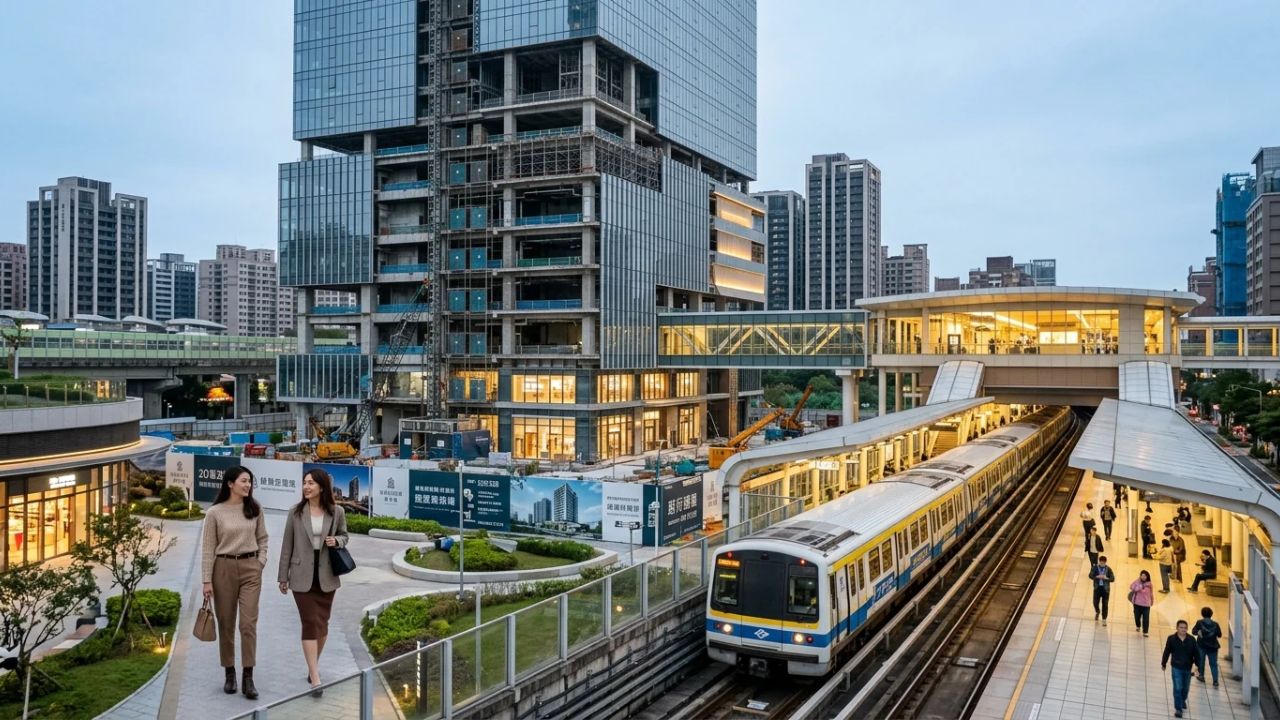
NEW TAIPEI CITY, Taiwan — New Taipei City has officially commenced construction on the NT$6.04 billion Banxin Station metro-linked development, launching a 38-storey transit-oriented project on the Circular Line as railway authorities across Taiwan, China, South Korea, Japan, and Singapore accelerate efforts to transform station precincts into integrated commercial, residential, and transit hubs.
The formal groundbreaking ceremony held on November 12, 2026, marks the transition from pre-development planning to active structural execution for one of northern Taiwan's most prominent transit-oriented developments (TOD). Designed to integrate high-density residential towers, Grade-A commercial workspace, community facilities, and retail pavilions directly above an operational rapid transit station, the project underscores an urban planning movement sweeping major Asian metropolitan regions. Facing intense population concentration and high land valuations, rail operators and municipal governments are turning station real estate into self-contained vertical cities.
However, the rapid proliferation of station-city mega-complexes introduces a decisive operational challenge for transport planners and travelers alike: ensuring that extensive commercial retail footprints do not compromise passenger circulation, lengthen walking distances, or create labyrinthine obstacles for passengers navigating high-frequency rail networks.
       NEW TAIPEI BANXIN STATION TRANSIT-ORIENTED HUB (TARGET: 2030)
 +-------------------------------------------------------------------+
 | 38 STOREYS ABOVE GROUND | 6 BASEMENT LEVELS | SITE: 4,603 M²      |
 +---------------------------------+---------------------------------+
                                   |
       +---------------------------+---------------------------+
       |                                                       |
       v                                                       v
+-----------------------------+         +-----------------------------+
|    COMMERCIAL & CIVIC       |         |     HIGH-DENSITY URBAN      |
| • Floors 1–2: Retail Mall   |         | • Upper Levels: Homes       |
| • Floor 3: Transfer & Plant |         | • 20,000+ Ping Floor Area   |
| • Floors 4–8: Office Suites |         | • ~66,000 m² Built Surface  |
| • Civic Center: 417 m²      |         | • Integrated Green District |
| • Projected Jobs: ~1,100    |         | • ~16,500 m² Public Park    |
+-----------------------------+         +-----------------------------+
                                   |
                                   v
+---------------------------------------------------------------------+
| CONNECTIVITY: New Taipei Circular Line (Yellow Line)                |
| 1 Stop to Banqiao Interchange (THSR • TRA • Taipei Metro Bannan)    |
+---------------------------------------------------------------------+
Architectural and Engineering Scope: Banxin Station’s Vertical Hub
The Banxin Station project represents a joint development model coordinated by the Department of Rapid Transit Systems (DORTS) of the New Taipei City Government alongside private development consortia. Formalizing an investment contract initially signed on October 3, 2023, the November 12, 2026 ground breaking initiates deep excavation works adjacent to the active, elevated guideway of the Circular Line.
Engineering specifications released by municipal authorities outline a 38-storey superstructure anchored by six subterranean basement levels engineered to accommodate private vehicle parking, mechanical systems, and direct subterranean pedestrian corridors:
- Site Footprint and Floor Area: The structural footprint occupies approximately 4,603 square metres of prime land in Banqiao District. The completed vertical development will encompass more than 20,000 ping (roughly 66,000 square metres) of gross floor space.
- Vertical Programme Stacking: The first two above-ground floors will house commercial retail outlets, restaurants, and commuter-oriented service amenities. The third level accommodates mechanical transfer equipment and station access nodes, while floors four through eight are dedicated to open-plan, enterprise-grade office suites designed to generate an estimated 1,100 localized jobs. The remaining upper storeys comprise modern residential apartments tailored for urban professionals seeking transit-adjacent living.
- Civic Integration: To satisfy municipal social infrastructure mandates, the development incorporates a dedicated community activity center spanning 126 ping (approximately 417 square metres), offering daycare services, public gathering halls, and municipal outreach desks.
- Urban Landscape Integration: Rather than operating as an isolated tower, the development connects with adjacent public gardens and green spaces to establish an integrated pedestrian district encompassing roughly 5,000 ping (16,500 square metres) of continuous open space.
| Structural & Project Dimension | Official Specification (New Taipei City DORTS) | Functional Role in Urban Fabric |
|---|---|---|
| Total Capital Investment | NT$6.04 Billion (~$190 Million USD) | Combined public-private development financing |
| Vertical Height & Levels | 38 Storeys Above Ground, 6 Basement Levels | High-density vertical stacking minimizing urban footprint |
| Total Site Surface Area | Approximately 4,603 square metres | Station-adjacent parcel zoned for mixed-use development |
| Gross Floor Area (GFA) | Exceeding 20,000 ping (~66,000 square metres) | Comprehensive residential, commercial, and civic floor space |
| Retail Allocation | Ground Level and Level 2 | Daily commuter retail, cafes, convenience, and services |
| Commercial Workspace | Levels 4 through 8 | Grade-A flexible office workspace for ~1,100 employees |
| Community Infrastructure | 126 ping (~417 square metres) | Public activity hall, civic outreach, and family care space |
| Public Realm Landscape | Approximately 5,000 ping (~16,500 square metres) | Unified open pedestrian space, plazas, and green parklands |
| Target Completion Window | Year 2030 | Multi-phase structural delivery and fit-out schedule |
The Regional Network: Banxin’s Link to the Banqiao Transit Spine
Banxin Station occupies a strategic position on the Circular Line (officially the Yellow Line), which began commercial passenger operations in early 2020. Running through New Taipei City's densest outer districts, the Circular Line was conceived to eliminate the historical requirement for suburban commuters to travel inward through downtown Taipei before transferring to outward radial lines.
The operational volume of the Circular Line highlights its growing role in metropolitan mobility. Annual patronage surpassed 22 million passenger journeys during 2025, and monthly usage throughout 2026 has consistently hovered around two million journeys.
       BANXIN STATION STRATEGIC INTERCHANGE PROXIMITY

  [ BANQIAO MEGA-INTERCHANGE ] <======= 1 STOP =======> [ BANXIN STATION ]
  • Taiwan High Speed Rail (THSR)                        • 38-Storey Mixed TOD
  • Taiwan Railways Administration (TRA)                 • Circular Line Local Stop
  • Taipei Metro Bannan Line (Blue Line)                 • 66,000 m² Built Surface
  • Regional Long-Distance Bus Terminal                  • 1,100 Projected Jobs
Importantly, Banxin Station is located just one stop from Banqiao Station, northern Taiwan's secondary intermodal hub. Banqiao provides direct, high-speed rail connections across the western development corridor via Taiwan High Speed Rail (THSR), conventional intercity services via the Taiwan Railways Administration (TRA), and rapid arterial transit into central Taipei via the Bannan Line (Blue Line). By positioning high-density office space and residential capacity at Banxin, planners can leverage Banqiao’s regional rail access while avoiding further congestion in the immediate station core.
New Taipei’s Broader TOD Master Plan: 37 Metro Land Development Nodes
The groundbreaking at Banxin Station is not an isolated initiative; it represents one component of New Taipei City's broader transit-oriented land development agenda. Recognizing that municipal rail expansion requires sustainable funding and ridership support, the city government has mapped out 37 dedicated metro-linked land development parcels along its transit corridors.
According to municipal disclosures published on November 12, 2026, 13 of these 37 parcels have successfully executed investor selection agreements and advanced into active architectural planning or construction. Across the entire 37-site portfolio, the New Taipei City Government projects:
- Demographic Absorption: Sustainable housing capacity for approximately 53,000 new residents.
- Employment Generation: Direct creation of roughly 43,000 long-term employment opportunities within office, retail, and service sectors.
- Economic Scale: Mobilization of over NT$327 billion (approximately $10.3 billion USD) in combined public-sector infrastructure spending and private capital investment.
| Metro Development Corridor | Active / Planned Sites | Key Hub Stations | Primary Development Focus |
|---|---|---|---|
| Circular Line (First Stage) | 10 Strategic Nodes | Banxin, Zhongyuan, Jingping, Shisizhang | High-density mixed towers, residential, district offices |
| Sanying Line Corridor | 7 Strategic Nodes | Sanxia, Yingge, National Academy esplanade | Cultural tourism, regional logistics, commuter housing |
| Wanda-Zhonghe-Shulin Line | 8 Strategic Nodes | Zhonghe, Liancheng, Jinhe | Light industrial transition, tech offices, civic facilities |
| Danhai Light Rail Grid | 6 Strategic Nodes | Kanding, Binhai Shaolun, Tamsui Admin | Coastal leisure, remote-work residential, retail parks |
| Ankeng Light Rail Spine | 6 Strategic Nodes | Shisizhang interchange, Rose China | Valley residential, eco-tourism links, healthcare hubs |
Five Railway Markets, One Shared Development Question
The spatial model being executed at Banxin mirrors planning priorities across East and Southeast Asia. Transport authorities in China, South Korea, Japan, and Singapore are similarly attempting to extract economic value from high-volume passenger terminals. However, each market approaches station-city integration with distinct scales, objectives, and passenger interfaces.
                  FIVE ASIAN STATION-CITY MODELS COMPARED

 +------------------+   +------------------+   +------------------+
 | TAIWAN (Banxin)  |   | CHINA (Baoshan)  |   | S. KOREA (Seoul) |
 | Local Suburban   |   | Mega-Interchange |   | Central MICE &   |
 | Metro TOD        |   | High-Speed Hub   |   | Corporate Tower  |
 | 66,000 m² GFA    |   | 18 Tracks, 8 Pl. |   | 337,000 m² GFA   |
 | Target: 2030     |   | Target: 2027     |   | Target: 2029     |
 +------------------+   +------------------+   +------------------+
          |                      |                      |
          +----------------------+----------------------+
                                 |
       +-------------------------+-------------------------+
       |                                                   |
       v                                                   v
+-----------------------------+             +-----------------------------+
| JAPAN (Takanawa Gateway)    |             | SINGAPORE (Pasir Ris Hub)   |
| Operational Global Hub      |             | Everyday Commuter Node      |
| Opened March 28, 2026       |             | Opened April 27, 2025       |
| 1,640 m² Hall, Travel Center|             | MRT, Bus, Polyclinic, Retail|
+-----------------------------+             +-----------------------------+
| Location & Project | Official Investment & Scale | Station & Intermodal Connectivity | Current Status (Nov 2026) |
|---|---|---|---|
| Taiwan: Banxin Station (New Taipei) | NT$6.04 Billion; 38 storeys; ~66,000 m² built space | New Taipei Circular Line (1 stop from Banqiao THSR/TRA hub) | Groundbreaking held Nov 12, 2026; completion target 2030 |
| China: Shanghai Baoshan Station | Mega-terminal; 8 platforms, 18 tracks; >100,000 m² TOD | National HSR lines, Shanghai Metro Line 19, suburban rail | Core design approved Feb 2026; railway opening target July 2027 |
| South Korea: Northern Seoul Station | KRW 338.4B public funding; 5 towers up to 39 storeys; ~337,000 m² | KTX, AREX Airport Express, Seoul Metro Lines 1 & 4 | Under active construction; target opening first half of 2029 |
| Japan: Takanawa Gateway City (Tokyo) | Mega-district; 1,640 m² convention hall, multiple towers | JR Yamanote Line, Keihin-Tohoku Line, Toei Asakusa link | Operating; grand opening held March 28, 2026 |
| Singapore: Pasir Ris Transport Hub | Multimodal civic hub; integrated air-conditioned bus interchange | Singapore MRT East-West Line, future Cross Island Line | Operating; bus interchange opened April 27, 2025 |
1. China: Shanghai Baoshan Tests High-Speed Multimodal Complexity
In China, station-city integration operates on an immense scale. Shanghai’s proposed station-city precinct around the upcoming Baoshan High-Speed Railway Station represents an ambitious test of passenger throughput and architectural layering. Following municipal approvals finalized in February 2026, the core integrated development parcel comprises over 100,000 square metres of permitted floor space organized above an 8-platform, 18-track high-speed terminal.
Designed to link the national rail network with Shanghai Metro Line 19, regional commuter lines, bus stations, and taxi concourses, the project relies on sunken plazas and vertical circulation cores to handle massive passenger flows. Railway operations are targeted for July 2027. The critical operational test for Baoshan is whether its multi-tiered concourses can prevent the disorientation and lengthy transfer walks that have historically challenged passengers at mega-terminals like Shanghai Hongqiao.
2. South Korea: Northern Seoul Station Adds a MICE and Corporate Focus
South Korea’s redevelopment of the northern rail yard at Seoul Station is explicitly geared toward international business travelers and corporate meetings. Managed under a municipal master plan updated in April 2026, the project features five high-rise towers rising up to 39 storeys across a 29,049-square-metre site, yielding roughly 337,000 square metres of total floor area.
The development integrates Grade-A corporate headquarters, extended-stay business hotels, and an international convention hall capable of accommodating over 2,000 delegates. To offset urban impacts, the developer provided approximately KRW338.4 billion in public contributions to build elevated, weather-protected pedestrian corridors linking the development directly to KTX high-speed train platforms, AREX airport rail links, and surrounding districts. Under active construction since late 2024, the complex targets completion in the first half of 2029.
3. Japan: Takanawa Gateway City Delivers an Operating Urban Benchmark
While Banxin, Baoshan, and Northern Seoul remain active construction sites, Tokyo’s Takanawa Gateway City offers a fully functioning operational model. Developed by East Japan Railway Company (JR East) along the Yamanote Line rail yards, the district celebrated its grand opening on March 28, 2026.
Takanawa Gateway City features a 1,640-square-metre pillarless convention hall supported by 15 breakout suites, high-rise luxury hotels, and modern commercial offices. Notably for travelers, the complex includes the dedicated JR East Takanawa Gateway Travel Service Center located inside The Linkpillar 1 South. Operating daily from 11:00 AM to 6:00 PM (cashless, credit card only), the center allows international travelers to exchange Japan Rail Passes, purchase regional shinkansen tickets, and access multilingual travel assistance directly at the station exit.
Japan’s Ministry of Land, Infrastructure, Transport and Tourism (MLIT) highlighted this coordination in its October 2026 railway-corridor town-planning guidelines, urging operators to design station districts that accommodate aging demographics while providing smooth, step-free access for international visitors.
4. Singapore: Pasir Ris Puts Everyday Commuter Transfers First
Singapore’s Pasir Ris Integrated Transport Hub (ITH) illustrates how transit-oriented development can prioritize daily commuter convenience over massive commercial footprint. Master-planned by the Land Transport Authority (LTA) and the Urban Redevelopment Authority (URA), the complex opened its new, fully air-conditioned bus interchange on April 27, 2025.
Unlike multi-tower speculative commercial developments, the Pasir Ris hub coordinates public transport directly with civic infrastructure. The complex integrates the elevated Pasir Ris MRT station (East-West Line) and the future underground Cross Island Line with an air-conditioned bus terminal, retail dining concourses, a public polyclinic, a municipal childcare center, and a central town plaza. With the opening of Punggol Coast in June 2025, Singapore reached 15 operational integrated transport hubs, demonstrating how public healthcare, family services, and transit transfers can co-exist within a compact, fully accessible footprint.
       SINGAPORE PASIR RIS INTEGRATED CIVIC-TRANSIT PROFILE
 +-------------------------------------------------------------------+
 |                   INTEGRATED CIVIC-TRANSIT FABRIC                 |
 +--------------------+--------------------+-------------------------+
 | Elevated Rail Node | Air-Conditioned    | Community Civic Anchor  |
 | MRT East-West Line | Bus Interchange    | Public Polyclinic,      |
 | Future Cross-Island| 100% Weatherproof  | Childcare & Town Plaza  |
 +--------------------+--------------------+-------------------------+
The Passenger Conundrum: Commercial Real Estate vs Transit Velocity
The core challenge facing all station-linked developments is the natural tension between commercial real estate objectives and transportation velocity. Commercial developers maximize retail revenue by designing layout paths that channel foot traffic past shopfronts, restaurants, and advertising displays. Conversely, rail passengers prioritize the shortest, most direct route between train doors, ticketing gates, and connecting street transport.
When property development takes precedence over transit design, travelers face significant friction:
- Labyrinthine Detours: Passengers are forced to navigate multi-level shopping mall escalators simply to reach street exits or bus bays.
- Vertical Mobility Bottlenecks: High-speed escalators and elevators frequently prioritize commercial shoppers, leaving passengers with heavy luggage or wheelchairs waiting in extended queues.
- Visual Clutter and Disorientation: Flashing commercial signage and retail storefronts often obscure standard municipal transport wayfinding, causing missed rail connections.
- Interchange Delays: While trains may operate at high speeds between cities, poorly integrated stations can add 15 to 25 minutes of walking and navigating time, eroding the time savings of modern rail travel.
              TRANSIT DESIGNS: DIRECT VS COMMERCIAL DETOUR

  [ IDEAL PASSENGER-CENTRIC FLOW ]
  Train Platform =====> Wide Lift/Escalator =====> Transit Concourse =====> Street / Bus
  * Time: 2–3 Minutes | Level Changes: 1 | Distance: Direct & Protected *

  [ COMPROMISED COMMERCIAL FLOW ]
  Train Platform =====> Escalator =====> Mall Level 3 =====> Winding Retail Arcade
                                                                    |
  Street / Connecting Bus <===== Basement 1 <===== Department Store Esc. Level 1
  * Time: 12–18 Minutes | Level Changes: 4 | Distance: Extended Detour *
Operational Evaluation Framework: How Travel Trade Planners Must Assess Station Hubs
Because official press releases focus heavily on capital valuations, tower heights, and floor areas, corporate travel managers, MICE organizers, and tour operators must conduct independent operational evaluations before incorporating station developments into passenger itineraries.
The following evaluation framework provides a practical methodology for assessing station transit districts:
| Operational Dimension | Critical Ground Checks | Traveler Impact & Risk Factors |
|---|---|---|
| Platform-to-Street Velocity | Measure actual walking time, count required level changes, inspect lift capacity | Prevents missed connections for travelers with heavy luggage or limited mobility |
| Multimodal Transfer Interfaces | Inspect connection distance to bus bays, taxi stands, and regional train tracks | Eliminates exposure to inclement weather and dangerous roadway crossings |
| Visual Wayfinding Clarity | Verify whether municipal transit directional signs remain visible against retail signage | Prevents passenger disorientation in complex, multi-level retail concourses |
| Vertical Mobility Resilience | Verify dedicated, high-capacity luggage lifts independent of retail shopping crowds | Reduces platform exit bottlenecks during peak commuter rush hours |
| Construction Zone Routing | Identify temporary exit detours, construction hoardings, and revised bus stop placements | Prevents tour group delays and incorrect vehicle pick-up dispatch instructions |
| Service Operating Hours | Verify ticketing desks, baggage storage, and tourist center operating schedules | Distinguishes between future development promises and active, operational amenities |
       TRAVEL INDUSTRY OPERATIONAL EVALUATION MATRIX
 +-------------------------------------------------------------------+
 | [ ] Step 1: Benchmark actual walking minutes from platform to exit|
 | [ ] Step 2: Confirm step-free elevator access along entire route  |
 | [ ] Step 3: Verify dedicated group check-in and luggage corridors |
 | [ ] Step 4: Map distance between rail gates and tour bus pick-ups  |
 | [ ] Step 5: Check construction hoardings and temporary detours   |
 +-------------------------------------------------------------------+
Strategic Guidance for Corporate Travel, MICE, and Tour Operators
As major Asian transport hubs undergo multi-year redevelopments, travel professionals must navigate shifting infrastructure landscapes. Implementing clear operational safeguards ensures smooth, reliable client journeys:
- Distinguish Between Under-Construction Proposals and Operational Facilities: Banxin Station (target 2030), Shanghai Baoshan (target 2027), and Northern Seoul Station (target 2029) remain active construction sites. Event planners must not market or contract conference halls or hotel rooms in these developments until formal certificate-of-occupancy clearances are issued.
- Conduct Ground Verification for Accessible Routing: When booking itineraries for travelers with reduced mobility, do not rely on generic "barrier-free" marketing claims. Verify whether dedicated platform-to-street elevators operate without requiring passage through privately managed retail malls that may close outside standard shopping hours.
- Account for Active Construction Disruptions: High-density construction around operational stations frequently requires temporary exit closures, sidewalk diversions, and shifted bus stops. Travel agencies arranging private airport transfers or tour coach pickups at hubs like Seoul Station or Banxin must verify active passenger loading zones monthly.
- Leverage Integrated Station Service Amenities: Where station developments are fully operational—such as Tokyo’s Takanawa Gateway City—incorporate official travel centers directly into itineraries. Directing arriving international clients to the Takanawa Gateway Travel Service Center provides convenient access to rail passes, IC transit cards, and bilingual regional travel guidance upon arrival.
Frequently Asked Questions
What is the New Taipei Banxin Station development and when will it open?
The Banxin Station project is an NT$6.04 billion transit-oriented development (TOD) located in New Taipei City, Taiwan. Formally breaking ground on November 12, 2026, the project will construct a 38-storey mixed-use skyscraper with six basement levels directly adjacent to the operational Circular Line metro station. Incorporating two floors of retail, five floors of enterprise office suites, residential apartments, and a civic community activity hall, the municipal government targets project completion by 2030.
Does the Banxin Station project include new rail lines or faster train services?
No. The groundbreaking marks the start of construction on station-adjacent property and community infrastructure, not the opening of a new train line or altered rail timetables. However, the development improves regional connectivity by positioning homes and offices within a single transit stop of Banqiao Station, northern Taiwan’s major intermodal interchange connecting Taiwan High Speed Rail (THSR), conventional Taiwan Railways (TRA), and the Taipei Metro Bannan Line.
How does Banxin compare to other major station developments across Asia?
Banxin represents a suburban mixed-use metro node. In contrast, China’s Shanghai Baoshan is a massive high-speed railway station-city hub featuring 8 platforms and 18 tracks planned for 2027. South Korea’s Northern Seoul Station is a major business and MICE district adding hotel and convention capacity for over 2,000 people by 2029. Japan’s Takanawa Gateway City in Tokyo is already operational with dedicated travel centers and event halls, while Singapore’s Pasir Ris hub integrates everyday community healthcare, childcare, and bus transit directly into the MRT network.
What should travel planners check when routing passengers through station developments?
Travel planners, corporate travel managers, and tour operators should verify actual platform-to-street walking times, the availability of direct step-free elevators, weather-protected transfer routes to buses or taxis, and the location of temporary construction detours. In addition, planners must verify that operating hours of ticket centers, baggage facilities, and hotel lobbies align with client arrival schedules, ensuring that commercial retail layouts do not obstruct transit connections.
Related Travel Guides
- Albania Euro Exchange Rate Plummets 35% Against Lek Since 2016 as Tourism Inflows and Property Boom Reshape Travel Costs
- Madrid Unveils 14 Million Christmas Lights, Giant Walk-Through Snowman, and 250 Urban Illuminations Across 21 Districts for 2026–2027 Season
- Spain Experiential Tourism Drive: Rural Heritage and Cultural Travel Across Spanish Regions
- Austria Smart Tourism Hubs: Combating Overtourism and Reshaping European Travel Standards
This article is for informational purposes. Flight routes, passenger regulations, visa rules, and transit advisories are subject to change by airlines and aviation authorities. Readers are advised to verify schedules and travel documentation with relevant carriers and border agencies before departure.
Related Stories
VIA Rail Canada Updates Guide Dog and Service Animal Documentation Rules with 48-Hour Verification and 5-Year Approval Validity
Spain Nationwide Rail Strike Disrupts AVE, Cercanías, and Rodalies Services as Renfe Cancels 24% of High-Speed Trains