Papua New Guinea’s Kainantu Rocked by 6.4 Earthquake as Travel Risks Mount Across the Highlands

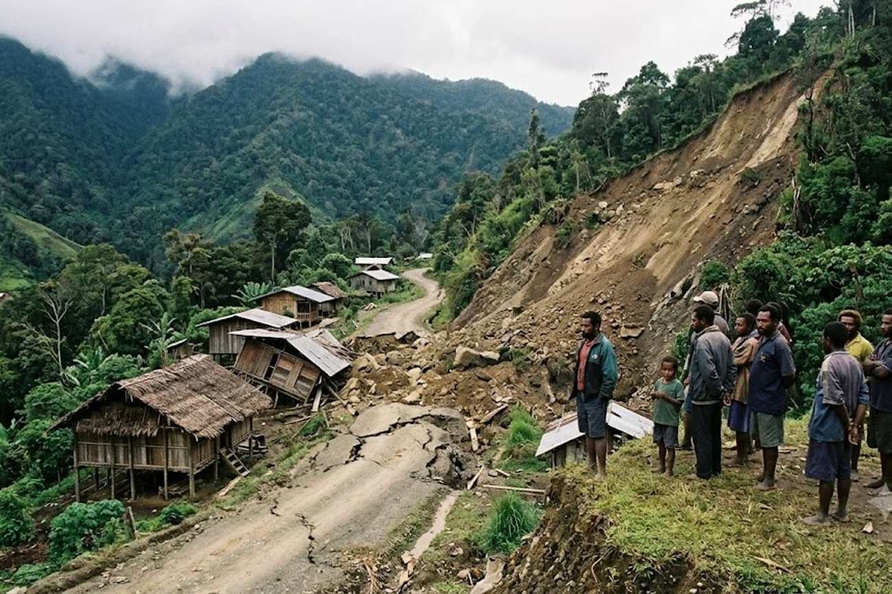
Image generated by AI
title: "Seismic Volatility in the Pacific Ring of Fire: Analyzing the Kainantu Event" date: "2026-09-22" The magnitude 6.4 earthquake that struck Papua New Guinea on September 20, 2026, represents a significant seismic event, yet it stands in stark contrast to the region's historical ceiling of 13 earthquakes measuring magnitude 7.5 or higher since 1900. This delta between current activity and historical maximums illustrates the critical difference between moderate seismic events and catastrophic systemic failures in the Pacific Ring of Fire.
The Kainantu Event in Numbers
The seismic event occurred at 09:17 UTC on September 20, 2026, with the epicenter located 49 kilometers north-northeast of Kainantu. According to data from the US Geological Survey (USGS), the tremor registered a magnitude of 6.4 at a depth of approximately 104.3 kilometers. This depth is a primary variable in the event's outcome; because it is classified as an intermediate-depth earthquake, the energy dissipated more broadly before reaching the surface, resulting in a "green" PAGER alert. This designation indicates that the probability of significant casualties or structural damage remained low.
The European Union’s RAPID-N natural-hazard platform corroborated these findings, recording the depth at exactly 104.33 kilometers. While the shaking was described as moderate to locally strong, the lack of shallow-crust rupture prevented the widespread devastation often associated with magnitude 6+ events. For the travel industry, the data point of most concern is not the magnitude itself, but the location: the Eastern Highlands area. This region is characterized by steep terrain where the interaction between seismic shaking and unstable soil often triggers secondary hazards.
Comparative Seismic Context
To understand the risk profile of Papua New Guinea, one must view the September 20 event against the broader tectonic history of the Australia-Pacific plate boundary. This boundary extends over 2,000 kilometers across Indonesia and New Guinea, creating a volatile environment where the lithosphere is constantly reshaped. The current event, while disruptive, is a minor data point when compared to the catastrophic 1998 tsunami event, which followed a magnitude 7.0 earthquake and resulted in at least 2,200 fatalities with wave run-ups reaching 15 meters.
The regional risk is further highlighted by comparing the Kainantu tremor to other Pacific Ring of Fire events, such as the magnitude 8.1 Solomon Islands earthquake of April 2007. The variance in impact between a 6.4 intermediate-depth quake and an 8.1 shallow quake is exponential, not linear.
| Metric | September 20, 2026 Event | Historical Regional Peak (Avg) | 1998 Tsunami Event |
|---|---|---|---|
| Magnitude | 6.4 | 7.5+ | 7.0 |
| Depth | 104.3 km | Variable (often shallower) | Shallow/Submarine |
| PAGER Alert | Green | Red/Orange | Extreme |
| Primary Impact | Moderate Shaking | Structural Collapse | 15m Tsunami/2,200 Deaths |
| Travel Risk | Infrastructure Inspection | Total Route Closure | Regional Displacement |
As noted by the International Air Transport Association (IATA), seismic activity in such regions requires a dynamic approach to flight planning and ground logistics, as airport runways and navigation aids can be compromised even if the primary city centers remain intact.
Practical Traveler Advisory and Strategic Insights
For those navigating the Highlands—specifically routes connecting Port Moresby, Goroka, Kainantu, and Madang—the data suggests a shift from "emergency response" to "infrastructure verification." Because the earthquake occurred in a region prone to landslides, the primary risk is not the tremor itself, but the stability of the roads and bridges that facilitate movement between these hubs.
If you are planning travel to the Eastern Highlands in the coming weeks, the following data-driven adjustments are essential:
- Buffer Itineraries: Avoid "tight" schedules. Given the vulnerability of Highlands roads to secondary landslides following a 6.4 magnitude event, a 24-to-48-hour buffer between regional transfers is recommended to account for mandatory infrastructure inspections.
- Diversify Transport: Relying solely on road transfers in the Highlands is currently high-risk. Prioritize domestic flight options where available, as aviation infrastructure is generally more resilient to intermediate-depth tremors than mountain roads.
- Monitor Real-Time Feeds: Use the USGS Latest Earthquakes map to track aftershocks. While the initial PAGER alert was green, subsequent shallower aftershocks can trigger the landslides that the initial 104km-deep quake did not.
- Verify Local Access: Contact operators in Kainantu and Goroka directly to confirm that bridge integrity has been verified by local authorities before attempting overland transit.
Forward Projection: The Ring of Fire Trajectory
The September 20 event is a reminder that Papua New Guinea remains in a state of permanent seismic tension. Based on the frequency of magnitude 7.5+ events since 1900, the region is overdue for significant adjustments in building codes and tourism infrastructure. The trend in the Pacific Ring of Fire is moving toward "resilience-based tourism," where the draw of volcanic landscapes and dramatic topography is balanced by high-tech early warning systems.
We expect to see an increase in the integration of seismic monitoring data into travel insurance premiums for the region. As the World Tourism Organization (UNWTO) emphasizes sustainable and safe travel, destinations like Papua New Guinea will likely implement more rigorous "Travel Warning" tiers based on real-time seismic depth and magnitude data rather than generic regional alerts. The trajectory suggests that future travel to the Highlands will be increasingly dependent on digital "safe-corridor" maps updated in real-time following any event above magnitude 5.0.
FAQ: Papua New Guinea Seismic Trends 2026
Will flight prices to Port Moresby increase after this earthquake? Unlikely. Because the USGS PAGER alert remained green and the earthquake was intermediate-depth, there is no widespread damage to primary aviation hubs. Prices typically only spike if major airport infrastructure is compromised or airspace is restricted.
Is it safe to visit the Highlands right now? Generally yes, but with caution. The primary risk is not the earthquake itself but secondary landslides on mountain roads. Travelers should verify road conditions with local authorities and avoid tight schedules.
Which transport method is safest following a tremor? Domestic flights are the safest option. Roads in the Highlands are susceptible to landslides and bridge failures following seismic activity, making air travel the most reliable way to bypass potentially damaged terrain.
How does a "green" PAGER alert affect my travel insurance? A green alert indicates low expected casualties and damage. Most insurance providers will not trigger "force majeure" clauses for a green-alert event unless a specific road closure or flight cancellation directly impacts your itinerary.
Seismic data proves that in the Highlands, the depth of the quake determines the danger of the journey.
Related Travel Guides
- Beck Hole North Yorkshire Why This Tiny Village Is Perfect For An Autumn Walking Escape
- America’s Top 5 Haunted Attractions 2026 Revealed As Halloween Destinations Deliver Immersive Horror Adventures Across USA
- Wuhan Autumn 2026 Tourism Season Unveils 279 Events, Cultural Festivals And New Experiences To Boost City Travel
This article is for informational purposes. Flight routes, passenger regulations, visa rules, and transit advisories are subject to change by airlines and aviation authorities. Readers are advised to verify schedules and travel documentation with relevant carriers and border agencies before departure.
Related Stories

Melbourne Airport Unveils AU$500 Million T2 Baggage Upgrade: Traveler Guide 2026

Cape Town Completes Table View Beachfront Coastal Transformation Ahead of 2026-2027 Summer Season