
Appalachian Deluge: Ohio and West Virginia Severe Flood Emergency and Park Travel Advisory 2026

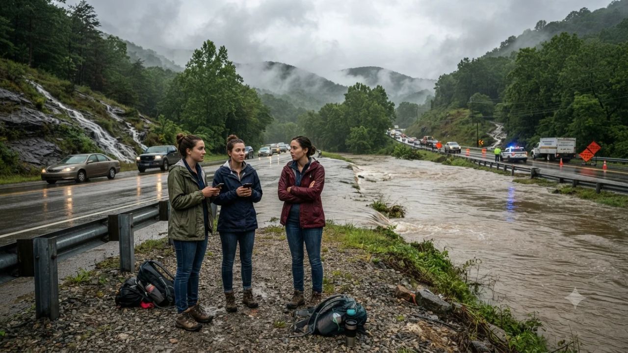
With localized storm bands dumping between 2.5 and 5 inches of torrential rain across southwestern Ohio and three to four inches across the sandstone gorges of Hocking County, emergency officials have issued urgent flash flood warnings stretching from suburban Cincinnati into the Appalachian ridges of West Virginia. The sudden deluge has overwhelmed mountain creeks, swamped low-lying sections of Interstate 77 and Interstate 79, and forced state park rangers to suspend hiking and camping activities around Hocking Hills State Park and Holly River State Park.
For travelers, outdoor enthusiasts, and road trippers exploring the central Appalachian corridor, rapid water runoff has transformed tranquil forest streams into churning torrents. The National Weather Service warned that saturated hillsides and swollen river basins—including the Hocking River near Enterprise and low-elevation crossings near the Ohio River—will continue to experience high water levels even after active storm clouds dissipate.
Severe Weather Footprint: Swollen Rivers and Interstates
The severe weather system concentrated its heaviest rainfall along two primary geographical axes: the forested hollows of southern Ohio and the rugged mountain passes of central West Virginia.
The major affected corridors and travel zones include:
| Geographic Zone & County | Measured Rainfall Accumulation | Highway & Park Impacts |
|---|---|---|
| Southern Hocking & Pickaway (OH) | 3.0 to 4.0 inches | Fast-rising water at Salt Creek and Laurel Run; Laurelville, South Bloomingville, and Tarlton roads impassable |
| Hocking River Basin (OH) | River above flood stage | Route 33 low-lying stretches near Enterprise; Route 93 south of Logan at risk |
| Cincinnati Metro & SW Ohio | 2.5 to 5.0 inches | Street flooding in Clermont, Clinton, Hamilton, and Warren counties near Mason, Lebanon, and Kings Island |
| Southern Ohio Counties (OH) | Continuous heavy runoff | Advisories across Athens, Meigs, Vinton, Jackson, Ross, Pike, Highland, and Brown counties |
| Interstate 79 Corridor (WV) | Torrential mountain showers | Standing water and washouts between Sutton, Gassaway, and Birch River near Holly River State Park |
| Interstate 77 Corridor (WV) | High-volume runoff | Flooded exit ramps around Parkersburg, Spencer, Elizabeth, Grantsville, and Glenville |
In West Virginia, the steep topography of the Appalachian plateau accelerates water velocity, funneling runoff from high ridges directly into narrow highway valleys. Along Interstate 79 between Sutton and Birch River, standing water on travel lanes has caused dangerous hydroplaning conditions, while Interstate 77 travelers heading toward Ohio River crossings encounter flooded access ramps and muddy debris.
What Sets the Hocking Hills and Appalachian Terrain Apart
The natural geology that makes Hocking Hills State Park and central West Virginia premier destinations for hikers also makes them uniquely vulnerable to sudden water surges. Millions of years of water erosion carved deep Black Hand Sandstone gorges, recess caves like Old Man's Cave and Ash Cave, and plunging waterfalls like Cedar Falls.
During flash flood events, these enclosed canyon trails can become hazardous within minutes:
- Slot-Like Gorge Walls: In areas like Conkle's Hollow and Rock House, sheer 200-foot sandstone cliffs leave hikers with no high-ground escape routes if valley streams suddenly crest their banks.
- Cascading Water Overhangs: Waterfall plunge pools that usually offer peaceful viewing turn into violent chutes capable of sweeping away wooden footbridges and trail markers.
- Undermined Trail Foundations: Saturated soil around hemlock root networks on ridge paths can cause sudden mudslides and tree falls across backcountry trekking circuits.
Travelers can monitor park trail closures, water level alerts, and campground conditions through the official Ohio Department of Natural Resources (ODNR) portal alongside updates from West Virginia Tourism.
Visitor Insider Tips for Navigating Appalachian Storm Conditions
When torrential weather impacts your outdoor travel itinerary, adopting practical safety strategies is essential:
- Follow the "Turn Around Don't Drown" Rule: Never attempt to drive through water-covered roadways, particularly on rural county routes in Hocking or Pickaway counties. Moving water as shallow as six inches can stall passenger cars, and twelve inches of rushing water can easily float most sports utility vehicles.
- Monitor Real-Time NWS Doppler Radar: Download weather radar apps with push alerts from the National Weather Service before driving into mountain hollows where cellular data reception is inconsistent.
- Postpone Gorge Hikes Until 24 Hours Post-Rain: Avoid descending into gorge floors or slot canyons during or immediately after multi-inch rain events. Wait at least 24 hours for runoff to subside, allowing park rangers to inspect trail railings, footbridges, and rock stability.
- Pivot to High-Ground Cultural Experiences: If trailheads are closed, redirect your afternoon to indoor attractions. Visit the Columbus Museum of Art to the north, explore indoor antique markets in historic Logan and Lancaster, or take in regional glassblowing exhibitions in the Ohio River valley.
- Confirm Cabin and Lodge Access Routes: Many vacation cabins in the Hocking Hills region are accessed via steep gravel driveways and low-water stream crossings. Contact your cabin host or rental agency before departure to verify that your specific access road remains passable for standard vehicles.
Cultural and Environmental Context of Appalachian Hydrology
The ancient Appalachian mountain chain features some of the oldest river systems on the North American continent. The mixed mesophytic forests that carpet southern Ohio and West Virginia—dominated by tulip poplars, oaks, and eastern hemlocks—play an irreplaceable role in absorbing rainfall and preventing catastrophic erosion.
However, historical logging, hillside development, and intensive mining in surrounding valleys have altered natural drainage pathways. Conservation agencies in Ohio and West Virginia are actively restoring riparian wetlands along the Hocking and Kanawha rivers, planting native switchgrass and buttonbush buffers to slow stormwater velocity before it reaches municipal drinking reservoirs.
Local communities along Salt Creek and the Hocking River embody deep Appalachian resilience, with volunteer fire departments and neighborhood networks swiftly mobilizing to clear road debris and assist stranded motorists. Respecting local road closure barricades and following evacuation guidance ensures that emergency personnel can focus their resources on protecting vulnerable low-elevation homesteads.
FAQ: Ohio and West Virginia Severe Flooding 2026
Is Hocking Hills State Park open during the flood warnings? While the park remains open, rangers have issued safety warnings and temporarily closed specific gorge trails, low-lying footbridges, and flooded camping loops. Check ODNR alerts before arriving.
Which highways are experiencing the worst flooding in West Virginia? Interstate 79 (between Sutton and Birch River) and Interstate 77 (near Parkersburg and Spencer) face heavy standing water, flooded ramps, and localized washouts.
How much rain fell during the September 2026 storms? Rainfall totals reached 3.0 to 4.0 inches in Hocking and Pickaway counties, and between 2.5 and 5.0 inches in the Cincinnati metropolitan area and southwestern Ohio.
Are vacation cabins in the Hocking Hills safe to stay in? Most cabins situated on elevated ridges are safe and dry, but access roads crossing low-lying creeks may be temporarily impassable. Verify route conditions with your property manager.
When mountain rivers swell beyond their banks, respecting nature's power is the first rule of Appalachian travel.
Related Travel Guides
- Air India Express Cancels Patna to Delhi Morning Flight IX1348: Passenger Rebooking and Rail Alternatives Guide
- France Uncovers Multimillion-Euro Louvre Ticketing Scam as Insider Fraud Network Targets Cultural Tourists: New Travel Alert
- Thailand Issues Urgent Health Warning and Enforces Mandatory 21-Day Quarantine for Arrivals from Uganda and Congo as Deadly Ebola Outbreak Surges: New Travel Alert
This article is for informational purposes. Flight routes, passenger regulations, visa rules, and transit advisories are subject to change by airlines and aviation authorities. Readers are advised to verify schedules and travel documentation with relevant carriers and border agencies before departure.
Related Stories

Odyssey Residential Cruise Strands 203 Passengers in Sihanoukville Cambodia as Fourfold Fuel Inflation Triggers Vessel Lay-Up

US Embassy Issues Dominican Republic Travel Security Alert Over Dating App Drugging and Robbery Risks