Ohio and West Virginia Declare Severe Weather Emergencies as Torrential Rains Disrupt Interstate 77, Interstate 79, and Hocking Hills Travel

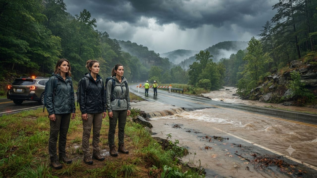
Image generated by AI
The National Weather Service has issued emergency Flash Flood Warnings across major regions of Ohio and West Virginia following torrential autumn downpours that dropped up to 5 inches of rain. Heavy runoff has flooded key transportation corridors—including Interstate 77 and Interstate 79—while forcing emergency travel advisories across popular outdoor recreation areas such as Hocking Hills State Park and Holly River State Park.
Torrential Downpours Trigger Widespread Flash Flood Alerts
A major storm system moving across the Midwest and Appalachian regions has produced severe localized flooding, inundating low-lying roadways and small tributaries. Reports confirmed by the National Weather Service (NWS) indicate that already-saturated soil conditions exacerbated rapid surface runoff across southern Ohio and central West Virginia.
Emergency management agencies across both states have warned motorists against traveling on submerged routes, highlighting life-threatening water velocities along rural state highways and major intercity freeways.
Southern Ohio & Hocking Hills State Park Impact
In southern Ohio, rainfall totals reached between 3 and 4 inches across Hocking County and Pickaway County. Rapidly rising waters along Salt Creek and Laurel Run forced emergency warnings for Laurelville, South Bloomingville, Tarlton, and Union Furnace:
- Hocking Hills State Park Advisory: Visitors and hikers were instructed to vacate low-lying trails, waterfalls, and campgrounds due to swift water currents.
- Hocking River Cresting: Near Enterprise, the Hocking River approached flood stage, inundating regional travel arteries including U.S. Route 33, Route 93 south of Logan, and low-lying sections near Rockbridge.
- Greater Cincinnati & Southwest Counties: Rainfall estimates between 2.5 and 5 inches hit Clermont, Clinton, Hamilton, and Warren counties. Flooding impacted local thoroughfares around Mason, Lebanon, Monroe, Loveland, Morrow, and areas adjacent to Kings Island theme park. Additional advisories remain active for Athens, Meigs, Vinton, Jackson, Ross, Pike, Highland, and Brown counties.
West Virginia Highway Corridors & Interstate Delays
West Virginia's steep mountain topography accelerated water accumulation along major interstate routes and state corridors:
- Interstate 79 (I-79): High water levels and runoff impacted I-79 between Sutton, Gassaway, and Birch River, restricting access toward Holly River State Park.
- Interstate 77 (I-77): Standing water and flooded access ramps created hazardous driving conditions near Parkersburg, Spencer, Elizabeth, Grantsville, and Glenville, slowing traffic toward Ohio River crossings.
Ohio & West Virginia Severe Weather Impact Specifications
The key geographic zones, travel corridors, and official weather parameters associated with the September 2026 flooding emergency are detailed below:
| Jurisdiction / Region | Affected Counties & Destinations | Key Transport Corridors Impacted | Recorded / Estimated Rainfall | Primary Hazard Profile |
|---|---|---|---|---|
| Southern Ohio (Hocking Region) | Hocking, Pickaway (Laurelville, S. Bloomingville, Tarlton) | U.S. Route 33, Route 93, Salt Creek & Laurel Run roads | 3.0 to 4.0 inches | Trail washouts, fast-rising creeks, Hocking River cresting |
| Southwest Ohio (Cincinnati Metro) | Clermont, Clinton, Hamilton, Warren (Mason, Loveland, Kings Island) | Local arterials, I-71/I-75 suburban feeder routes | 2.5 to 5.0 inches | Urban street flooding, overwhelmed drainage, creek overflows |
| Southeast Ohio Counties | Athens, Meigs, Vinton, Jackson, Ross, Pike, Highland, Brown | State Routes connecting rural communities | 2.0 to 4.0 inches | Delayed river cresting, prolonged road submergence |
| Central & Northern West Virginia | Braxton, Gilmer, Calhoun, Wirt, Wood (Parkersburg, Sutton) | Interstate 79, Interstate 77, Holly River access roads | 3.0 to 4.5 inches | Mountainous flash runoff, flooded ramps, highway standing water |
Traveler Logistics Guide: Navigating Flood Alerts & Highway Rerouting
Severe weather events across the U.S. Midwest and Appalachian regions require proactive route management for road travelers, truck operators, and outdoor tourists.
Real-Time Road Condition & Navigation Tools
- State Department of Transportation Portals: Check real-time road closure maps via OHGO (Ohio DOT) and West Virginia 511 before departing. Avoid relying solely on GPS navigation, as automatic rerouting may direct vehicles onto submerged rural secondary roads.
- Interstate Rerouting: Drivers traveling northbound or southbound along I-77 and I-79 should anticipate lane closures and reduced speed zones near river crossings. Maintain safe trailing distances and watch for hydroplaning hazards.
Outdoor & State Park Reservation Management
- Hocking Hills & State Park Access: Tourists holding campsite or cabin reservations at Hocking Hills State Park or Holly River State Park should contact the Ohio Department of Natural Resources (ODNR) or West Virginia State Parks to verify trail safety before traveling.
- Turn Around Don't Drown Protocol: Never attempt to drive through flooded road segments. As little as 12 inches of moving water can float a passenger vehicle, while hidden washouts beneath surface water present extreme drowning hazards.
Regional Infrastructure & Outdoor Tourism Impact Assessment
The severe flooding across Ohio and West Virginia highlights the vulnerability of regional transportation corridors to extreme precipitation events. Road-based tourism represents a primary economic engine for the Hocking Hills region and West Virginia's state park system.
Temporary closures of state routes and trail networks lead to immediate booking cancellations for local lodge operators, outdoor outfitters, and regional hospitality businesses. State transportation departments in Ohio and West Virginia are deploying maintenance crews to clear debris, inspect bridge abutments, and repair eroded highway shoulders once floodwaters recede.
Frequently Asked Questions: Ohio & West Virginia Flood Emergency (2026)
Which major interstates are affected by flooding in Ohio and West Virginia?
Interstate 77 (near Parkersburg and Elizabeth) and Interstate 79 (between Sutton and Birch River) face standing water, flooded access ramps, and severe travel delays.
Is Hocking Hills State Park open during the flood warning?
Authorities have advised travelers to delay outdoor activities. Fast-rising streams and trail washouts make gorge trails, waterfalls, and low-lying roads near Hocking Hills dangerous.
What rainfall totals were reported in southern and southwest Ohio?
Southern Hocking County recorded 3 to 4 inches of rain, while parts of the Cincinnati metropolitan area (Hamilton and Warren counties) received between 2.5 and 5 inches.
How can travelers check real-time road conditions in Ohio and West Virginia?
Drivers can access official road condition updates via OHGO.com for Ohio highways and WV511.org for West Virginia interstates and state routes.
Related Travel Guides
- Tragic West Englewood Fire Claims Four Lives as Police Launch an Urgent Chicago Arson Investigation into the Suspicious Early Morning Blaze: New Travel Alert
- NWS Declares Red Flag Fire Emergency Across Texas, Oklahoma, Nebraska, Kansas, Colorado, and Wyoming as Wildfires Threaten Major Road Trip Disruption: New Travel Alert
- South Korea and Over Thirty Nations Face a Severe Global Medical Tourism Disruption as West Asia Geopolitical Conflict Cuts Off High-Value Patient Flows: New Travel Alert
This article is for informational purposes. Flight routes, passenger regulations, visa rules, and transit advisories are subject to change by airlines and aviation authorities. Readers are advised to verify schedules and travel documentation with relevant carriers and border agencies before departure.
Related Stories

US State Department Worldwide Caution Alert 2026: Impact on Middle East Aviation and Travel Insurance

US State Department Maintains Israel Level 3 Travel Advisory Amid Houthi Missile Risks 2026