
Ohio and West Virginia Under Flash Flood Emergency: Travel Alerts for Hocking Hills and Interstate Corridors

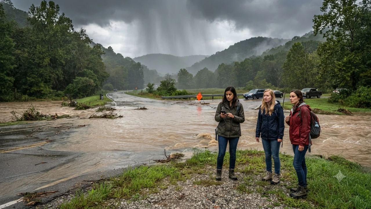
Image generated by AI
While the sandstone gorges of southern Ohio normally attract thousands of autumn hikers, torrential downpours dumping between 3 and 5 inches of rain have transformed peaceful streams into dangerous torrents, forcing emergency flash flood alerts across Hocking Hills State Park and key Appalachian transit arteries. The National Weather Service issued widespread flash flood warnings spanning southwest Ohio, the Hocking River basin, and central West Virginia. With major freight and passenger corridors including Interstate 77 and Interstate 79 impacted by standing water, travelers navigating the Appalachian plateau face dangerous conditions, impassable low-water bridges, and sudden mountain runoff.
The Appalachian Deluge: Severe Inundation From Cincinnati to West Virginia
The sudden storm system delivered intense precipitation over ground already saturated from late-summer rains. The most acute hazard zones developed across southern Hocking County and southeastern Pickaway County in Ohio, where overnight rain gauges measured 3 to 4 inches of rapid rainfall. Communities surrounding Salt Creek and Laurel Run—including Laurelville, South Bloomingville, Tarlton, and Union Furnace—confronted rising creeks that rapidly spilled over riverbanks.
Near Enterprise, the Hocking River approached flood stage, threatening low-lying pavement along Route 33 and creating hazardous access near Rockbridge and Route 93 south of Logan. In southwestern Ohio, intense convective bands swept across Clermont, Clinton, Hamilton, and Warren counties, dropping 2.5 to 5 inches of rain around Cincinnati, Mason, Lebanon, Monroe, Loveland, Morrow, and areas surrounding Kings Island. Additional flood advisories extended into Athens, Meigs, Vinton, Jackson, Ross, Pike, Highland, and Brown counties.
Across the state line, West Virginia experienced severe highway disruptions as storm runoff rushed down steep mountain hollows. The National Weather Service placed vital north-south arteries under flash flood warnings:
- Interstate 79: Flooding hazards concentrated along the highway corridor between Sutton, Gassaway, and Birch River, complicating access toward Holly River State Park.
- Interstate 77: High water threatened travel near Parkersburg, Spencer, Elizabeth, Grantsville, and Glenville, creating treacherous conditions near Ohio River bridge approaches and low-lying highway off-ramps.
What Makes Appalachian Gorges and River Valleys Prone to Flash Floods
Understanding flash flood mechanics in the Appalachian foothills requires looking at regional topography and bedrock geology. The Hocking Hills region sits on dense Black Hand Sandstone, characterized by sheer cliff faces, deeply incised gorges, and narrow box canyons. When heavy rain falls over the forest canopy, water cannot penetrate the solid rock surfaces and instead channels rapidly into narrow ravine bottoms like Old Man's Cave and Cedar Falls.
In West Virginia, mountainous terrain amplifies runoff velocity. Tiny streams running through narrow hollows can surge several feet in under twenty minutes, carrying mud, tree limbs, and gravel onto winding two-lane mountain roads.
Unlike broad coastal plains where floodwaters rise gradually, mountain valleys funnel vast quantities of water into confined creek beds. This creates sudden hydrological surges where quiet park trails transform into impassable waterways with little visual warning for hikers stationed downstream.
Visitor Insider Tips for Navigating Flash Floods in Ohio and West Virginia
Travelers and outdoor enthusiasts currently in the region or planning weekend departures should follow these localized safety protocols:
- Postpone Gorge Hikes at Hocking Hills: Avoid descending into gorge trails, canyon floors, and waterfall basins managed by the Ohio Department of Natural Resources. Fast-moving water makes rim trails slick and cuts off exit stairs in box canyons without warning.
- Never Attempt Low-Water Crossings: Flowing water just six inches deep can stall passenger vehicles or sweep cars off low-water rural bridges. If you encounter water over the road on Route 93, Route 33, or rural county routes, turn around immediately.
- Monitor Real-Time Mountain Road Closures: Check state transport feeds before driving Interstate 77 or Interstate 79 through West Virginia. Secondary mountain roads can remain blocked by fallen rocks and mudslides long after rain stops.
- Check River Gauge Levels Before Water Activities: Kayakers and canoeists should cancel paddling trips along the Hocking River and Little Miami River until stream gauges drop below flood advisory stages. Explore higher-elevation cultural sites in Columbus or Athens instead.
Cultural and Environmental Context of Extreme Weather in Appalachia
Appalachian communities possess a rich heritage of resilience, shaped by generations of living alongside winding rivers, coal hollows, and timbered ridgelines celebrated across West Virginia State Parks. However, the increasing frequency of high-intensity precipitation events presents significant infrastructure challenges for historic mountain towns.
Many small communities nestled in narrow valleys rely on single-access rural roads that cross historic iron bridges. When localized downpours exceed drainage capacity, small business districts, cabin rental operations, and agricultural bottomlands suffer direct economic disruption.
From an ecological perspective, severe flash floods alter forest riverbed ecosystems. Heavy runoff scours stream bottoms, threatening native salamander habitats, brook trout populations, and fragile fern beds clinging to moist sandstone cliff faces. Sustainable park stewardship requires active trail reinforcement, improved watershed management, and educated visitor practices that respect temporary park closures during extreme atmospheric events.
FAQ: Visiting Ohio and West Virginia During Flood Alerts
Is Hocking Hills State Park safe to hike during flash flood warnings?
No. Gorge trails, waterfall basins, and canyon paths in Hocking Hills become highly dangerous during heavy rainfall. Visitors should postpone outdoor hikes until floodwaters recede.
Which major highways are affected by flooding in West Virginia?
Interstate 77 near Parkersburg, Spencer, and Glenville, alongside Interstate 79 near Sutton, Gassaway, and Birch River, face standing water and flooded exit ramps.
How much rain fell during the Ohio storm emergency?
Rainfall totals reached 3 to 4 inches in southern Hocking and Pickaway counties, with southwestern Ohio counties recording between 2.5 and 5 inches.
Can rivers continue rising after the rain stops?
Yes. Upstream mountain runoff continues draining into river basins hours after storms pass, causing waterways like the Hocking River to peak well after rainfall ends.
Related Travel Guides
- Ethiopian Airlines Suspends Flights to Mekelle, Axum, and Shire: Tigray Travel Alert and Heritage Guide 2026
- Airline Capacity Cuts 2026: Southwest, Wizz, United Adjust Routes Amid Rising Fuel Costs
- Japan Aviation Alert: ANA Okinawa to Saga Flight Returns to Naha as Travelers Reorganize Kyushu Transit in 2026
This article is for informational purposes. Flight routes, passenger regulations, visa rules, and transit advisories are subject to change by airlines and aviation authorities. Readers are advised to verify schedules and travel documentation with relevant carriers and border agencies before departure.
Related Stories

Odyssey Residential Cruise Strands 203 Passengers in Sihanoukville Cambodia as Fourfold Fuel Inflation Triggers Vessel Lay-Up

US Embassy Issues Dominican Republic Travel Security Alert Over Dating App Drugging and Robbery Risks