
Ohio Alongside West Virginia Face Severe Weather Emergency As Torrential Rains Trigger Widespread U.S. Flood Alerts
Ohio Alongside West Virginia Face Severe Weather Emergency As Torrential Rains Trigger Widespread U.S. Flood Alerts

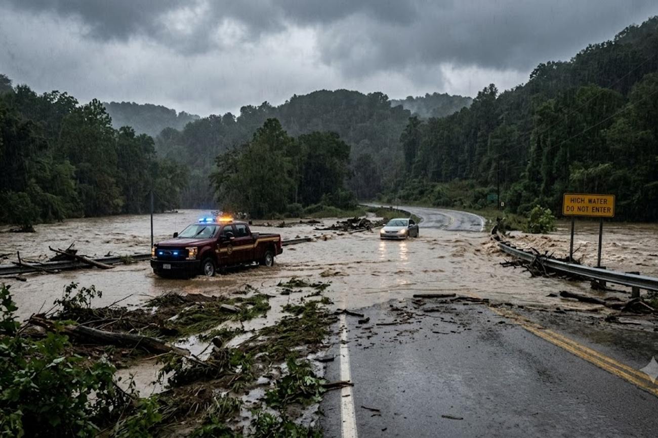
Image generated by AI
Regional precipitation levels in Southwestern Ohio have surged to between 2.5 and 5 inches, a volume that historically correlates with immediate drainage failure in urban corridors and rapid saturation in Appalachian terrains. This spike in rainfall is not an isolated weather event but a signal of increasing volatility in the Midwest and Appalachian travel corridors, where saturated ground is now triggering flash flood warnings across multiple state lines simultaneously.
The Appalachian Hydrological Crisis in Numbers
The current weather system has created a high-risk environment for transit and tourism across Ohio and West Virginia. In the Cincinnati metropolitan area—specifically within Clermont, Clinton, Hamilton, and Warren counties—rainfall totals have reached a peak of 5 inches. This intensity has placed immediate pressure on drainage infrastructure in communities such as Mason, Lebanon, Monroe, Loveland, and Morrow.
Further east, the Hocking Hills region has recorded rainfall between 3 and 4 inches. While these numbers may seem lower than the Cincinnati peak, the topographical context is different. In southern Hocking County and southeastern Pickaway County, the combination of steep gradients and already saturated soil has accelerated the rate of stream and river rises. This has directly impacted high-traffic tourism hubs, including the Hocking Hills State Park, where rapidly moving water has compromised hiking trails and camping zones.
The impact extends to critical logistics arteries. The National Weather Service has issued warnings that encompass the corridors of Interstate 77 and Interstate 79. In West Virginia, the risks are concentrated around the Sutton, Gassaway, and Birch River segments of I-79, and the Parkersburg, Spencer, Elizabeth, Grantsville, and Glenville stretches of I-77. These routes serve as the primary conduits for interstate commerce and tourism, meaning any closure triggers a ripple effect across the regional supply chain.
Comparative Regional Vulnerability
When analyzing the current flood data against historical benchmarks for the Ohio River Valley, a pattern of "compounded saturation" emerges. Unlike singular storm events, this period is characterized by new rainfall falling on ground that is already unable to absorb moisture, leading to immediate runoff.
The following table illustrates the distribution of rainfall and the resulting risk levels across the affected zones:
| Region | Rainfall Range (Inches) | Primary Infrastructure at Risk | Risk Level | Key Impacted Hubs |
|---|---|---|---|---|
| Southwest Ohio | 2.5 - 5.0 | Urban Drainage / Local Roads | High | Cincinnati, Kings Island |
| Hocking Hills / SE Ohio | 3.0 - 4.0 | State Routes / Nature Trails | Critical | Laurelville, Route 33 |
| Central/North WV | Variable (Heavy) | Interstates (I-77, I-79) | High | Sutton, Parkersburg |
| Appalachian Valleys | Variable (Heavy) | Mountain Roads / Low-lying Ramps | Critical | Holly River State Park |
This distribution shows that while the highest volume of water is in the southwest, the highest operational risk is in the mountainous regions of West Virginia and the valleys of Southeast Ohio. According to data trends tracked by the World Travel & Tourism Council (WTTC), nature-based tourism is increasingly susceptible to these "flash" events, which can render a destination inaccessible within hours.
What This Means for Travelers
For those navigating the Midwest and Appalachian regions, the data suggests that standard GPS routing is currently unreliable. Flash flooding often affects "low-lying roads" and "flooded ramps" that may not be updated in real-time on consumer mapping apps.
If you are planning travel through Ohio or West Virginia in the current window, the following data-backed precautions are essential:
- Avoid Route 33 and Route 93: Specifically near Enterprise and south of Logan, where river levels are expected to exceed flood stages.
- Audit Your Itinerary for Nature Parks: If your trip includes Hocking Hills State Park or Holly River State Park, expect closures. The rapid rise of creeks and streams makes hiking trails structurally unstable.
- Buffer Travel Times by 30-50%: With I-77 and I-79 under watch, detours are likely. The mountainous landscape of West Virginia means a single flooded valley road can add significant mileage to a detour.
- Verify "Last-Mile" Access: Even if the Interstates remain open, the "last-mile" roads leading to hotels or rentals in rural counties (such as Athens, Meigs, Vinton, Jackson, Ross, Pike, Highland, and Brown) are the most likely to be submerged.
Travelers should consult the International Air Transport Association (IATA) or local DOT portals for real-time infrastructure status, as ground transport volatility often leads to secondary delays in regional airport transfers.
Projection of Regional Transit Stability
The current trajectory suggests that travel disruptions will persist even after the rain stops. This is due to the "lag effect" of upstream runoff. In the Hocking River basin and the various West Virginia watersheds, water levels often peak hours or days after the heaviest precipitation has passed.
We are seeing a shift in the regional weather pattern where "saturated ground" becomes a permanent variable in travel planning. For the remainder of the season, travelers should expect a higher frequency of Flash Flood Watches. The vulnerability of the I-77 and I-79 corridors indicates that these routes are becoming bottlenecks during extreme weather events. As more travelers shift toward "outdoor-centric" tourism in the Appalachian region, the collision between increased visitor volume and increased hydrological volatility will likely lead to more frequent emergency closures of state parks and scenic byways.
FAQ: Appalachian Flood Impacts 2024
Are the major interstates currently closed? While I-77 and I-79 remain open, they are under flash flood warnings. Specific ramps and low-lying sections near Parkersburg and Sutton are high-risk. Check state DOT reports before departure.
Is it safe to visit Hocking Hills State Park right now? No. Authorities have advised delaying outdoor activities. Rainfall of 3-4 inches has created dangerous currents in streams and waterfalls, making trails and camping areas unsafe.
Which Ohio counties are most affected by rainfall? The highest totals (up to 5 inches) are in Hamilton, Warren, Clermont, and Clinton counties. Secondary impacts are widespread across Athens, Ross, and Pike counties.
Will these floods affect flight schedules in Cincinnati? While the primary focus is on road infrastructure, heavy rainfall of 2.5 to 5 inches in the Cincinnati metro area can lead to ground handling delays and regional airport congestion.
When the map turns red, the road ends; prioritize hydrological data over GPS convenience.
#OhioFlood2024 #WestVirginiaTransit #AppalachianWeatherImpact #HockingHillsSafety #I77_I79_Disruptions #MidwestHydrologicalTrends
Related Travel Guides
- Portugal’s Flores Island Reveals A Hidden Atlantic Paradise For Nature Lovers And Adventure Travellers
- Bahrain to Host International Tourism Investment Forum 2027 With UN Tourism to Unlock Global Hospitality Projects and Future Growth
- Williamsburg Virginia Creates a Multi Faceted Tourism Future Beyond Its Famous Past
Disclaimer
This article is for informational and educational purposes only. It does not constitute legal, financial, or professional advice. While we strive to provide accurate and up-to-date information, travel policies, regulations, and conditions change rapidly. Always verify information with official sources before making travel decisions. Nomad Lawyer makes no representations about the accuracy, reliability, completeness, or suitability of the information provided. Readers should consult qualified professionals for advice specific to their circumstances. The views expressed in this article are those of the author and do not necessarily reflect the views of Nomad Lawyer.
Raushan Kumar
Founder & Lead Developer
Full-stack developer with 11+ years of experience and a passionate traveller. Raushan built Nomad Lawyer from the ground up with a vision to create the best travel and law experience on the web.
Learn more about our team →