
Galata Tower Observation Guide 2026: Navigating Istanbul's Panoramic Skyline and Landmarks
A professional transit and logistics guide to navigating the Galata Tower observation deck, identifying key Istanbul landmarks, and optimizing visitor flow in 2026.

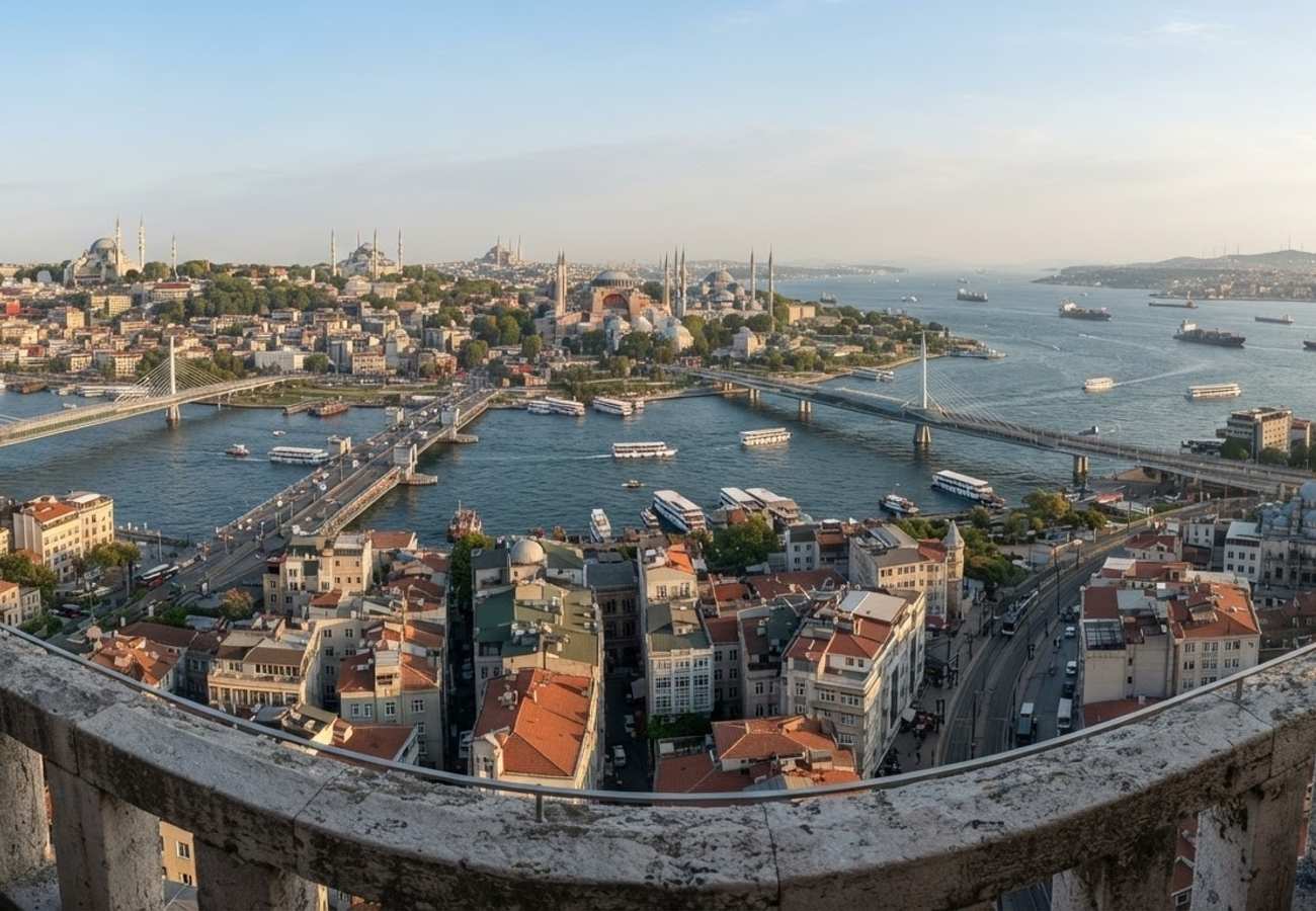
Image generated by AI
The Galata Tower remains the primary vertical vantage point for understanding Istanbul's complex urban layout, offering a 360-degree orientation of the Golden Horn and the Bosphorus.
Navigating the Galata Tower Observation Deck
The Galata Tower is situated in the Karaköy district on the northern bank of the Golden Horn. The observation balcony sits approximately 50 meters above street level. Due to the narrow, circular design of the terrace, passenger flow can become congested during peak hours.
Visitors typically exit the elevator and ascend a short flight of stairs, emerging on the terrace facing north or northwest. To orient yourself quickly, identify the water bodies: a wide, curving inlet indicates the Golden Horn, while a straight channel with large container ships and tankers signifies the Bosphorus.
Visitor Logistics and Pricing 2026
For international travelers, standard entry tickets are priced at approximately 900 Turkish lira. To avoid the high-density crowds associated with the sunset rush, the most efficient windows for visitation are late morning or immediately following the primary evening peak.
Landmark Identification and Visual Mapping
The terrace features landmark boards along the railing to assist in identifying the city's silhouettes. The following table breaks down the primary visual sectors:
| Visual Sector | Key Landmarks | Distinguishing Features |
|---|---|---|
| South | Golden Horn | Wide estuary, white city ferries, and three spanning bridges. |
| South-East | Sultanahmet | Hagia Sophia (broad dome) and Blue Mosque (layered domes). |
| South-West | Süleymaniye | High ridge position, single large central dome, four tall minarets. |
| Directly Below | Karaköy | Steep narrow streets, T1 tram line, and ferry piers. |
| North/East | Bosphorus | Straight shipping channel, large tankers, and Asian-side skyline. |
The Golden Horn and Bridge Infrastructure
Facing south, the Golden Horn serves as the dividing line between the historic peninsula and northern districts. This vantage point allows travelers to identify the city's critical transit arteries:
- Galata Bridge: The most prominent double-decker structure, characterized by active fishing lines on the upper deck.
- Golden Horn Metro Bridge: A modern white cable-stayed structure carrying the M2 metro line.
- Atatürk Bridge: The furthest horizontal span of the three.
The Sultanahmet and Süleymaniye Skylines
The historic peninsula is defined by a "stone crown" of domes. Hagia Sophia is identifiable by its broader, flatter dome, while the Blue Mosque features a more complex cascade of smaller domes. To the southwest, the Süleymaniye Mosque dominates the ridge, providing a clear visual link to the urban density of the Eminönü district and the Spice Bazaar.
Traveler Logistics Guide: Ground-Level Integration
From a ground-level perspective, the best way to navigate this experience is to use the tower as a "mapping session" before beginning a walking tour.
Optimal Transit Connection: After descending from the tower, the most efficient route is to walk down through the narrow streets of Karaköy toward the waterfront. From here, you can utilize the T1 tram line, which connects Karaköy directly to Eminönü and the Sultanahmet tourist zone.
Photography and Timing: For those capturing the skyline, a 35mm to 50mm lens is recommended to avoid the extreme distortion common with wide-angle lenses on narrow balconies. Winter months typically offer the highest visibility and sharpest detail of the minarets due to lower humidity and haze.
Customs and Digital Policies: While the tower itself does not require digital transit permits, visitors utilizing the M2 metro or T1 tram should ensure they have a valid Istanbulkart. For those traveling from the EU or US, ensure your digital travel authorizations (such as ETIAS for Europe-bound connections) are updated if combining this trip with other regional stops.
Infrastructure Impact Assessment
The Galata Tower serves as more than a tourist attraction; it is a critical point of orientation for understanding Istanbul's transition from a maritime hub to a modern metropolis. The visibility of the three bridges across the Golden Horn highlights the city's reliance on integrated transit (metro, tram, and ferry) to move millions of passengers between the European and Asian sides. The continued investment in the Karaköy waterfront and the T1 tram corridor ensures that the tower remains accessible despite the dense, medieval street layout of the surrounding district.
The view from the top is the only way to truly visualize the scale of the city before stepping into its chaos.
Related Travel Guides
Disclaimer
This article is for informational and educational purposes only. It does not constitute legal, financial, or professional advice. While we strive to provide accurate and up-to-date information, travel policies, regulations, and conditions change rapidly. Always verify information with official sources before making travel decisions. Nomad Lawyer makes no representations about the accuracy, reliability, completeness, or suitability of the information provided. Readers should consult qualified professionals for advice specific to their circumstances. The views expressed in this article are those of the author and do not necessarily reflect the views of Nomad Lawyer.
Kunal K Choudhary
Co-Founder & Contributor
A passionate traveller and tech enthusiast. Kunal contributes to the vision and growth of Nomad Lawyer, bringing fresh perspectives and driving the community forward.
Learn more about our team →