
Devils Tower Marks 120 Years of Federal Protection: Geological Volcanology, Indigenous Sanctity, and Black Hills Tourism Logistics

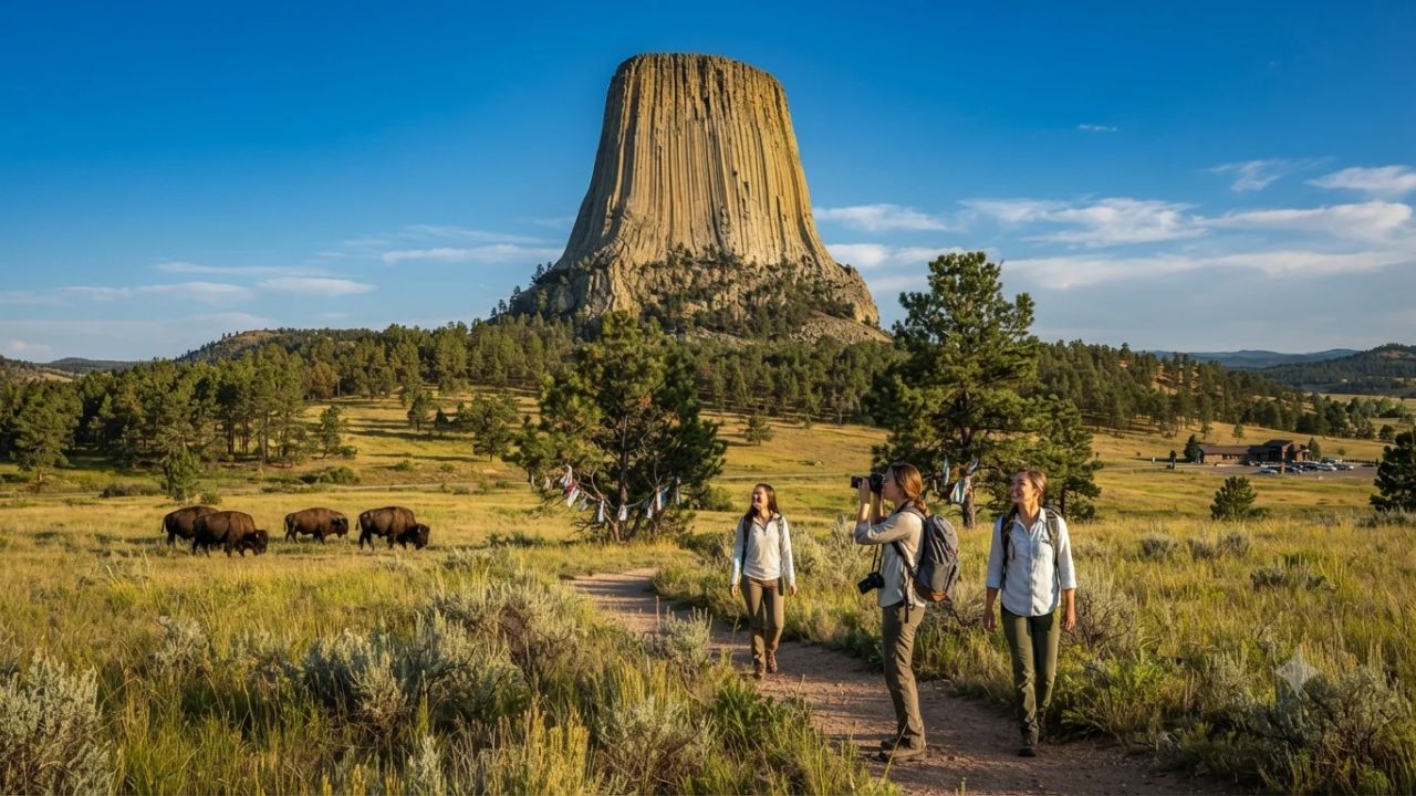
Image generated by AI
Marking precisely 120 years since President Theodore Roosevelt invoked the Antiquities Act on September 24, 1906, to establish America’s very first national monument, Devils Tower in northeastern Wyoming is experiencing record commemorative interest across the northern Great Plains. Soaring 867 feet from its base and towering 1,267 feet above the meandering Belle Fourche River, this monumental igneous monolith stands as both the foundational legal benchmark of American public land preservation and a living sacred sanctuary for Northern Plains tribal nations.
The historical timing of this 120-year milestone resonates far beyond the borders of the Equality State. Established a full decade before the formal creation of the National Park Service (NPS) in 1916, the designation proved that executive federal authority could permanently shield extraordinary natural architecture from speculative mining and commercial exploitation. Today, as tourism boards across northeastern Wyoming report surging inquiries regarding campground availability, ranger-led interpretive talks, and backcountry permits, the monument faces a complex modern mandate: accommodating hundreds of thousands of annual road-trippers and technical climbers while honoring the deep spiritual traditions of Indigenous communities who have revered the site for millennia.
Magmatic Intrusion and Columnar Physics: Decoding the 867-Foot Pluton
The architectural wonder of Devils Tower stems from unique subterranean volcanic processes dating back over 50 million years. Rather than forming from an explosive surface volcano that deposited ash and lava across the plains, scientific analysis coordinated with the U.S. Geological Survey (USGS) confirms the formation is a massive igneous intrusion, or pluton. Molten magma forced its way upward into existing sedimentary rock layers beneath the Earth's crust, cooling slowly beneath the surface. As the molten material crystallized into phonolite porphyry—an extraordinarily dense, durable igneous rock—it contracted into distinct stress patterns, producing hundreds of striking vertical, hexagonal columns resembling a tightly packed bundle of colossal stone pillars.
Over countless millennia, natural drainage networks, driven by the Belle Fourche River, systematically stripped away the softer overlying sedimentary sandstones, shales, and siltstones. Because the crystallized phonolite core proved far more resistant to weathering than the surrounding sedimentary beds, the erosion exposed the towering, fluted stone pillar visible today. The vertical columns, many measuring up to ten feet across, feature fracture mechanics that continue to serve as a world-renowned open-air laboratory for structural geologists and petrologists studying how subterranean cooling rates shape monumental earth architecture.
| Monument Feature & Sector | Dimensional Metric | Geological / Environmental Characteristic | Cultural & Practical Visitor Directive |
|---|---|---|---|
| Monolith Summit Elevation | 1,267 feet above river level | Phonolite porphyry with vertical columnar jointing | Technical rock climbing permitted; seasonal falcon closures apply |
| Monolith Vertical Rise | 867 feet from base to summit | Formed via underground magmatic intrusion | Sacred tribal prayer bundles present; do not touch or disturb |
| Tower Trail (Paved Loop) | 1.3 miles (2.1 km) distance | Encircles the base through ponderosa pine forests | Accessible walking route suitable for casual visitors and families |
| Red Beds & Joyner Ridge | 2.8 miles and 1.5 miles | Red sedimentary strata, prairie dog towns, ridgelines | Prime wildlife corridors for viewing mule deer, elk, and wild turkeys |
| Belle Fourche River Valley | Surrounding riparian corridor | Riparian cottonwood groves and alluvial floodplains | Lowland camping, seasonal fishing, and historic photography viewpoints |
Sacred Geography and Ecological Stewardship: Mato Tipila Across the Seasons
Long before European settlers reached the western frontier, the monolith occupied the spiritual center of regional Native American cosmologies. Known traditionally to the Lakota, Northern Cheyenne, Kiowa, and other regional tribes as Mato Tipila ("Bear Lodge"), the site embodies sacred tribal oral histories. Prominent legends recount the story of several young girls pursued by giant bears; upon praying to the Great Spirit for salvation, the ground beneath them thrust skyward into the clouds, while the bears’ desperate claws carved the vertical grooves along the rock face before the children were safely transported into the stars.
The cultural sanctity of Mato Tipila remains unbroken today. Visitors navigating the popular 1.3-mile paved Tower Trail frequently encounter colorful fabric prayer bundles and cloths tied to ponderosa pine branches, left by tribal pilgrims during sacred spiritual observances. Out of institutional respect for traditional Sun Dance ceremonies, vision quests, and solstice gatherings held in early summer, the National Park Service implements a voluntary climbing closure throughout the entire month of June. Supported by state marketing partners at the Wyoming Office of Tourism, rangers urge visitors to balance outdoor recreation with cultural sensitivity, treating the formation not merely as a gym for rock climbers, but as an active indigenous cathedral.
Expert Analysis: Managing Recreational Pressure and Sacred Land Governance
For travelers booking this route, the direct consequence is that accommodation inventory in adjacent gateway communities such as Hulett, Sundance, and Moorcroft reaches total saturation months in advance, requiring visitors to secure lodging or campsite reservations well ahead of peak summer and autumn travel windows. The limited capacity of the monument’s internal parking lots creates severe morning vehicular staging queues along Highway 24, compelling road-trippers to arrive before 9:00 AM or plan late-afternoon visits.
The pricing pressure this creates means independent travelers must contend with elevated hospitality rates across northeastern Wyoming, forcing many to base their itineraries in larger regional hubs like Gillette, Wyoming, or Spearfish, South Dakota. Furthermore, the governance framework established at Devils Tower represents an enduring legal template for American public land management. By successfully upholding the voluntary June climbing moratorium against legal challenges, the National Park Service demonstrated that federal recreational infrastructure can coexist with Indigenous religious freedom. For contemporary visitors, honoring this voluntary agreement has become an essential test of responsible ecotourism, proving that sustainable exploration requires respecting the sacred human heritage entwined with geological marvels.
Key Takeaways
- Devils Tower celebrates its 120th anniversary as America's first national monument, established under the Antiquities Act by President Theodore Roosevelt on September 24, 1906.
- The geological formation rises 867 feet from its base and 1,267 feet above the Belle Fourche River, consisting of rare phonolite porphyry columnar rock.
- Known as Mato Tipila (Bear Lodge) to Lakota, Cheyenne, and Kiowa peoples, the site remains an active sanctuary marked by sacred prayer cloths along the Tower Trail.
- The National Park Service implements a voluntary climbing closure every June to protect traditional Indigenous summer solstice ceremonies and sacred rituals.
- Trail options including the 1.3-mile Tower Trail, Red Beds Trail, and Joyner Ridge Trail offer access to prairie dog colonies, ponderosa pine groves, and wildlife viewing.
FAQ: Devils Tower 120th Anniversary and Visitor Logistics 2026
When was Devils Tower established as America's first national monument?
President Theodore Roosevelt designated Devils Tower as the country's first national monument on September 24, 1906, utilizing the newly passed Antiquities Act to safeguard the geological marvel.
How tall is Devils Tower from its base and the river?
The monolith rises 867 feet from its immediate base and stands 1,267 feet above the Belle Fourche River valley, dominating the surrounding plains of northeastern Wyoming.
Why does the National Park Service request a voluntary climbing closure in June?
The NPS asks climbers to voluntarily refrain from scaling the tower during June out of respect for Native American tribes who conduct sacred Sun Dances and summer solstice ceremonies.
What are the main hiking trails available at Devils Tower?
Visitors can hike the paved 1.3-mile Tower Trail around the monument's base, the 2.8-mile Red Beds Trail through vibrant red sandstone country, or the scenic 1.5-mile Joyner Ridge Trail.
Standing as a timeless monument to volcanic power and indigenous spiritual devotion, Devils Tower reminds modern travelers that true wilderness stewardship requires honoring both the earth’s ancient geology and the sacred cultures that revere it.
Disclaimer
This article is for informational and educational purposes only. It does not constitute legal, financial, or professional advice. While we strive to provide accurate and up-to-date information, travel policies, regulations, and conditions change rapidly. Always verify information with official sources before making travel decisions. Nomad Lawyer makes no representations about the accuracy, reliability, completeness, or suitability of the information provided. Readers should consult qualified professionals for advice specific to their circumstances. The views expressed in this article are those of the author and do not necessarily reflect the views of Nomad Lawyer.
Preeti Gunjan
Contributor & Community Manager
A passionate traveller and community builder. Preeti helps grow the Nomad Lawyer community, fostering engagement and bringing the reader experience to life.
Learn more about our team →