California Pacific Coast Highway Reopens: Big Sur Restoration, Santa Ynez Wine Country, and Coastal Resilience Drive $166B Tourism Surge

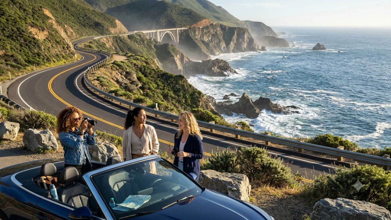
BIG SUR, California — Following years of catastrophic mudslide disruptions, atmospheric river storms, and multi-million-dollar geotechnical reconstruction, California's iconic Highway 1 has achieved full corridor reopening through the cliffs of Big Sur.
Highlighted as a premier global journey in international travel rankings, the restoration of the continuous 656-mile coastal highway—stretching from Leggett in Mendocino County down to Dana Point in Orange County—reconnects one of the world's most celebrated scenic byways.
The reopening removes multi-hour inland detours, restoring the uninterrupted vehicular route between Northern and Southern California and breathing immediate economic life into isolated coastal communities, family-owned lodges, and seaside artisan workshops.
The infrastructural triumph arrives alongside record macroeconomic momentum across the Golden State's visitor economy.
Statewide tourism projections for 2026 reveal that traveler spending is expanding by $7 billion to reach a historic $166 billion, directly supporting over 1.0 million jobs across California.
Total statewide visitation is projected to reach nearly 277 million visitors, buoyed by a 6 percent year-on-year increase in international airline seat capacity into Los Angeles International Airport (LAX) and San Francisco International Airport (SFO).
From the historic maritime streets of Monterey's Cannery Row to the tranquil vineyards of the Santa Ynez Valley, the reopening of Highway 1 symbolizes more than repaired asphalt; it represents a comprehensive model of climate-resilient infrastructure, sustainable electric-vehicle corridors, and community-led conservation across fragile Pacific ecosystems.
CALIFORNIA PACIFIC COAST HIGHWAY RESTORATION MATRIX
| Entity / Route | Metrics | Operational Status |
|---|---|---|
| Operational Dimension | 2026 Benchmark / Specification | Strategic Travel Significance |
| Full Route Geographic Extent | 656 Miles (Leggett to Dana Pt) | Complete coastal continuity |
| Primary Reconstruction Epicenter | Big Sur Coastal Precipices | Soil nails, retaining walls |
| Real-Time Geotechnical Monitoring | Smart moisture & tilt sensors | Prevents unexpected closure |
| Statewide Visitor Spending Forecast | $166 Billion ($7B Annual Lift) | Record economic impact |
| Total Projected Annual Visitation | Nearly 277 Million Travelers | Dominant domestic travel |
| California Tourism Labor Force | Over 1.0 Million Direct Jobs | Vital community livelihood |
| Inbound International Flight Growth | +6% Seat Capacity at SFO/LAX | Transatlantic/Pacific surge |
| Highway 1 Fast-Charging Network | > 450 Renewable DC Fast-Ports | Eliminates EV range anxiety |
| Long-Stay Remote Work Influx | +18% 30-Day+ Rental Bookings | Year-round coastal economy |
| Wellness Tourism Outlay Growth | +22% Resort Booking Expansion | Clifftop holistic retreats |
The Engineering Odyssey: Reconnecting the 656-Mile Pacific Arterial
The geotechnical instability that closed Highway 1 across Big Sur represents one of the most formidable civil engineering challenges in American transportation history.
The coastline's precipitous slopes—where the Santa Lucia Mountains drop sheer into the Pacific Ocean—consist of heavily fractured Franciscan Complex rock, subject to intense seismic activity and marine erosion.
Consecutive winters dominated by powerful atmospheric river storm systems dumped historic volumes of precipitation onto mountainsides previously stripped of vegetative root anchors by wildfire events.
The resulting saturation triggered massive, deep-seated landslides—most notably at Paul's Slide and Regent's Slide—that completely displaced hundreds of thousands of tons of earth, severing roadbeds and sweeping structural asphalt straight into the surf below.
                               BIG SUR GEOTECHNICAL RESILIENCE CYCLE

   +---------------------------------------------------------------------------------+
   | HISTORIC STORM SATURATION: Atmospheric rivers trigger massive earth displacement|
   +---------------------------------------------------------------------------------+
                                           |
                                           v [Caltrans Civil Engineering Overhaul]
   +---------------------------------------------------------------------------------+
   | DEEP-SET FOUNDATIONS: Subterranean micropiles, rock sheds, cable-draped netting |
   +---------------------------------------------------------------------------------+
                                           |
                                           v [Real-Time Climate Automation]
   +---------------------------------------------------------------------------------+
   | GEOTECHNICAL MONITORING: Embedded moisture saturation & tilt-meter telemetrics  |
   +---------------------------------------------------------------------------------+
                                           |
                                           v [Full Highway Opening]
   +---------------------------------------------------------------------------------+
   | UNINTERRUPTED HIGHWAY 1: 656 continuous miles restored from Mendocino to Orange |
   +---------------------------------------------------------------------------------+
Restoring the roadway demanded extraordinary persistence from the California Department of Transportation (Caltrans) and specialized geotechnical contractors.
Rather than merely regrading unstable soil surfaces, engineers engineered permanent structural solutions: installing hundreds of deep subterranean micropiles anchored into underlying bedrock, erecting concrete-and-steel rock sheds, affixing heavy-gauge cable netting across sheer vertical escarpments, and re-engineering drainage culverts capable of diverting torrential runoff away from road shoulders.
Critically, the rebuilt highway incorporates climate-adaptive monitoring technology.
Subsurface moisture sensors and real-time tilt-meters embedded along vulnerable slopes transmit telemetric geotechnical data directly to transportation operations centers.
This active monitoring allows engineers to detect subterranean slope movement hours before surface failure occurs, facilitating proactive traffic management and preventing catastrophic surprises.
The completion of this infrastructure project restores unbroken connectivity along the 656-mile highway, securing the fragile physical lifeline between coastal residents, emergency services, and the global travel community.
HIGHWAY 1 CORRIDOR SPATIAL PROFILE & KEY HIGHLIGHTS
| Entity / Facility | Delays | Cancellations | Details |
|---|---|---|---|
| Highway Sector | Geographic Scope | Defining Topography | Iconic Travel Anchors |
| Northern Gateway | Leggett to SFO | Redwoods, Coastal Bluffs | Mendocino, Golden Gate |
| Central Sanctuary | Monterey to Big Sur | Sea Clifs, Kelp Forests | Cannery Row, Bixby Bridge |
| Central Coast Enclaves | San Simeon to S. Ynez | Rolling Hills, Wineries | Harmony, Solvang, Vines |
| American Riviera | Santa Barbara | Spanish Colonial Coast | Old Mission, Stearns Whf |
| Southern Finale | Malibu to Dana Point | Broad Sandy Ocean Beaches | Santa Monica Pier, Dunes |
The $166 Billion Economic Horizon: Macro Drivers of California Tourism
The full reopening of Highway 1 arrives at a moment of exceptional expansion across California's travel and hospitality industries.
According to comprehensive macroeconomic projections compiled by state tourism authorities for 2026, direct visitor spending across California is on trajectory to reach $166 billion.
This represents an annual increase of $7 billion over 2025, demonstrating the Golden State's enduring status as the preeminent travel destination in the United States.
This $166-billion expenditure injection directly sustains over 1.0 million employment positions statewide, providing essential livelihoods across lodging, food services, arts, entertainment, recreation, and passenger transport.
In addition, visitor spending generates billions of dollars in state and local tax receipts, funding essential municipal services, emergency response capabilities, public park conservation, and regional highway maintenance across rural coastal counties.
                           CALIFORNIA TOURISM ECONOMIC CONTRIBUTION (2026)

   +---------------------------------------------------------------------------------+
   | TOTAL STATEWIDE VISITOR SPENDING: $166.0 BILLION (+$7.0 Billion Annual Growth)   |
   +---------------------------------------------------------------------------------+
               |                                                         |
               v                                                         v
   +---------------------------------------+   +-------------------------------------+
   | DIRECT LABOR IMPACT: > 1.0 MILLION    |   | STATEWIDE VISITOR VOLUME:           |
   | JOBS SUSTAINED STATEWIDE              |   | NEARLY 277 MILLION TRAVELERS        |
   +---------------------------------------+   +-------------------------------------+
               |                                                         |
               v                                                         v
   +---------------------------------------+   +-------------------------------------+
   | AVIATION LIFT: +6% INBOUND SEATS      |   | REGIONAL SPREAD: SPENDING SHIFTS    |
   | EXPANSION AT SFO AND LAX GATEWAYS     |   | INTO RURAL COASTAL & WINE COUNTIES  |
   +---------------------------------------+   +-------------------------------------+
Total visitation across the state is projected to reach nearly 277 million travelers in 2026.
While domestic road-trippers and regional travelers form the solid foundation of this demand, international visitation has rebounded vigorously.
Aviation data indicates a 6 percent year-on-year expansion in international inbound seat capacity into California's primary international gateways at SFO and LAX, driven by new direct transatlantic connections from Western Europe and expanded transpacific routes from East Asia and Australasia.
For overseas travelers, embarking on a classic open-top road trip down the Pacific Coast Highway represents the quintessential American travel experience.
Re-establishing the continuous coastal route allows international visitors to seamlessly combine northern cultural institutions in San Francisco with southern beach communities in Los Angeles without having to detour through the agricultural interior of the Central Valley.
The Cultural Pilgrimage: From Beat Literature to Marine Biology in Monterey
For more than a century, the rugged Pacific shoreline traversed by Highway 1 has served as a profound source of inspiration for American literature, photography, and environmental philosophy.
Long before the advent of digital imagery, mid-century landscape photographers Ansel Adams and Edward Weston hauled heavy plate cameras onto the windswept headlands of Big Sur and Point Lobos, capturing the dramatic contrast between crashing Pacific breakers and ancient Monterey cypress groves.
Painter Chiura Obata translated the dramatic verticality of California's coastal cliffs into expressive brushstrokes that fundamentally shaped American modernist landscape art.
Simultaneously, literary masters found creative clarity in the region's untamed maritime atmosphere.
Jack Kerouac retreated into the remote coastal canyons of Bixby Creek to write his famous semi-autobiographical reflections, while John Steinbeck immortalized the working-class spirit of the coast in works that documented the lives of fishermen, laborers, and coastal residents along Monterey's Cannery Row.
Today, travelers traversing this storied route participate in a living cultural continuum, experiencing the exact vistas that gave birth to American environmental conservation movements.
MONTEREY PENINSULA CULTURAL & ECOLOGICAL PROFILE
| Highlight Facility | Primary Attraction Feature | Marine Conservation Purpose |
|---|---|---|
| Monterey Bay Aquarium | "Ocean in Motion" Exhibit | Bilingual youth education |
| Cannery Row Historic District | Preserved Sardine Canneries | Literary & maritime history |
| Monterey Bay Marine Sanctuary | Clifftop Whale Watching Bluffs | Deep submarine canyon eco |
| 17-Mile Drive Scenic Circuit | Lone Cypress & Coastal Dunes | Sustainable luxury leisure |
Anchoring the northern central coast is Monterey, a destination that balances industrial maritime history with cutting-edge marine science.
The crown jewel of the waterfront is the world-renowned Monterey Bay Aquarium, situated directly on Cannery Row.
Occupying the site of a former sardine canning factory, the institution educates millions of visitors annually through exhibits like the bilingual children's installation Ocean in Motion, which bridges English and Spanish language instruction to inspire ocean stewardship among younger generations.
Outside the aquarium, the Monterey Bay National Marine Sanctuary encompasses a vast offshore submarine canyon deeper than the Grand Canyon, supporting cold-water kelp forests that shelter sea otters, harbor seals, and migrating whales.
By prioritizing sustainable seafood sourcing and funding marine mammal rehabilitation programs, Monterey demonstrates how scientific education and responsible tourism can mutually protect fragile coastal waters.
                               MONTEREY MARINE STEWARDSHIP FUNNEL

   +---------------------------------------------------------------------------------+
   | SCIENTIFIC IMMERSION: Monterey Bay Aquarium & Submarine Canyon Research         |
   +---------------------------------------------------------------------------------+
                                           |
                                           v [Public Conservation Education]
   +---------------------------------------------------------------------------------+
   | RESPONSIBLE TOURISM: Sustainable seafood dining along historic Cannery Row      |
   +---------------------------------------------------------------------------------+
                                           |
                                           v [Ecosystem Reinvestment]
   +---------------------------------------------------------------------------------+
   | MARINE PRESERVATION: Otters, kelp beds, and offshore whale corridors protected  |
   +---------------------------------------------------------------------------------+
The American Riviera and Santa Ynez: Wine Country and Architectural Preservation
Continuing south, Highway 1 transitions from the raw cliffs of Big Sur into the sun-drenched landscapes of Santa Barbara County, where the dramatic backdrop of the Santa Ynez Mountains meets the Pacific Ocean.
Widely celebrated as the American Riviera, Santa Barbara is defined by its Mediterranean architectural harmony, mandated by strict municipal preservation ordinances enacted after the historic 1925 earthquake.
Commercial and residential buildings throughout the city feature whitewashed stucco walls, hand-painted ceramic tiles, and red terracotta roofs.
Key cultural touchstones include the historic Old Mission Santa Barbara, established by Franciscan friars in 1786, with its iconic twin-bell towers and historic gardens.
Down by the shoreline, Stearns Wharf extends into the harbor as the oldest operating wooden wharf in California, offering fresh seafood dining and panoramic views of the coastline.
Upscale boutique hospitality and heritage tourism inject steady economic resources into Santa Barbara, providing capital to maintain historical monuments, support organic agricultural markets along State Street, and fund coastal preservation policies.
SANTA YNEZ VALLEY & SANTA BARBARA CONTRAST MATRIX
| Entity / Facility | Delays | Cancellations | Details |
|---|---|---|---|
| Geographic Sector | Aesthetic Character | Primary Gastronomic Focus | Regional Travel Appeal |
| Santa Barbara Coastal | Spanish Colonial Revival | Fresh Seafood, Raw Oysters | American Riviera Lux |
| Santa Ynez Valley | Pastoral Ranchland | Cool-Climate Pinot & Rhon | Historic Boutique Wine |
| Solvang Enclave | Traditional Danish | Danish Pastries & Bakeri | Thematic Architecture |
| Los Olivos & Ballard | Victorian Countryside | Farm-to-Table Fine Dine | Relaxed Rural Tasting |
Just inland from the coast, sheltered across the mountain pass, lies the picturesque Santa Ynez Valley.
Comprising charming country hamlets including Solvang (celebrated for its Danish windmills and traditional bakeries), Los Olivos, Ballard, and Santa Ynez, this agricultural valley has emerged as one of the premier cool-climate viticultural regions in North America.
Coastal fog flowing inland through transverse east-west valleys creates ideal microclimates for world-class Pinot Noir, Chardonnay, and Syrah vineyards.
For road-tripping motorists on Highway 1, taking an inland loop through the Santa Ynez Valley provides a pastoral contrast to the dramatic ocean cliffs.
Visitors can patronize boutique tasting rooms, lodge at historic ranch estates, and dine at farm-to-table restaurants that source produce directly from neighboring organic growers.
This symbiotic relationship between agriculture, wine production, and boutique hospitality exemplifies how regional tourism supports family farming traditions while providing sophisticated cultural exploration for discerning travelers.
                               SANTA YNEZ VITICULTURAL VALUE CYCLE

   [Marine Fog via Transverse Valley] ===> Cool-Climate Terroir (Pinot Noir & Syrah)
                                                        |
                                                        v
   [Boutique Estate Wineries] ===========> Farm-to-Table Gastronomy in Los Olivos
                                                        |
                                                        v
   [Dispersed Tourist Capital] ==========> Directly Preserves Rural Ranching Heritage
Micro-Towns and Urban Termini: Harmony's Artisans to Santa Monica's Coastal Energy
A unique dimension of the Highway 1 experience is the contrast between tiny, eccentric rural hamlets and dynamic metropolitan beach cities.
Along the Central Coast in San Luis Obispo County, motorists encounter the historic dairy town of Harmony.
With an official population of roughly eighteen residents, Harmony represents a charming roadside sanctuary where time appears to stand still.
Founded in the nineteenth century as the operational hub of a cooperative creamery, the hamlet has been carefully revitalized as an artisan craft haven.
Visitors can watch master glassblowers shape molten glass in open studios, explore handcrafted ceramic galleries, and sample regional wines beside stone fireplaces, experiencing an authentic slice of historic California rural character.
ROADSIDE DIVERSITY: FROM MICRO-TOWNS TO METROPOLIS
| Entity / Facility | Delays | Cancellations | Details |
|---|---|---|---|
| Settlement Stop | Municipal Scale | Prominent Roadside Asset | Unique Traveler Vibe |
| Harmony Hamlet | Population Approx. 18 | Handcrafted Glass Studio | Quaint & Whimsical |
| Fort Bragg | Small Coastal Town | Glass Beach & Redwoods | Rugged North Coast |
| San Simeon | Historic Coastal Village | Hearst Castle Monument | Extravagant Heritage |
| Santa Monica | Dynamic Beach Metropolis | Historic Pier & Solar Whl | Coastal Urban Energy |
At the southern end of the journey, Highway 1 sweeps past the beachfront communities of Malibu before arriving at the western edge of Los Angeles County in Santa Monica.
Santa Monica blends relaxed surf culture with sophisticated urban design, anchored by the iconic Santa Monica Pier.
Featuring the world's only solar-powered Ferris wheel, vintage carousel rides, and open-air carnival games, the historic pier marks the official symbolic terminus of historic Route 66 and a primary focal point for coastal travelers.
Below the pier bluffs, miles of broad sandy public beaches welcome surfers, cyclists, and sunseekers.
The city's expansive network of separated coastal bicycle lanes, pedestrian shopping districts along the Third Street Promenade, and zero-emission municipal transit shuttles demonstrate forward-thinking urban environmental management.
Tourism revenues in Santa Monica directly fund beach-cleaning technologies, water-filtration systems, and public park maintenance, ensuring that high-volume visitation coexists with environmental preservation.
                               SANTA MONICA URBAN RECREATION DUALITY

   +---------------------------------------------------------------------------------+
   | HISTORIC PIER AMENITIES: Solar-powered Ferris wheel & Route 66 terminus marker  |
   +---------------------------------------------------------------------------------+
                                           |
                                           v
   +---------------------------------------------------------------------------------+
   | ACTIVE BEACH CULTURE: Ocean bike paths, coastal bluffs & open volleyball sands  |
   +---------------------------------------------------------------------------------+
                                           |
                                           v
   +---------------------------------------------------------------------------------+
   | SUSTAINABLE TRANSIT: Zero-emission bus fleets & pedestrianized commerce zones   |
   +---------------------------------------------------------------------------------+
The Green Road Trip: EV Fast-Charging Corridors and Fleet Electrification
Environmental stewardship along Highway 1 is undergoing a modern transformation through the rapid deployment of clean transportation infrastructure.
Long considered a challenging route for alternative-fuel vehicles due to remote topography and isolated power grids, the coastal corridor has been upgraded into one of the nation's premier green road-trip corridors.
Supported by state clean-transportation infrastructure grants and partnerships with regional electric utilities, more than 450 new direct-current (DC) ultra-fast electric vehicle chargers have been installed across remote stretches of Big Sur, the Central Coast, and Mendocino County.
These charging hubs utilize smart microgrids paired with commercial battery energy storage systems (BESS) and on-site solar arrays, ensuring reliable charging capacity even during stormy conditions or grid disruptions.
HIGHWAY 1 ELECTRIC VEHICLE INFRASTRUCTURE 2026
| Entity / Route | Metrics | Operational Status |
|---|---|---|
| Clean Transit Dimension | Deployment Parameter / Benchmark | Traveler Significance |
| DC Fast-Chargers Deployed | Over 450 Ultra-Fast Ports | Eliminates range anxiety |
| Clean Power Generation | 100% Renewable Solar & Wind | True carbon-neutral driving |
| Rental Fleet Electrification | 35% Hybrid and Fully Electric | Broad consumer vehicle choice |
| State Park EV Incentives | Discounted Charging & Parking | Rewards sustainable travel |
| Microgrid Battery Resilience | Substation BESS Integration | Stable power in storms |
This infrastructure expansion is synchronized with the automotive rental market.
Rental car operations across SFO, LAX, and regional airports report that hybrid and fully electric vehicles now comprise 35 percent of their total commercial fleets.
Motorists touring Highway 1 in electric vehicles enjoy discounted charging tariffs, designated green-vehicle parking privileges at major state park trailheads, and the knowledge that their journey produces zero tailpipe emissions across sensitive marine and redwood forest habitats.
By linking scenic road trips with clean energy innovation, California is demonstrating that automotive adventure can harmonize with aggressive climate goals.
Extended Stays and Wellness: The 18% Remote Work and Clifftop Spa Boom
The rise of flexible remote employment has permanently reshaped travel behavior along the Pacific coast.
Local property managers across Mendocino, Monterey, and Santa Barbara counties report an 18 percent increase in extended-stay rental reservations of thirty days or longer throughout 2026.
Professionals are trading dense downtown office cubicles for coastal cottages and ocean-view apartments, using high-speed fiber internet networks to balance career commitments with outdoor recreation.
This digital nomad migration delivers substantial economic stability to regional communities.
Extended-stay visitors smooth out the dramatic occupancy peaks and valleys that historically characterized seasonal tourism, providing steady, year-round patronage for local cafes, bakeries, coworking spaces, and neighborhood markets without overwhelming local parking facilities or roadway capacity.
WELLNESS & EXTENDED-STAY MARKET EXPANSION (2026)
| Entity / Route | Metrics | Operational Status |
|---|---|---|
| Growth Indicator Sector | Recorded Benchmark | Regional Economic Impact |
| 30-Day+ Extended Stays | +18% Rental Booking Increase | Smooths seasonal dips |
| Clifftop Holistic Spa Packages | +22% Reservation Expansion | Captures high-spending base |
| Indigenous Heritage Tours | +30% Interpretive Attendance | Empowers Native communities |
| Farm-to-Table Gastronomic Outlays | 25% of Total Road-Trip Budget | Direct agricultural support |
Simultaneously, wellness tourism has emerged as one of the fastest-growing sectors across California's hospitality landscape, recording a 22 percent surge in holistic retreat bookings.
Upscale coastal resorts nestled along the Big Sur cliffs and Santa Barbara foothills offer personalized wellness programs that integrate oceanfront yoga pavilions, sound-bath meditations, and therapeutic hydrotherapy treatments utilizing locally harvested sea salts and native botanicals.
High-spending travelers frequently combine wellness therapies with guided mindfulness hikes through coastal redwoods or sea kayaking through offshore kelp beds, finding restorative balance in the soothing rhythm of the Pacific waves.
                               HOLISTIC COASTAL WELLNESS MODEL

   +---------------------------------------------------------------------------------+
   | CLIFFTOP RESTORATION: Oceanfront yoga, sound meditation & sea-salt hydrotherapy |
   +---------------------------------------------------------------------------------+
                                           |
                                           v
   +---------------------------------------------------------------------------------+
   | NATURE ADVENTURE THERAPY: Guided redwood hiking & kelp forest sea kayaking      |
   +---------------------------------------------------------------------------------+
                                           |
                                           v
   +---------------------------------------------------------------------------------+
   | NUTRITIONAL HARMONY: Organic farm-to-table dining sourced from Santa Ynez farms |
   +---------------------------------------------------------------------------------+
The International Road-Tripper's Strategic Field Guide: Timing, Whales, and Logistics
Executing an unforgettable road trip along California's Pacific Coast Highway requires disciplined preparation and an understanding of seasonal coastal patterns.
While the route offers breathtaking panoramas, strategic travelers know that success depends on thoughtful timing and responsible route planning.
INTERNATIONAL ROAD-TRIPPER STRATEGIC FIELD GUIDE
| Entity / Route | Metrics | Operational Status |
|---|---|---|
| Travel Dimension | Recommended Traveler Protocol | Key Operational Insight |
| Seasonal Travel Windows | Spring (Mar-May) & Autumn | Clear skies, minimal crowds |
| Direction of Travel | North-to-South (SFO to LAX) | Ocean-side lane for pullouts |
| Wildlife Observation | Year-Round Whale Watching | Binoculars for coastal blufs |
| Advance Reservations | State Parks & Lodging Months A | Bixby, Pfeiffer & Aquariums |
| Environmental Ethics | Leave No Trace Stewardship | Strict wildfire restrictions |
Step 1: Target the Spring and Autumn Shoulder Seasons
While summer attracts the largest crowds, experienced travelers favor the spring (March through May) and autumn (September through November) shoulder seasons.
During these months, coastal fog clears more quickly, highway traffic thins out, and daytime temperatures remain comfortable.
Spring brings hillsides blanketed in golden California poppies and coastal lupine, alongside northern gray whale migrations.
Autumn delivers calm winds, fiery sunsets over the ocean, and active feeding displays by humpback and blue whales swimming close to the Monterey headlands.
Step 2: Drive North-to-South for Optimal Ocean Vistas
Whenever possible, plan your driving itinerary from north to south (commencing in San Francisco and traveling down toward Los Angeles).
Driving in the southbound lane places your vehicle immediately adjacent to the ocean edge, offering unobstructed clifftop views and facilitating convenient, safe right-hand turns into scenic pullouts, photographic viewpoints, and coastal trailheads without having to cross opposing traffic lanes.
Step 3: Practice Mindful Coastal Stewardship
The beauty of Highway 1 is matched by its ecological fragility.
Park strictly in designated paved or gravel pullouts; never park on dry grasses that can catch fire from hot vehicle exhaust pipes.
Observe all posted wildfire restrictions and campfire bans.
Pack out all personal trash, stay on established walking trails to prevent cliffside topsoil erosion, and maintain a respectful distance of at least 50 yards from resting sea otters, harbor seals, and nesting sea birds.
By practicing mindful Leave No Trace ethics, travelers ensure that this magnificent highway remains pristine for future generations.
Strategic Horizons: Preserving California's Open Road for the Next Generation
The reopening of the Pacific Coast Highway through Big Sur marks a triumphant celebration of human resilience, advanced engineering, and the enduring allure of the open road.
By refusing to surrender this iconic corridor to geological destruction, California has reaffirmed the vital cultural and economic connection between its communities and the natural wonders that surround them.
As travelers once again navigate the sweeping curves of Highway 1, watch Pacific mists roll over towering sea stacks, and savor the hospitality of historic towns from Monterey to Santa Ynez, they step into a living testament to environmental stewardship.
The road ahead is more than a path between cities; it is an enduring invitation to slow down, respect the untamed power of the Pacific Ocean, and celebrate the wild, majestic soul of California.
Related Travel Guides
- Shanghai Inbound Tourism Surges to 5.31M Visitors: Jinshan Expansion and Luxury Rates
- China Revolutionizes Cultural Souvenir Tourism: Dongguan's Agile Manufacturing and Museum Retail
- Thailand Cultural Tourism Boom Accelerates as Grab Unveils TASTE Digital Framework
- Gyeonggi Province Elevates South Korean Family Tourism: Six Autumn Nature and Heritage Day Trips
- Spain Smashes All-Time Tourism Records with 80.5M Visitors and €114.4B in Spending: Historic 100M Milestone
This article is for informational purposes. Flight routes, passenger regulations, visa rules, and transit advisories are subject to change by airlines and aviation authorities. Readers are advised to verify schedules and travel documentation with relevant carriers and border agencies before departure.