Queensland Unveils 2046 Cape York and Torres Strait Regional Plan Integrating Infrastructure and Indigenous Ecotourism

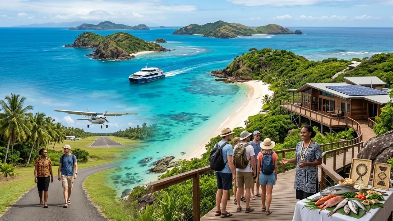
The Queensland Government has released the draft Cape York and Torres Strait Regional Plan alongside an integrated Infrastructure Plan, establishing the first-ever statutory framework unifying mainland peninsula governance with the maritime island archipelago of Zenadth Kes through 2046. Introduced by Deputy Premier and Minister for State Development Jarrod Bleijie alongside Member for Cook David Kempton, the landmark blueprint coordinates multi-million-dollar investments across multi-modal aviation, maritime ports, and arterial road sealing along the Peninsula Developmental Road. By resolving severe remote housing shortages, deploying clean renewable microgrids, and devolving planning authority to Traditional Owners and Indigenous Shire Councils, the statutory architecture unlocks sustainable Indigenous-led ecotourism while safeguarding sacred cultural landscapes and declared wild river catchments.
For decades, Far North Queensland’s economic development was constrained by fragmented administrative jurisdictions that legally separated terrestrial planning on the Cape York Peninsula from maritime governance across the Torres Strait. The 2046 regional plan resolves this historical divide by legally binding the Torres Shire Council, the Torres Strait Island Regional Council, Cook Shire Council, the Weipa Town Authority, and eight mainland Aboriginal Shire Councils into a unified planning instrument.
With public consultation open through February 2027 to accommodate remote island and mainland geographies, the framework designates five core regional hubs—Bamaga, Cooktown, Weipa, Thursday Island (Waiben), and Horn Island (Ngurupai)—as focal points for civic services and tourism infrastructure. Supported by coordinated capital delivery, the plan provides housing for over 1,900 residents, upgrades key air terminals, and converts seasonal dirt corridors into all-weather bitumen arteries, creating a durable foundation for high-yield, low-impact cultural tourism.
CAPE YORK & TORRES STRAIT REGIONAL BLUEPRINT TO 2046
| Column 1 |
|---|
| PLANNING PARAMETER STATUTORY SPECIFICATION & OPERATIONAL FOCUS |
| ------------------------------------------------------------------------------------------------ |
| Statutory Horizon 20-Year Regional Architecture (2026 through 2046) |
| Jurisdictional Scope Mainland Cape York Peninsula & Marine Zenadth Kes (Torres Strait) |
| Lead Governance Authorities Queensland Dept of State Development, Infrastructure and Planning; |
| Torres Shire Council, TSIRC, Cook Shire, Weipa Town Authority |
| Public Consultation Window Active through February 2027 across mainland & outer island nodes |
| Core Regional Hubs Bamaga, Cooktown, Weipa, Thursday Island (Waiben), Horn Island |
| Key Highway Infrastructure Peninsula Developmental Road (Over 200km newly sealed bitumen) |
| Aviation Upgrades Horn Island Airport (Ngurupai) & Northern Peninsula Airport Bamaga |
| Housing Delivery Target Over 1,900 new community, staff, and seasonal workforce dwellings |
| Environmental Protections Strict Strategic Environmental Areas (SEAs) & Wild River Buffers |
Statutory Architecture: Unifying Far North Queensland Governance to 2046
The formal gazetting of the draft Cape York and Torres Strait Regional Plan marks a decisive departure from past piecemeal land administration. Historically, terrestrial land zoning on Cape York operated under distinct state planning schemes, while the marine archipelago of the Torres Strait fell under complex overlapping state, federal, and international treaty arrangements with Papua New Guinea.
By establishing a single statutory instrument under Queensland planning legislation, the state government integrates land use, environmental zoning, and capital infrastructure across Far North Queensland. The plan aligns the municipal policies of:
- Torres Shire Council: Administering Thursday Island, Horn Island, Prince of Wales Island, and surrounding inner islands.
- Torres Strait Island Regional Council (TSIRC): Governing 15 outer island communities spanning five distinct cultural dialect clusters across Zenadth Kes.
- Cook Shire Council & Weipa Town Authority: Overseeing central and western mainland mining, pastoral, and commercial service corridors.
- Mainland Aboriginal Shire Councils: Including Mapoon, Napranum, Aurukun, Lockhart River, Hope Vale, Kowanyama, Pormpuraaw, and Wujal Wujal.
- Northern Peninsula Area Regional Council (NPARC): Administering five distinct communities at the northern tip of the mainland (Bamaga, Seisia, Injinoo, Umagico, and New Mapoon).
Far North Queensland Integrated Governance Network
-------------------------------------------------------------------------------------
Mainland Industrial & Gateway Hubs:  Cooktown, Weipa, Lakeland, Laura
Indigenous Mainland Shire Councils:  Mapoon, Napranum, Aurukun, Lockhart, Hope Vale,
                                     Kowanyama, Pormpuraaw, Wujal Wujal, NPARC
Maritime Gateway Nodes:              Horn Island (Ngurupai), Thursday Island (Waiben)
Outer Torres Strait Communities:     Badu, Mabuiag, Poruma, Erub, Mer, Boigu, Saibai
-------------------------------------------------------------------------------------
During the official launch, Deputy Premier Jarrod Bleijie and David Kempton, Member for Cook, underscored that statutory integration is supported by multi-million-dollar funding commitments. Rather than imposing top-down planning schemes, the state has scheduled an extended consultation window through February 2027. This extended period ensures Traditional Owner Prescribed Bodies Corporate (PBCs), island elders, and local business operators can directly influence statutory zoning boundaries and community infrastructure priorities.
| Regional Operational Hub | Local Governing Authority | Primary Economic & Tourism Function |
|---|---|---|
| Horn Island (Ngurupai) | Torres Shire Council | Primary regional civil aviation gateway; passenger ferry interchange |
| Thursday Island (Waiben) | Torres Shire Council / Ports North | Administrative capital; boutique cruise disembarkation at Engineers Wharf |
| Bamaga (Northern Peninsula) | Northern Peninsula Area Reg. Council | Northern mainland air hub; commercial access to Pajinka (The Tip) |
| Cooktown | Cook Shire Council | Historical gateway; southern access conduit to the Peninsula Developmental Road |
| Weipa | Weipa Town Authority | Western industrial and charter hub; marine logistics and ecotourism access |
Multi-Modal Transport: Connecting Air, Maritime, and Arterial Networks
Far North Queensland’s physical isolation has long been accentuated by monsoonal wet seasons that routinely cut overland road transit between December and May. The regional plan formulates a synchronized, multi-modal transport network designed to withstand extreme wet season conditions while expanding dry season touring traffic.
FAR NORTH QUEENSLAND MULTI-MODAL LOGISTICS CORRIDOR
| Column 1 |
|---|
| TRANSIT SECTOR KEY INFRASTRUCTURE ASSET OPERATIONAL UPGRADE DELIVERED |
| ------------------------------------------------------------------------------------------------ |
| Civil Aviation Horn Island Airport (Ngurupai) Runway resurfacing & apron expansion |
| Northern Peninsula Airport (Bamaga) All-weather monsoonal runway paving |
| Maritime Shipping Engineers Wharf (Thursday Island) Dedicated passenger cruise terminal |
| Horn Island Marine Terminal Consolidated heavy industrial cargo |
| Seisia Wharf Node (Endeavour Strait) Passenger catamarans & freight barge |
| Arterial Highways Peninsula Developmental Road (PDR) Over 200km continuous bitumen sealing |
| Key PDR River Crossings Hann River, Laura, Archer River bridge |
| Digital Network Regional Terrestrial Fibre & Low-Orbit High-speed reservation systems & |
| Satellite Ground Stations remote 4WD emergency telemetry |
Civil Aviation: Gateway Modernization at Horn Island and Bamaga
Air services departing Cairns Airport (CNS) provide the primary passenger connection for government specialists, local residents, and high-yielding independent travelers entering the northern frontier.
At Horn Island Airport (Ngurupai), operated by Torres Shire Council, significant airside capital works are underway. Funded through partnerships between the Queensland Government and the Federal Remote Airstrip Upgrade Program, the project encompasses runway rejuvenation, structural surface resealing, and apron expansion. These enhancements accommodate larger regional turboprop aircraft (such as Dash 8-Q400 series), reduce weather-related flight diversions during monsoonal squalls, and expand baggage handling capacity for touring groups.
Concurrently, at Northern Peninsula Airport in Bamaga, situated near the northernmost tip of the Australian mainland, runway reinforcement works guarantee all-weather commercial operations. This airstrip provides direct fly-in access for travelers heading to Pajinka (The Tip of Australia), while preserving nearby historic World War II aviation wreckage and defensive installations that form a key component of regional historical tours.
Maritime Reconfiguration: Prioritizing Passenger Vessels at Engineers Wharf
Maritime transit across the Torres Strait is undergoing a functional reorganization directed by Ports North. Previously, commercial freight barges, container vessels, and passenger ferries competed for limited berthing space at Thursday Island’s primary waterfront.
Under the new infrastructure framework:
- Heavy Industrial Logistics Relocation: Cargo container handling, fuel bunkering, and heavy freight staging have been moved to dedicated industrial wharves on Horn Island.
- Engineers Wharf Repositioning: With freight operations relocated, Engineers Wharf on Thursday Island is now dedicated to passenger catamarans, luxury private yachts, and expedition cruise vessels operated by boutique lines such as Coral Expeditions and Ponant. Cruise passengers disembark directly into the commercial center of Thursday Island, where local guides conduct walking tours of Green Hill Fort and cultural exhibits.
- Bespoke Island Water Taxis: Local Indigenous charter operators provide scheduled passenger transfers from Thursday Island to eco-safari glamping retreats on Roko Island and historic cultured pearl farms on Friday Island, channeling visitor spending directly into family-owned maritime ventures.
- Seisia Wharf Node: On the mainland, Seisia Wharf serves as the deep-water terminus for the fast catamaran ferry crossing the Endeavour Strait to Thursday and Horn Islands, linking overland 4WD travelers directly to island cultural circuits.
Terrestrial Sealing: Transforming the Peninsula Developmental Road
The Peninsula Developmental Road (PDR) forms the overland spine of Cape York, connecting the Mulligan Highway north of Lakeland through Laura, Coen, and Archer River to Weipa and the Northern Peninsula. Historically a corrugated, red-dirt track prone to severe washouts, the PDR is being systematically upgraded under joint Commonwealth and Queensland funding packages.
To date, over 200 kilometres of unsealed road have been converted to high-grade, two-lane bitumen. Active construction packages are sealing critical segments between Musgrave, Red Blanket, Yarraden, Three Sisters, and the Hann River corridor.
This progressive sealing program delivers major benefits:
- Extending the Tourism Operating Season: Sealing extends the self-drive touring window into the shoulder months of April and November, which were previously inaccessible due to early monsoonal storms.
- Expanding Vehicle Accessibility: Smoother surfaces allow conventional caravans, all-wheel-drive vehicles, and commercial tour coaches to travel as far north as Weipa and Coen without suffering mechanical chassis failures.
- Preserving Fragile Wilderness: Paved corridors eliminate dangerous dust plumes that choke roadside rainforest margins and improve sightlines for drivers navigating cattle movements and native wildlife.
Housing and Workforce Lodging: Breaking Remote Development Constraints
A persistent obstacle to economic development across remote northern Australia has been the acute shortage of residential housing. Severe multi-generational overcrowding has affected Indigenous communities, while tourism operators and civic institutions have struggled to secure accommodation for seasonal wilderness guides, chefs, healthcare professionals, and teachers.
The regional plan resolves this bottleneck by integrating legally binding housing targets for over 1,900 residents into statutory planning schemes through 2046, structured across three distinct delivery streams:
THREE-TIER HOUSING DELIVERY ARCHITECTURE
| Column 1 |
|---|
| DELIVERY STREAM PRIMARY BENEFICIARIES DEVELOPMENT MODEL |
| ------------------------------------------------------------------------------------------------ |
| 1. Community Social Housing Indigenous residents across Partnerships with Aboriginal Land |
| mainland & island councils Trusts to relieve overcrowding |
| 2. Civic Service Dwellings Healthcare staff, educators, High-quality municipal housing to |
| police, infrastructure engineers attract and retain skilled personnel |
| 3. Seasonal Workforce Zones Wilderness guides, hospitality Modular, cyclone-rated units in |
| workers, charter boat crews designated eco-tourism corridors |
De-risking Eco-Resort Investment on Native Title Land
Historically, private capital hesitated to invest in remote experiential accommodation due to the legal complexity of securing commercial leases over land held under Aboriginal Freehold, Deed of Grant in Trust (DOGIT), or Determined Native Title. Navigating overlapping native title claims, cultural heritage assessments, and environmental impact studies frequently took years.
The 2046 plan resolves this by designating pre-cleared commercial tourism corridors within defined Priority Living Areas (PLAs). Developed in direct partnership with Traditional Owner Prescribed Bodies Corporate (PBCs), these corridors maintain underlying Native Title rights while providing commercial resort developers with 30-year leasehold certainty. Operators can deploy modular, cyclone-rated luxury glamping pavilions and off-grid eco-lodges with streamlined development approvals.
Clean Energy Microgrids Displace Diesel Maritime Shipments
Tourism facilities in remote island and mainland environments face high operating costs driven by reliance on diesel generators, which require maritime fuel barge shipments that carry environmental contamination risks during cyclone season.
To stabilize operating expenses and decarbonize remote facilities, Energy Queensland and Ergon Energy are rolling out clean energy microgrids. Advanced solar photovoltaic arrays paired with utility-scale lithium battery energy storage systems (BESS) are operational across Horn, Thursday, and Hammond Islands. These microgrids provide stable, clean power to hotels, municipal buildings, and refrigeration plants, shielding the regional visitor economy from global diesel price fluctuations.
Environmental Zoning: Safeguarding Wild Rivers and Managing 4WD Tracks
Cape York Peninsula and Zenadth Kes encompass some of the most ecologically intact savannahs, tropical rainforests, and coral reef ecosystems on Earth. The draft regional plan uses the statutory zoning powers of the Regional Planning Interests Act 2014 to establish a balance between conservation and adventure tourism.
STATUTORY ENVIRONMENTAL ZONING MATRIX
| Column 1 |
|---|
| ZONING CLASSIFICATION PERMITTED ACTIVITIES STATUTORY RESTRICTIONS & BANS |
| ------------------------------------------------------------------------------------------------ |
| Priority Living Areas Residential housing, civic Incompatible open-cut mining and |
| (PLAs) facilities, commercial tourism heavy industrial processing banned |
| Priority Agricultural Areas Pastoral grazing, commercial Non-agricultural resource extraction |
| (PAAs) food cropping, farm tourism permanently restricted |
| Strategic Environmental Low-impact ecotourism, cultural Open-cut mining and broadacre land |
| Areas (SEAs) interpretation, walking trails clearing legally prohibited |
Strategic Environmental Areas (SEAs) and Wild River Protections
Declared Cape York Strategic Environmental Areas protect entire river basins, including the Archer, Lockhart, Stewart, and Wenlock river systems. Within these pristine catchments, open-cut mining and unmanaged broadacre land clearing are prohibited by law.
For ecotourism operators developing lodges or tour camps within an SEA precinct, stringent statutory conditions apply:
- Riparian Non-Disturbance Buffers: Strict 100-metre to 200-metre setback buffers must be maintained along all riverbanks, billabongs, and estuarine mangrove habitats.
- Zero Off-Site Wastewater Discharge: All tourist facilities must install closed-loop, advanced tertiary bio-filtration wastewater treatment systems that prevent nitrogen or phosphorus leaching into adjacent waterways.
- Hydrological Preservation: Architectural foundations must use suspended pier engineering rather than continuous concrete slabs to allow natural wet season surface water sheet flows to pass undisturbed.
Managing the Overland Telegraph Track (OTT)
The legendary Overland Telegraph Track (OTT) draws thousands of four-wheel-drive enthusiasts each dry season, navigating challenging river crossings such as Gunshot Creek, Palm Creek, and the Nolans Brook crossing. However, increasing visitor traffic has caused localized soil erosion, riverbank collapse, and unauthorized bush camping.
The regional plan implements structured management protocols developed jointly by the Queensland Parks and Wildlife Service (QPWS) and Aboriginal Land Trusts:
- Closure of Degraded Bypass Trails: Informal, eroding tracks cut through sensitive riverbanks have been closed and rehabilitated with native vegetation.
- Designated Low-Impact Campsites: Unregulated bush camping is restricted to designated, hardened camping nodes equipped with solar-powered composting toilets, sealed rubbish collection facilities, and fire pits.
- Seasonal Maintenance Programs: Traditional Owner ranger units receive state funding to conduct track repairs following each monsoonal wet season, stabilizing river entry points with geotextile webbing to prevent sediment runoff from choking clear waterways.
Four-Wheel-Drive Adventure Corridor Management
-------------------------------------------------------------------------------------
Iconic Track Assets:      Overland Telegraph Track, Frenchmans Track, CREB Track
Environmental Controls:   Mandatory closed-loop waste removal, defined camping nodes
Erosion Mitigation:       Geotextile entry reinforcement at Gunshot and Palm Creeks
Cultural Protection:      Exclusion buffers around sacred rock art galleries and burials
-------------------------------------------------------------------------------------
Devolving Authority: Expanding Indigenous Land and Sea Ranger Programs
The central governance innovation of the Cape York and Torres Strait Regional Plan is the formal devolution of planning and decision-making powers to regional Indigenous councils and Traditional Owner groups, including the Kaurareg people of the lower Torres Strait and mainland Native Title holders.
DEVOLVED INDIGENOUS MANAGEMENT RESPONSIBILITIES
| Column 1 |
|---|
| PROGRAM SECTOR TRADITIONAL OWNER ROLE ECONOMIC OUTCOME |
| ------------------------------------------------------------------------------------------------ |
| Land & Sea Ranger Deployment Biosecurity, environmental Accredited full-time ranger jobs in |
| monitoring, cultural site care remote ancestral homelands |
| Native Title Leasing (PBCs) Administering 30-year leases Direct commercial lease revenue and |
| for eco-resort operators employment quotas for locals |
| Cultural Asset Management Managing access to sacred sites Protecting sacred integrity while |
| through licensed guiding only creating cultural storytelling jobs |
| Indigenous Tourism Ventures Operating cultural centres, Retaining visitor spend within |
| sportfishing & culinary tours local community enterprises |
Expanding Land and Sea Rangers into Active Destination Managers
Rather than limiting Indigenous Land and Sea Rangers to conservation monitoring, the plan expands their mandate to include active destination management and visitor engagement:
- Marine and Terrestrial Biosecurity: Stationed across outer Torres Strait islands including Boigu, Saibai, and Erub, ranger units conduct continuous surveillance along the maritime border with Papua New Guinea, safeguarding northern Australia from exotic pest incursions.
- Cultural Guiding and Interpretation: Rangers manage visitor access to sacred Quinkan rock art galleries near Laura, historical battle sites, and shell middens, ensuring travelers receive authentic cultural education from traditional custodians.
- Marine Tourism Stewardship: Rangers monitor recreational sportfishing vessels across the Great Barrier Reef northern ribbon reefs and the Torres Strait, protecting sensitive dugong and green sea turtle feeding grounds from unauthorized vessel anchoring.
Authentic Cultural Enterprises: Gab Titui and Beyond
Devolving commercial authority supports Indigenous-owned cultural enterprises across the northern frontier. The Gab Titui Cultural Centre on Thursday Island exemplifies this model, functioning as a premier cultural gallery, performance space, and retail outlet for contemporary Torres Strait Islander art, intricate pearl shell carving, and traditional woven textiles.
On the mainland, Aboriginal corporations in Hope Vale, Lockhart River, and Mapoon are launching guided sportfishing charters, guided bush-tucker walks, and coastal mud-crabbing tours. These commercial ventures ensure tourism dollars flow directly to local families, providing sustainable career pathways for young Indigenous Australians on their ancestral homelands.
Strategic Travel Guide: Touring Cape York and Zenadth Kes in 2026/2027
Travelers planning an overland or fly-in expedition through Far North Queensland across 2026 and 2027 should incorporate essential logistical updates:
- Plan Around the Dry Season Window: Schedule touring between June and October. While road sealing on the Peninsula Developmental Road has lengthened the touring season, unsealed bypasses and river crossings on the Overland Telegraph Track remain impassable during monsoonal rains from December to April.
- Book Indigenous-Guided Experiences Early: Access to sacred cultural sites, traditional rock art, and remote island marine zones requires authorized Traditional Owner permits or accredited guides. Secure bookings with entities like the Gab Titui Cultural Centre or local ranger trusts months in advance.
- Equip for Self-Contained Travel: When traveling the PDR or OTT, carry satellite communication devices (such as Garmin inReach or Starlink Mini), dual spare tyres, emergency recovery gear, and sufficient drinking water. Respect designated camping nodes and observe fire restrictions.
- Coordinate Multi-Modal Island Transfers: Take advantage of scheduled passenger ferries departing Seisia Wharf to explore Thursday Island and Horn Island. Incorporate boutique water taxi charters to visit Friday Island’s pearl culture operations and Roko Island’s eco-safari facilities.
Frequently Asked Questions
What is the Cape York and Torres Strait Regional Plan?
The Cape York and Torres Strait Regional Plan is a statutory 20-year planning and infrastructure framework developed by the Queensland Government through 2046. It is the first statutory plan to unify land use and environmental planning on the Cape York Peninsula with the maritime island communities of the Torres Strait (Zenadth Kes).
Which regional hubs are prioritized for development under the plan?
The plan designates five major regional hubs for prioritized infrastructure delivery and civic services: Bamaga, Cooktown, Weipa, Thursday Island (Waiben), and Horn Island (Ngurupai). These hubs coordinate with an extensive network of mainland Aboriginal Shire Councils and outer Torres Strait island communities.
How does the plan improve transport connectivity in Far North Queensland?
The framework coordinates major upgrades across air, sea, and road corridors. It funds runway and apron resurfacing at Horn Island Airport and Northern Peninsula Airport in Bamaga, reconfigures Engineers Wharf on Thursday Island for cruise and passenger vessels, and progresses continuous bitumen sealing across more than 200 kilometres of the Peninsula Developmental Road (PDR).
How does the framework support Indigenous self-determination and tourism?
The plan devolves decision-making authority to Traditional Owner Prescribed Bodies Corporate (PBCs) and Indigenous local councils. It expands Indigenous Land and Sea Ranger programs into active tourism and biosecurity management, establishes clear 30-year leasing models for eco-resort investments, and supports authentic cultural enterprises like the Gab Titui Cultural Centre on Thursday Island.
Related Travel Guides
This article is for informational purposes. Flight routes, passenger regulations, visa rules, and transit advisories are subject to change by airlines and aviation authorities. Readers are advised to verify schedules and travel documentation with relevant carriers and border agencies before departure.
Related Stories
Uruguay Targets British Holidaymakers as Buenos Aires Ferry Links and New Aviation Pacts Unlock Southern Cone Travel

Saudi Arabia and Gulf Allies Power $371 Billion Tourism Boom as Smart Tech and Seamless Visitor Journeys Redefine Growth