Asia Travel Weather Advisory: Deconstructing Tropical Storm Cempaka, Monsoon Rains, and Separate Sea Alerts Across Six Nations

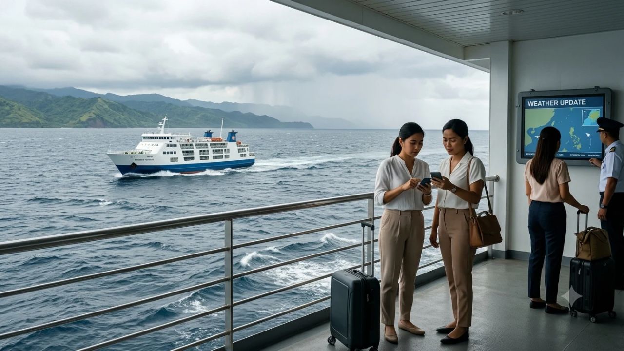
MANILA, Philippines — An intricate confluence of distinct meteorological phenomena across East and Southeast Asia has triggered a wave of travel alerts, requiring international travelers, airlines, and marine operators to distinguish localized monsoon hazards from offshore tropical cyclones.
On November 7, 2026, bulletins published by the Philippine Atmospheric, Geophysical and Astronomical Services Administration (PAGASA) confirmed that Tropical Storm Cempaka remained stationed far out over the open Pacific Ocean, thousands of kilometers outside the Philippine Area of Responsibility (PAR). Concurrently, Japan’s meteorological apparatus provided continuous regional tracking intelligence, while national weather agencies in Vietnam, Thailand, Malaysia, and Indonesia released completely separate operational advisories detailing seasonal monsoon rain, localized flash flooding, or rough maritime conditions.
For corporate travel managers, tour wholesalers, and independent vacationers traveling through Asia, this six-country meteorological comparison establishes an essential distinction: sensationalized regional headlines often bundle disparate atmospheric events under a single storm name. In reality, national alerts communicate sovereign risks driven by independent microclimates rather than a unified six-country emergency.
+----------------------------------------------------------------------------------------------------+ | SIX-NATION TRAVEL WEATHER & METEOROLOGICAL SCORECARD: NOVEMBER 2026 | +----------------------------------------------------------------------------------------------------+ | Primary System Tracked | Tropical Storm Cempaka (Positioned 2,175 km East of Northern Luzon)| | Philippine Status (PAGASA) | Outside PAR; Domestic Rain Driven by Shear Line & Northeast Monsoon| | Regional Tracking (JMA) | RSMC Tokyo Typhoon Centre Providing Regional Marine Coordinates | | Central Vietnam (NCHMF) | Heavy Rain (70–140mm, Local >700mm) & 4–6m Northern South China Sea| | Southern Thailand (TMD) | Monsoonal Downpours & Thunderstorm Seas (>2m) in Gulf & Andaman | | Malaysia (METMalaysia) | Storm Name Contributor; Zero Cyclones in Domain; Local Wave Alerts | | Indonesia (BMKG) | District-Level Rainfall Tiers (Siaga in Aceh, Banten Nowcasts) | | Global Early Warning Link | WMO Early Warnings for All (EW4All) Multi-Hazard Implementation | +----------------------------------------------------------------------------------------------------+
The Anatomy of a False Alarm: Why "Cempaka" Headlines Mislead Travelers
In modern digital travel journalism, sensationalized weather reporting frequently causes unwarranted panic. When an international storm name appears across news feeds, automated aggregators and casual social media channels frequently project a blanket disaster narrative across thousands of square kilometers of the Asia-Pacific basin.
Tropical Storm Cempaka provides a textbook case study in the gap between meteorological tracking and actual travel disruption:
THE REALITY GAP: REGIONAL CYCLONE COORDINATES VS. LOCALIZED TRAVEL HAZARDS
=============================================================================================
REGIONAL HEADLINE MYTH:
"Massive Superstorm Cempaka Threatens Six Asian Nations Simultaneously"
                                      |
                                      v
METEOROLOGICAL REALITY:
[Tropical Storm Cempaka] ---> Centered at 20.0°N, 142.8°E (Deep Open Pacific Ocean)
                         ---> 2,175 km East of Northern Luzon, Philippines
                         ---> Sustained Winds 65 km/h (Moderate Tropical Storm)
                         ---> ZERO Direct Landfall Impact on Southeast Asian Mainland

LOCALIZED DOMESTIC HAZARDS (ENTIRELY SEPARATE DRIVERS):
* Philippines: Winter Northeast Monsoon (Amihan) + Localized Eastern Shear Line
* Vietnam: Cold Air Surges Interacting with Tropical Easterly Waves over Annamite Range
* Thailand: High-Pressure System from Continental China Over Gulf of Thailand
* Malaysia: Isolated Coastal Convective Thunderstorms & Rough Offshore Waters
* Indonesia: Intertropical Convergence Zone (ITCZ) Convective Downpours
=============================================================================================
A primary source of public confusion stems from international nomenclature. Under the naming conventions established by the ESCAP/WMO Typhoon Committee, member nations submit regional names. Malaysia contributed the name Cempaka—referring to the fragrant frangipani or magnolia blossom (Michelia champaca) cherished in Southeast Asian culture.
However, the fact that Malaysia contributed the linguistic name bears zero correlation to the storm's physical coordinates. On November 7, Cempaka was located more than 3,500 kilometers away from peninsular Malaysia, yet casual readers frequently misinterpret the naming credit as proof that Malaysian resorts face an imminent cyclone threat.
Philippines: Cempaka Offshore While Shear Lines and Amihan Drive Domestic Rain
According to official bulletins released by PAGASA at 4:00 PM local time on November 7, Tropical Storm Cempaka was centered approximately 2,175 kilometers east of Extreme Northern Luzon (specifically at 20.0 degrees North, 142.8 degrees East). The storm maintained sustained winds of 65 km/h near the center, with gusts reaching 80 km/h, moving west-northwest across the open Philippine Sea at a brisk 30 km/h.
PAGASA MONITORING DOMAINS & DOMESTIC WEATHER DRIVERS
=============================================================================================
+-------------------------------------------------------------------------------------------+
|                          PHILIPPINE MONITORING JURISDICTIONS                              |
|                                                                                           |
|  [TROPICAL CYCLONE ADVISORY DOMAIN]                                                       |
|  - Broadest surveillance zone monitored by PAGASA radar and international satellites.     |
|  - Cempaka currently tracked here; poses NO imminent landfall risk to Philippine soil.    |
|                                                                                           |
|  [PHILIPPINE AREA OF RESPONSIBILITY (PAR)]                                                |
|  - Sovereign boundary triggering domestic Tropical Cyclone Wind Signals (TCWS #1 to #5).  |
|  - Cempaka remains well OUTSIDE this boundary; ZERO wind signals raised.                  |
|                                                                                           |
+-------------------------------------------------------------------------------------------+
                                              |
                                              v
+-------------------------------------------------------------------------------------------+
|                          DOMESTIC RAIN & MARINE REALITIES                                 |
|                                                                                           |
|  1. THE NORTHEAST MONSOON (AMIHAN)                                                        |
|  - Cool continental air blowing from Siberia across Northern and Central Luzon.           |
|  - Moderate to rough coastal seas (1.5 to 4.0 meters) along the northern seaboard.        |
|                                                                                           |
|  2. THE EASTERN SHEAR LINE                                                                |
|  - Zone where cool northeasterly air collides with warm easterly Pacific trade winds.     |
|  - Produces heavy cloudbursts, localized flash floods, and minor landslides across        |
|    Aurora, Quezon, and Camarines Norte provinces.                                         |
|                                                                                           |
+-------------------------------------------------------------------------------------------+
Clarifying Domestic Philippine Disruptions
Travelers visiting the Philippines must distinguish between two completely separate realities:
- Offshore Surveillance vs. Domestic Alerts: A cyclone appearing in a PAGASA tropical advisory does not mean an island is facing gale-force winds. Because Cempaka is outside PAR, no domestic shipping bans or flight cancelations have been ordered as a result of the cyclone.
- The Real Drivers of Philippine Weather: Domestic rain in the eastern provinces is driven by an active shear line—a narrow boundary where cold northeasterly monsoon winds collide with warm Pacific trade winds. This atmospheric friction triggers scattered rain showers across Southern Luzon, Aurora, Quezon, and Camarines Norte.
- Coastal Sea Warnings: For Northern Luzon, PAGASA forecast sea conditions ranging from moderate to rough, with open-ocean waves between 1.5 and 4.0 meters. While large inter-island roll-on/roll-off (Ro-Ro) ferries continue operating, small outrigger motorboats (bancas) used for leisure island-hopping tours along the northern coasts of Cagayan and Batanes face localized maritime restrictions due to monsoon chop, not typhoon winds.
Japan's Dual Meteorological Role: RSMC Tokyo Regional Tracking vs. Domestic Impact
The inclusion of Japan in regional storm bulletins frequently puzzles travelers planning vacations to Tokyo, Kyoto, or Okinawa. To understand Japan's involvement, one must examine international meteorological architecture.
Under the mandate of the United Nations World Meteorological Organization (WMO), the Japan Meteorological Agency (JMA) operates the RSMC Tokyo Typhoon Centre. The Tokyo facility is the designated Regional Specialized Meteorological Centre responsible for tracking, assigning international names, and issuing official technical guidance for every tropical cyclone forming across the Western North Pacific and the South China Sea (from the equator to 60°N and from 100°E to 180°E).
THE DUAL JURISDICTION OF JAPAN METEOROLOGICAL AGENCY (JMA)
=============================================================================================
REGIONAL MANDATE (RSMC TOKYO TYPHOON CENTRE)     DOMESTIC MANDATE (JMA NATIONAL WARNINGS)
* Tracks all storms across Western North Pacific * Evaluates physical threat to Japanese soil
* Issues 3-hourly marine advisory bulletins      * Issues Emergency Warnings, Gale Advisories
* Standardizes 10-minute sustained wind data     * Mandates Shinkansen train or flight stops
* Serves as technical advisor to 14 Asian nations* Activated ONLY when storm nears territory
                      \                                         /
                       \                                       /
                        v                                     v
             +---------------------------------------------------------+
             |         OPERATIONAL STATUS FOR TROPICAL STORM CEMPAKA   |
             | RSMC Tokyo is actively tracking Cempaka for navigation; |
             | Japan domestic services report ZERO flight groundings   |
             | or regional emergency warnings for the Japanese main    |
             | islands or Okinawa related to this weather system.      |
             +---------------------------------------------------------+
When JMA issues a tracking update for Cempaka, it is fulfilling its international service obligation to commercial maritime shipping and neighboring national agencies. JMA explicitly emphasizes that regional tracking coordinates must never be confused with domestic emergency warnings.
As of November 7, Tropical Storm Cempaka was positioned thousands of kilometers southeast of the Japanese archipelago, posing zero threat to passenger rail networks, international airport hubs at Haneda or Narita, or popular tourism destinations across Japan.
Central Vietnam's Severe Precipitation Outlook: Flooding and Marine Risks
While Cempaka churns harmlessly in the open Pacific, the nation facing the most immediate and serious travel weather hazards is Vietnam. However, Vietnam's hazards are driven by seasonal continental pressure systems and tropical moisture surges, completely independent of the distant Pacific storm.
On November 7, Vietnam’s National Centre for Hydro-Meteorological Forecasting (NCHMF) issued a critical weather bulletin warning of an extensive, multi-day heavy rainfall episode concentrated across Central Vietnam.
CENTRAL VIETNAM HYDRO-METEOROLOGICAL RISK CORRIDOR
=============================================================================================
SUB-REGION / PROVINCES        FORECAST RAINFALL WINDOW          TRAVEL VULNERABILITY
---------------------------------------------------------------------------------------------
Southern Nghệ An to           70 to 140 mm (Locally >200 mm)    Highway flooding along National
Northern Quảng Trị            Night of Nov 8 to Nov 9           Route 1A; hill-tribe trekking halts.
Southern Quảng Trị to         40 to 70 mm (Locally >120 mm)     Short-duration downpours (>100mm/3h);
Đà Nẵng Coastal Belt          November 9                        urban street waterlogging in Da Nang.
Huế – Đà Nẵng – Eastern       Cumulative >700 mm Projected      Severe river swelling (Perfume River);
Quảng Ngãi Corridor           Extended Window: Nov 9 to 11      Heritage site access limits in Hue.
Northern East Sea             North-Easterly Winds & Rough Seas Maritime cruise cancellations;
(South China Sea)             Waves Measuring 4.0 to 6.0 Meters Cham Islands ferry halts.
=============================================================================================
Critical Operational Implications for Vietnam Travelers
- Heritage and Cultural Tourism Disruptions: Central Vietnam is home to the nation's premier historical monuments, including the Imperial City of Huế and the UNESCO-listed ancient trading port of Hội An. The forecast of accumulated rainfall exceeding 700 mm between November 9 and 11 across the Thừa Thiên Huế and Quảng Nam provinces introduces significant risks of localized river overflow. In Hội An, where the Thu Bồn River frequently inundates riverside streets during autumn monsoon peaks, boutique hotels prepare flood barriers and relocate ground-floor furniture.
- Short-Burst Downpour Hazards: NCHMF’s advisory highlighted that short-duration downpours could exceed 100 mm within a single three-hour window. Intense precipitation of this magnitude rapidly overwhelms municipal storm drains, turning urban roads in Đà Nẵng into temporary canals and disrupting private vehicle transfers.
- Severe Offshore Marine Warnings: Offshore, NCHMF forecast powerful north-easterly winds driving rough seas with wave heights between 4.0 and 6.0 meters across the northern South China Sea. These conditions mandate immediate cancelations of tourist ferry services to the Chàm Islands, halt coastal diving excursions, and require luxury overnight junk cruises in Ha Long Bay and Lan Ha Bay to monitor port authority boarding clearances closely.
Thailand: High-Pressure Systems, Southern Monsoonal Squalls, and Andaman Seas
In Thailand, the Thai Meteorological Department (TMD) issued an independent seven-day weather outlook attributing unsettled conditions to a high-pressure system extending southward from continental China, colliding with prevailing easterly moisture tracks over the Gulf of Thailand and the Andaman Sea.
THAILAND TOURISM SECTOR WEATHER SENSITIVITY
=============================================================================================
NORTHERN & CENTRAL THAILAND                     SOUTHERN RESORT & ISLAND CORRIDORS
[Chiang Mai / Chiang Rai / Bangkok]             [Gulf of Thailand & Andaman Coast]
* Mild Day Temperatures, Cool Mountain Mornings * Heavy to Very Heavy Rain (Nov 8–13)
* Isolated Gusty Afternoon Thunderstorms        * Phetchaburi, Chumphon, Surat Thani, Songkhla
* Road Transfers & Sightseeing Fully Clear      * Squall Waves Exceeding 2 Meters
                      \                                         /
                       \                                       /
                        v                                     v
             +---------------------------------------------------------+
             |         OPERATIONAL ACTION FOR THAILAND TRAVELERS       |
             | High-speed catamaran ferries between Koh Samui, Koh     |
             | Phangan, and Koh Tao must monitor local maritime wave   |
             | advisories; speedboat diving tours in Phuket and Krabi  |
             | should verify harbor master green-flag departure status.|
             +---------------------------------------------------------+
Southern Thailand's Monsoonal Exposure
Between November 8 and 13, the TMD projects isolated heavy to very heavy rainfall across southern coastal provinces:
- The Gulf Coast Corridor: Provinces including Phetchaburi, Prachuap Khiri Khan (Hua Hin), Chumphon, Surat Thani, Nakhon Si Thammarat, Phatthalung, and Songkhla face persistent downpours. In Surat Thani, the primary gateway for travelers heading to Koh Samui, Koh Phangan, and Koh Tao, ferry operators like Lomprayah and Seatran closely monitor wave heights.
- Andaman Sea Conditions: Along the western coast (Phuket, Phang Nga, Krabi, and the Phi Phi Islands), the TMD warned that open-sea waves could exceed 2.0 meters during thunderstorm squalls. While large passenger ferries continue their scheduled crossings, small private longtail boats and high-speed day-trip speedboats face temporary port suspensions during squall lines.
Tour operators organizing jungle trekking in Khao Sok National Park must also monitor localized stream levels, as rapid runoff can temporarily close hiking trails and cave exploration routes.
Malaysia and Indonesia: Sovereign Alerts and Localized Microclimates
The southern tier of maritime Southeast Asia demonstrates how localized equatorial weather behaves independently of northern typhoons:
EQUATORIAL MARITIME METEOROLOGICAL MONITORING
=============================================================================================
MALAYSIA (METMALAYSIA JURISDICTION)             INDONESIA (BMKG JURISDICTION)
* Defined Domain: 0°–20°N, 95°–130°E            * Daily Three-Tier Warning System:
* ZERO Cyclones Present in Area of Surveillance   Waspada (Advisory) | Siaga (Watch) | Awas (Warning)
* Strong Wind & Rough Sea Marine Bulletins:     * Active Siaga Alerts in Aceh Province
  Winds up to 50 km/h; Waves to 3.5 Meters      * Afternoon Nowcasting: Lebak & Pandeglang (Banten)
  Specific Shipping Zones: Condore & Reef North * Early November Rainfall: 358mm Java, 300mm Bali
=============================================================================================
Malaysia: Maritime Focus Away from Cyclone Paths
At 5:30 PM on November 7, METMalaysia officially reported zero tropical cyclones within its sovereign monitoring zone (bounded between 0°–20° North and 95°–130° East). Tropical Storm Cempaka, sitting at longitude 142.8° East, was located well outside Malaysian tracking limits.
However, METMalaysia issued localized marine warnings for specific offshore shipping waters, including Condore and Reef North, forecasting north-easterly winds between 40 and 50 km/h and wave heights reaching up to 3.5 meters from November 8 to 10. These conditions pose genuine risks to small leisure craft, fishing charters, and inter-island passenger ferries along exposed eastern maritime borders, even while mainland city tours across Kuala Lumpur, Penang, and Melaka operate under standard tropical conditions.
Indonesia: District-Level Precision Under BMKG
In Indonesia, the Meteorology, Climatology and Geophysics Agency (BMKG) utilizes a sophisticated, three-tiered rainfall warning classification:
- Waspada (Yellow / Advisory): Conditions require awareness; standard outdoor plans can proceed with basic precautions.
- Siaga (Orange / Watch): Heightened vigilance required; potential for localized infrastructure flooding and transit disruptions.
- Awas (Red / Warning): Severe multi-hazard conditions; immediate safety precautions and potential evacuation measures.
On November 7, BMKG placed select regencies in Aceh under the elevated Siaga alert tier due to intense convective cloud clusters. Concurrently, BMKG’s regional office in Banten issued rapid short-term "nowcasting" notices for the Lebak and Pandeglang regencies, alerting travelers to intense afternoon thunderstorms with lightning and localized gusty winds.
BMKG’s historical weekly logs noted extreme early-November rainfall observations—including 358 mm in East Java and 300 mm in Bali during the first four days of the month—reflecting the standard onset of the southern hemisphere wet monsoon rather than any external cyclone influence.
Multi-Hazard Early Warnings: The WMO Early Warnings for All (EW4All) Framework
The synchronized publication of detailed weather bulletins across six Asian nations highlights the growing sophistication of the global hydrometeorological community.
According to an update published by the World Meteorological Organization (WMO) on October 29, 2026, more than 50 nations are actively implementing national roadmaps under the United Nations Early Warnings for All (EW4All) initiative. The WMO’s global assessment found that 119 countries (representing 60 percent of UN member states) now maintain operational multi-hazard early warning systems (MHEWS).
THE WMO MULTI-HAZARD EARLY WARNING VALUE CHAIN
| Column 1 |
|---|
| PILLAR 1: DISASTER RISK KNOWLEDGE & MONITORING |
| - Satellite and Doppler radar surveillance detecting atmospheric instability early. |
| - Real-time data exchange between RSMC Tokyo, PAGASA, NCHMF, TMD, METMalaysia, BMKG. |
| PILLAR 2: WARNING EMISSION & FORECAST ACCURACY |
| - Standardizing impact-based forecasting (measuring what the weather will DO, not just |
| what it will BE). Moving from raw millibar readings to specific flood inundation zones. |
| PILLAR 3: DISSEMINATION & PRACTICAL COMMUNICATION |
| - Ensuring warnings reach end-users: airlines, port authorities, hotel managers, and |
| independent travelers via mobile alerts, SMS broadcasts, and digital dashboards. |
| PILLAR 4: PREPAREDNESS & ACTIONABLE RESPONSE |
| - Establishing clear, pre-agreed operational thresholds for tour operators, such as |
| automatic ferry suspension when waves exceed 2.5 meters, eliminating guesswork. |
The expansion of these national early warning frameworks is a tremendous advancement for international tourism safety. However, the presence of more frequent, highly detailed government weather warnings requires travel agencies and consumers to interpret data responsibly. A high-resolution rainfall advisory does not signify a nationwide emergency; it represents an advanced risk-communication tool designed to enable targeted, proportionate travel adjustments.
Six Nations, Meteorological Agencies, Specific Hazards, and Travel Thresholds
The following matrix provides travel directors, tour operators, and travelers with a definitive comparative breakdown of the November 7 weather landscape across East and Southeast Asia:
| Nation | Sovereign Meteorological Agency | Specific Weather Hazard Monitored | Current System Trigger | Impacted Tourist Corridors | Operational Travel Decision Threshold |
|---|---|---|---|---|---|
| Philippines | PAGASA | Shear line rains & 1.5–4m northern coastal waves | Cold Amihan winds colliding with warm Pacific trades | Aurora, Quezon, Camarines Norte, Batanes, Cagayan | Small outrigger (banca) tours restricted in north; flights and central resorts fully operational |
| Japan | JMA (RSMC Tokyo) | Regional cyclone tracking coordination | Mandated WMO Western North Pacific surveillance | Open North Pacific maritime shipping lanes | Zero domestic travel restrictions; Tokyo, Kyoto, Osaka, and Okinawa fully normal |
| Vietnam | NCHMF | Torrential rains (70–140mm, up to 700mm) & 4–6m seas | Continental cold air surges meeting tropical easterlies | Huế, Đà Nẵng, Hội An, Quảng Ngãi, northern East Sea | Ground tours in Central Vietnam prepare flood contingencies; offshore island ferries suspended |
| Thailand | TMD | Southern monsoonal squalls & thunderstorm waves (>2m) | High-pressure system from China crossing the Gulf | Koh Samui, Koh Phangan, Koh Tao, Phuket, Krabi, Chumphon | Speedboat transfers and diving excursions subject to localized harbor master squall flags |
| Malaysia | METMalaysia | Offshore maritime chop (waves up to 3.5m) | Northeast monsoon wind friction over open waters | Condore and Reef North maritime zones; East Coast | Small leisure boats advised against deep offshore trips; mainland city & cultural tours clear |
| Indonesia | BMKG | District-level flash flood alerts (Siaga tier) | Equatorial convective cloud clusters & wet monsoon onset | Northern Sumatra (Aceh), Western Java (Lebak, Pandeglang) | High-clearance vehicles advised on rural roads; mountain stream trekking routes monitored |
The Travel Risk Management Blueprint: Airlines, Ferries, and Tour Operators
For professional travel managers, inbound destination management companies (DMCs), and retail travel agents, navigating seasonal Asian weather requires an active, structured protocol:
TRAVEL RISK MANAGEMENT PROTOCOL FOR REGIONAL WEATHER ALERTS
| Column 1 |
|---|
| STEP 1: IDENTIFY THE SPECIFIC PHENOMENON & HAZARD TYPE |
| - Determine whether the bulletin concerns a cyclone, monsoon shear line, or squall. |
| - Never assume a named storm in the Pacific dictates conditions in the Gulf of Thailand. |
| STEP 2: MAP WARNING ZONES PRECISELY AGAINST CLIENT ITINERARIES |
| - Overlay the exact meteorological coordinates or district names onto travel routes. |
| - A flood warning in Thừa Thiên Huế does not impact travelers sightseeing in Hanoi. |
| STEP 3: DECOUPLE WEATHER BULLETINS FROM SERVICE CANCELLATIONS |
| - A weather advisory is an informational forecast, NOT a confirmed airline shutdown. |
| - Confirm operational service changes directly with primary carriers and port captains. |
| STEP 4: ESTABLISH PROPORTIONATE BACKUP CONTINGENCY PLANS |
| - Prepare indoor museum or culinary alternatives when heavy rain threatens city walking. |
| - Re-route exposed island speedboat transfers to sheltered mainland coastal excursions. |
Navigating Aviation vs. Maritime Disruption
- Aviation Realities: Commercial jet aircraft operate thousands of meters above localized surface monsoons. Heavy rainfall alone rarely grounds flights; disruptions occur only when severe low-level wind shear, tropical thunderstorms directly over the runway, or zero-visibility conditions exceed safe landing minimums. Travelers should never cancel flight itineraries based purely on weather headlines without checking official flight status boards at Manila (MNL), Bangkok (BKK), Da Nang (DAD), or Jakarta (CGK).
- Maritime Realities: Unlike commercial aviation, maritime operations are acutely sensitive to surface weather. A wave height of 2.5 to 3.5 meters may cause minor motion discomfort on a 150-meter steel ferry, but it poses immediate capsizing hazards to small fiberglass speedboats, traditional wooden catamarans, and open outriggers. When national agencies issue rough-sea warnings, marine travelers must immediately verify whether port authorities have raised small-craft advisory flags before heading to the pier.
Actionable Advice for Independent Travelers Facing Asian Shoulder-Season Weather
For independent adventurers and holidaymakers exploring East and Southeast Asia during November, adopting smart travel habits ensures an enjoyable, safe journey:
- Rely on Sovereign Official Weather Portals: Bypass algorithmic commercial weather apps that display generic thunderstorm icons for 30 consecutive days. Bookmark official national portals: PAGASA (
pagasa.dost.gov.ph) for the Philippines, NCHMF (nchmf.gov.vn) for Vietnam, TMD (tmd.go.th) for Thailand, METMalaysia (met.gov.my) for Malaysia, and BMKG (bmkg.go.id) for Indonesia. - Pack Waterproof Essentials: When traveling through Central Vietnam or Southern Thailand in November, travel with high-grade silicone waterproof covers for daypacks, waterproof phone pouches, quick-drying synthetic clothing, and sturdy footwear with high-traction rubber soles for wet cobblestones and slick temple steps.
- Build Buffer Days for Island Connections: If your itinerary requires taking a ferry from Koh Tao to Koh Samui or from the Cham Islands to Da Nang to catch a scheduled international flight home, always schedule your ferry crossing at least 24 hours prior to flight departure. Monsoonal squalls can cause temporary two- to four-hour ferry suspensions that could otherwise cause missed long-haul flight connections.
- Maintain Flexible Activity Scheduling: Plan outdoor activities—such as hiking Mount Batur in Bali, visiting the Marble Mountains in Da Nang, or exploring the temples of Ayutthaya—during morning hours, as tropical monsoonal downpours predominantly develop during the late afternoon and early evening.
By understanding the distinct meteorological mechanisms at play across Asia, travelers and tourism professionals can replace sensationalized anxiety with informed confidence, navigating the dynamic landscapes of the region with safety and ease.
Related Travel Guides
- Southeast Asia Monsoon Travel Masterclass: Navigating Wet and Dry Seasons by Country
- Island-Hopping Safety Protocols: Ferries, Speedboats, and Maritime Alerts Across Asia
- Vietnam Regional Weather and Travel Guide: From Sapa’s Mountains to the Mekong Delta
- The Philippine Island Transit Guide: Navigating Domestic Flights, Ferries, and Weather Alerts
This article is for informational purposes. Flight routes, passenger regulations, visa rules, and transit advisories are subject to change by airlines and aviation authorities. Readers are advised to verify schedules and travel documentation with relevant carriers and border agencies before departure.
Related Stories

Middle East Travel Alert: Deconstructing US Security Warnings, Gulf Flight Corridors, and Airspace Risks Across 14 Nations
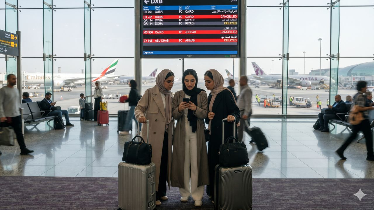
Middle East Flight Disruptions: Over 1,180 Delays and 106 Cancellations Across Gulf Hubs