
Thanksgiving Storm Alert 2026: Heavy Mountain Snow, Coastal Gales, and Cross-Country Route Disruptions

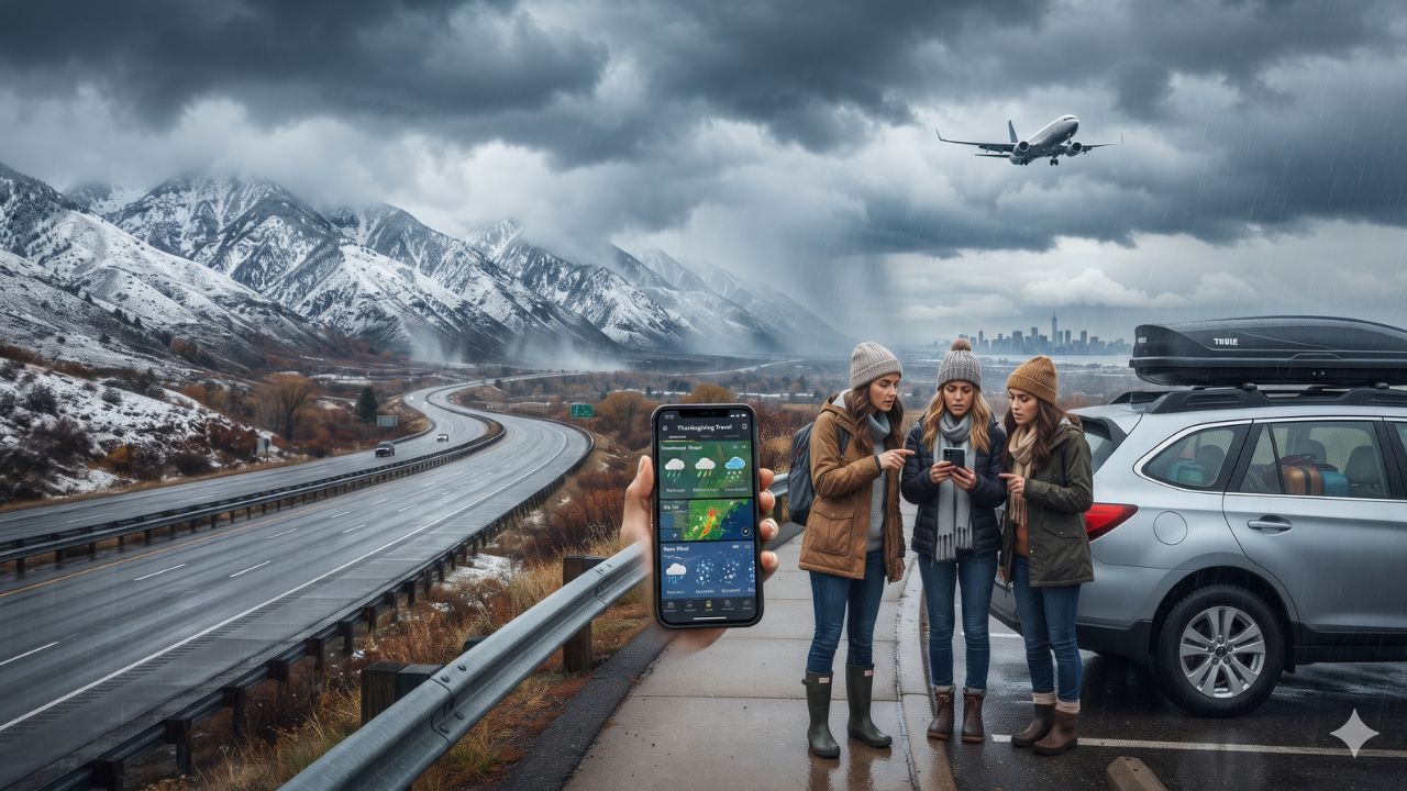
With tropical Pacific ocean temperatures spiking 2.5 degrees Celsius above average, a strengthening El Niño pattern is steering powerful storm tracks directly into North America—threatening more than a foot of snow across Sierra Nevada passes just as 72.9 million motorists hit the highways.
Holiday travel across the United States is confronting severe meteorological hurdles as the nation prepares for the annual Thanksgiving exodus. According to a hazardous weather outlook released on 17 November 2026 by the NOAA Climate Prediction Center, a vigorous North Pacific low-pressure system is bearing down on the West Coast, while moisture funnels out of the Southern Plains toward the Atlantic. With the American Automobile Association (AAA) projecting that 81.5 million Americans will travel at least 50 miles between 24 and 30 November 2026, severe weather conditions spanning from the Pacific Northwest to the Eastern Seaboard threaten critical road arteries and high-density airport operations.
The Meteorological Setup: El Niño Forcing and Coastal Storms
The underlying driver of this seasonal turbulence is an active El Niño Advisory formalized on 12 November 2026, when equatorial Pacific sea-surface anomalies in the Niño-3.4 zone hit 2.5°C above normal. With NOAA assigning a greater than 79 percent probability that strong-to-very-strong El Niño conditions will persist through March 2027, the subtropical jet stream is positioned to funnel moisture into western mountain ranges and the southern tier of the United States.
Forecasters have placed the Klamath Mountains, the northern Sierra Nevada, and coastal zones from Cape Mendocino north to the Canadian border under a Moderate Risk of severe weather on 25 November. Forecast model guidance reveals a greater than 40 percent probability of snowfall exceeding 12 inches over a three-day period across higher elevations of the Sierra Nevada, alongside a 60 percent probability of snowfall topping six inches across portions of the Cascades, Klamath, and Sierra ranges.
In low-elevation valleys across northern California and southwest Oregon, models indicate a greater than 50 percent probability of rainfall exceeding one inch on 25 November alone. Meanwhile, secondary storm bands pose Slight Risk warnings for heavy rainfall along the Gulf Coast (25–27 November) and the Mid-Atlantic and Northeast corridors (26–29 November).
| Hazard Region & Transit Vector | Primary Weather Threat | NOAA Risk Level & Dates | Key Travel Corridors & Transport Hubs |
|---|---|---|---|
| Northern Sierra Nevada (CA) | Heavy snowfall (>12 inches possible) | Moderate (25 Nov) | Interstate 80 (Donner Pass), Truckee, South Lake Tahoe |
| Klamath Mountains (CA/OR) | Heavy snow over passes | Moderate (25 Nov) | Interstate 5 (Siskiyou Summit), Mount Shasta, Weed |
| Pacific Coast (Mendocino to WA) | High winds & coastal rain squalls | Moderate (25 Nov) | US Highway 101, Brookings, Eureka, Astoria |
| Cascades & Pacific Northwest | Rain in valleys; mountain snow | Slight (25 Nov – 1 Dec) | I-5 corridor, Portland (PDX), Seattle-Tacoma (SEA) |
| Rockies & Wasatch Range | High-altitude snow accumulations | Slight (25–28 Nov) | I-70 corridor, Salt Lake City, Denver mountain passes |
| Gulf Coast & Southeast | Heavy rainfall & localized flash floods | Slight (25–27 Nov) | Interstate 10, New Orleans (MSY), Atlanta (ATL) |
| Mid-Atlantic & Northeast | Rain, coastal wind gusts | Slight (26–29 Nov) | I-95 corridor, Philadelphia (PHL), NYC airports, Boston (BOS) |
Highway Checkpoints: Donner Pass, Siskiyou Summit, and Coastal Routes
Motorists commanding the 72.9 million road journeys face severe bottlenecks where interstate freeways cross high-altitude gaps.
Along Interstate 80 connecting northern California with Nevada, Donner Pass sits at an elevation of 7,239 feet. Heavy Sierra snowfall combined with gusty winds can prompt immediate chain controls or complete highway closures by the California Department of Transportation. Farther north on Interstate 5, Siskiyou Summit at the California–Oregon border rises to 4,310 feet, where commercial trucks and passenger cars regularly face whiteout conditions between Redding, California, and Ashland, Oregon.
Along the Pacific coastline, US Highway 101 faces potential mudslides, ponding water, and falling timber from gusty onshore winds, particularly around Cape Mendocino and the southern Oregon coast near Brookings. In the East, heavy rain along Interstate 95 between Washington, Baltimore, Philadelphia, and New York could severely lengthen driving times during the peak return window on Sunday, 29 November.
Airport Operations: Navigating Air Delays and Surging Fares
Aviation networks will be operating at near-capacity throughout the holiday window. AAA projects 5.96 million domestic air travelers, with average round-trip domestic airfares climbing to $800—a 17 percent increase over the previous year.
West Coast hubs—including Seattle-Tacoma (SEA), Portland (PDX), San Francisco (SFO), Sacramento (SMF), and regional fields like Medford (MFR) and Arcata/Eureka (ACV)—will contend with low ceilings and crosswinds that disrupt arrival slot sequencing. Because US air carriers operate tight aircraft turnaround rotations, delays in Seattle or San Francisco quickly ripple eastward to Atlanta (ATL), Chicago (ORD), and New York (JFK/LGA/EWR), where rainfall and wind gusts are forecast to peak between 26 and 29 November.
Visitor Insider Tips
- Siskiyou and Donner Pass Timing: If driving between California and the Pacific Northwest or Nevada, cross mountain passes before 10:00 am on Tuesday, 24 November. Storm intensity and chain control enforcement escalate dramatically on Wednesday, 25 November.
- Carry Mandated Winter Gear: California Highway Patrol and Oregon State Police legally require motorists crossing mountain zones to carry tire chains matched to vehicle tire sizes, even on all-wheel-drive vehicles. Pack a headlamp, thermal blankets, emergency water, and food rations.
- Buffer Connecting Flight Windows: If connecting through western or northeastern hubs, avoid itineraries with layovers under two hours. Ground-delay programs caused by low cloud ceilings can cause missed gates on tight 45-minute connections.
- Check Real-Time Road Portals: Verify live highway cameras and road conditions on TripCheck Oregon and the National Weather Service before leaving home.
Cultural and Environmental Context
Thanksgiving represents one of the most culturally significant mass migrations in the modern world, as families travel across thousands of miles to reunite. However, the intersection of mass holiday transit with climate-driven winter storm cycles illustrates the growing friction between human schedules and volatile weather patterns.
In western mountain ecosystems, heavy early-season snowpack is essential for replenishing reservoirs and mitigating multi-year droughts across California and the Colorado River basin. Yet, when atmospheric rivers dump moisture across burn scars left by previous summer wildfires, mountain communities face acute flash flooding and debris flow risks. Drivers should honor local evacuation advisories and refrain from driving around road-closure barricades, allowing municipal emergency crews to keep vital transit corridors clear.
FAQ: Thanksgiving Weather and Travel Storms 2026
What are the biggest mountain pass snow risks for Thanksgiving 2026?
NOAA models project moderate risks of heavy snow on 25 November across Donner Pass on Interstate 80 in California and Siskiyou Summit on Interstate 5 at the California–Oregon border, with some Sierra locations facing over 12 inches.
How many Americans are traveling for Thanksgiving this year?
AAA projects 81.5 million Americans will travel at least 50 miles between 24 and 30 November 2026, including 72.9 million by car and 5.96 million by air.
How does El Niño affect this year's Thanksgiving weather?
An active El Niño with sea-surface temperatures 2.5°C above normal is channeling moisture across the Pacific into the West Coast and Southern states, increasing precipitation risks across the country.
Which major airports face the highest storm delay risks?
Airports to monitor for wind and rain delays include Seattle (SEA), Portland (PDX), San Francisco (SFO), Atlanta (ATL), Philadelphia (PHL), Boston (BOS), and the New York metro hubs (JFK, EWR, LGA).
Related Travel Guides
- Oregon and Portland Thanksgiving Road Trip Guide and Fuel Costs
- American Airlines Ramps Up Caribbean Winter Hub at Miami
- Andean Slow Transit for Solo Female Travelers Across Peru and Chile
By packing emergency winter chains and timing mountain pass crossings ahead of storm fronts, travelers can navigate holiday hazards and arrive safely at the Thanksgiving table.
This article is for informational purposes. Flight routes, passenger regulations, visa rules, and transit advisories are subject to change by airlines and aviation authorities. Readers are advised to verify schedules and travel documentation with relevant carriers and border agencies before departure.
Related Stories
United Airlines Tech Outage Stalls US Departures: Flight Delay Protections, FAA Context, and Passenger Refund Rules

California Storm Warnings and Banff Snow Shortages: Winter 2026 Travel Alert