Northern California Tremor Near The Geysers: Geothermal Science, Sonoma Wine Travel, and Safety Guide

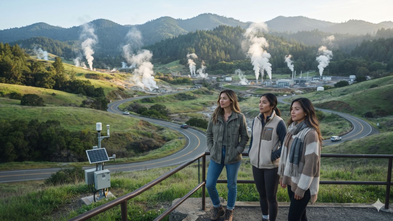
Located just an hour's drive north of Sonoma County's celebrated vineyard valleys lies the largest active geothermal field on earth—where subterranean steam networks generate clean electricity while producing regular micro-tremors that rarely spill a single drop of wine.
In the early morning hours of Tuesday, 17 November 2026, seismic instruments detected a shallow magnitude 2.5 earthquake centered approximately six kilometers north-northwest of The Geysers in Northern California. Occurring at a depth of roughly 2.6 kilometers at 12:45 am Pacific Standard Time (08:45 UTC), the localized tremor serves as a quiet reminder of the potent tectonic and geothermal energy shaping California’s Mayacamas Mountains. While the event caused zero structural damage and triggered no airport or winery closures, understanding the geological forces beneath California wine country offers travelers valuable insights into regional safety and disaster preparedness.
The Event: Shallow Hypocenter in the Mayacamas Mountains
The seismic record documented by regional seismic stations confirmed an epicenter situated within the rugged ridge complex spanning northeastern Sonoma County and southwestern Lake County. At a focal depth of barely 2.6 kilometers, the tremor was exceptionally shallow, meaning ground vibrations were localized immediately around the unpopulated geothermal steam fields rather than radiating strongly into urbanized valley floors.
The Geysers is internationally recognized as the world's most productive geothermal energy complex, comprising dozens of power plants fueled by superheated subterranean steam reservoirs. Minor seismic activity in this specific zone occurs frequently due to a combination of natural strike-slip tectonic faults associated with the San Andreas Fault system and localized fluid pressures generated by water injection and steam extraction.
Seismologists continually monitor the region to differentiate between routine induced micro-earthquakes and broader tectonic stress shifts. The 17 November event registered well below the threshold of physical destruction, leaving regional transportation networks, regional airfields, and visitor hospitality operations functioning without interruption.
| Seismic & Travel Metric | Recorded Event Data (17 Nov 2026) | Practical Traveler Context |
|---|---|---|
| Recorded Magnitude | Magnitude 2.5 | Minor micro-tremor; rarely felt beyond immediate epicenter |
| Epicenter Location | 6 km NNW of The Geysers, California | Remote mountainous terrain north of San Francisco Bay Area |
| Hypocenter Depth | Approximately 2.6 kilometers | Shallow crustal event typical of geothermal steam fields |
| Event Timestamp | 12:45 am PST / 08:45 UTC | Occurred overnight during low traffic hours |
| Tourism & Hotel Impact | Zero confirmed closures or structural damage | Sonoma, Napa, and Lake County attractions open as normal |
| Regional Airport Status | Fully operational (SFO, OAK, STS) | Charles M. Schulz–Sonoma County Airport operating smoothly |
| Early Warning Trigger | Did not meet public alert threshold | MyShake app sends alerts for M4.5+ events with moderate shaking |
Wine Country and Bay Area Tourism: Normal Operations
For travelers exploring Northern California, separating regional seismic reporting from real-world travel safety is essential. Major visitor destinations throughout the region remain entirely unaffected:
In Sonoma County, boutique tasting rooms and historic estates across the Alexander Valley, Dry Creek Valley, and Russian River Valley are open on regular schedules. Gateway cities such as Santa Rosa and Healdsburg reported zero ground disruption. Similarly, sixty miles to the south, San Francisco’s iconic cultural attractions—including the Golden Gate Bridge, Alcatraz Island ferries, and Fisherman’s Wharf—experienced no operational impacts.
Air transit across the region remains unaffected. Terminal operations and runway arrivals at San Francisco International Airport (SFO), Oakland International Airport (OAK), and regional flight connections through Charles M. Schulz–Sonoma County Airport (STS) in Santa Rosa continue operating on published timetables without seismic inspection holds.
What Makes The Geysers Region Geologically Unique
The Mayacamas Mountains north of Calistoga represent a remarkable geological convergence. Beneath The Geysers lies a massive subterranean magma chamber that superheats underground water trapped within fractured greywacke sandstone, creating an enormous natural steam boiler.
Beginning in the 1920s and expanding dramatically in the 1960s, energy operators tapped this steam reservoir to generate carbon-free baseload electricity, which today supplies substantial power across Northern California. This high-energy thermal environment is also what feeds the world-renowned hot springs and mineral mud baths of Calistoga at the northern tip of Napa Valley, where travelers have journeyed for over a century to soak in naturally heated, volcanic waters.
Visitor Insider Tips
- Install Earthquake Warning Apps: Download the state-sponsored Earthquake Warning California MyShake mobile application on your smartphone. Powered by the UC Berkeley Seismological Laboratory and the USGS ShakeAlert system, the application delivers early seconds-ahead warnings for qualifying earthquakes (typically magnitude 4.5 and higher with noticeable shaking).
- The "Drop, Cover, and Hold On" Protocol: If strong shaking occurs while inside a winery, hotel, or restaurant, immediately drop to your hands and knees, crawl beneath a sturdy table or desk, and protect your head and neck with your arms. Never run outside during active shaking, as falling glass, roof tiles, and facade masonry pose the greatest injury hazard.
- Driving Safety During Tremors: If you experience an earthquake while driving along winding mountain routes like Highway 128 or Highway 29, gently pull over away from overpasses, power lines, and steep rockfall zones. Set the emergency parking brake and remain inside your vehicle until shaking subsides.
- Explore Local Wine Country Resources: Check tasting room reservations, farm trails, and road conditions through the official Sonoma County Tourism Portal.
- Track Real-Time Seismology: Follow verified earthquake magnitude maps and epicenter reports through the official United States Geological Survey (USGS).
Cultural and Environmental Context
Living and traveling in California requires coexisting with an active, evolving geological landscape. The same subterranean forces that generate earthquakes are responsible for creating the dramatic topography, mineral-rich volcanic soils, and microclimates that make Sonoma and Napa valleys the most celebrated agricultural and viticultural regions in North America.
Local communities demonstrate high civic resilience through strict building codes, reinforced seismic retrofitting of historic stone wineries, and comprehensive municipal emergency response teams. When visiting regional parks and nature reserves, staying on marked trails prevents erosion along fragile fault scarps. Supporting family-run vineyard estates, indigenous Pomo cultural centers, and local farm-to-table dining ensures that tourism strengthens regional economic resilience.
FAQ: Northern California Earthquake Safety 2026
Where did the 17 November 2026 earthquake occur?
The magnitude 2.5 earthquake struck roughly six kilometers north-northwest of The Geysers geothermal area in Northern California at a depth of approximately 2.6 kilometers.
Were any wineries or tourist attractions damaged?
No. The magnitude 2.5 tremor was minor and caused zero structural damage, road closures, or tourism disruptions across Sonoma, Napa, or San Francisco.
Did the earthquake trigger a MyShake alert on mobile phones?
No. California’s early warning system reserves public phone alerts for earthquakes registering magnitude 4.5 or higher with potentially damaging ground acceleration.
Is it safe to travel to Northern California wine country?
Yes. Regional highways, airports, and hotels are operating normally. Minor tremors are a routine feature of California's active geology and do not warrant travel cancellations.
Related Travel Guides
- Global Luxury Car Rental Market Surges Toward $52 Billion by 2030
- Thanksgiving Storm Alert 2026: Heavy Mountain Snow and Route Disruptions
- Oregon and Portland Thanksgiving Road Trip Guide and Fuel Costs
By respecting the natural power beneath California's soils and keeping early warning apps active, travelers can explore wine country with complete confidence and peace of mind.
This article is for informational purposes. Flight routes, passenger regulations, visa rules, and transit advisories are subject to change by airlines and aviation authorities. Readers are advised to verify schedules and travel documentation with relevant carriers and border agencies before departure.
Related Stories

California Storm Warnings and Banff Snow Shortages: Winter 2026 Travel Alert

FAA Nationwide Ground Stop Grounds Over 12,000 Flights: Cruise and Hotel Travel Disruption Guide