
Germany, France, and US Trekkers Fuel Autumn Tourism Surge in Nepal's Kanchenjunga Region
International trekkers from Germany, France, Australia, and the US drive an autumn tourism surge in Nepal's remote Kanchenjunga region around Pangpema and Oktang.

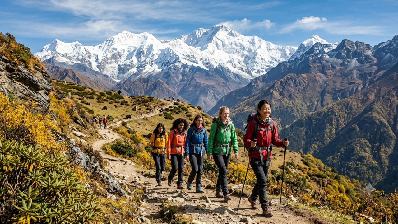
Driven by a steady influx of high-altitude mountaineers from Germany, France, Australia, and the United States, eastern Nepal's remote Kanchenjunga circuit is experiencing an autumn tourism surge, reviving local hospitality and mountain guiding economies across the Taplejung district.
Towering over the border triangle connecting Nepal, Sikkim, and Tibet, Mount Kanchenjunga (8,586 meters)—the third-highest peak on Earth—has long stood as one of the Himalaya's most challenging and preserved wilderness frontiers.
Official records from the Kanchenjunga Conservation Area Management Council (KCAMC) tourism checkpoint in Ghunsa show that approximately 170 international trekkers entered the protected corridor during the autumn season as of Monday, October 12, 2026.
Paired with a concurrent wave of domestic travelers journeying into the eastern highlands during the Dashain and Tihar festive holidays, this autumn influx is providing a welcome economic boost for local teahouse lodges, high-altitude porters, mountain guides, and rural transport operators.
===================================================================================
       KANCHENJUNGA CONSERVATION AREA: DUAL BASE CAMP TREKKING CORRIDOR
===================================================================================
                                [MOUNT KANCHENJUNGA]
                                    (8,586 Meters)
                                    /            \
                (North Face Approach)            (South Face Approach)
                         /                              \
               [Pangpema North Base Camp]        [Oktang South Base Camp]
                    (5,140 Meters)                    (4,730 Meters)
                          |                                 |
                     [Lhonak] (4,780m)                 [Ramche] (4,580m)
                          |                                 |
                   [Kambachen] (4,050m)                [Tseram] (3,870m)
                          |                                 |
            +------------[Ghunsa Acclimatization]            [Yamphudin] (2,080m)
            |            (3,595 Meters)                     |
  (Sele Le Pass 4,480m)   |                                 |
  [High Altitude Link] ---+                                 |
                          \                                 /
                           \====== [Tapethok Checkpost] ====/
                                          |
                                [Taplejung / Suketar Hub]
                                (Airstrip & Overland Road)
===================================================================================
Autumn 2026 Inflow Data: European and Western Inbound Growth
For decades, the bulk of Nepal’s international trekking traffic has gravitated toward commercial routes in the Annapurna and Everest (Khumbu) sanctuaries. However, as congestion, helicopter traffic, and over-commercialization reshape those western routes, experienced mountaineers are turning to the raw, untamed valleys of the east.
Official logs kept at the KCAMC Ghunsa checkpoint highlight a diverse international visitor profile:
- Primary European Source Markets: Trekkers from Germany and France represent the largest foreign contingent, drawn by Kanchenjunga’s multi-week itineraries, technical high-pass traverses, and authentic teahouse culture.
- Transpacific Long-Haul Inbound: Adventurers from the United States and Australia form a substantial secondary tier, commonly undertaking extended 21-to-26-day full-circuit expeditions linking both base camps via the challenging Sele Le Pass (4,480m).
- Baseline Arrivals Milestone: With approximately 170 foreign permits officially stamped through Ghunsa by mid-October, the region is on pace to match or exceed pre-pandemic autumn benchmarks, confirming sustained demand for remote wilderness tourism.
KANCHENJUNGA CONSERVATION AREA: VISITOR DEMOGRAPHICS
| Entity / Route | Metrics | Operational Status |
|---|---|---|
| Visitor Category | Origin / Focus Markets | Key Trekking Preferences |
| International Western | Germany, France, USA, | 20-25 day full circuits; |
| Adventurers | Australia, UK, Switzerland | Pangpema North Face views |
| Domestic Nepali | Kathmandu, Biratnagar, | Short holiday treks to |
| Holidaymakers | Dharan, Jhapa youth groups | Ghunsa & Pathibhara Devi |
| Ratio of Travelers | ~2 Domestic per 1 Foreigner | High domestic concentration |
| (Local Estimates) | (Unrecorded informal stays) | during Dashain & Tihar |
| Checkpoint Benchmark | ~170 Registered Foreigners | Verified by KCAMC Ghunsa |
| (October 12, 2026) | at Ghunsa Tourism Post | entry post for autumn 2026 |
The Domestic Holiday Surge: Dashain and Tihar Travel Trends
Alongside foreign expeditions, domestic tourism has emerged as a major economic driver for the Taplejung region. While formal government checkpoints maintain exact records for international travelers carrying restricted-area trekking permits, domestic travelers move across district borders without mandatory registration.
Local lodge operators in Ghunsa, Amjilosa, and Yamphudin estimate that Nepali holidaymakers currently outnumber international travelers by roughly two to one.
This domestic surge coincides with Dashain and Tihar, Nepal’s most celebrated national festival period. Urban professionals, university trekking clubs, and multi-generational families from Kathmandu, Pokhara, and the eastern plains (Biratnagar, Dharan, Birtamod) take advantage of favorable October weather to explore their country's eastern mountain heritage.
Many domestic travelers combine trekking in the Kanchenjunga foothills with a pilgrimage to the revered hill shrine of Pathibhara Devi near Taplejung, creating strong demand for 4WD jeep charters and local guesthouse beds.
ANNUAL TOURISM SEASONS IN EASTERN NEPAL
| Entity / Route | Metrics | Operational Status |
|---|---|---|
| SEASON | DURATION | MOUNTAIN CLIMATIC CONDITIONS |
| Spring Trekking Window | March to May | Moderate temperatures; blooming |
| rhododendron canopies; melting snow | ||
| Summer Monsoon Surge | June to August | Heavy rainfall; leeches; active |
| (Low Season / Closure) | landslides along Tamor river roads | |
| Autumn Peak Window | September to Dec | Crisp, stable weather; cloudless |
| (Current Active Boom) | skies; post-monsoon festive season | |
| Winter Freeze Window | Dec to February | Heavy snowfall; sub-zero freezes; |
| (Pass Closures) | high passes blocked (Sele Le closed) |
Economic Dividends for Mountain Communities
The economic impact of the autumn trekking boom extends across the entire Taplejung district. Unlike heavily commercialized regions where corporate travel agencies dominate supply chains, Kanchenjunga’s tourism economy remains deeply rooted in local communities.
KANCHENJUNGA TOURISM LOCAL VALUE CHAIN
| Entity / Route | Metrics | Operational Status |
|---|---|---|
| SECTOR | BENEFICIARY GROUPS | ECONOMIC IMPACT |
| Teahouses & Homestays | Sherpa, Rai, and Limbu | 100% seasonal occupancy; |
| families across Ghunsa valley | revenue for winter supplies | |
| Guiding & Porterage | Local high-altitude guides, | Daily wages; seasonal tips; |
| kitchen staff, trail porters | equipment rental earnings | |
| Rural Road Transport | Mahindra 4WD jeep drivers | Charters between Birtamod, |
| and local tractor operators | Taplejung, and Sekathum | |
| Agrarian Producers | Smallholder hill farmers | Local sales of potatoes, |
| and yak-cheese herders | buckwheat, yak milk, butter |
Full Occupancy in Mountain Teahouses
In high-altitude settlements like Ghunsa (3,595m) and Kambachen (4,050m), lodges and traditional homestays are running at peak capacity. For teahouse operators, autumn earnings provide the financial cushion needed to purchase grain, solar equipment, and heating fuel before the winter freeze closes the high passes from late December through February.
Employment for Mountain Guides and Porters
Extended Kanchenjunga treks typically require 18 to 26 days on foot, creating sustained employment for certified mountain guides, camp cooks, and high-altitude porters. Trekking crews carry food supplies and heavy camping gear into remote glaciated zones beyond Lhonak, generating essential seasonal income for families in rural eastern villages.
Agricultural Integration and Local Food Systems
Rather than relying solely on packaged foods imported from low-elevation cities, teahouses in the Kanchenjunga Conservation Area purchase local produce directly from hill farmers. Trekkers are nourished by locally grown potatoes, stone-ground buckwheat flatbreads (phapar roti), organic cabbage, dried yak cheese (chhurpi), and locally harvested cardamom, keeping tourism revenues circulating within the mountain valley.
Trail Logistics: Exploring Pangpema and Oktang Base Camps
The Kanchenjunga trekking region offers two main trekking routes: the Northern Base Camp trek leading to Pangpema, and the Southern Base Camp route heading toward Oktang.
COMPARATIVE ELEVATION & LOGISTICS: DUAL BASE CAMPS
| Entity / Route | Metrics | Operational Status |
|---|---|---|
| ROUTE PARAMETER | NORTHERN ROUTE (PANGPEMA) | SOUTHERN ROUTE (OKTANG) |
| Terminal Elevation | 5,140 meters (Pangpema Camp) | 4,730 meters (Oktang View) |
| Key Staging Villages | Ghunsa, Kambachen, Lhonak | Yamphudin, Tseram, Ramche |
| Primary Mountain Views | Kanchenjunga North Face, | Kanchenjunga South Face, |
| Yalung Kang, Chang Himal | Kabru peaks, Rathong | |
| Glacial Systems | Kanchenjunga Glacier | Yalung Glacier |
| Technical Challenge | Gradual acclimatization; | Steep river valleys; |
| moraine walking above Lhonak | demanding early ascents |
The Northern Route: Ghunsa to Pangpema (5,140m)
The journey to Pangpema follows the rushing waters of the Ghunsa Khola, passing through dense pine and rhododendron forests before emerging into wide alpine valleys.
Trekkers spend an essential rest day in Ghunsa (3,595m), a picturesque stone-built Sherpa village home to ancient Buddhist monasteries, community wooden houses, and high-altitude health clinics.
From Ghunsa, the trail ascends past the landslide-prone moraines of Kambachen (4,050m) and the windswept seasonal outpost of Lhonak (4,780m). Trekkers then cross the lateral moraine of the Kanchenjunga Glacier to reach Pangpema (5,140m), where they are greeted by the massive North Face of Kanchenjunga rising three vertical kilometers above the glacier floor.
The Southern Route: Yamphudin to Oktang (4,730m)
The southern approach journeys through the cultural villages of Mamankhe and Yamphudin, home to Rai and Limbu communities, before climbing steeply through bamboo thickets into high alpine meadows at Tseram (3,870m) and Ramche (4,580m).
Trekkers push past frozen glacial tarns to reach the Oktang Viewpoint (4,730m), which delivers panoramic views across the Yalung Glacier, the southern face of Kanchenjunga, and the jagged ridge of Kabru.
Mountain Hazards and Climate Vulnerabilities
While the autumn season brings clear skies and stable daytime temperatures, high-altitude trekking in eastern Nepal carries real physical risks that demand careful preparation.
SEASONAL HIGH-ALTITUDE MOUNTAIN HAZARDS
| Entity / Route | Metrics | Operational Status |
|---|---|---|
| HAZARD CATEGORY | CAUSATIVE FACTORS | MITIGATION PROTOCOLS |
| Acute Mountain | Rapid ascent above 3,500m; | Mandatory rest day in |
| Sickness (AMS) | sleeping at high elevations | Ghunsa; slow acclimatization |
| Monsoon Landslides | Residual waterlogging along | Pre-trek route checks with |
| (Post-September) | Tamor river gorges | KCAMC; local 4WD routing |
| Early Winter Blizzards | Sudden Arctic cold fronts | High-grade thermal gear; |
| (November / December) | across Sele Le Pass (4,480m) | satellite messenger beacons |
| Trail Washouts | Melting glacial moraines | Hiring experienced local |
| & Rockfall | between Kambachen & Lhonak | guides; avoiding late walks |
Acclimatization Discipline
The elevation profile of Kanchenjunga rises steeply once trekkers pass Sekathum. Skipping acclimatization days in Ghunsa or climbing too fast past Kambachen significantly increases the risk of Acute Mountain Sickness (AMS), High Altitude Pulmonary Edema (HAPE), and High Altitude Cerebral Edema (HACE). Trekkers should carry preventative medication (such as acetazolamide) and descend immediately if severe altitude symptoms appear.
Weather Volatility Across High Passes
Connecting the northern and southern base camps requires crossing the Sele Le Pass (4,480m) and Sinion La. Late autumn storms can drop heavy snow on these exposed ridgelines within hours, hiding trail markers and turning boulder scrambles into treacherous ice fields. Trekkers should never attempt these passes without a licensed guide and reliable navigation tools.
Infrastructure Gaps and Sustainable Development Priorities
The autumn 2026 tourism boom highlights both the promise and the infrastructure challenges facing eastern Nepal. To sustain tourism growth without damaging the region's fragile alpine ecology, local leaders and conservation authorities are advocating for targeted upgrades:
SUSTAINABLE DEVELOPMENT ACTION PLAN FOR KANCHENJUNGA
| Entity / Route | Metrics | Operational Status |
|---|---|---|
| PRIORITY SECTOR | CURRENT BOTTLENECK | RECOMMENDED UPGRADE |
| Emergency Health | No medical clinic between | Permanent seasonal first |
| Infrastructure | Ghunsa and Pangpema Base Camp | aid posts at Kambachen |
| Digital Communications | Cellular coverage drops out | Solar satellite SOS |
| & Search / Rescue | past Amjilosa teahouses | terminals along high route |
| Waste Management | Plastic water bottle waste | Community water refilling |
| Protocols | accumulating near camps | stations in Sherpa hamlets |
| Trail Engineering | Moraine slides wash out | Stone-stepped bypass paths |
| & Signage Standards | walking paths every season | and multilingual markers |
- Trail Stabilization and Navigation Signage: Seasonal monsoon rains wash out sections of trail along the Tamor and Ghunsa river gorges every year. Building permanent stone bypass paths and installing multilingual trail signs will improve safety for both independent and guided parties.
- High-Altitude Emergency Rescue: Cellular phone coverage is limited beyond Ghunsa. Installing community-run satellite emergency communication terminals in Kambachen, Lhonak, and Tseram would enable faster helicopter rescue dispatches during medical emergencies.
- Environmental Protection and Waste Control: As visitor numbers rise, plastic pollution presents an increasing challenge. Expanding community-managed drinking water refilling stations in Ghunsa and banning single-use plastic bottles across the conservation area will help preserve clean river headwaters.
Frequently Asked Questions
How many foreign tourists visited Kanchenjunga during autumn 2026?
The Kanchenjunga Conservation Area Management Council (KCAMC) tourism checkpoint at Ghunsa recorded approximately 170 foreign tourists during the autumn 2026 season as of October 12, led by trekkers from Germany, France, Australia, and the United States.
When are the best seasons to trek around Mount Kanchenjunga?
The primary trekking windows are spring (March to May) and autumn (September to December). Autumn offers the clearest mountain views, stable weather, and coincides with Nepal's festive Dashain and Tihar holiday seasons.
What is the elevation of Kanchenjunga's base camps?
Kanchenjunga’s northern base camp at Pangpema sits at approximately 5,140 meters above sea level, while the southern base camp and Oktang viewpoint lie at roughly 4,730 meters.
How do domestic tourists contribute to Kanchenjunga's seasonal travel economy?
Nepali travelers visiting during the Dashain and Tihar festival holidays outnumber foreign visitors by approximately two to one, filling homestays and lodges while supporting 4WD transport operators and local mountain food businesses.
Related Travel Guides
Disclaimer
This article is for informational and educational purposes only. It does not constitute legal, financial, or professional advice. While we strive to provide accurate and up-to-date information, travel policies, regulations, and conditions change rapidly. Always verify information with official sources before making travel decisions. Nomad Lawyer makes no representations about the accuracy, reliability, completeness, or suitability of the information provided. Readers should consult qualified professionals for advice specific to their circumstances. The views expressed in this article are those of the author and do not necessarily reflect the views of Nomad Lawyer.
Preeti Gunjan
Contributor & Community Manager
A passionate traveller and community builder. Preeti helps grow the Nomad Lawyer community, fostering engagement and bringing the reader experience to life.
Learn more about our team →