Japan Faces Rare Twin Tropical System Travel Disruption as Mekkhala and Higos Raise Heavy Rain, Aviation, Rail, Road and MICE Risk Across Okinawa, Kyushu, Shikoku, Kansai, Chubu and Tokyo Corridors
Japan faces travel disruptions as Severe Tropical Storm Mekkhala and Tropical Storm Higos cause heavy rain and aviation
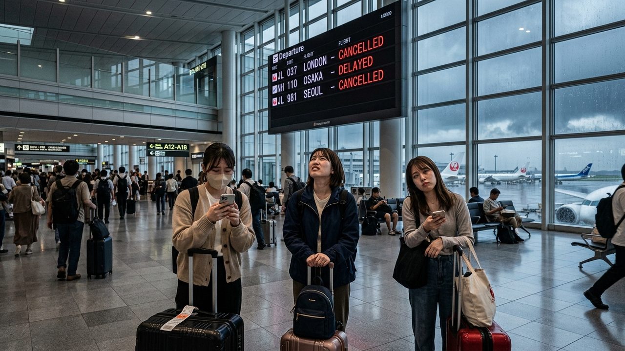
Image generated by AI
[Tokyo, June 26, 2026] — Japan is currently navigating a high-risk travel disruption window as two tropical systems, Severe Tropical Storm Mekkhala and Tropical Storm Higos, interact with the seasonal rain front. This rare atmospheric combination is triggering widespread warnings for heavy rain, landslides, and storm surges, creating significant operational risks for aviation, rail, road networks, and the MICE (Meetings, Incentives, Conferences, and Exhibitions) sector across Okinawa, Kyushu, Shikoku, Kansai, Chubu, and the Tokyo metropolitan corridors.
Shift From Wind Risk to Rain-Driven Operational Hazards
While early reports may have focused on wind intensity, industry observers note that the primary threat has shifted toward rain-driven operational instability. According to the Japan Meteorological Agency (JMA), Mekkhala has weakened below typhoon intensity, and Higos remains classified as a tropical storm. However, the interaction between these systems and the active seasonal rain belt is fueling an influx of warm, humid air, leading to saturated ground and hazardous conditions.
For the travel trade, this distinction is critical. Even without typhoon-force winds, the compound effect of heavy precipitation can paralyze infrastructure. Risks are currently highest for island airport operations, rural road access, and intermodal transport links that connect regional hubs to the primary gateways of Tokyo, Osaka, and Nagoya. Travel operators are advised to treat this as an active itinerary-management event rather than a standard weather update.
Technical Analysis of Tropical Systems Mekkhala and Higos
Precision in reporting is essential to avoid unnecessary panic while maintaining safety. Current data indicates that while both systems are named tropical cyclones in the western North Pacific basin, they do not currently meet the threshold to be classified as a "pair of typhoons."
| Official Element | Mekkhala | Higos | Travel Trade Implication |
|---|---|---|---|
| JMA Storm Number | T2607 | T2608 | Both are named tropical cyclones |
| Latest JMA Classification | Severe Tropical Storm | Tropical Storm | Not currently classified as typhoons |
| Central Pressure | 985 hPa | 1002 hPa | Mekkhala is the more dominant system |
| Max Wind Near Centre | 30 m/s (55 kt) | 18 m/s (35 kt) | Significant risk to aviation and marine sectors |
| Primary Japan Risk | Heavy rain, flood, landslide | Track uncertainty | Combined systems increase forecast volatility |
The JMA maintains a strict hierarchy: a tropical storm is below a severe tropical storm, which in turn is below the typhoon threshold (64 kt). For visitors, this means the danger is less about wind-blown debris and more about terrain instability and transport failure.
Infrastructure Risks: Heavy Rain and Landslide Warnings
Official warnings issued on June 26 highlight severe hazards for southern territories and island regions. In Japan, the layered warning system—ranging from "Advisories" (possible damage) to "Warnings" (serious disaster) and "Emergency Warnings" (extremely serious hazards)—is the gold standard for B2B planning.
| Hazard Channel | Impact on Travel | Likely Affected Operations |
|---|---|---|
| Heavy Rain | Disrupts road/rail and ground handling | Day tours, airport transfers, walking tours |
| Landslides | Slope instability on coastal/mountain routes | Kyushu coach tours, hot spring areas, national parks |
| River Flooding | City mobility and regional rail disruptions | Urban transfers, convention mobility, road bridges |
| Storm Surge | Coastal exposure and port limits | Okinawa/Amami ferries, cruise port calls |
| Poor Visibility | Air operation delays | Domestic flights, international connections |
Aviation Disruptions Spreading to Tokyo Gateways
The sensitivity of Japan's aviation network means that disruptions in the southwest quickly ripple toward major hubs. Flight tracking data and airline notices indicate that the impact is expanding from regional island strips to the nation's largest international gateways.
Japan Airlines (JAL) has issued notices for June 26 affecting numerous airports, including Naha, Miyazaki, Kagoshima, Tanegashima, Yakushima, Kikaijima, Amami Oshima, Tokunoshima, Okinoerabu, Yoron, Kitadaito, Minamidaito, Kumejima, Miyako, Tarama, Ishigaki, and Yonaguni. Crucially, JAL has also flagged Tokyo Haneda and Tokyo Narita for June 27, signaling that knock-on effects are reaching the capital.
Similarly, Jetstar Japan is monitoring operations at Naha, Miyazaki, Kochi, Kansai, Chubu, and Narita through June 28. ANA has also reported tightening availability for routes involving Miyako, Naha, and Ishigaki. Haneda Airport has already seen delays and cancellations starting June 25, with some terminal retail hours adjusting accordingly.
Rail and Road Network Stress Tests
While the Shinkansen (bullet train) network is renowned for its resilience, extreme rainfall often triggers speed restrictions, short-term suspensions, or severe station congestion. The "last-mile" connection—the link between the station and the hotel or venue—is where the highest risk resides.
NEXCO Central reports indicate a volatile situation where road closures are being lifted in some sectors while new wide-area closures are being anticipated for June 27. This fluidity makes coach travel particularly risky, as a route that is open in the morning may be closed by the afternoon.
| Surface Transport | Operational Risk | Recommended Trade Action |
|---|---|---|
| Expressways | Temporary and renewed closures | Maintain flexible coach departures |
| Regional Rail | Speed controls and suspended segments | Build buffer time into Kyushu/Kansai itineraries |
| Airport Buses | Road flooding and restrictions | Avoid tight connection windows |
| Rental Cars | Surface water and poor visibility | Delay non-essential rural driving |
| Ferries | High seas and port handling limits | Implement rebooking clauses for island trips |
| MICE Shuttles | Venue access and delegate delays | Prepare indoor alternatives and staggered plans |
Contingency Planning for MICE and Corporate Travel
The timing of these storms coincides with a peak window for corporate meetings and incentive programs in Tokyo, Osaka, Kyoto, Nagoya, and Fukuoka. For the MICE sector, the disruption creates four primary vulnerabilities: fragmented delegate arrival times, delayed airport-to-hotel transfers, the cancellation of off-site cultural excursions, and cargo delays for exhibitors.
Organizers are urged to adopt layered contingency plans, including flexible rooming lists, remote speaker options, and "wet-weather" venue mapping to ensure business continuity.
Economic Implications for Japan's Tourism Sector
With May 2026 arrivals exceeding 3.55 million according to JNTO data, Japan is operating at a high-volume capacity. This scale means that even a brief weather event can impact thousands of bookings simultaneously. For travel agencies, this translates into a surge in re-accommodation requests and refund claims.
| Tourism Segment | Short-term Effect | Strategic Implication |
|---|---|---|
| International FIT | Flight delays; hotel check-in shifts | Need for app-based updates and flexible tools |
| Group Travel | Altered coach routes and sightseeing | Tour directors need itinerary autonomy |
| Luxury Travel | Timing risks for private transfers/ryokans | Demand for high-touch concierge support |
| Cruise/Ferry | Altered shore excursions | Need for inland backup plans |
| MICE Travel | Fragmented arrival patterns | Value of hybrid-ready event design |
| Domestic Air | High cancellation risk on island routes | Rebooking automation becomes decisive |
Why This Matters: The Evolution of Weather-Resilient Tourism
The current interaction of Mekkhala and Higos serves as a critical case study in the evolution of "weather-resilient" travel design. As Japan continues to attract record-breaking inbound volumes, the industry's ability to maintain a seamless experience during seasonal volatility becomes a competitive advantage.
This event demonstrates that the modern travel risk is no longer just about the "storm" itself, but about the interconnectedness of the supply chain. A rain warning in a rural prefecture can trigger a cascade of failures: a closed road leads to a missed train, which leads to a missed domestic flight, ultimately resulting in a missed international connection at Narita or Haneda.
For the aviation and hospitality sectors, the shift toward real-time, data-driven communication—moving away from sensationalist "typhoon" headlines toward specific "operational risk" alerts—is essential. The ability to pivot itineraries dynamically without compromising the traveler's experience will define the next era of premium tourism in East Asia.
Related Travel Guides
Disclaimer
This article is for informational and educational purposes only. It does not constitute legal, financial, or professional advice. While we strive to provide accurate and up-to-date information, travel policies, regulations, and conditions change rapidly. Always verify information with official sources before making travel decisions. Nomad Lawyer makes no representations about the accuracy, reliability, completeness, or suitability of the information provided. Readers should consult qualified professionals for advice specific to their circumstances. The views expressed in this article are those of the author and do not necessarily reflect the views of Nomad Lawyer.

Kunal K Choudhary
Co-Founder & Contributor
A passionate traveller and tech enthusiast. Kunal contributes to the vision and growth of Nomad Lawyer, bringing fresh perspectives and driving the community forward.
Learn more about our team →