Guatemala Tourism Shifts Beyond Acatenango as Volcano Alerts Reshape Big Highland Travel

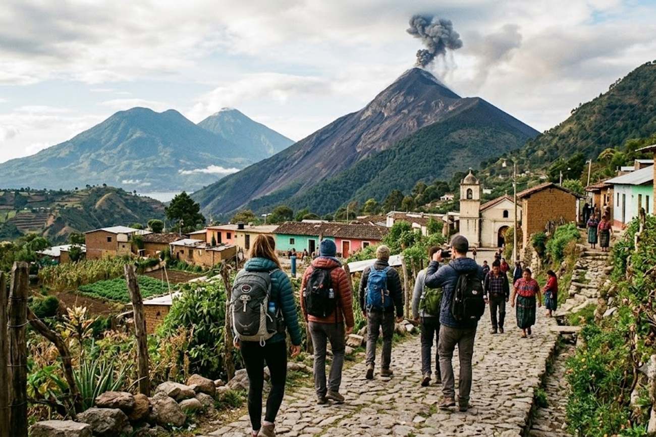
Image generated by AI
Are you planning a high-altitude trek in Guatemala this September? You need to know that the traditional approach to Volcán de Fuego and Acatenango has shifted toward a strict "observation-only" model due to increased volcanic activity.
The Shift in Volcanic Access and Safety Protocols
The landscape for adventure travel in Guatemala is undergoing a significant safety reset. As of mid-September, the national disaster management agency, CONRED, has implemented stricter controls over access to the country's most active peaks. The primary driver is the resurgence of activity at Volcán de Fuego and the Santiaguito volcano, which has forced a transition from "summit-seeking" to "safe-distance observation."
For those targeting the Acatenango trek—the most famous route for viewing Fuego's eruptions—the rules have changed. In August, CONRED personnel were stationed directly at the Acatenango entrance to block climbers from ascending during peaks of instability. Current official guidelines now actively discourage movement toward the high private camps on Acatenango. The objective is to prevent tourists from entering high-risk zones where volcanic material or pyroclastic flows could pose a lethal threat.
The activity levels are precise: Volcán de Fuego has been recording between five and eight weak to moderate explosions every hour. These events are pushing ash columns up to 4,800 metres above sea level. Furthermore, authorities have documented incandescent pulses and avalanches of volcanic material moving through various ravines, making the immediate vicinity of the crater an exclusion zone.
Route and Schedule Details
While traditional summit access to active cones is restricted, alternative observation routes and highland destinations remain operational. The following table outlines the current status of primary volcanic and mountain sites.
| Route / Destination | Primary Activity | Access Status | Typical Observation Target | Risk Level |
|---|---|---|---|---|
| Acatenango | Trekking/Camping | Restricted (No High Camps) | Volcán de Fuego | Moderate to High |
| Volcán de Fuego | Direct Ascent | Prohibited | Crater Interior | Extreme |
| Santa María | Hiking/Summit | Open | Santiaguito Volcano | Moderate |
| Santiaguito | Direct Ascent | Prohibited | Lava Domes | Extreme |
| Chicabal | Cultural Hike | Open | Crater Lake/Forest | Low |
| Quetzaltenango (Xela) | Base Hub | Open | Regional Highlands | Low |
Traveler Logistics Guide
Navigating the Guatemalan highlands during a period of volcanic unrest requires a different tactical approach than a standard trekking holiday. Here is the step-by-step logistics strategy for September arrivals.
1. Booking and Operator Vetting Avoid operators promising "summit access" to Fuego or "private high camps" on Acatenango. Any guide claiming they can bypass CONRED checkpoints is operating illegally and putting your safety at risk. Ensure your tour operator coordinates directly with INGUAT (the Guatemalan Tourism Institute) to verify which trails are currently open.
2. Optimal Layover and Base Selection Instead of centering your entire trip in Antigua, split your time between Antigua and Quetzaltenango (Xela). Xela serves as a superior logistics hub for the western highlands, providing safer access to the Santa María volcano and the sacred lake of Chicabal. This diversification reduces your reliance on the volatile Acatenango-Fuego corridor.
3. Gear and Health Precautions With ash columns reaching 4,800 metres, air quality can deteriorate rapidly. Pack a high-quality N95 mask to protect your lungs from volcanic ash. Because rainfall in September can mobilize volcanic debris into lahars (mudflows), ensure your footwear has deep lugs for unstable terrain and that you have waterproof gear for sudden highland storms.
4. Customs and Local Regulations Be prepared for spontaneous checkpoints. CONRED personnel have the authority to turn back hikers at the trailhead based on real-time seismic data. Do not argue with these officials; their instructions are based on immediate telemetry of incandescent blocks and degassing patterns.
5. Timing Your Visit If you are traveling around 15 September for Independence Day, expect heavy domestic traffic in the Altiplano. Book your ground transport between Antigua and Xela at least two weeks in advance, as domestic tourists flood the highlands to celebrate Maya culture and national heritage.
Regional Connectivity Impact
The current restrictions are effectively decentralizing Guatemalan tourism. For years, the "Acatenango experience" dominated the adventure market, creating a bottleneck of tourists in a high-risk zone. The current safety reset is pushing travelers toward the western highlands, specifically the Quetzaltenango region.
This shift is benefiting destinations like Chicabal, where the focus is on the intersection of nature and Maya ancestral traditions rather than adrenaline-fueled eruption watching. By moving the tourist flow toward Santa María, travelers can still observe the activity of Santiaguito—which is currently producing one to three weak to moderate explosions per hour—but from a distance that adheres to official safety margins.
Furthermore, the timing of the September Independence celebrations is integrating cultural tourism with adventure travel. The Altiplano, including Chichicastenango and Xela, is seeing an increase in itineraries that combine textile markets and gastronomy with low-risk mountain hiking. This evolution transforms the region from a "volcano destination" into a "highland corridor," where physical activity is balanced with cultural immersion.
FAQ: Guatemala Volcano Transit 2024
Do I need a special permit to hike Acatenango? While basic entry is managed by local guides, you must follow CONRED's real-time access rules. If the volcano is in a high-activity phase, no permit or guide can grant you legal access to restricted high camps.
Can I still see Volcán de Fuego erupting? Yes, but only from authorized observation points. Direct ascents of Fuego are prohibited. The safest way to view eruptions is from the lower, approved slopes of Acatenango or other designated safe zones.
How does the weather in September affect volcanic safety? September rainfall is a significant risk factor. Rain can trigger lahars (volcanic mudflows) by mobilizing accumulated ash and rock, making ravines and valley floors dangerous even if the volcano is not actively erupting.
Is Santiaguito safe to visit? Direct access to the Santiaguito cone is prohibited due to degassing and pyroclastic flows. The recommended logistics strategy is to hike the Santa María volcano to view Santiaguito from a safe distance.
Prioritize the view over the summit; the mountains will still be there when the ash settles.
#Acatenango2024 #VolcanDeFuego #CONRED #QuetzaltenangoTransit #GuatemalaHighlands #SantiaguitoSafety
Related Travel Guides
- Amsterdam Aligns Paris and More with Surging Oil Prices Affecting Hotel Price Hikes Creating Conundrum
- Brazil Keeps Pace With Argentina as Hotel Investment in the Americas Fuels a New Chapter for Emerging Destinations
- PriceTravel Holding And Mangia’s Hotels Create A Powerful New Travel Network Connecting Italy With Global Travellers
This article is for informational purposes. Flight routes, passenger regulations, visa rules, and transit advisories are subject to change by airlines and aviation authorities. Readers are advised to verify schedules and travel documentation with relevant carriers and border agencies before departure.
Related Stories

Marriott Unveils 2026 Holiday and New Year Programmes Across 11 Luxury Resorts in the Americas
EU Probes Booking.com Under Digital Services Act Over Fake Hotel Listings, Hijacked Reservations, and Search Ranking Transparency