
Ecuador El Niño Flooding Disrupts Mainland Travel as Galápagos Tourism Rebounds with Normal Flights and Cruises

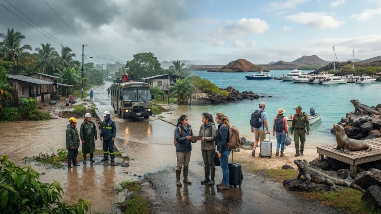
Severe El Niño-induced torrential rainfall has triggered river overflows, flash flooding, and transport disruptions across multiple coastal and low-lying provinces of mainland Ecuador, while tourism operations across the Galápagos Islands have largely returned to normal following late-October weather disruptions. Emergency authorities, including the National Secretariat for Risk Management (SNGR) and the National Institute of Meteorology and Hydrology (INAMHI), have issued ongoing flood alerts and weather advisories for Guayas, Los Ríos, Manabí, and Esmeraldas after riverbanks burst in Milagro and Babahoyo. In contrast, airline flights into Baltra and San Cristóbal, inter-island ferries, liveaboard cruises, and main transit corridors across Santa Cruz Island are operating on regular schedules, though park authorities maintain precautionary access restrictions on several sensitive ecological visitor sites.
The unfolding weather emergency highlights a sharp geographical divergence in travel conditions across Ecuador. On the mainland, prolonged precipitation associated with the Pacific El Niño phenomenon has saturated river catchments along the western littoral plain, causing mudslides along Andean transit highways and flooding key agricultural corridors. Conversely, the Galápagos archipelago—located approximately 1,000 kilometers (600 miles) off the mainland coast—has largely recovered from an isolated storm system that affected Santa Cruz Island on October 30 and 31. For international travelers and tour operators, understanding the distinct operational realities of mainland transit corridors versus island ecotourism hubs is essential for planning itineraries safely and avoiding unnecessary cancellations.
========================================================================================
ECUADOR EL NIÑO WEATHER IMPACT & TRAVEL STATUS SCORECARD (NOVEMBER 2026)
========================================================================================
Region / Jurisdiction             Current Operational Status        Primary Travel Impact
----------------------------------------------------------------------------------------
Mainland Coastal Plain (Guayas)   Red Alert / Active River Floods   Milagro River overflow; delays
Mainland Agricultural (Los Ríos)  High Flood Alert / Saturated Soil Babahoyo rural road washouts
Mainland Northwest (Esmeraldas)   Weather Warning / Heavy Rains     Localized flash flood hazards
Mainland Central (Santo Domingo)  Heavy Rain Advisory / Mudslides   Mountain corridor caution
Galápagos Aviation (Baltra / GPS) Fully Operational                 Normal commercial flight links
Galápagos Aviation (San Cristóbal)Fully Operational                 Scheduled inter-island flights
Galápagos Road Corridors          Baltra–Itabaca–Puerto Ayora Open  Normal bus & ferry transfers
Galápagos Marine Operations       Cruises & Day Tours Active        Liveaboards operating to plan
Protected Visitor Site Reopened   Playa El Garrapatero (Santa Cruz) Inspected & open to tourists
Protected Visitor Sites Closed    Las Grietas, El Chato, Puntudo    Precautionary trail safety holds
San Cristóbal Visitor Sites ClosedPuerto Chino, Playa Baquerizo     Drainage & trail maintenance
Isabela Visitor Site Closed       The Wetlands (Humedales)          Precautionary flooding hold
National Cocoa Sector Output      Projected ~7.0% Harvest Drop      Transport & processing delays
========================================================================================
Source: National Secretariat for Risk Management (SNGR) & Galápagos National Park (2026).
========================================================================================
The Dual Travel Reality: Contrasting Mainland Flooding with Island Normalcy
International travelers arriving in Ecuador frequently combine high-altitude Andean culture in Quito or Cuenca with wildlife expeditions in the Galápagos Islands, often passing through the coastal aviation hub of Guayaquil. However, current meteorological conditions demand that visitors evaluate each segment of their journey independently.
Mainland coastal Ecuador is currently bearing the brunt of a declared El Niño event. Warmer-than-average sea surface temperatures in the eastern equatorial Pacific Ocean have energized the Intertropical Convergence Zone, generating repeated waves of deep atmospheric moisture across the Guayas, Babahoyo, and Daule river basins. The National Secretariat for Risk Management (SNGR) declared a national red alert in August 2026, and emergency agencies have since recorded thousands of localized weather incidents, including damaged bridges, inundated highways, and submerged residential sectors.
In stark contrast, the Galápagos Islands operate under a separate microclimate governed by oceanic currents. While the archipelago experienced an intense, localized precipitation event on October 30 and 31 that temporarily halted flights at Seymour Airport on Baltra Island and flooded low-lying streets in Puerto Ayora, municipal and park crews restored essential services within days. By mid-November, the islands' core tourism infrastructure was functioning normally, even as mainland river plains continued to face acute flood emergencies.
========================================================================================
MAINLAND LOWLANDS VS. GALÁPAGOS ARCHIPELAGO OPERATIONAL COMPARISON
========================================================================================
Operational Feature       Mainland Coastal Provinces (Guayas/Los Ríos) Galápagos Archipelago
----------------------------------------------------------------------------------------
Aviation Infrastructure   Guayaquil (GYE) open; local road delays     Baltra & San Cristóbal open
Highway & Ground Transit  Active river overflows, bypasses in place   Main island arteries fully open
Marine & Water Logistics  River navigation hazardous; debris flows    Coastal cruises & ferries normal
Visitor Attraction Access Localized municipal closures in flood zones  Core park open; 6 sites restricted
Primary Traveler Concern  Road washouts, mudslides, urban flooding    Trail safety on specific paths
Emergency Alert Level     National Red Alert (SNGR active)            Normal operations under monitoring
========================================================================================
Mainland Infrastructure in Crisis: River Overflows and Highway Disruptions
The most acute travel disruptions on the Ecuadorian mainland are concentrated in the agricultural and riverine plains of the coastal provinces. Between November 12 and 14, torrential rainfall centered over Guayas province caused the Milagro River to burst its banks, inundating neighborhoods, commercial districts, and connecting roadways in Milagro canton. Emergency assessment teams requested drone mapping and satellite analysis to identify stranded communities and plan bypass routes for heavy traffic.
In neighboring Los Ríos province, the provincial capital of Babahoyo and adjacent cantons experienced repeated river surges as runoff from the western slopes of the Andes converged into the lowlands. The rising waters have compromised rural bridges, flooded secondary highways, and slowed the transit of passenger buses connecting coastal agricultural communities with the commercial center of Guayaquil.
========================================================================================
MAINLAND PROVINCIAL IMPACT & WEATHER ADVISORY DIRECTORY
========================================================================================
Province          Key Affected Centers       Reported Hazard & Travel Guidance
----------------------------------------------------------------------------------------
Guayas            Milagro, Guayaquil, Daule  Milagro River overflow; urban waterlogging; slow transit
Los Ríos          Babahoyo, Quevedo, Vinces  River surges; secondary road damage; agricultural washouts
Manabí            Portoviejo, Chone, Manta   Localized drainage bottlenecks; variable canton rain
Esmeraldas        Quinindé, Esmeraldas City  Saturated hillsides; river swelling; mudslide watch
Santo Domingo     Santo Domingo de los Colorados Andean slope runoff; heavy downpours on highway passes
Loja (Southern)   Catamayo, Loja Valley      Localized slope erosion on southern mountain highways
========================================================================================
Source: Instituto Nacional de Meteorología e Hidrología (INAMHI Advisory, November 2026).
========================================================================================
The National Institute of Meteorology and Hydrology (INAMHI) issued urgent bulletins forecasting further heavy rainfall across Esmeraldas, Guayas, Los Ríos, Santo Domingo de los Tsáchilas, and parts of Loja. The agency warned that saturated soil conditions significantly elevate the danger of sudden landslides along mountain highways connecting the coastal lowlands to the Andean highlands, including the primary arteries linking Guayaquil with Cuenca and Riobamba.
Travelers moving across mainland Ecuador should anticipate delays, verify road conditions with the Integrated Security Service ECU 911 before departure, and avoid attempting to drive through moving floodwaters.
Agricultural Exposure: Cocoa Supply Chains and Economic Repercussions
Beyond passenger mobility, prolonged El Niño flooding is placing severe pressure on Ecuador’s agricultural economy. The country is the world’s leading producer and exporter of fine aroma cocoa (Cacao Nacional), an essential raw material for the global gourmet chocolate industry. The vast majority of cocoa plantations are located in the flood-affected lowland provinces of Guayas, Los Ríos, and Manabí.
Excessive water accumulation and poor soil drainage create multiple challenges for cocoa farmers:
- Root Rot and Fungal Outbreaks: Prolonged waterlogging deprives root systems of oxygen and creates optimal conditions for fungal diseases, notably frosty pod rot (Moniliophthora roreri) and black pod (Phytophthora palmivora), which can destroy pods before harvest.
- Harvest and Fermentation Delays: Persistent rains prevent farmworkers from entering muddy fields to harvest ripe pods and disrupt the traditional sun-drying process essential for developing flavor profiles.
- Logistical Blockages: Flooded rural feeder roads prevent harvested beans from reaching regional aggregation centers and processing facilities in Guayaquil.
========================================================================================
COCOA PRODUCTION & SUPPLY CHAIN EXPOSURE MATRIX
========================================================================================
Vulnerability Factor      Agricultural Consequence          Economic & Travel Ramification
----------------------------------------------------------------------------------------
Excess Soil Saturation    Fungal spore proliferation (Monilia)Estimated ~7.0% crop loss projection
Impassable Feeder Roads   Harvested beans trapped on farms  Higher transport costs & delays
Drying Yard Inundation    Fermentation molds & quality loss Reduced export volumes at Guayaquil
Rural Farm Livelihoods    Lost day-labor wages in cantons   Economic strain across agrarian hubs
Agro-Tourism Disruption   Farm visits & tastings suspended  Hacienda tours paused in Los Ríos
========================================================================================
Agricultural economists estimate that seasonal cocoa production could contract by approximately 7 percent if floodwaters do not recede swiftly. While this figure represents an industry projection rather than a finalized census, the disruption threatens rural employment and agro-tourism programs across coastal haciendas.
The Galápagos Rebound: Restoring Tourism Operations in the Archipelago
While mainland authorities manage river overflows, the tourism industry in the Galápagos Islands has demonstrated remarkable resilience. The archipelago experienced its own severe weather emergency on October 30 and 31, when an unseasonal subtropical storm dropped unprecedented volumes of rain over Santa Cruz Island.
The storm overwhelmed local storm drains in Puerto Ayora, inundating businesses and homes, while rock and mud debris temporarily blocked sections of the primary paved highway connecting the urban center to the Itabaca Channel and Seymour Airport on Baltra Island. Flights were briefly suspended as ground crews inspected runways and taxiways.
========================================================================================
GALÁPAGOS INFRASTRUCTURE RECOVERY TIMELINE (OCTOBER–NOVEMBER 2026)
========================================================================================
Date             Operational Milestone              Field Reality & Passenger Impact
----------------------------------------------------------------------------------------
30–31 Oct 2026   Severe storm hits Santa Cruz       Urban flooding in Puerto Ayora; Baltra halted
01–03 Nov 2026   Emergency clearing & inspections   Baltra highway cleared; flight operations resume
04 Nov 2026      Latin American Travel Assn (LATA)  Confirms normal airline, boat & cruise schedules
08 Nov 2026      National Park initial advisory     Precautionary restrictions on six visitor sites
11 Nov 2026      Park status operational update     Playa El Garrapatero reopens; others evaluated
Mid-Nov 2026     Full operational normalcy          Cruises, inter-island ferries & hotels active
========================================================================================
Source: Latin American Travel Association (LATA) & Galápagos Municipal Bulletins (2026).
========================================================================================
Emergency response teams restored ground transport within 48 hours. By early November, the Latin American Travel Association (LATA), working in coordination with the Galápagos National Park Directorate (DPNG) and local hotel associations, confirmed that the tourism ecosystem had resumed normal operations:
- Commercial Aviation: Scheduled flights operated by LATAM and Avianca into Seymour Airport on Baltra (GPS) and San Cristóbal Airport (SCY) returned to complete schedule integrity.
- Highway Corridors: The 42-kilometer highway linking Puerto Ayora to the Itabaca Channel ferry terminal is fully open, ensuring transfer times between airport arrivals and town hotels remain under an hour.
- Naval Operations: Inter-island passenger catamarans, liveaboard expedition yachts, and organized day-trip dive boats are operating their published itineraries.
Prospective travelers should recognize that mainland weather news does not reflect the current operational reality of the islands.
Protected Area Management: The Dynamic Status of National Park Visitor Sites
The primary lingering effect of the late-October rainfall in the Galápagos is access management across protected visitor sites. The Galápagos National Park encompasses 97 percent of the archipelago's land area, and park rangers maintain strict protocols to prevent trail erosion, protect wildlife habitats, and ensure visitor safety following extreme weather.
Immediately following the October storm, park authorities temporarily restricted access to six high-traffic visitor locations. However, as trail assessments progress, the status of individual sites is evolving dynamically:
========================================================================================
GALÁPAGOS NATIONAL PARK VISITOR SITE OPERATIONAL STATUS DIRECTORY
========================================================================================
Island           Visitor Site Name        Current Status        Safety Assessment Rationale
----------------------------------------------------------------------------------------
Santa Cruz       Playa El Garrapatero     REOPENED (Active)     Sand clearing & road access cleared
Santa Cruz       Las Grietas (Chasm)      Temporarily Closed    Trail erosion & water clarity checks
Santa Cruz       El Chato Tortoise ReserveTemporarily Closed    Waterlogged mud trails & safety review
Santa Cruz       El Puntudo (Volcanic)    Temporarily Closed    Steep trail stability & slip hazards
San Cristóbal    Puerto Chino             Temporarily Closed    Drainage repairs along approach trail
San Cristóbal    Playa Baquerizo          Temporarily Closed    Rocky trail erosion & shoreline surge
Isabela          The Wetlands (Humedales) Temporarily Closed    Flooded boardwalks & mangrove trails
All Islands      Marine & Coastal Sites   OPEN & Operating      Snorkeling, diving & boat landings
========================================================================================
Source: Galápagos National Park Directorate (DPNG Official Field Updates, November 2026).
========================================================================================
Reopening of Playa El Garrapatero
On November 11, park officials confirmed that Playa El Garrapatero on Santa Cruz Island had safely reopened to the public. Access roads and mangrove trails leading to the pristine white-sand beach were cleared of debris, allowing visitors to view flamingos and coastal seabirds as usual.
Ongoing Precautionary Restrictions
Other popular terrestrial sites remain temporarily offline while park maintenance teams reinforce wooden boardwalks, install drainage culverts, and repair eroded volcanic paths:
- Las Grietas (Santa Cruz): The famous brackish-water volcanic fissure remains closed while engineers inspect cliff trail stability and water filtration levels.
- El Chato (Santa Cruz Highlands): Saturated highland soils have left trails waterlogged, making walking paths slippery near free-roaming giant tortoises.
- The Wetlands (Isabela): Boardwalk paths through coastal lagoons and mangrove forests west of Puerto Villamil were temporarily closed due to high water levels.
Tour operators have adapted smoothly by substituting restricted trails with accessible alternative sites, such as the Charles Darwin Research Station, Tortuga Bay, Dragon Hill, and guided zodiac explorations of coastal lava bays.
Traveler Advisory and Safety Protocol: Practical Guidance for Visiting Ecuador
For travelers planning trips to Ecuador in late 2026, managing risk requires staying informed and exercising flexibility rather than canceling journeys outright.
========================================================================================
ECUADOR TRAVEL SAFETY & CONTINGENCY PROTOCOL
========================================================================================
Travel Stage              Recommended Action                Practical Implementation
----------------------------------------------------------------------------------------
Pre-Departure Planning    Separate mainland & island itinerariesVerify regional alerts independently
Mainland Ground Transit   Avoid driving after sunset        Night rains heighten mudslide risks
River Crossing Protocol   Never ford moving floodwaters     Turn around; request police detour
Aviation Connections      Buffer layovers in Guayaquil/QuitoAllow 3+ hours for weather delays
Galápagos Excursion Prep  Check daily park ranger bulletins Guide teams will substitute open sites
Health & Hygiene Safeguards Drink only bottled or boiled water Prevent waterborne intestinal illness
Insect Protection         Apply DEET repellent regularly    Guards against coastal mosquito vectors
Travel Insurance Audit    Confirm force majeure coverage    Covers weather cancellations & reroutes
========================================================================================
- Monitor Official Information Channels: Regularly consult updates from the National Secretariat for Risk Management (SNGR) and the National Institute of Meteorology and Hydrology (INAMHI).
- Buffer Mainland Transit Schedules: When transiting between Quito, Guayaquil, or Cuenca to connect with flights to the Galápagos, allow additional buffer time. Road journeys crossing coastal lowlands or mountain passes may encounter unexpected detours or temporary lane closures.
- Reconfirm Flight Schedules: While Baltra and San Cristóbal airports are operating normally, check flight status directly with airlines (LATAM, Avianca) 24 hours prior to departure, particularly if departing from Guayaquil's José Joaquín de Olmedo International Airport (GYE) during heavy coastal rainstorms.
- Follow Park Ranger Guidance: Never attempt to enter restricted trails or closed visitor sites in the Galápagos independently. Park closures exist to preserve fragile volcanic ecosystems and protect travelers from hazardous terrain.
Comprehensive Frequently Asked Questions
What is causing the severe flooding across mainland Ecuador?
The flooding is driven by an ongoing El Niño oceanic-atmospheric event, which brings warmer Pacific Ocean waters to Ecuador’s coast, triggering prolonged, intense rainfall that has overwhelmed river basins and saturated soils.
Which provinces on the mainland are most severely affected?
The primary affected provinces are Guayas (particularly Milagro and rural Guayaquil), Los Ríos (including Babahoyo and Vinces), Esmeraldas, Manabí, and Santo Domingo de los Tsáchilas.
Are the Galápagos Islands currently closed to tourists?
No. Tourism operations in the Galápagos Islands are largely operating as normal. Commercial flights to Baltra and San Cristóbal, liveaboard cruise ships, inter-island ferries, and hotels are open and welcoming visitors.
Did the Galápagos Islands experience recent flooding?
Yes. On October 30 and 31, an intense, unseasonal rainfall storm caused localized flooding in Puerto Ayora on Santa Cruz Island and temporarily suspended operations at Baltra Airport. However, all core transport corridors were fully restored within days.
Which visitor sites in the Galápagos National Park are currently restricted?
Precautionary closures remain in place for Las Grietas, El Chato, and El Puntudo on Santa Cruz Island; Puerto Chino and Playa Baquerizo on San Cristóbal; and the Wetlands (Los Humedales) on Isabela. Playa El Garrapatero on Santa Cruz has reopened.
Can tourists still see giant tortoises if highland reserves like El Chato are closed?
Yes. Tour operators utilize accessible alternative reserves and captive breeding centers, including the Charles Darwin Research Station in Puerto Ayora and the Arnaldo Tupiza Breeding Center on Isabela.
How is mainland flooding impacting Ecuador’s cocoa industry?
Flooding in Guayas, Los Ríos, and Manabí has waterlogged plantations, heightened fungal disease risks, and blocked rural transport routes, leading industry analysts to project a potential 7 percent drop in seasonal cocoa harvest volumes.
Is it safe to travel between Guayaquil and other mainland cities?
Travel is feasible, but requires vigilance. Key highway corridors crossing river basins face localized flooding, and mountain passes are vulnerable to landslides during heavy rain. Travelers should avoid night driving and verify road statuses with ECU 911.
Are international flights into Quito and Guayaquil operating?
Yes. Mariscal Sucre International Airport in Quito (UIO) and José Joaquín de Olmedo International Airport in Guayaquil (GYE) continue to handle scheduled international and domestic flights, though localized ground delays can occur during heavy storms.
What precautions should travelers take regarding health in flooded areas?
In mainland flood zones, travelers should drink only bottled or boiled water, avoid raw street foods, and use DEET-based insect repellent to safeguard against mosquito-borne illnesses like dengue fever.
Strategic Takeaways: Managing Travel Amid Climatic Extremes
The contrast between mainland Ecuador's flood emergency and the Galápagos Islands' operational recovery provides valuable lessons in modern destination management:
========================================================================================
STRATEGIC LESSONS IN POLARIZED DESTINATION MANAGEMENT
========================================================================================
Traditional Travel Assumptions           Modern Climate-Responsive Travel Strategy
----------------------------------------------------------------------------------------
Assumes national weather affects all hubs. Distinguishes regional microclimates & island ecosystems.
Cancels entire itineraries prematurely.    Maintains unaffected legs (Galápagos) while adapting mainland.
Ignores agrarian & supply chain impacts.   Recognizes economic links between cocoa, transit & trade.
Relies on unverified social media rumors.  Follows official park ranger & emergency agency bulletins.
Forces access onto damaged park trails.    Employs adaptive rerouting to accessible wilderness sites.
========================================================================================
First, modern travelers must recognize that national weather alerts rarely apply uniformly across geographically diverse nations. While mainland river plains in Guayas and Los Ríos face acute water management challenges, the Galápagos archipelago remains fully prepared to host ecotourists on its world-renowned cruises and island tours.
Second, the proactive response of the Galápagos National Park Directorate illustrates the importance of precautionary conservation. Temporarily closing rain-damaged trails while keeping the broader park accessible protects both the fragile volcanic terrain and the physical safety of visitors.
Finally, by maintaining flexible travel arrangements, staying updated on official meteorological advisories, and respecting natural conditions, travelers can continue to experience Ecuador’s extraordinary biodiversity and cultural heritage responsibly.
Related Travel Guides
- Germany Achieves Record 389.8 Million Overnight Stays as International Visitors Fuel 100% of September Tourism Growth
- Croatia Tourism Faces Value-for-Money Pressure as Daily Adriatic Spend Reaches €162 Amid 2027 Strategic Planning Shift
- German Airports Deploy Real-Time Baggage Tracking as New EU Passenger Rights Mandate Standardized Claim Forms and Rerouting by 2027
- Germany Travel Industry Projects Major 2027 Expansion as Inbound Receipts Reach €26 Billion Driven by European and US Demand
This article is for informational purposes. Flight routes, passenger regulations, visa rules, and transit advisories are subject to change by airlines and aviation authorities. Readers are advised to verify schedules and travel documentation with relevant carriers and border agencies before departure.
Related Stories

US State Department Issues 2026 Worldwide Caution: Holiday Travel Security Alerts and Rights

Spain General Strike 2026: Nationwide Transport Collapse Hits Madrid and Barcelona Airports