
California’s Carlsbad Coastal Bluff Emergency Raises Fresh Risks for Beach Travel Ahead of El Niño
California’s Carlsbad Coastal Bluff Emergency Raises Fresh Risks for Beach Travel Ahead of El Niño

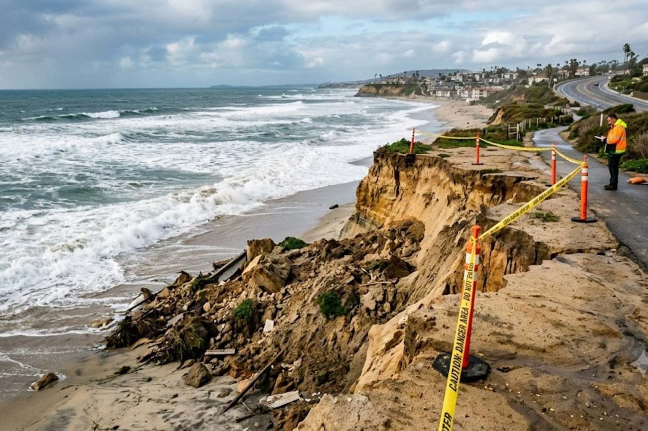
Image generated by AI
Planning a coastal trip to Southern California during the 2026-27 winter season? You need to be aware of emergency infrastructure work and potential road closures along the south Carlsbad Boulevard corridor. If you are navigating the San Diego coastline, the stability of the bluffs and the accessibility of the main coastal arteries are now subject to emergency city interventions due to severe erosion risks.
The South Carlsbad Boulevard Emergency
On 9 September 2026, the City of Carlsbad issued a formal local emergency declaration to address an unstable coastal bluff. This decision followed a series of events starting on 25 June, when city inspectors identified pavement cracks on the roadway. To determine the severity of the risk, independent geotechnical experts were commissioned to analyze the bluff's structural integrity.
The resulting geotechnical report, delivered on 8 September, concluded that the road and the supporting bluff required immediate stabilization to prevent failure. The primary solution is the extension of an existing rock revetment—a sloped structure of boulders designed to absorb the energy of incoming waves and prevent the bluff from washing away. The city intends to extend this protection by approximately 192 feet to the north of the current line.
This is not a new project but an expansion of a long-term coastal defense strategy. The city already manages a 1,270-foot revetment system, with the first 750 feet installed in 2009 and an additional 520 feet added between 2015 and 2016. The current emergency allows the city to bypass some standard timelines to secure emergency coastal permitting from the California Coastal Commission, ensuring the boulders are in place before the peak of the winter storm season.
Route and Schedule Details
For those planning transit through the area, the following table outlines the specifics of the construction and the environmental drivers behind the emergency.
| Metric | Detail | Impact/Status |
|---|---|---|
| Affected Route | South Carlsbad Boulevard | Intermittent Southbound Closures |
| Construction Zone | North of Las Encinas Creek bridge | High Activity Area |
| Revetment Extension | 192 feet | Pending Emergency Permit |
| Material Specs | 4 to 8 ton boulders | Heavy Machinery Presence |
| Existing Protection | 1,270 feet | Stable/Existing |
| El Niño Probability | >90% (Nov to Jan) | High Risk of Severe Storms |
| Primary Access Points | Palomar Airport Road to Island Way | Potential Bottlenecks |
Traveler Logistics Guide
Navigating a construction zone in a high-traffic tourist corridor requires a specific strategy. This is not a total shutdown of the coastline, but it will change how you move between attractions.
Optimal Route Planning If you are traveling southbound between Palomar Airport Road and Island Way, expect delays. Do not rely on the boulevard as your sole transit artery during peak hours. I recommend using inland alternatives to bypass the coastal strip if you are simply transitioning between cities. If you are staying in coastal accommodation, allow an extra 20 to 30 minutes for local movements.
Beach Access and Safety It is a common mistake to assume a "coastal emergency" means the beaches are closed. Most of Carlsbad's seven miles of coastline remain open. However, the area near the south Carlsbad Boulevard bluff is high-risk. You must strictly adhere to all signage. Avoid the edges of the bluffs entirely, as the pavement cracks noted on 25 June indicate that the ground is shifting. For those seeking stable sandy shores, I suggest pivoting to Tamarack State Beach or South Ponto.
Digital Monitoring and Updates Before heading out, check the local city traffic alerts. Because this is an emergency declaration, lane closures can be implemented with very little notice based on tide levels or construction needs. Use real-time GPS mapping, but be aware that narrow coastal roads offer few detour options once you are committed to the boulevard.
Baggage and Vehicle Considerations If you are renting a vehicle, be mindful that heavy construction equipment moving 4-to-8-ton boulders will be active in the area. Avoid parking in non-designated zones near the construction perimeter to prevent towing or blocking emergency access for geotechnical crews.
Regional Connectivity Impact
The instability at south Carlsbad Boulevard is a symptom of a larger climatic event. The National Oceanic and Atmospheric Administration (NOAA) has reported a very strong El Niño for the 2026-27 cycle. The data is stark: the Niño-1+2 index reached +3.4°C, and the Niño-3.4 index was +1.8°C in August. Furthermore, sea-surface temperature anomalies in the eastern equatorial Pacific have climbed above +3°C.
For the traveler, this means the entire San Diego County beach circuit is under increased pressure. The "very strong El Niño" designation—which NOAA uses instead of the colloquial "super El Niño"—suggests a greater than 90% chance of extreme weather between November and January.
This reshapes the travel experience in three ways:
- Infrastructure Fragility: You will likely see similar emergency works in neighboring coastal towns as they race to reinforce bluffs.
- Weather Volatility: Plan for sudden road closures due to flooding or debris, not just construction.
- Diversified Itineraries: Instead of a linear "beach hop" along the coast, plan your trip around "hub" beaches (like South Ponto) where you can spend more time without needing to move your vehicle frequently through potentially disrupted corridors.
FAQ: Carlsbad Coastal Transit 2026
Are the beaches in Carlsbad closed due to the emergency? No. The emergency is focused on the bluff and the roadway of south Carlsbad Boulevard. Most beaches remain open, but you must avoid the restricted bluff edges near the construction zone for your own safety.
How will my drive be affected on South Carlsbad Boulevard? Expect intermittent southbound lane closures between Palomar Airport Road and Island Way. This will likely increase travel times for those moving between coastal attractions or heading toward the Las Encinas Creek bridge.
Is this a "Super El Niño" event? NOAA officially classifies this as a "very strong El Niño." While the media may use the term "super," the technical data shows a >90% probability of a very strong event impacting the West Coast through January 2027.
Do I need to change my hotel or accommodation bookings? Generally, no. However, if your accommodation is located directly on the south end of Carlsbad Boulevard, check with the property regarding current road access and potential noise from boulder installation.
Stay alert to the tides and the traffic signs to ensure your coastal transit remains seamless.
#CarlsbadBoulevard2026 #SanDiegoCoastalTransit #NOAAElNino2027 #CaliforniaCoastalCommission #SouthCarlsbadBluff
Related Travel Guides
Disclaimer
This article is for informational and educational purposes only. It does not constitute legal, financial, or professional advice. While we strive to provide accurate and up-to-date information, travel policies, regulations, and conditions change rapidly. Always verify information with official sources before making travel decisions. Nomad Lawyer makes no representations about the accuracy, reliability, completeness, or suitability of the information provided. Readers should consult qualified professionals for advice specific to their circumstances. The views expressed in this article are those of the author and do not necessarily reflect the views of Nomad Lawyer.
Preeti Gunjan
Contributor & Community Manager
A passionate traveller and community builder. Preeti helps grow the Nomad Lawyer community, fostering engagement and bringing the reader experience to life.
Learn more about our team →