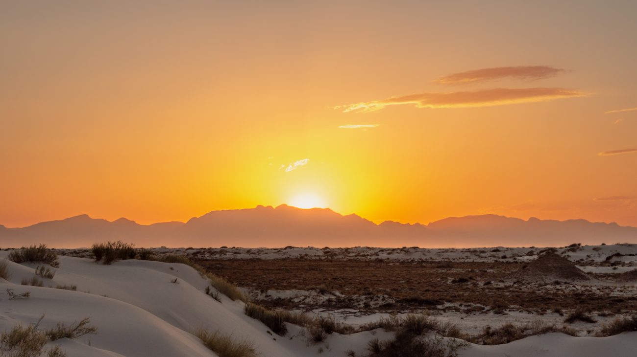
10 Best Michigan Upper Peninsula Waterfall Road Trip Stops Reddit Travelers Recommend in 2027: A Chaser's Guide to Secret Cascades and Amber Torrents

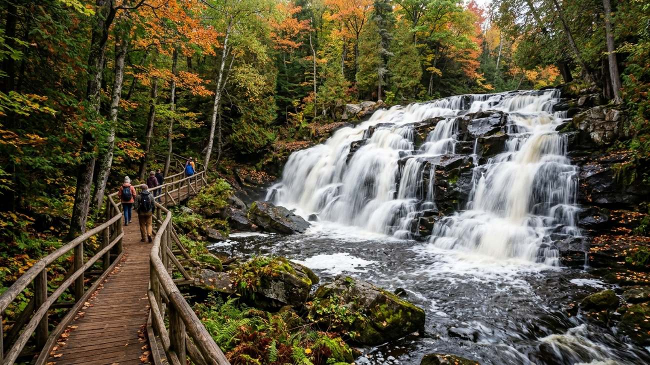
The thunderous tiered amphitheater of Bond Falls in southern Ontonagon County, framed by golden birch and sugar maples.
There is a sound you only hear north of the Mackinac Bridge. It is the hollow, thrumming vibration of cold water dropping over billion-year-old Precambrian rock, muffled by dense hemlock boughs and damp northern moss. In Michigan’s Upper Peninsula—the “U.P.”—there are more than three hundred mapped waterfalls, ranging from thundering fifty-foot curtains of root-beer-colored water to delicate silver veils sliding down stepped limestone staircases.
Chasing waterfalls in the U.P. is not about checking tourist boxes off a glossy brochure; it is about rattling down washboard forest service roads, following faint unpaved footpaths through silent cedar swamps, and feeling the icy spray of Lake Superior tributaries on your face. On r/CampAndHikeMichigan and r/roadtrip, travelers continually swap secrets about which falls justify the detour and which ones are choked with bus tours.
Having logged thousands of miles across Michigan’s northern wilderness, here are the 10 best Upper Peninsula waterfall road trip stops Reddit travelers recommend for 2027, paired with practical hiking notes, vehicle advice, and local backroad lore.
1. Bond Falls, Ontonagon County: The Tiered Basalt Masterpiece
Bond Falls tumbling over dark basalt rock shelves along the Middle Branch of the Ontonagon River.
If you ask seasoned Yoopers to name the single most aesthetically pleasing waterfall in the entire Upper Peninsula, nine out of ten will point you toward Bond Falls, located on the Middle Branch of the Ontonagon River just east of Paulding. Unlike sheer vertical plunge waterfalls that drop into inaccessible chasms, Bond Falls is an expansive, hundred-foot-wide tiered amphitheater where the river cascades fifty vertical feet over a stair-step formation of fractured basalt.
The state park maintains an immaculate, accessible wooden boardwalk that hugs the riverbank, allowing you to walk right along the lower plunge pool where mist hangs in the cool gorge air. But the real adventure lies along the unpaved rustic footpaths that climb up the east ridge. Scrambling up through old-growth cedar roots brings you to the crest, where small subsidiary chutes and tranquil eddies reflect the brilliant yellow birch canopy above.
- The Traveler's Route: Located just off US-45 on Bond Falls Road. Pair this stop with nearby Agate Falls Scenic Site, located seven miles northwest on M-28, which plunges thirty-nine feet over shelf-like terraces of Jacobsville sandstone beneath an historic steel railroad trestle.
- Reddit Traveler Consensus: While summer weekends can be busy, r/roadtrip contributors emphasize that Bond Falls is spectacular in late September and October, when autumn foliage creates an emerald, gold, and ruby amphitheater around the rushing white foam.
2. Miners Falls, Pictured Rocks: The Roaring Sandstone Canyon Plunge
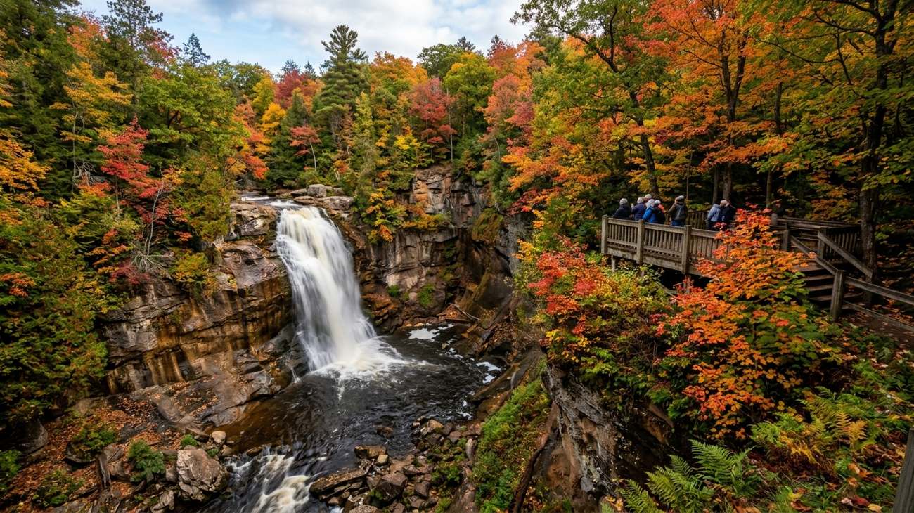 The powerful 50-foot plume of Miners Falls roaring over a sandstone ledge in Pictured Rocks National Lakeshore.
Located within the boundaries of Pictured Rocks National Lakeshore six miles north of Munising, Miners Falls delivers sheer raw power. The Miners River funnels through a narrow rock constriction before plunging fifty feet over an abrupt sandstone shelf into a deep, boulder-strewn canyon surrounded by sheer mossy cliffs.
The hike to the falls is an easy, tranquil 1.2-mile round-trip walk through a dense upland deciduous forest of beech, birch, and sugar maple. As you near the river gorge, the trail descends sixty-four steps to a sturdy cantilevered wooden viewing platform built out over the canyon rim. Standing on the lower platform, the roar of the water reverberates off the stone walls, kicking up a cool, fragrant mist scented with pine needles and wet shale.
- The Traveler's Route: Take Miners Castle Road north from H-58. After visiting the falls, continue three miles north to Miners Castle to view the famous sandstone turret formation overlooking the turquoise expanse of Lake Superior.
- Reddit Traveler Consensus: Hikers on Reddit advise visiting early in the morning (before 9:30 AM) to catch morning sunbeams cutting through the canopy mist into the gorge and enjoy the viewing deck entirely to yourself.
3. Laughing Whitefish Falls: The 100-Foot Limestone Slide Fan
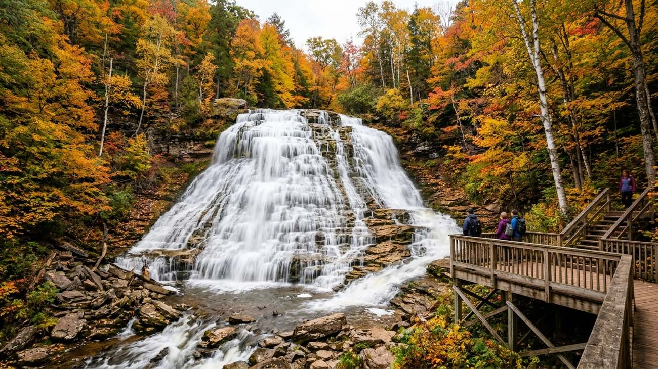 The elegant 100-foot limestone slide of Laughing Whitefish Falls fanning across stepped rock shelves.
Tucked into a quiet corner of Alger County near the community of Sundell, Laughing Whitefish Falls State Scenic Site boasts one of the tallest waterfalls in Michigan. Unlike dramatic free-falling drops, Laughing Whitefish is an architectural marvel of natural erosion: the river glides over an upper rock ledge before spreading out into a delicate, fan-shaped white bridal veil that cascades down nearly one hundred feet of stepped limestone and shale escarpment.
The half-mile trail from the quiet gravel parking area meanders under towering eastern hemlocks and ancient white pines. At the brink of the falls, wooden stairs descend alongside the rock slide all the way to the canyon floor, giving you an intimate view of the delicate rock strata and mineral deposits formed over hundreds of millions of years.
- The Traveler's Route: Reached via M-94 and Sundell Road. The last three miles follow a well-maintained gravel county road that winds past peaceful homesteads and northern hardwood woodlands.
- Reddit Traveler Consensus: Water flow at Laughing Whitefish is heaviest during spring snowmelt (May to June) and following autumn rainstorms. In late August, the flow narrows to a gentle trickle; plan your road trip for spring or late September for maximum visual drama.
4. Presque Isle River Waterfalls: The Wild Gorge of the Porcupine Mountains
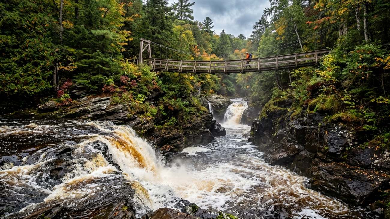 The churning amber waters of the Presque Isle River tumbling beneath the historic timber suspension footbridge.
On the western boundary of Porcupine Mountains Wilderness State Park, the Presque Isle River cuts a ferocious course through ancient black basalt, dark shale, and conglomerate bedrock before emptying directly into the icy waters of Lake Superior. In a single one-mile stretch of river, you encounter three major named waterfalls: Nawadaha Falls, Manido Falls, and Manabezho Falls.
Manabezho is the giant of the trio, a roaring fifteen-foot drop that spans more than one hundred feet across the riverbed, churning dark root-beer-colored foam against jagged rock islands. A scenic loop trail features rustic boardwalks, carved stone steps, and an historic wooden suspension bridge suspended over the river mouth. Standing on the bridge watching the tannin-stained river rush into the emerald shallows of Lake Superior is one of the premier wilderness vistas in the Midwest.
- The Traveler's Route: Located at the western terminus of South Boundary Road in the Porkies. The drive along South Boundary Road itself is a spectacular scenic corridor cutting through Michigan’s largest contiguous tract of virgin northern hardwood forest.
- Reddit Traveler Consensus: Community members on r/CampAndHikeMichigan recommend wearing sturdy trail shoes with sticky rubber soles; river spray keeps the boardwalks and shale outcrops persistently slick year-round.
5. Sable Falls, Grand Marais: Cascades into the Lake Superior Dunes
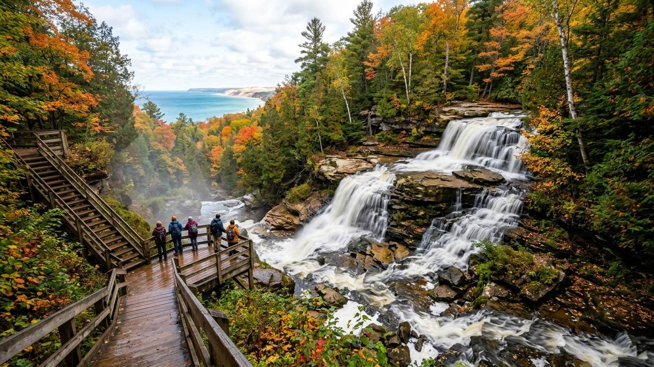 Sable Falls tumbling 75 feet through dense cedar woods towards the open waters of Lake Superior.
Marking the eastern gateway to Pictured Rocks National Lakeshore just outside the historic fishing town of Grand Marais, Sable Falls tumbles seventy-five feet over a series of stepped sandstone ledges in the shadows of the colossal Grand Sable Dunes.
The trail to the falls descends 168 wooden steps into a shaded, cool ravine thick with northern white cedar, fern fronds, and ancient yellow birch. After taking in the cascading falls from the wooden observation platforms, do not turn around. Follow the sandy footpath another quarter-mile downstream along Sable Creek. The trail opens up abruptly onto a vast, windswept cobblestone beach on Lake Superior, where the colossal 300-foot sand wall of the Grand Sable Dunes rises directly out of the water.
- The Traveler's Route: Located just off County Road H-58, one mile west of Grand Marais.
- The Local Bite: Stop at the Grand Marais Tavern or The Dunes Saloon for a hot bowl of whitefish chowder and a pint of local microbrew after hiking the staircases.
- Reddit Traveler Consensus: The climb back up the 168 steps can test your calves, but bench landings provide plenty of resting spots. The gravel beach at the mouth of the creek is one of the best locations in the U.P. to hunt for unpolished Lake Superior agates.
6. Hungarian Falls, Keweenaw Peninsula: Secret Sandstone Gorges and Copper Ruins
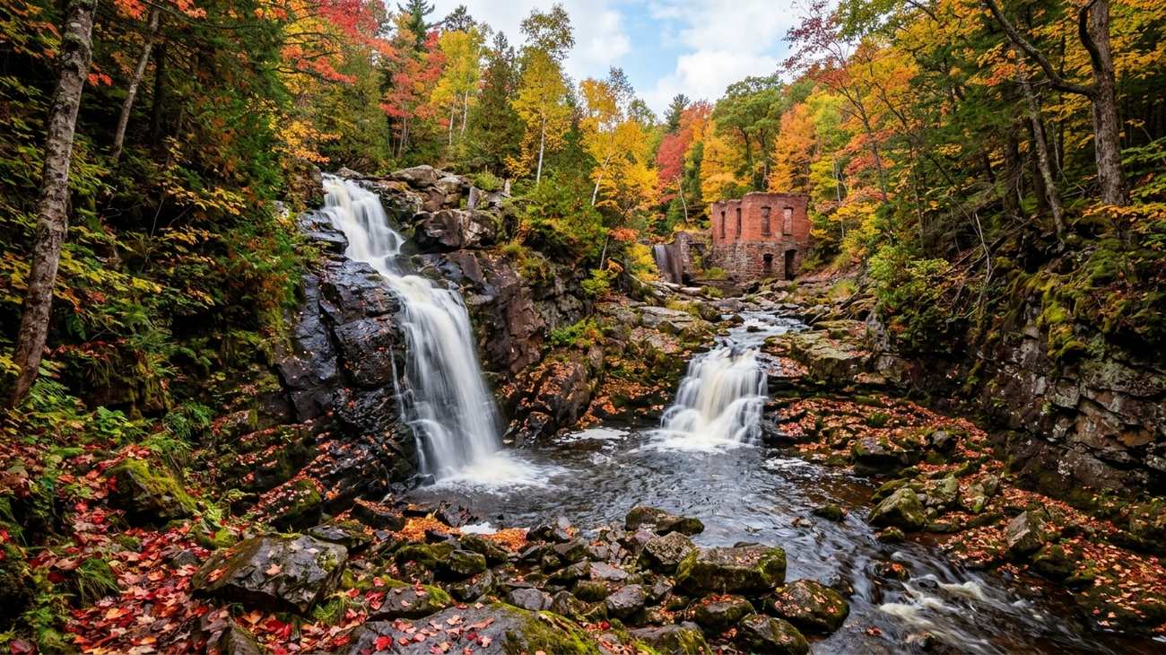 The secluded double drop of Hungarian Falls cascading over Jacobsville sandstone in the Keweenaw Peninsula.
Tucked away in the hills above Torch Lake near the village of Hubbell, Hungarian Falls is a hidden treasure beloved by Michigan Tech students and adventurous locals. This nature preserve protects a series of three distinct waterfalls—Upper, Middle, and Lower Falls—flowing through an intricate gorge carved into deep red Jacobsville sandstone.
What gives Hungarian Falls its unique, haunting character is the historical juxtaposition: perched atop the Middle Falls are the crumbling red-brick and iron ruins of an early 20th-century dam built to provide water for the historic stamp mills of the copper mining boom. The Middle Falls features a dramatic twenty-foot drop over a sheer rock wall, while the Lower Falls plunges nearly fifty feet down into a canyon offering glimpses of Torch Lake through the trees.
- The Traveler's Route: Located off Golf Course Road in Hubbell. The trail is unmarked and rugged, following dirt footpaths alongside the canyon rim.
- Reddit Traveler Consensus: On r/keweenaw, locals advise bringing a headlamp if visiting late in the afternoon, as the deep hemlock canopy plunges the gorge into twilight thirty minutes before sunset. Vehicles with standard clearance can park at the lower access turnout along Golf Course Road.
7. Tahquamenon Falls, Luce County: The Legendary Upper and Lower Amber Giants
No road trip through the eastern Upper Peninsula is complete without paying homage to the undisputed heavyweight of Michigan waterways: Tahquamenon Falls. The Upper Falls spans more than two hundred feet across and drops nearly fifty feet, funneling more than 50,000 gallons of water per second during spring runoff. Its rich amber color—often compared to dark tea or root beer—comes from cedar and hemlock tannins leaching from surrounding peatlands, creating mountains of white, frothy foam at the base that look like whipped meringue.
Four miles downstream lies Lower Tahquamenon Falls, a sprawling series of five cascading chutes ringing a central wooded island. Visitors can rent rowboats or walk across the pedestrian bridge to explore the island footpaths, getting within arm’s reach of the rushing water.
- The Traveler's Route: Located on M-123 between Paradise and Newberry. The four-mile River Trail linking the Upper and Lower Falls is one of the most rewarding woodland hikes in the state.
- Reddit Traveler Consensus: The Upper Falls viewing decks are fully paved and wheelchair-accessible, making this a popular stop. To beat the crowds, arrive before 9:00 AM, then take the four-mile foot trail down to the Lower Falls where fewer travelers venture.
8. Canyon Falls, Baraga County: "The Grand Canyon of the Upper Peninsula"
Located just off US-41 south of L'Anse, Canyon Falls is one of the easiest and most spectacular waterfall stops on the entire Trans-U.P. driving corridor. Known locally as the "Grand Canyon of the U.P.," the Sturgeon River carves a dramatic, vertical-walled box canyon out of solid Precambrian slate and granite.
A flat, scenic boardwalk trail winds through a whispering pine forest along the quiet upper river before leading out onto exposed granite ledges overlooking the main falls. Here, the river constricts and plunges thirty feet over a churning jagged chute into the deep gorge below. Downstream, the sheer slate walls rise up to eighty feet high, with dark swirling pools and rugged river bends that stretch for miles into the wilderness.
- The Traveler's Route: The trailhead begins right at a well-marked roadside rest area on US-41, making it the perfect midway leg-stretcher between Marquette and Houghton.
- Reddit Traveler Consensus: Do not stop at the main viewing deck. Continue hiking another half-mile along the unmarked dirt path downstream along the canyon rim to view secluded smaller cascades and dramatic rock formations that ninety percent of highway tourists miss.
9. Black River Scenic Byway Waterfalls, Gogebic County: The Western Five-Cascade Corridor
Running north from Bessemer out to Lake Superior along County Road 513, the Black River National Forest Scenic Byway packs more dramatic cascades into a single dead-end road than anywhere else in the Midwest. Within twelve miles, the Black River tumbles over five distinct named waterfalls: Great Conglomerate, Potawatomi, Gorge, Sandstone, and Rainbow Falls.
Each waterfall has its own unique geological personality: Great Conglomerate splits around a colossal boulder of quartz puddingstone; Gorge Falls plunges thirty feet between narrow sheer rock walls barely twenty feet apart; and Rainbow Falls drops forty vertical feet into a churning mist bowl that creates brilliant morning rainbows on sunny days.
- The Traveler's Route: Take County Road 513 north from Bessemer all the way to the Black River Harbor Recreation Area, where an historic suspension footbridge crosses the river mouth to a pristine Lake Superior driftwood beach.
- Reddit Traveler Consensus: Dedicated waterfall chasers on r/CampAndHikeMichigan rank the Black River Byway higher than Pictured Rocks for raw, uncommercialized wilderness atmosphere. Potawatomi Falls features an accessible wooden boardwalk, while Rainbow Falls requires climbing 200+ wooden steps.
10. Munising Falls & Memorial Falls: Sandstone Amphitheaters and Hidden Grottoes
Wrapping up your waterfall journey in the town of Munising itself, Munising Falls and nearby Memorial Falls showcase how water interacts with the fragile Munising sandstone formation. Munising Falls drops fifty vertical feet over a sheer sandstone bluff into a cool, shaded amphitheater where natural ferns and mosses cling to damp vertical rock faces.
Just a mile away in a quiet residential neighborhood lies the unmarked Memorial Falls (and Tannery Falls) nature preserve, managed by the Michigan Nature Association. Here, hidden footpaths wind into narrow, twin slot-like sandstone gorges where waterfalls tumble over natural rock overhangs, allowing hikers to walk directly behind the falling curtain of water.
- The Traveler's Route: Munising Falls is located right off Washington Street at the official national park visitor center. Memorial Falls is accessed via a small, easily missed dirt turnout on H-58 across from Munising Baptist Church.
- Reddit Traveler Consensus: In winter, Munising transforms into the ice-climbing capital of the Midwest. Munising Falls and the surrounding sandstone cliffs freeze into massive, fifty-foot columns of blue and yellow ice that attract ice climbers from around the globe.
Upper Peninsula Waterfall Road Trip: Planning & Route Comparison
| Waterfall Name | County / Region | Height / Type | Hike Difficulty | Drive Base | Reddit Traveler Pro-Tip |
|---|---|---|---|---|---|
| Bond Falls | Ontonagon | 50 ft / Tiered Basalt | Easy (Boardwalk) | Watersmeet / Bruce Crossing | Scramble the unpaved trail to the upper cascades for seclusion. |
| Miners Falls | Alger (Pictured Rocks) | 50 ft / Sandstone Plunge | Moderate (64 steps) | Munising | Visit before 9:30 AM to catch sunbeams filtering through the mist. |
| Laughing Whitefish | Alger / Marquette | 100 ft / Limestone Slide | Easy to Moderate | Marquette / Munising | Best in spring or late September; flow narrows in late summer. |
| Presque Isle Falls | Gogebic / Ontonagon | 3 Falls (to 25 ft) | Moderate (Boardwalk loop) | Ironwood / Silver City | Wear shoes with sticky grip; slate rocks stay slick year-round. |
| Sable Falls | Alger (Grand Marais) | 75 ft / Stepped Sandstone | Moderate (168 steps) | Grand Marais | Follow the trail downstream to the driftwood beach for agates. |
| Hungarian Falls | Houghton (Keweenaw) | 3 Falls (to 50 ft) | Moderate to Strenuous | Houghton / Hancock | Look for the historic red-brick copper dam ruins above Middle Falls. |
| Tahquamenon Falls | Luce / Chippewa | 50 ft drop, 200 ft wide | Easy (Upper) / Moderate | Paradise / Newberry | Arrive early; hike the 4-mile River Trail between Upper and Lower. |
| Canyon Falls | Baraga | 30 ft / Box Canyon Chute | Easy to Moderate | L'Anse / Baraga | Continue half a mile past the main deck to explore the slate gorge. |
| Black River Byway | Gogebic | 5 Distinct Waterfalls | Easy to Moderate | Bessemer / Ironwood | Drive all the way to Black River Harbor for Lake Superior sunset. |
| Munising Falls | Alger | 50 ft / Sandstone Amphitheater | Easy (Paved path) | Munising | Combine with Memorial Falls to walk behind a flowing water curtain. |
Essential Reddit Wisdom for UP Waterfall Chasing in 2027
1. The Mud Season and Black Fly Warnings
The waterfalls flow with the most thunderous volume in May and early June as winter snowpack melts into Lake Superior tributaries. However, early June also brings peak black fly season across wooded lowlands. Always pack a headnet and picaridin bug repellent if visiting before July 1st.
2. Vehicle Clearance and Forest Service Roads
While all ten waterfalls featured in this guide are accessible via paved state highways or well-maintained gravel roads, venturing to more obscure cascades in Baraga or Ontonagon counties requires navigating unmarked two-track logging roads. A crossover or SUV with all-wheel drive and at least 7.5 inches of ground clearance is highly recommended for peace of mind.
3. Footwear and Winter Spikes
Sandstone and river shale in the U.P. are notoriously slick, often coated in microscopic algae. Pack waterproof hiking boots with Vibram outsoles. If you plan to chase frozen waterfalls between December and April, carry microspikes or Yaktrax; spray ice transforms viewing decks and wooden steps into perilous bobsled runs.
Frequently Asked Questions
What is the best month to do an Upper Peninsula waterfall road trip?
Late September to early October is the golden window. The hardwood canopy explodes in brilliant red, gold, and orange autumn colors, summer bug hatches are completely gone, and autumn rainstorms replenish river volume after the late-summer lull.
How many days are needed for an Upper Peninsula waterfall road trip?
A comprehensive waterfall road trip spanning from Tahquamenon in the east to the Porcupine Mountains and Keweenaw in the west requires five to seven days. This pacing allows you to spend half a day in each major cluster without spending entire days behind the steering wheel.
Are dogs allowed on these waterfall trails?
Yes, the vast majority of Michigan State Parks and National Lakeshore trails featured here (including Bond Falls, Tahquamenon, and Pictured Rocks waterfall trails) welcome leashed dogs on 6-foot leashes. Always pack waste bags and clean up after your pet.
Which Upper Peninsula waterfall has the shortest walk from the car?
Miners Falls and Bond Falls both offer short, gentle walks. Bond Falls features a level, accessible boardwalk starting right at the parking area, while Canyon Falls and Tahquamenon Upper Falls feature paved paths under a quarter-mile from the trailhead.
Grab your boots, queue up an open-road playlist, and follow the sound of roaring water into the northern wild.
This article is for informational purposes. Flight routes, passenger regulations, visa rules, and transit advisories are subject to change by airlines and aviation authorities. Readers are advised to verify schedules and travel documentation with relevant carriers and border agencies before departure.
Related Stories
10 Best Keweenaw Peninsula Scenic Drives Reddit Travelers Recommend in 2027: A Highway Guide to Michigan's Copper Country
10 Best Great Lakes Circle Tour Stops Reddit Travelers Recommend in 2027: An Epic Odyssey Around North America's Inland Seas