10 Best Keweenaw Peninsula Scenic Drives Reddit Travelers Recommend in 2027: A Highway Guide to Michigan's Copper Country

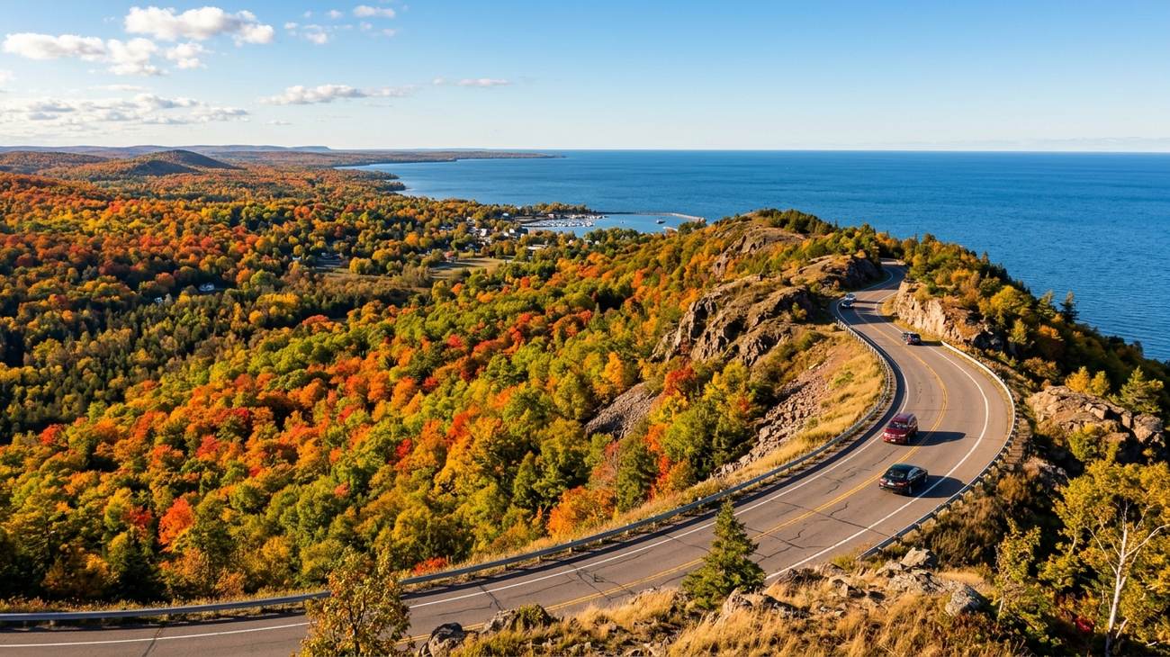
Brockway Mountain Drive cresting 720 feet above Lake Superior, looking down over the autumn hardwood canopy and Copper Harbor.
If you look at a map of Michigan, the Keweenaw Peninsula is the rugged, jagged thumb that juts fifty miles out into the deepest, coldest waters of Lake Superior. To drive here is to feel the continent slowly narrow to a point until there is nothing left ahead of your bumper except ancient volcanic basalt and a vast, unbroken freshwater horizon. This is Michigan’s Copper Country—a remote subarctic peninsula shaped by billion-year-old lava flows, a 19th-century mining rush that predated California’s gold boom, and more than two hundred inches of annual lake-effect snow.
On r/keweenaw and r/roadtrip, travelers speak of the peninsula with a reverent fondness. While most tourists turn around at Mackinac Island or Munising, those who continue north across the Portage Lake Lift Bridge find an intimate driving sanctuary where two-lane blacktop twists beneath dense hardwood canopies, past abandoned copper stamp mills, and along wave-battered red sandstone shelves.
Drawing on thousands of miles of northern exploration and community consensus, here are the 10 best Keweenaw Peninsula scenic drives Reddit travelers swear by for 2027, complete with pullout coordinates, local lore, and essential road safety advice.
1. Brockway Mountain Drive: The High Ridge Overlook Above the Inland Sea
Brockway Mountain Drive winding along the rocky mountain crest high above the deep blue waters of Lake Superior.
Rising 720 feet above Lake Superior and 1,320 feet above sea level, Brockway Mountain Drive is widely celebrated as the single most spectacular scenic mountain drive between the Black Hills and the Adirondacks. Built during the Great Depression in 1933, this 9.5-mile two-lane ridge road hugs the spine of the ancient Keweenaw Fault between Eagle Harbor and Copper Harbor.
Driving east out of Eagle Harbor, the road climbs steadily through birch and cedar before breaking out onto an open, windswept ridge crest where the earth drops away on both sides. To the south, an unbroken emerald sea of sugar maple, yellow birch, and northern hemlock fills the Lake Medora valley; to the north, Lake Superior stretches across three hundred miles of cobalt horizon. At the summit observation turnout, you can look straight down into the sheltered harbor basin where the Isle Royale Queen IV passenger ferry ties up at the village docks.
- The Traveler's Route: Enter via M-26 just west of Copper Harbor or from the Silver River cutoff east of Eagle Harbor.
- Reddit Traveler Consensus: On r/roadtrip, travelers call Brockway Mountain Drive the premier raptor migration watching point in North America. Visit in late April or May to watch hundreds of golden eagles, bald eagles, and broad-winged hawks soaring on thermal updrafts right at eye level, or visit at sunset in late September when the autumn leaves below burn with incandescent scarlet.
2. M-26 Lake Superior Coastal Byway: Basalt Ledges, Sand Bays, and Crashing Surf
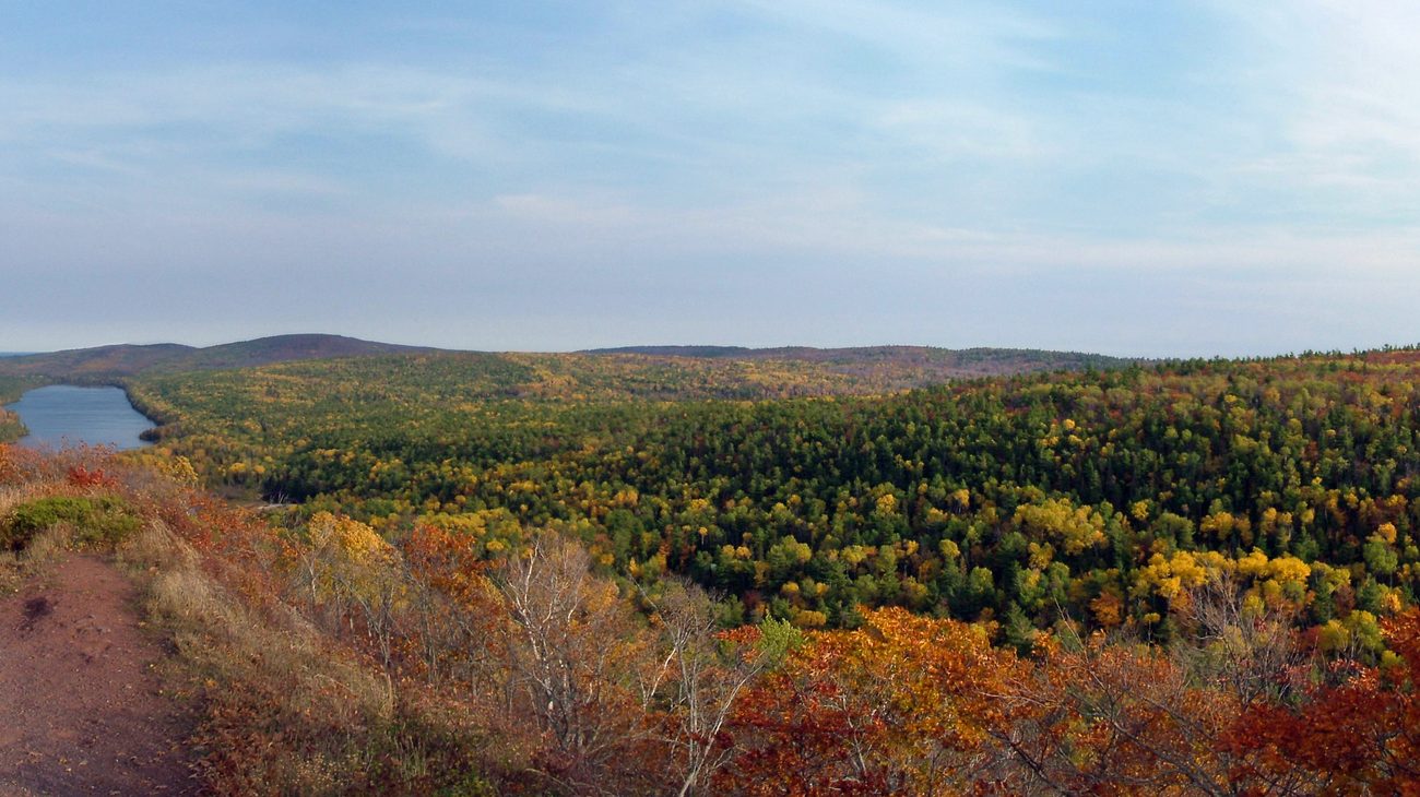 The rolling ridge line and coastal contours of the northern Keweenaw Peninsula along Lake Superior.
If Brockway Mountain Drive is about high-altitude perspective, M-26 between Eagle River and Copper Harbor is all about visceral, close-quarters intimacy with Lake Superior. For fourteen glorious miles, this state highway hugs the rocky waterline so closely that autumn storm swells routinely fling freshwater sea spray directly across your windshield.
The terrain transitions continuously: one moment you are gliding past the shifting golden dunes of Great Sand Bay, where hardy swimmers take quick polar dips in July; the next, the road cuts through jagged road cuts of dark volcanic basalt at Esrey Park, where wooden staircases lead out onto rocky headlands overlooking boiling freshwater surf.
- The Traveler's Route: Drive this route from South to North (heading towards Copper Harbor) in the late afternoon. This puts you directly on the water-facing side of the road and gives you a front-row seat to the sunset over Lake Superior.
- The Local Bite: Stop in Eagle River to visit the historic Fitzgerald’s Restaurant & Hotel (known locally as "The Fitz"), enjoying smoked brisket and an exceptional craft beer list while waves crash against the restaurant's panoramic dining room windows.
3. Eagle Harbor to Cat Harbor Loop: Maritime History and Driftwood Shores
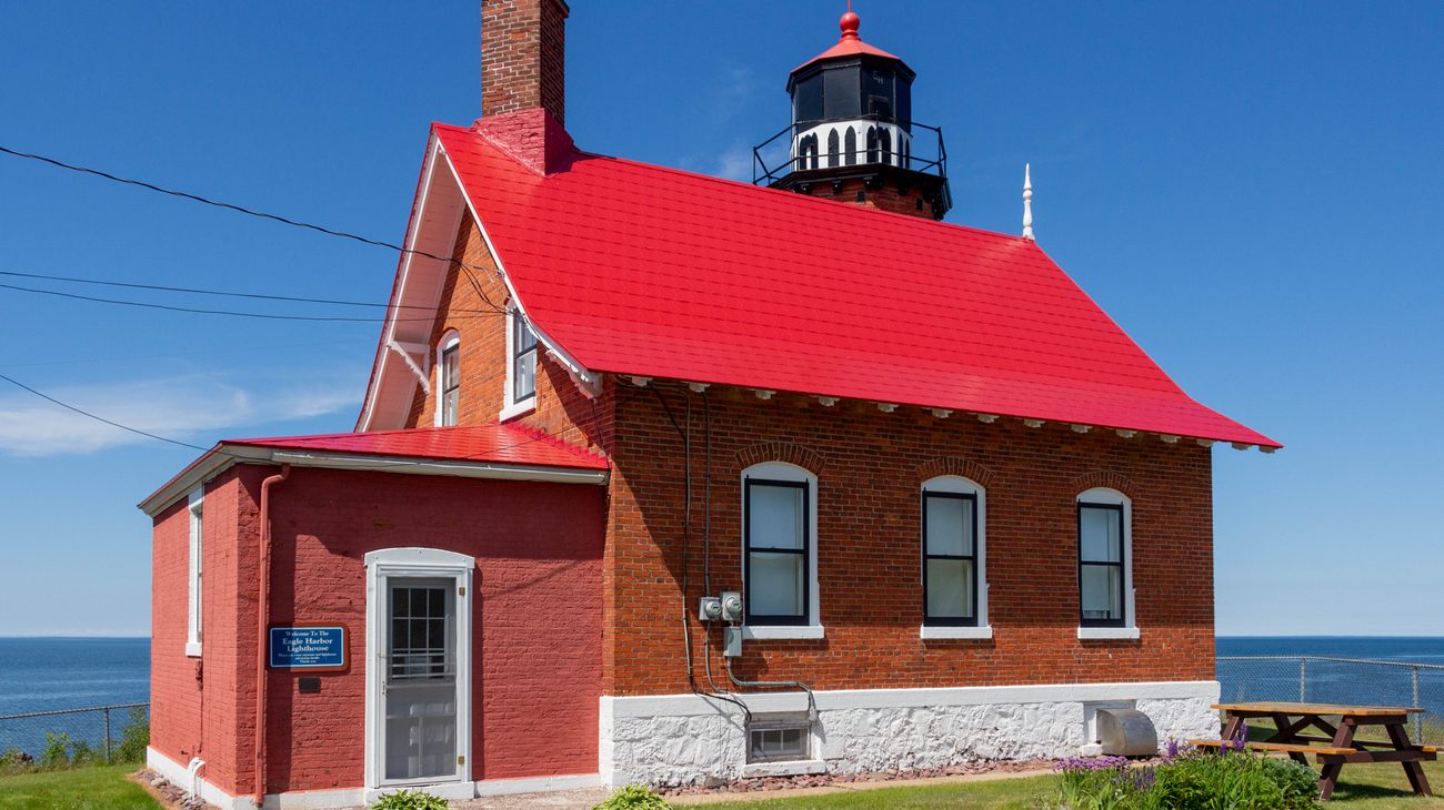 Eagle Harbor Lighthouse standing sentinel over the rocky red basalt reef at the entrance to Eagle Harbor.
The short, peaceful coastal loop connecting Eagle Harbor with Cat Harbor and the Silver River mouth provides a window into the heroic maritime past of Lake Superior. The centerpiece of the drive is Eagle Harbor Lighthouse, built in 1871 on an exposed spit of dark red conglomerate rock at the harbor entrance.
The lighthouse station remains a fully operational navigational beacon, housing three distinct museums dedicated to the Life-Saving Service, local mining history, and maritime shipwrecks. Continuing west along the shoreline road brings you to Cat Harbor, a quiet crescent of pebble beach strewn with weathered cedar driftwood, where local rockhounds spend peaceful hours searching the surf gravel for elusive Keweenaw agates, datolite, and greenstone (chlorastrolite)—Michigan's official state gem.
- The Traveler's Route: Depart Eagle Harbor via Marina Road and reconnect with M-26 near the Silver River bridge.
- Reddit Traveler Consensus: Make a quick detour to visit the Eagle Harbor Life-Saving Station, where heroic volunteers once rowed open wooden surfboats into gale-force Lake Superior blizzards to rescue sailors from grounded schooners.
4. The "Covered Drive" on US-41: The Cathedral Tunnel of Hardwood Trees
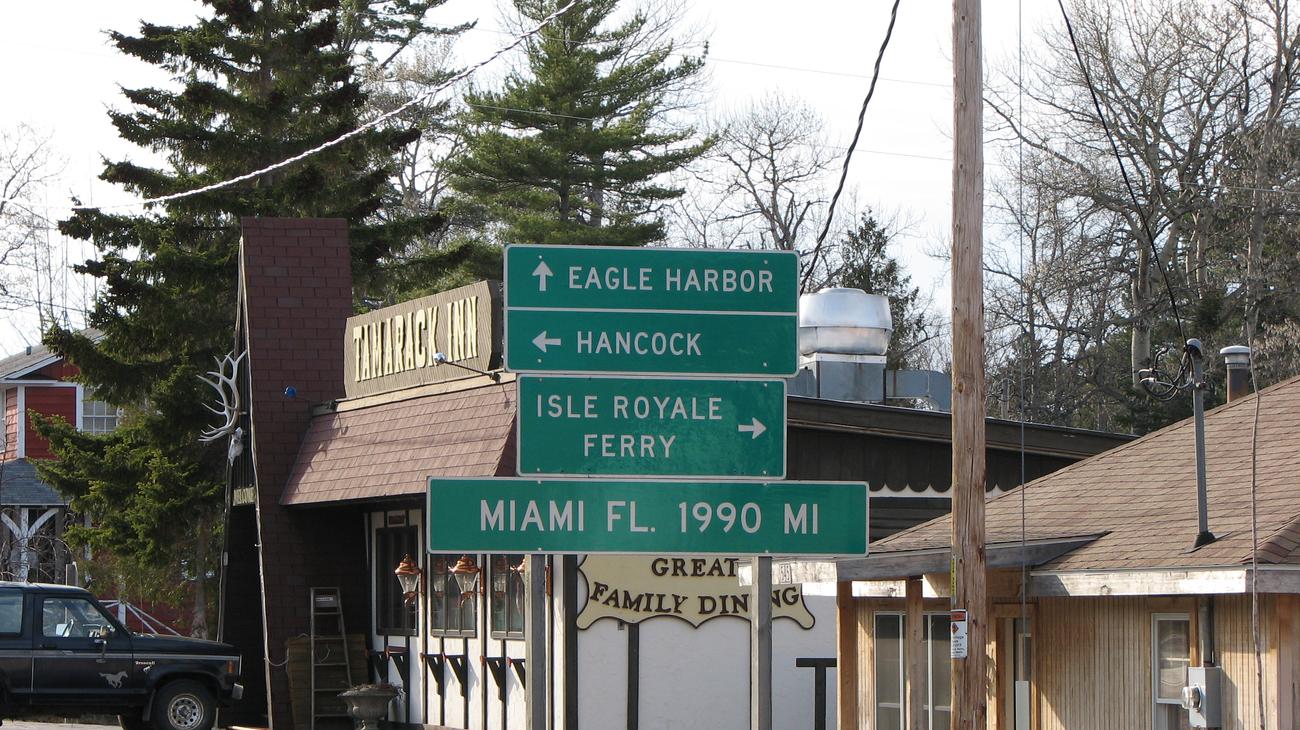 US-41 passing through the historic 'Covered Drive' tree tunnel, where mature hardwoods form a vaulted natural canopy.
Running for nearly two thousand miles from the tip of Miami, Florida, US Highway 41 reaches its northernmost, dead-end terminus in the wilderness of the Keweenaw. The final twelve-mile stretch between the historic mining settlement of Delaware and Copper Harbor is known across the Midwest simply as the Covered Drive.
Here, the highway narrows into a tranquil, two-lane ribbon flanked by soaring virgin sugar maples, paper birches, and northern red oaks whose branches interlock completely overhead, forming a vaulted natural cathedral ceiling. In peak autumn (typically the first ten days of October), driving this corridor feels like gliding through an incandescent tunnel of pure stained glass, with golden leaves fluttering down like confetti behind your car.
- The Traveler's Route: Drive this stretch at a leisurely 35 mph with your windows down to take in the sweet, earthy aroma of fallen leaves and northern balsam fir.
- Reddit Traveler Consensus: Community members on r/keweenaw emphasize that while the Covered Drive is world-famous in fall, driving it in late May—when fresh spring chartreuse leaves unfurl against white birch trunks—is just as magical and completely free of traffic.
5. Copper Harbor Village & Fort Wilkins Loop: The End of the Earth
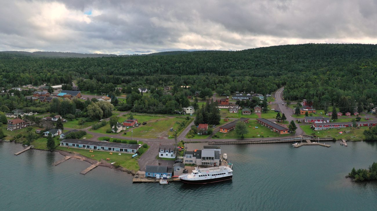 An aerial view of Copper Harbor, nestled between sheltered bays and the vast blue expanse of Lake Superior.
Arriving in Copper Harbor feels like reaching the true edge of the continent. The tiny harbor village of roughly one hundred year-round residents is surrounded by vast boreal forest and Lake Superior waters, serving as the jumping-off point for mountain bikers, hikers, and Isle Royale wilderness expeditions.
Just a mile east of downtown along US-41 lies Fort Wilkins Historic State Park, an extraordinarily well-preserved 1844 military outpost built during the chaotic early days of the copper mining boom. The scenic loop meanders between Lake Fanny Hooe and Lake Superior, passing restored wooden stockades, officer quarters, and historic copper mine shafts from the 1840s.
- The Traveler's Route: Continue to the literal dead-end cul-de-sac of US-41, marked by a humble wooden highway sign reading "US 41 Ends Here / Miami 1990 Miles."
- The Local Bite: Stop at the Jamsen’s Fish Market & Bakery right on the harbor docks at 7:30 AM for warm, flaky thimbleberry cream cheese pastries and smoked Lake Superior trout fresh from the smoker.
6. Fort Wilkins & Lake Fanny Hooe Road: Preserved Frontier Wilderness
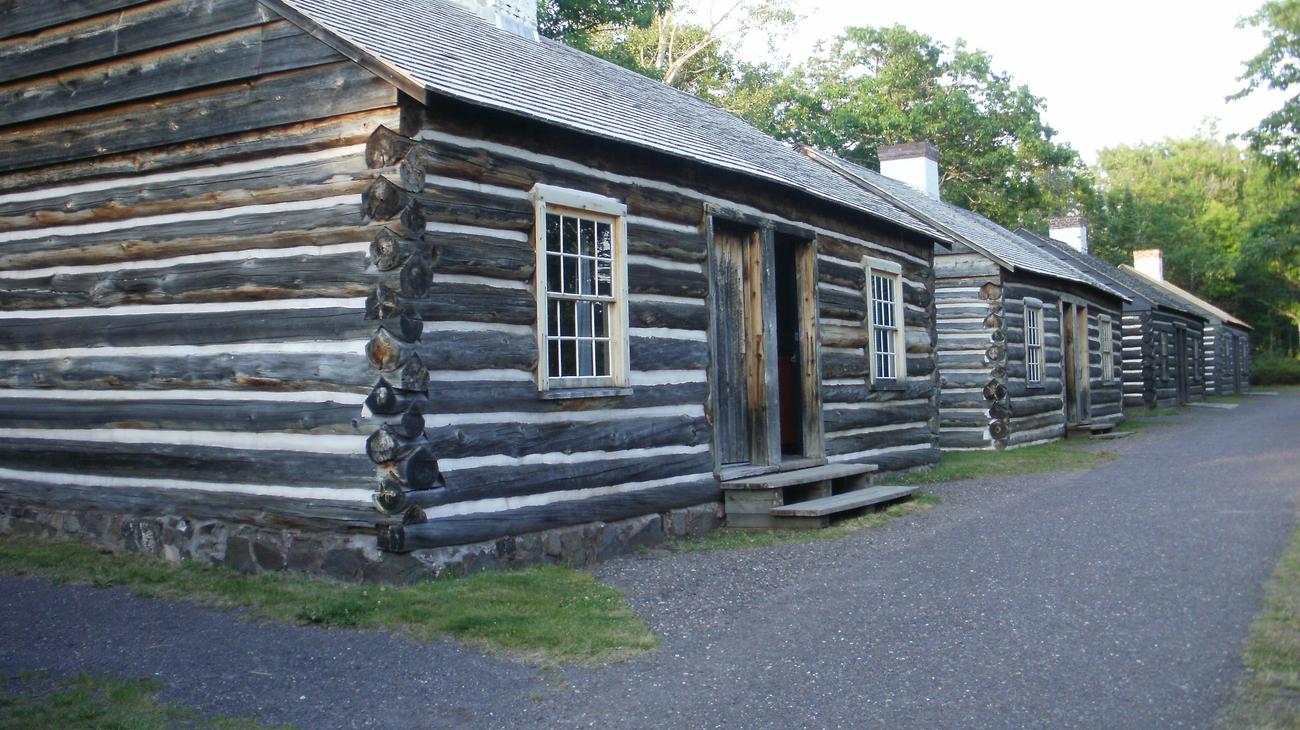 Historic 1844 timber buildings and military quarters preserved at Fort Wilkins Historic State Park.
Skirting the calm, sheltered waters of Lake Fanny Hooe opposite the crashing surf of Lake Superior, this peaceful drive offers mirror-like reflections of the forested hills and historic frontier buildings. In the 1840s, federal soldiers were dispatched here to maintain order among rowdy prospectors seeking native float copper. Today, the fort functions as an immersive living history museum where costumed interpreters demonstrate 19th-century frontier army life.
The narrow gravel perimeter roads allow you to explore hidden camping loops, boat launches, and quiet walking trails that cross wooden footbridges over bubbling creeks connecting Lake Fanny Hooe with Lake Superior.
- The Traveler's Route: Accessed via US-41 east of Copper Harbor.
- Reddit Traveler Consensus: Rent a canoe or kayak from the state park camp store and paddle the quiet waters of Lake Fanny Hooe in the evening to spot nesting loons and bald eagles.
7. Lac La Belle & Mount Bohemia Scenic Byway: Alpine Vistas and Inland Lakes
Branching off US-41 south of Delaware, the scenic drive down through Bete Grise Road to Lac La Belle takes you through the steep, mountainous heart of the Keweenaw. The road hugs the base of Mount Bohemia, a legendary 900-foot vertical ridge celebrated among extreme skiers for having the longest runs and deepest lake-effect powder in the Midwest.
In summer and autumn, the road curves alongside Lac La Belle—a clear, spring-fed inland lake connected to Lake Superior by a navigable dredged canal. Stop to view Haven Falls, an easily accessible roadside waterfall where Haven Creek tumbles twenty feet over a dark basalt cliff face inside a quiet county park.
- The Traveler's Route: Continue three miles east of Lac La Belle to reach the pristine white quartz sand beach at Bete Grise Bay, renowned for its "singing sand" that hums when you rub it with your palm.
- Reddit Traveler Consensus: On r/CampAndHikeMichigan, travelers praise Bete Grise as the cleanest, most serene swimming beach on Lake Superior, protected from northern swells by the high arm of the Keweenaw Peninsula.
8. High Rock Bay: The Extreme 4x4 Trail to the Peninsula's Tip
For adventurers equipped with high-clearance four-wheel-drive vehicles, the unpaved expedition beyond the end of US-41 out to High Rock Bay is the ultimate bucket-list drive in the Upper Peninsula. This rough, rocky two-track trail winds six miles through dense boreal wilderness, crossing mud ruts, bedrock shelves, and abandoned historic logging clearings.
Reaching High Rock Bay brings you to the literal geographical apex of the Keweenaw Peninsula. Waves crash against flat conglomerate rock shelves, with Manitou Island and its lonely offshore lighthouse visible across two miles of open water. Just north along the coast lies the historic Keweenaw Rocket Range, where NASA and the University of Michigan launched two dozen suborbital meteorological rockets into space between 1964 and 1971.
- The Vehicle Requirement: High ground clearance (8+ inches) and all-terrain tires are strictly necessary. Do not attempt this drive in passenger sedans or minivans.
- Reddit Traveler Consensus: If you do not have a 4x4, rent an e-mountain bike or heavy gravel bike in Copper Harbor. Riding the six-mile trail out to High Rock Bay takes roughly forty-five minutes each way and avoids the risk of bottoming out an oil pan.
9. Gay-Mohawk Road & The Eastern Stamp Sand Shores
While the western coast of the Keweenaw is famous for crashing surf and steep cliffs, the southeastern shore along Gay-Mohawk Road delivers an entirely different, hauntingly beautiful landscape. This quiet, flat two-lane road traces the coastline of Grand Traverse Bay on Lake Superior, passing through quiet fishing hamlets and vast expanses of historic dark stamp sand beaches.
In the village of Gay, an enormous 265-foot red-brick smokestack rises above the lake—the sole standing remnant of the historic Wolverine & Mohawk copper stamp mills. The contrast between the dark purple-black stamp sands, deep green shoreline pines, and the sparkling turquoise waters of Lake Superior creates an ethereal, post-industrial coastline found nowhere else in North America.
- The Traveler's Route: Connects M-26 in Lake Linden with US-41 in Mohawk via County Road 26.
- Reddit Traveler Consensus: Stop at the quirky, legendary Gay Bar in town for a classic cheeseburger and to sign the guestbook, which holds signatures from road trippers from all fifty states and dozens of countries.
10. Quincy Hill & The Old US-41 Copper Spine: Historic Boomtown Corridors
Rounding out your peninsula tour, the drive along Old US-41 and M-26 between Houghton, Hancock, and Calumet takes you directly through the architectural heart of the Copper Country boom. Climbing the steep grade of Quincy Hill north out of Hancock gives you panoramic views back across the Portage Lake Lift Bridge—the heaviest and widest double-deck vertical lift bridge in the world.
Perched atop the ridge sits the towering hoist house and steel headframe of the Quincy Mine, historically known as "Old Reliable" for paying uninterrupted dividends to investors for over fifty years. Continuing north into Calumet, you enter a pristine 19th-century Victorian streetscape built entirely from quarried Jacobsville red sandstone, preserved as part of Keweenaw National Historical Park.
- The Traveler's Route: Take the underground mine tour at Quincy Mine, riding a cog railway down the hillside before stepping into a subterranean shaft to view the world's largest steam-driven mine hoist.
- Reddit Traveler Consensus: Spend an afternoon strolling 5th Street in downtown Calumet. Stop at the Red Jacket Mineral Springs or the historic Shute’s Bar (operating continuously since 1890) to admire its hand-carved wooden back-bar and stained glass canopy.
Keweenaw Peninsula Drives: Comparison & Logistics
| Scenic Drive | Distance / Road | Best Time of Day | Highlights | Vehicle Requirement |
|---|---|---|---|---|
| Brockway Mountain Drive | 9.5 mi / Paved | Sunset | 720-ft ridge crest, 360° views | Any passenger vehicle |
| M-26 Coastal Byway | 14 mi / Paved | Late afternoon | Great Sand Bay, Esrey Park | Any passenger vehicle |
| Covered Drive (US-41) | 12 mi / Paved | Midday / Autumn | Arching tree canopy, thimbleberries | Any passenger vehicle |
| Eagle Harbor Loop | 8 mi / Paved | Morning | 1871 Lighthouse, agate hunting | Any passenger vehicle |
| Lac La Belle Byway | 16 mi / Paved | Afternoon | Haven Falls, Bete Grise beach | Any passenger vehicle |
| High Rock Bay Trail | 6 mi / Dirt 2-track | Full daylight | Geographical peninsula tip, rocket range | High-clearance 4WD only |
| Gay-Mohawk Road | 18 mi / Paved | Morning | Dark stamp sands, historic smokestack | Any passenger vehicle |
| Copper Harbor Loop | 5 mi / Paved | Morning | Fort Wilkins, US-41 dead-end | Any passenger vehicle |
| Quincy Hill / Calumet | 12 mi / Paved | Midday | Victorian sandstone architecture, mines | Any passenger vehicle |
| Freda / Redridge Dam | 14 mi / Paved & Gravel | Afternoon | Historic steel dam ruins, Superior surf | Standard clearance |
Essential Reddit Wisdom for Driving the Keweenaw in 2027
1. The Fall Foliage Clock
Peak autumn color in the Keweenaw occurs earlier than in southern Michigan, typically peaking between September 28th and October 8th. Because the peninsula is surrounded on three sides by Lake Superior, lake-effect winds can strip leaves within twenty-four hours of a cold front. Monitor local Keweenaw webcams closely when timing your trip.
2. Thimbleberries and Local Bakeries
The cool, humid microclimate of the northern Keweenaw is one of the only places in North America where wild thimbleberries thrive. Look for roadside honor-system farm stands selling homemade thimbleberry jam in late July and August; the tart, ruby-red preserve is a true Yooper delicacy.
3. Fuel and Winter Weather Readiness
Once you head north of Calumet, gas stations are few and far between; Copper Harbor has only one seasonal fueling station. Fill your tank in Houghton or Calumet before heading out to Brockway or High Rock Bay. Between November and April, lake-effect snowstorms can drop two feet of snow in a single afternoon; carry emergency recovery gear, blankets, and studded winter tires if traveling outside summer.
Frequently Asked Questions
Is Brockway Mountain Drive paved all the way?
Yes. Brockway Mountain Drive is fully paved two-lane asphalt from its western entrance near Eagle Harbor all the way to its eastern terminus at Copper Harbor. It is suitable for all passenger cars, RVs, and motorcycles.
Can you see the Northern Lights from the Keweenaw Peninsula?
Yes. The northern coast of the Keweenaw Peninsula—particularly Brockway Mountain, Esrey Park, and Eagle Harbor—faces directly north across open Lake Superior with zero light pollution, making it one of the premier dark-sky aurora borealis viewing corridors in the United States.
How far is Copper Harbor from the Mackinac Bridge?
Copper Harbor is located approximately 250 miles northwest of the Mackinac Bridge (roughly a 4.5 to 5-hour drive across US-2, M-28, and US-41).
Set your odometer to zero, roll down the windows, and let Lake Superior guide you to the edge of the map.
This article is for informational purposes. Flight routes, passenger regulations, visa rules, and transit advisories are subject to change by airlines and aviation authorities. Readers are advised to verify schedules and travel documentation with relevant carriers and border agencies before departure.
Related Stories
10 Best Great Lakes Circle Tour Stops Reddit Travelers Recommend in 2027: An Epic Odyssey Around North America's Inland Seas