Tropical Storm Edouard Unleashes Flash Floods Across Texas Gulf Coast: 21 Inches of Rain Triggers Travel Emergencies

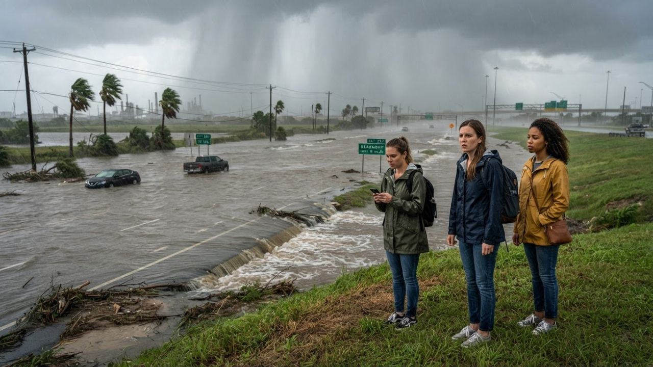
Image generated by AI
Dumping between 10 and 21 inches of torrential rainfall over Hardin and Tyler counties, Tropical Storm Edouard has paralyzed road transit across Southeast Texas, forcing Flash Flood Emergencies, municipal shutdowns, and severe river surges across the Sabine-Neches basin.
Tropical Storm Edouard's Inland Surge: From Johnsons Bayou to East Texas
Tropical Storm Edouard, the 5th named storm of the 2026 Atlantic hurricane season, made landfall near Johnsons Bayou, Louisiana, at 2:20 p.m. CDT on September 1, 2026. Striking approximately 15 miles southeast of Port Arthur, Texas, the storm packed maximum sustained winds of 60 mph. An offshore National Ocean Service observing platform near Texas Point, Texas, documented sustained winds of 57 mph alongside a peak gust of 71 mph, generating dangerous surf and storm surges along the coastal boundary.
Rather than dissipating rapidly at the coastline, Edouard pushed inland across the Texas border, tracking directly through Jefferson County. By 4:00 p.m. CDT on September 1, the storm's circulation center passed roughly 5 miles west of Port Arthur with sustained winds of 50 mph. By 7:00 p.m. CDT, the center was positioned 10 miles northwest of Beaumont with sustained winds of 45 mph.
Edouard continued its northwestward track into the East Texas Piney Woods throughout September 2. By 10:00 a.m. CDT on September 2, the system weakened into a tropical depression with 35 mph winds, centered 125 miles northwest of Beaumont and about 40 miles west-northwest of Lufkin. Despite diminishing wind intensity, the National Hurricane Center and the Weather Prediction Center cautioned that Edouard’s deep tropical moisture plume presented an ongoing hazard across East Texas, extending northward into Angelina and Nacogdoches counties.
Southeast Texas Flood Emergency: Meteorological Data and River Crests
The primary travel danger shifted swiftly from coastal gales to life-threatening inland flash flooding. While forecasters originally anticipated 3 to 6 inches of rain near Beaumont–Port Arthur with localized ceilings around 9 inches, the storm stalled over Hardin and Tyler counties. Rain bands unloaded precipitation at rates of 1 to 5 inches per hour, resulting in confirmed cumulative totals ranging from 10 to 21 inches.
The National Weather Service declared a Flash Flood Emergency for Kountze, Village Mills, and Honey Island, instructing residents and transit operators to seek immediate high ground. Hydrological networks documented rapid escalation along regional waterways, creating prolonged road impassability.
| Storm Metric & Hydrological Marker | Recorded / Forecast Figure | Location / Agency Source |
|---|---|---|
| Storm Season Identifier | 5th named Atlantic storm | National Hurricane Center |
| Landfall Coordinates & Timing | 2:20 p.m. CDT, Sept 1, 2026 | Johnsons Bayou, Louisiana |
| Landfall Maximum Sustained Winds | 60 mph | National Hurricane Center |
| Peak Measured Coastal Wind Gust | 71 mph | Texas Point, Texas (NOS Station) |
| Sustained Coastal Winds | 57 mph | Texas Point, Texas |
| Rainfall Rate in Emergency Zone | 1 to 5 inches per hour | Kountze, Village Mills, Honey Island |
| Flash Flood Emergency Total Rainfall | 10 to 21 inches | Hardin and Tyler Counties |
| Village Creek Flood Stage | 17.0 feet | National Weather Service |
| Village Creek Forecast Crest | Approximately 23.3 feet | Village Creek near Kountze (Major Flood) |
| Neches River Flood Category | Moderate Flooding | Neches River Basin Monitoring |
| Pine Island Bayou Status | Minor Flooding | Pine Island Bayou near Sour Lake |
| Inland Depression Center (Sept 2, 10 a.m.) | 35 mph sustained winds | 40 miles WNW of Lufkin, Texas |
Municipal Shutdowns and Transit Gridlock Across Jefferson and Hardin Counties
The deluge triggered systemic municipal closures across Southeast Texas. In Beaumont (population 112,893), persistent electrical outages prompted city officials to suspend non-emergency municipal operations on September 2. Facilities forced to close included the Beaumont Municipal Court, recreation and public event venues, public health clinics, and Beaumont Animal Care intake and adoption centers. Beaumont public works teams extended solid-waste operating schedules to clear storm debris and clear blocked drainage culverts.
In Port Arthur (population 55,804), storm-surge conditions combined with rainfall runoff inundated low-lying arterial thoroughfares. Farther north, the National Weather Service placed an expansive network of communities under flood watches and warnings, including Orange (population 19,419), Nacogdoches (population 32,381), Bridge City, Vidor, Nederland, Silsbee, Lumberton, Buna, Woodville, Deweyville, Evadale, Spurger, China, Ivanhoe, Mauriceville, Warren, and Gist.
Along the immediate Gulf shoreline, Sabine Pass and Sea Rim State Park endured coastal surge and high tides, prompting park rangers to restrict beach access and coastal boardwalks. Highway corridors connecting Lufkin, Nacogdoches, Jacksonville, San Augustine, and Rusk faced intermittent closures as runoff moved from headwaters into downstream creek systems.
Cultural and Ecological Significance: Big Thicket and Coastal Wetlands
For visitors exploring Southeast Texas, the Sabine-Neches corridor represents an extraordinary ecological and cultural meeting point. This region houses the Big Thicket National Preserve, celebrated by conservationists as the biological crossroads of North America, where southeastern swamps meet eastern hardwood forests and coastal prairies.
When tropical systems like Edouard strike, these protected wetlands serve as critical regional shock absorbers. The cypress-tupelo sloughs of Village Creek and the Neches River basin retain millions of gallons of storm runoff, shielding downstream settlements from even more catastrophic flooding. However, intense inundations disrupt eco-tourism infrastructure, temporarily submerging state paddling trails, nature boardwalks, and canoe launch sites.
Culturally, Southeast Texas blends Cajun-French traditions with authentic Texas heritage. In communities like Beaumont, Port Arthur, and Orange, local businesses—from family-run crawfish boils and boudin smokehouses to heritage hubs like the Spindletop-Gladys City Boomtown Museum and the Museum of the Gulf Coast—rely heavily on drive-in visitors. Sustaining these community establishments after storm events provides direct economic relief to local hospitality workers and independent restaurateurs working through power restorations.
Local Insider Guidance for Navigating the Gulf Coast Corridor
Travelers currently in Southeast Texas or planning road transits between Houston, Louisiana, and the Piney Woods must adjust itineraries to manage lingering hazards:
- Monitor Highway Status via Official Portals: Do not trust standard GPS mapping tools during post-tropical flood events, as back-road washouts and bridge inspections take hours to register digitally. Consult the Texas Department of Transportation via DriveTexas (drivetexas.org) for real-time closures along US-69, US-96, US-287, and Interstate 10.
- Respect the 72-Hour River Lag: Flash flood waters may recede from city streets within hours, but major waterways take days to drain. With Village Creek forecast to crest at roughly 23.3 feet (over 6 feet above its 17-foot flood stage), low-lying access roads near Kountze and Village Mills remain hazardous for 48 to 72 hours after rainfall halts.
- Observe Wildlife Buffer Protocols: Flooded bayous displace local wildlife, including American alligators, water moccasins, and feral hogs, driving them toward elevated asphalt roads and suburban edges. Maintain distance from pooled water and avoid wading into storm pools.
- Support Local Piney Woods Purveyors: Once thoroughfares safely reopen, direct your travel spending toward local family-owned eateries in Beaumont and Hardin County. Sampling regional specialties like smoked boudin links, hot links, and seafood gumbo directly assists local purveyors during recovery.
- Adhere to Absolute Turn-Around Rules: More than half of flood-related fatalities occur in motor vehicles. Moving water just 12 inches deep can carry away small cars, while 24 inches sweeps away trucks and SUVs. Never bypass official barricades or venture onto water-covered county roads.
Long-Term Tourism Outlook and Coastal Resilience
Tropical Storm Edouard serves as a case study in modern Gulf Coast storm behavior: tropical systems increasingly deliver their greatest economic disruption through concentrated, slow-moving inland deluges rather than pure wind velocity. As Southeast Texas continues to invest in stormwater engineering, coastal sea walls, and wetland restoration, destination resilience will determine how rapidly visitor traffic rebounds.
With transit corridors gradually draining and power restoration crews advancing across Beaumont and Port Arthur, travel across the region will normalize over the coming days. In the interim, travelers must place safety first, verify conditions through local emergency agencies, and allow the Sabine-Neches river basins time to absorb the unprecedented surge.
Frequently Asked Questions: Tropical Storm Edouard Travel Disruptions
Where did Tropical Storm Edouard make landfall? Tropical Storm Edouard made landfall near Johnsons Bayou, Louisiana, at 2:20 p.m. CDT on September 1, 2026, roughly 15 miles southeast of Port Arthur, Texas, with sustained winds of 60 mph.
How much rain fell in the hardest-hit Texas communities? Hardin and Tyler counties experienced a Flash Flood Emergency, with confirmed rainfall totals reaching between 10 and 21 inches across Kountze, Village Mills, and Honey Island, falling at rates of 1 to 5 inches per hour.
Which city services in Beaumont were suspended? Due to power outages, the City of Beaumont closed its Municipal Court, Beaumont Animal Care, recreation facilities, event facilities, and Public Health operations on September 2, while deploying solid-waste teams for storm debris collection.
What are the crest expectations for Village Creek? Village Creek near Kountze has a flood stage of 17 feet and was forecast to reach a major flood crest of approximately 23.3 feet, resulting in extensive road and low-land closures.
Related Travel Guides
This article is for informational purposes. Flight routes, passenger regulations, visa rules, and transit advisories are subject to change by airlines and aviation authorities. Readers are advised to verify schedules and travel documentation with relevant carriers and border agencies before departure.
Related Stories

Israel Tourism Recovery 2026: North American Flight Restorations and New ETA-IL Entry Rules

PGA Tour Returns to Austin 2026: New Championship at Omni Barton Creek to Drive Texas Golf Tourism