
Northeast I-95 Flooding Crisis: How Severe Storms Paralyzed Travel Across New York, Connecticut, and New Jersey
Intense thunderstorms on September 13, 2026, brought up to 7 inches of rain across the Northeast, flooding Interstate 95 and halting regional transit.

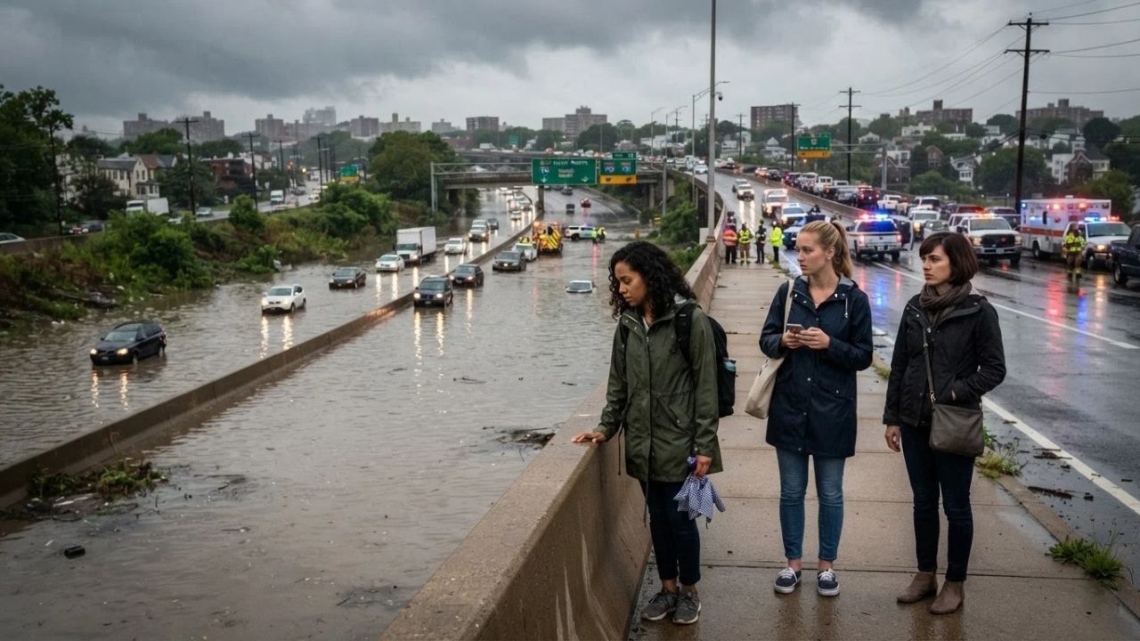
Image generated by AI
Intense thunderstorms stalled directly above the Northeast on Sunday morning, September 13, 2026, unleashing peak rainfall rates of 3 to 4 inches per hour across coastal Connecticut and inundating Interstate 95 with up to 7 inches of standing water. The resulting flash floods submerged arterial roadways from northern New Jersey to Rhode Island, forcing Bridgeport emergency teams into inflatable rescue boats, trapping motorists in Westport, and temporarily closing the departures terminal at Tweed New Haven Airport. For travelers navigating the most heavily traveled transit corridor in the United States, the sudden deluge demonstrated how quickly severe weather can sever road, rail, and air links across state lines.
The September 13 Deluge Across the I-95 Megalopolis
The storm began gathering strength before daybreak on September 13, when slow-moving thunderstorm clusters repeatedly trained over the same dense communities. In several locations across the tri-state area, sustained downpours dropped between 1 and 2 inches of rain every sixty minutes. However, the most destructive bands anchored themselves over southwestern Connecticut's Fairfield County, where drainage networks constructed decades ago were overwhelmed within minutes.
Interstate 95, which links Boston, New York, Philadelphia, and Washington, turned into an obstacle course of abandoned sedans, submerged off-ramps, and stalled tractor-trailers. The National Weather Service issued urgent flash flood warnings as low-lying underpasses filled with several feet of brown, fast-moving runoff. In Westport alone, emergency services conducted 13 separate vehicle rescues, pulling drivers from submerged cars before floodwaters reached door windows. To the east in Bridgeport, first responders navigated flooded neighborhood avenues in rubber watercraft, evacuating residents from ground-floor homes surrounded by rising tides.
The disruption rippled immediately across state boundaries. In Paterson, New Jersey, emergency teams rescued approximately 20 people trapped by surging waters, while in nearby Paramus, a half marathon scheduled for Sunday morning ground to a halt as runners encountered knee-deep washouts across the course. At the height of the storm, roughly 5,600 homes and businesses across New Jersey lost electrical service, while Westchester County and metropolitan New York faced flash flood conditions that jammed parkway connectors. On the rails, Metro-North Railroad and Amtrak reported sweeping delays and selective cancellations along the Northeast Corridor, while airports across the region recorded thousands of secondary flight delays that persisted through Monday, September 14, as recovery efforts got underway.
What Makes the Northeast Corridor's Geography Vulnerable
To understand why a morning rainstorm can paralyze five states at once, one must examine the unique geographic and infrastructural realities of the Northeast urban corridor. The strip of coastline stretching from northern New Jersey across the Bronx and along Long Island Sound toward Rhode Island is one of the most densely paved regions on earth. When torrential rain falls on continuous asphalt and concrete, natural absorption is virtually non-existent; water rushes straight into storm sewers, tidal estuaries, and sunken highway beds.
The coastal topography of southern New England compounds the issue. Communities like Norwalk, Westport, Bridgeport, and Old Saybrook sit at the confluence of interior river drainages and Long Island Sound tidal basins. When 3 to 4 inches of rain fall in an hour during high tide, ocean water pushes inland while river runoff surges seaward, creating an inescapable hydraulic dam. Interstate 95 was constructed through coastal marshlands and river plains in the 1950s, placing major transit arteries right in the path of natural overflow basins.
Rail infrastructure shares this exact geographic vulnerability. The tracks utilized by Metro-North's New Haven Line and Amtrak's Northeast Regional hug the coastline, traversing dozens of low-lying bridges across tidal rivers such as the Saugatuck, the Housatonic, and the Connecticut River between Old Saybrook and Old Lyme. Saturated track beds, flooded switching equipment, and downed overhead catenary wires routinely bring passenger rail to a standstill whenever storm systems stall over the Sound.
Visitor Insider Tips
Navigating severe weather along the I-95 corridor requires localized knowledge and quick tactical decisions rather than blindly following navigation apps:
- Never use low-clearance parkways as emergency storm detours: When I-95 floods, navigation algorithms often route motorists onto Connecticut's Merritt Parkway (Route 15) or New York's Hutchinson River Parkway. Avoid this during severe rain; these historic parkways feature stone arch overpasses with zero drainage, poor sightlines, and strict bans on trucks, causing severe bottlenecks and trapped vehicles beneath standing water.
- Monitor real-time updates through official state transport portals: Rely on official road sensors and live camera feeds from the Connecticut Department of Transportation rather than relying exclusively on crowdsourced maps. Official state advisories identify flooded underpasses and bridge closures hours before third-party digital apps update their routing algorithms.
- Seek higher-ground detours along the historic Post Road: If forced off I-95 in Fairfield County, stick to elevated segments of U.S. Route 1 (the historic Boston Post Road). While certain downtown dips in Norwalk and Westport flood, the higher ridgelines remain passable, offering access to local diners, fuel stations, and dry parking lots away from rising rivers.
- Turn storm delays into an authentic coastal food stop: If safely pulled off the highway between Bridgeport and New Haven, wait out the congestion by supporting historic shoreline institutions built above flood zones. Sample fresh New Haven-style apizza in Wooster Square, or head inland for warm buttered lobster rolls served on toasted split-top brioche buns at elevated shoreline shacks.
- Respect the life-saving rule of standing water: It takes only six inches of moving water to sweep an adult off their feet, and twelve inches to float a standard passenger sedan. Downed power lines, displaced manhole covers, and collapsed asphalt are frequently invisible beneath muddy runoff.
Cultural and Environmental Context
The September 13 flooding spotlights the accelerating clash between century-old civil engineering and modern climate dynamics across the Northeast. As ocean temperatures in Long Island Sound climb, coastal thunderstorms carry significantly higher moisture loads, resulting in tropical-style downpours over infrastructure designed for gentle temperate rains.
The immediate environmental impacts are evident in coastal conservation zones. At Sherwood Island State Park in Westport, Connecticut's oldest state park, floodwaters breached salt marsh boundaries and covered recreational lawns with river silt, forcing park staff to implement emergency repairs before partially reopening the facility on Monday, September 14. These coastal wetlands serve as nature's premier flood sponges, absorbing storm surges that would otherwise devastate inland neighborhoods. Protecting and expanding these tidal salt marshes has become an urgent ecological priority for shoreline conservationists.
Culturally, these recurring weather emergencies are reshaping the relationship between coastal residents and the highway that defines their daily lives. Generations of New Englanders have relied on I-95 as an unbroken umbilical cord connecting jobs, family ties, and commercial markets. As storm intensities increase, regional town meetings from Greenwich to New London are re-evaluating zoning bylaws, requiring new developments to incorporate permeable pavements and green stormwater retention basins. Preserving the historical charm of these colonial maritime communities now depends on their ability to adapt to unprecedented weather shocks.
FAQ: Navigating Northeast Storm Disruptions in 2026
What should drivers do if trapped on flooded highways like I-95?
Never attempt to drive through standing water. If water begins rising around your vehicle, immediately abandon it for higher ground. If safely stopped, remain inside with hazard lights on and call emergency responders for extraction assistance.
How quickly does passenger rail recover after major flooding?
Rail operators like Metro-North and Amtrak typically restore restricted service within 12 to 24 hours after waters recede, though residual delays often persist while track crews inspect signal boxes, bridges, and submerged electrical switches.
Are coastal state parks in Connecticut open immediately after floods?
State parks like Sherwood Island often close temporarily for safety assessments and debris removal. Always check the official Connecticut Department of Energy and Environmental Protection portal before visiting shoreline facilities following heavy rains.
How can travelers avoid flight cancellations during Northeast thunderstorms?
Book early-morning flights before afternoon storm systems develop. If severe weather is forecast, take advantage of airline travel waivers to rebook flights without change fees through alternative hubs outside the storm corridor.
When coastal skies open over the Northeast, knowing when to pull off the road is the difference between an inconvenient delay and a dangerous rescue.
Related Travel Guides
New York Drivers Lose 125 Hours Yearly as Worst US Rush-Hour Cities Revealed in 2026
10 Essential Tips for Driving the I-95 Northeast Corridor, According To Reddit
Disclaimer
This article is for informational and educational purposes only. It does not constitute legal, financial, or professional advice. While we strive to provide accurate and up-to-date information, travel policies, regulations, and conditions change rapidly. Always verify information with official sources before making travel decisions. Nomad Lawyer makes no representations about the accuracy, reliability, completeness, or suitability of the information provided. Readers should consult qualified professionals for advice specific to their circumstances. The views expressed in this article are those of the author and do not necessarily reflect the views of Nomad Lawyer.
Kunal K Choudhary
Co-Founder & Contributor
A passionate traveller and tech enthusiast. Kunal contributes to the vision and growth of Nomad Lawyer, bringing fresh perspectives and driving the community forward.
Learn more about our team →