
Mount Sinabung Erupts in North Sumatra 2026: Tourism Restrictions and Level III Alert
Indonesia's North Sumatra region faces tourism disruptions after Mount Sinabung erupted on August 31, 2026, triggering a Level III Siaga alert and the closure of key attractions.

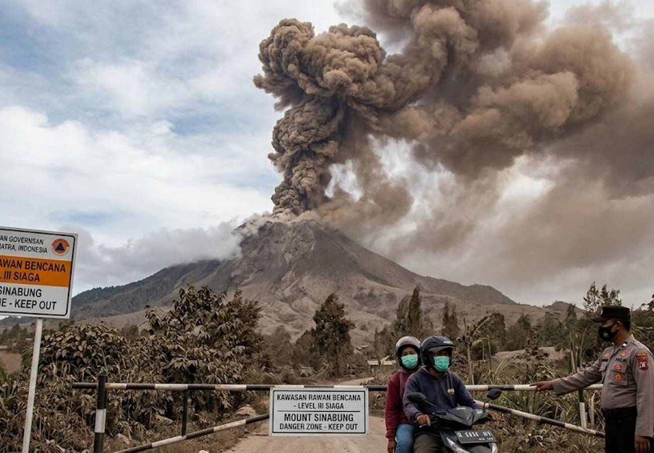
Image generated by AI
North Sumatra's tourism infrastructure is under pressure following a significant explosive eruption of Mount Sinabung on August 31, 2026. Authorities have implemented strict exclusion zones and closed popular highland attractions as the volcano enters its first major eruptive phase in five years.
The event began at approximately 10:17 am local time, characterized by a dense black ash column that ascended 3,500 metres above the summit, reaching an altitude of roughly 5,960 metres above sea level. The Geological Agency reported that the ash plume drifted primarily toward the east and south-east.
In response to escalating seismic activity, officials upgraded the volcano's status from Level II (Waspada) to Level III (Siaga) at 12:30 pm on August 31. This represents the second-highest warning tier in Indonesia's four-level system, signaling a substantial increase in risk to nearby populations and visitors.
Immediate Impact on Karo Regency Tourism
The eruption has caused direct disruptions to the tourism economy in the Karo Regency. Most notably, Lau Kawar Lake and its associated camping grounds in Kuta Gugung village are now closed to the public.
While the eruption occurred on August 31, the Karo Regency administration had proactively closed these sites on August 19 due to rising volcanic unrest. These attractions remain closed indefinitely, with reopening contingent on seismic stabilization.
Travelers are cautioned against attempting to access these sites via unofficial routes, as online maps and outdated guides may still list them as operational.
Understanding the Exclusion Zones
The Level III Siaga status mandates strict boundaries to prevent casualties from pyroclastic flows and ballistic materials. The current danger zones are defined as follows:
- General Radius: A total prohibition on entry within 3 kilometres of the summit.
- Directional Risk: An extended exclusion zone of 6 kilometres toward the south and south-east.
- Relocated Areas: Absolute prohibition on entering villages previously evacuated due to long-term volcanic hazards.
These measures are based on technical hazard assessments. Because visual cues are often misleading, visitors must adhere to these boundaries even if the mountain appears dormant.
Regional Travel Implications
It is important for international travelers to distinguish between the localized danger zone and the broader North Sumatra province. The eruption has not triggered a province-wide tourism shutdown.
Berastagi and Highland Travel
Berastagi remains a primary hub for highland tourism. While the town is not closed, its proximity to the Karo highlands means it is susceptible to ashfall depending on wind patterns. Travelers in this region should monitor air quality and carry masks, as ash can cause respiratory irritation.
Aviation and Flight Status
As of the latest reports, there has been no immediate disruption to flight schedules. However, aviation authorities continue to monitor the ash plume, as volcanic particles pose a known risk to aircraft engines.
Volcanic Activity Summary: Mount Sinabung 2026
| Category | Detail |
|---|---|
| Location | Karo Regency, North Sumatra, Indonesia |
| Eruption Date/Time | 31 August 2026, approx. 10:17 am local time |
| Ash Column Height | 3,500 metres above summit (5,960m above sea level) |
| Ash Drift Direction | East to South-East |
| Current Alert Level | Level III Siaga (Raised at 12:30 pm, 31 August) |
| Exclusion Radius | 3 km (General) / 6 km (South & South-East) |
| Closed Attractions | Lau Kawar Lake & Camping Area |
| Evacuated Villages | Kuta Tengah and Payung |
| Aviation Status | No immediate disruptions reported |
| Primary Hazards | Ashfall, pyroclastic flows, and volcanic mudflows (lahars) |
Historical Context and Future Risk
This eruption marks the end of a five-year period of relative quiet, with the last significant activity occurring in 2021. Mount Sinabung's history is characterized by sudden transitions; after centuries of dormancy, it became active in 2010, leading to a decade of volatility that displaced thousands of residents.
The Geological Agency has warned that the August 31 event may be an "initial eruption." This suggests that the current episode may not have peaked, and the possibility of a larger, more destructive eruption remains a critical concern for emergency planners.
Key Takeaways for Travelers
- Avoid the Danger Zone: Stay outside the 3km general and 6km south/south-east exclusion radii.
- Verify Destinations: Check the specific coordinates of planned visits in North Sumatra against current hazard maps.
- Prepare for Ash: If visiting the Karo highlands or Berastagi, keep N95 masks available.
- Ignore Outdated Maps: Do not rely on third-party apps for the status of Lau Kawar Lake.
Frequently Asked Questions
Is all of North Sumatra closed to tourists? No. Restrictions are localized to the Mount Sinabung area and specific danger zones in the Karo Regency. Most other parts of the province remain open.
Can I still visit Berastagi? Yes, Berastagi is generally open, but visitors should remain alert to changing wind directions that may bring volcanic ash into the town.
What is the difference between Level II and Level III alerts? Level II (Waspada) indicates a state of vigilance. Level III (Siaga) indicates a significantly higher level of activity and risk, requiring expanded exclusion zones and mandatory evacuations of high-risk villages.
Stay updated on local government advisories before venturing into the Karo highlands.
Related Travel Guides
Disclaimer
This article is for informational and educational purposes only. It does not constitute legal, financial, or professional advice. While we strive to provide accurate and up-to-date information, travel policies, regulations, and conditions change rapidly. Always verify information with official sources before making travel decisions. Nomad Lawyer makes no representations about the accuracy, reliability, completeness, or suitability of the information provided. Readers should consult qualified professionals for advice specific to their circumstances. The views expressed in this article are those of the author and do not necessarily reflect the views of Nomad Lawyer.
Preeti Gunjan
Contributor & Community Manager
A passionate traveller and community builder. Preeti helps grow the Nomad Lawyer community, fostering engagement and bringing the reader experience to life.
Learn more about our team →