
Hurricane Trudy Pummels Mexico’s Pacific Coast: 15-Inch Rain Floods, Landslide Risks, and Travel Disruptions
Hurricane Trudy threatens Mexico’s Pacific coastline with up to 15 inches of rain, 16-foot waves, and flash floods across Jalisco, Colima, Michoacán, and Guerrero.

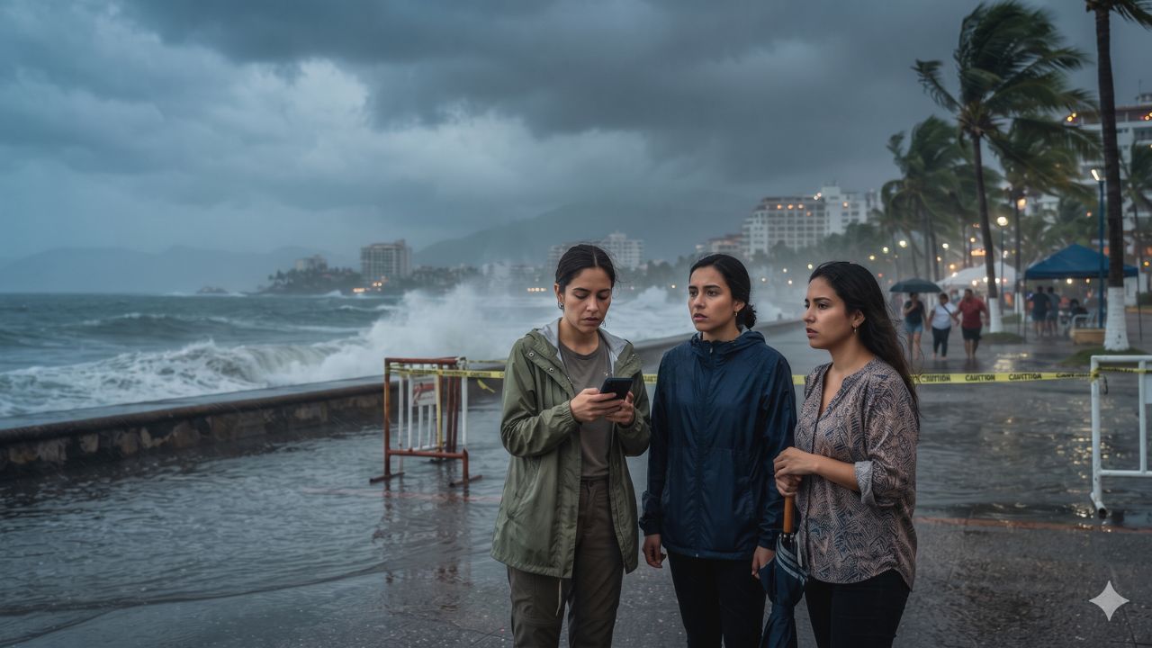
With meteorological models projecting isolated rainfall totals of up to 15 inches and destructive 16-foot ocean swells pounding western shorelines, Hurricane Trudy has triggered emergency civil defense activations across Jalisco, Colima, Michoacán, Guerrero, and Oaxaca. Although sustained wind velocities declined from a peak Category 3 strength of 120 mph (195 km/h) on 16 October down to Category 1 status near 90 mph (150 km/h) by the morning of 17 October, meteorological agencies warn that wind deceleration masks severe hydrological dangers. Positioned approximately 190 miles south-southeast of Manzanillo and advancing northwestward at a sluggish 8 mph, the tropical cyclone is channeling immense volumes of Pacific moisture directly into the steep coastal topography of west-central Mexico, generating life-threatening flash floods, mudslides, and extensive transportation delays across Puerto Vallarta, Manzanillo, Acapulco, and Puerto Escondido.
Tracked by the National Hurricane Center (NHC) and monitored domestically by the Servicio Meteorológico Nacional (CONAGUA), the storm’s slow forward translation threatens sustained downpours over saturated river basins. For international leisure vacationers and commercial supply chains, the cyclone presents dual logistical challenges: coastal marine prohibitions shutting down maritime ports and boat excursions, combined with mountain runoff severing regional highway arteries between airport gateways and shoreline hotel corridors.
Meteorological Progression and Coastal Warning Corridors: From Tropical Storm to Category 3 Cyclone
The development of Hurricane Trudy highlights the volatility of late-season eastern Pacific cyclogenesis. Originating as a disorganized tropical disturbance off southern Mexico on 14 October 2026, the system encountered exceptionally warm sea-surface temperatures and minimal wind shear, enabling rapid intensification:
- 14 October: Designated as a named tropical storm off southern Mexico, prompting initial coastal weather advisories regarding deteriorating marine conditions.
- 15 October: Strengthened rapidly into a Category 1 and subsequently Category 2 hurricane as central barometric pressure dropped.
- 16 October (Early Morning): Reached major hurricane status, peaking as a formidable Category 3 cyclone packing sustained winds of 120 mph (195 km/h).
- 16 October (Midday): Satellite estimates indicated initial inner-core erosion, with sustained winds easing to approximately 110 mph (175 km/h).
- 17 October (Morning): Reclassified as a Category 1 hurricane with sustained winds of 90 mph (150 km/h), centered roughly 190 miles south-southeast of Manzanillo, tracking northwest at 8 mph.
- 17–18 October: Projected closest coastal approach along the west-central Pacific corridor, bringing outer rainbands and violent surf directly ashore.
In response to the storm’s trajectory, Mexican authorities established a primary hurricane warning corridor extending from the commercial port of Manzanillo in Colima northwestward to Cabo Corrientes in Jalisco. Simultaneously, the Secretaría de Marina (SEMAR) activated Plan Marina on 16 October across Colima, Guerrero, Michoacán, and Oaxaca, deploying naval emergency personnel, amphibious transport, and portable water filtration units to assist local civil protection teams.
Territorial Vulnerability and Transit Infrastructure Impact
While coastal wind damage remains largely confined to trees and unreinforced structures, rainfall and wave dynamics present severe risks across multiple states:
In Jalisco, the primary concern focuses on Puerto Vallarta, Cabo Corrientes, and the Costalegre resort belt. Heavy squalls and elevated storm tides threaten beachfront boardwalks and urban drainage networks, with localized runoff risking road closures along Federal Highway 200. Further south in Colima, Manzanillo faces a double threat: coastal inundation threatening hotel properties in Cuyutlán alongside potential disruptions to Mexico's leading Pacific container port, where high swells can force harbor master closures for commercial shipping and sportfishing fleets.
Michoacán faces extreme landslide risks along the coastal highway connecting Lázaro Cárdenas and Playa Azul, where four to eight inches of rain—and isolated pockets reaching 15 inches—threaten to trigger mudslides across unstable road cuts. In Guerrero, Acapulco and Ixtapa-Zihuatanejo face rainfall totals between two and four inches, with isolated spikes of six inches capable of flooding low-lying hotel districts and mountain access passes. In Oaxaca, renowned surfing destinations like Puerto Escondido and resort bays in Huatulco face dangerous ocean rip currents, closed beaches, and washed-out rural river crossings.
The following data table breaks down the state-level hazards, coastal destinations, maritime conditions, and operational travel implications:
| Mexican State / Region | Targeted Coastal Destinations | Primary Meteorological Threat | Forecast Wave Heights | Travel, Aviation & Marine Implications |
|---|---|---|---|---|
| Jalisco | Puerto Vallarta, Cabo Corrientes, Costalegre | Hurricane-force gusts, storm surge, torrential rain | 7 to 10 feet | PVR airport flight holds; beach red flags; road blocks on Highway 200 |
| Colima | Manzanillo, Cuyutlán coastal zone | Severe coastal inundation, damaging waves, heavy rain | 8 to 11 feet | Playa de Oro Airport (ZLO) delays; commercial container port halts |
| Michoacán | Lázaro Cárdenas, Playa Azul, coastal hamlets | Intense rainfall (up to 15 in), flash floods, mudslides | 13 to 16 feet | Coastal highway washouts; maritime navigation bans; river surges |
| Guerrero | Acapulco, Ixtapa-Zihuatanejo | Heavy squalls (2–6 in), urban runoff, coastal surge | 13 to 16 feet | Beach excursions cancelled; ACA and ZIH airport weather monitoring |
| Oaxaca | Puerto Escondido, Bahías de Huatulco | High-energy surf, rip currents, localized river floods | 8 to 11 feet | Surfing and boating prohibitions; regional bridge inspection delays |
| Nayarit | Bahía de Banderas, Punta Mita, Riviera Nayarit | Tropical-storm squalls, dangerous swell, rip tides | 6 to 9 feet | Precautionary catamaran cancellations; outer bay surfing warnings |
Aviation infrastructure remains on high alert. Travelers moving through Puerto Vallarta International Airport (PVR), Manzanillo’s Playa de Oro International Airport (ZLO), Acapulco International Airport (ACA), and Ixtapa-Zihuatanejo International Airport (ZIH) must prepare for ground stop advisories, poor runway visibility, and turbulent approach corridors.
Expert Analysis: The Wind-versus-Water Disconnect, Mountain Orographic Traps, and Passenger Legal Rights
The most dangerous operational trap for travelers navigating Hurricane Trudy is the psychological disconnect between wind speed classifications and actual ground hazards.
For travelers booking this route, the direct consequence of Trudy weakening from Category 3 (120 mph) to Category 1 (90 mph) is a false sense of security. The Saffir-Simpson Hurricane Wind Scale measures only sustained wind velocity; it does not measure moisture volume, storm diameter, or forward speed. Because Trudy’s forward translation slowed to just 8 mph, its outer bands linger over the same coastal communities for hours.
This moisture collides directly with the steep mountain slopes of the Sierra Madre del Sur and Sierra Madre Occidental. This terrain forces warm, moisture-laden Pacific air rapidly upward—a process known as orographic lift—which supercharges condensation and triggers localized downpours of up to 15 inches. For resort vacationers, the primary danger is not structural wind failure at concrete beachfront hotels, but the complete physical severance of transport corridors. Saturated mountain soils trigger mudslides that bury two-lane coastal highways, stranding passengers attempting to transfer between airport terminals and isolated resort corridors like Costalegre or Punta Mita.
From a passenger rights perspective, travelers encountering cancelled or delayed flights must understand the legal framework enforced by PROFECO (Procuraduría Federal del Consumidor), Mexico's consumer protection authority:
- Force Majeure Classifications: Tropical cyclones and declared natural emergencies are legally designated as force majeure events outside airline control. Consequently, domestic and international airlines are not legally mandated to provide cash compensation or hotel accommodation vouchers for weather-induced cancellations.
- Rebooking and Ticket Validity: Under Mexican civil aviation regulations, airlines must offer passengers the choice between the earliest available alternative flight without penalty, a rescheduling of travel for a later date within ticket validity parameters, or a full refund of unused flight segments.
- Accommodation Cancellation Rights: When regional governments or municipal Civil Protection agencies declare formal red-level storm alerts or issue mandatory coastal evacuation orders, hotel properties operating in regulated tourism zones typically waive cancellation penalty fees, permitting guests to rebook without forfeiting deposits.
- Terminal Ground Mobility Risks: Vacationers currently situated inside resorts should avoid dispatching private taxis or rental vehicles onto mountain highways during active torrential downpours. It is far safer to extend hotel shelter stays than to risk being trapped in a vehicle between rising river fords and active rockfalls.
Key Takeaways
- Significant Hydrological Danger: Hurricane Trudy threatens Jalisco, Colima, Michoacán, Guerrero, and Oaxaca with up to 15 inches of rain and 16-foot waves despite weakening to Category 1 (90 mph winds).
- Active Hurricane Warning Zone: Warning boundaries encompass the coastal corridor from Manzanillo, Colima, north to Cabo Corrientes, Jalisco.
- Emergency Plan Marina Enacted: The Mexican Navy (SEMAR) has activated disaster preparedness operations across four Pacific states to support civil defense and flood management.
- Airport and Transit Disruptions: High alert status across airports in Puerto Vallarta (PVR), Manzanillo (ZLO), Acapulco (ACA), and Zihuatanejo (ZIH), with road closures possible along Highway 200.
- Consumer Protection Exemptions: Under PROFECO regulations, weather disruptions are classified as force majeure, entitling travelers to fee-free rebooking or ticket refunds rather than cash compensation.
FAQ: Hurricane Trudy Mexico Travel Alert 2026
What category is Hurricane Trudy and where is it heading?
Hurricane Trudy reached Category 3 intensity (120 mph) before weakening to Category 1 (90 mph winds). It is tracking northwest at 8 mph roughly 190 miles south-southeast of Manzanillo.
Are flights cancelled at Puerto Vallarta and Manzanillo airports?
Airports remain on high alert for ground stops, wind shear, and delays. While blanket shutdowns depend on immediate runway conditions, travelers should verify flight status directly with airlines.
What are the expected rainfall totals and wave heights?
Rainfall is forecast between 4 and 8 inches across Jalisco, Colima, and Michoacán, with isolated totals reaching 15 inches. Coastal wave heights range from 7 to 16 feet along impacted beaches.
Can travelers get refunds under Mexican law for storm disruptions?
Yes. Under PROFECO guidelines, force majeure cancellations entitle passengers to fee-free flight rebooking on the next available flight or full ticket refunds, though cash delay compensation is exempt.
As tropical rainbands press against the steep cliffs of the Pacific, travelers must remember that in mountain cyclone country, the quiet rising of inland waters poses a far greater danger than the wind.
Related Travel Guides
Disclaimer
This article is for informational and educational purposes only. It does not constitute legal, financial, or professional advice. While we strive to provide accurate and up-to-date information, travel policies, regulations, and conditions change rapidly. Always verify information with official sources before making travel decisions. Nomad Lawyer makes no representations about the accuracy, reliability, completeness, or suitability of the information provided. Readers should consult qualified professionals for advice specific to their circumstances. The views expressed in this article are those of the author and do not necessarily reflect the views of Nomad Lawyer.
Raushan Kumar
Founder & Lead Developer
Full-stack developer with 11+ years of experience and a passionate traveller. Raushan built Nomad Lawyer from the ground up with a vision to create the best travel and law experience on the web.
Learn more about our team →