Colorado and Southwest Tourism Paralyzed as Atmospheric River Flash Floods Batter Ski Resorts, Rails, and Desert Parks

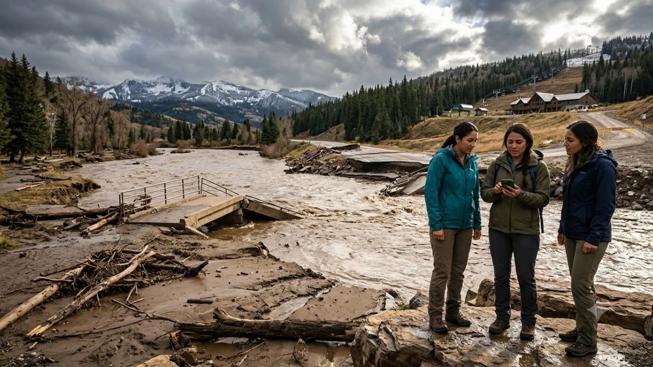
DURANGO, Colo. / FLAGSTAFF, Ariz. — A destructive late-autumn flash flood disaster fueled by a subtropical atmospheric river has torn through the American Southwest, leaving mountain resorts wrecked, historic rail lines washed out, and desert park access severed across Colorado, Arizona, and New Mexico.
The extreme weather event struck at an exceptionally fragile operational juncture for the regional visitor economy. In the high alpine peaks of southwest Colorado, mountain towns were gearing up for the lucrative winter ski season, while the arid valleys of northern Arizona and northwestern New Mexico were enjoying their autumn peak for hiking, camping, and cultural road trips.
Instead of delivering gentle, snow-building winter precipitation, the warm storm system unleashed tropical downpours across high elevations. The deluge triggered destructive runoff, sweeping debris across highways, undermining historic rail beds, flooding commercial properties, and forcing emergency evacuations across three states.
In southwest Colorado, the disaster forced the abrupt closure of Wolf Creek Ski Area only 24 hours after opening for the season, washed away sections of the iconic Animas River Trail, and damaged tracks along the historic Durango and Silverton Narrow Gauge Railroad.
Downstream in Arizona, the floodwaters claimed two lives in Flagstaff, inundated riverside RV campgrounds in Camp Verde, and prompted creek-side evacuations in Sedona.
Across the border in New Mexico, floodwaters surging down the Animas and San Juan rivers battered riverside neighborhoods in Farmington, damaged highway links in Flora Vista, and threatened bridge infrastructure on the Navajo Nation at Shiprock.
       SOUTHWEST FLASH FLOOD DISASTER: MULTI-STATE IMPACT CORRIDOR

  [ COLORADO: SAN JUAN MOUNTAINS ]
  * Wolf Creek Ski Area: Opened Oct 31, closed Nov 1 due to torrential rain & mudslides
  * US Highway 160: Wolf Creek Pass closed by rockslides and pavement washouts
  * Durango: Animas River peaks at 12,900 cfs (50x seasonal normal); Animas Trail closed
  * D&SNG Railroad: Track beds undermined between Durango and Hermosa
  * Pagosa Springs: Foundation erosion at Museum; riverside campgrounds submerged
  * Highway 151: Washouts sever access south of Chimney Rock National Monument
                 |
                 v
  [ NEW MEXICO: FOUR CORNERS & SAN JUAN BASIN ]
  * Farmington: Animas & San Juan confluence overflow; residential & commercial flooding
  * Flora Vista: Highway erosion disrupts arterial transport links
  * Shiprock: San Juan River breaches flood stage, impacting Navajo Nation routes
  * Cultural Gateways: Access roads to Aztec Ruins & Chaco Culture heavily impaired
                 |
                 v
  [ ARIZONA: MOGOLLON RIM & VERDE VALLEY ]
  * Flagstaff: Two confirmed flood fatalities; urban drainage channels overwhelmed
  * Camp Verde: Swift-water rescues at RV parks; Verde River campgrounds submerged
  * Sedona: Oak Creek flash floods trigger evacuations; canyon hiking trails eroded
The Meteorological Engine: How an Unseasonable Atmospheric River Overwhelmed the High Country
The severe flooding stemmed from a meteorological clash driven by a potent subtropical atmospheric river (AR) originating in the deep tropical Pacific Ocean.
During the opening days of November 2026, a strong low-pressure trough stalled over the Great Basin, pumping a continuous plume of warm, moisture-laden maritime air across the desert Southwest and driving it directly into the towering topographic barriers of the southern Rocky Mountains.
METEOROLOGICAL PROFILE: NOVEMBER 2026 SOUTHWEST FLOODS
| Column 1 |
|---|
| Storm Type: Tropical Atmospheric River (AR) combined with Great Basin Low |
| Freezing Level: Unseasonably high (above 11,500 feet during peak rainfall) |
| Precipitation Dynamic: Warm rain-on-snow event causing catastrophic runoff |
| Peak River Discharge: Animas River at Durango reached ~12,900 cfs (Nov 2) |
| Historical Comparison: 50 times the seasonal median discharge (~250 cfs) |
| Primary Basins Affected: Animas, San Juan, Piedra, Verde, Oak Creek |
Under normal early-November climatological conditions, storms crossing the San Juan Mountains drop temperatures below freezing, depositing dry powder snow that forms the foundational base for Colorado’s winter ski resorts.
In this event, however, the tropical origin of the air mass drove freezing levels above 11,500 feet. Instead of snowfall, torrential rain fell directly onto early-season snowpack across mountain peaks.
This "rain-on-snow" phenomenon accelerated snowmelt, saturating thin alpine soils and generating massive surface runoff. Small mountain creeks transformed into raging torrents within hours, carrying boulders, timber, and mud into major river channels.
The Animas River, which flows from the alpine heights of Silverton down through Durango and into New Mexico, experienced an unprecedented hydrologic surge. On Monday, November 2, streamflow gauges at Durango recorded discharge rates soaring to approximately 12,900 cubic feet per second (cfs).
To put this figure in perspective, the median historical streamflow for the Animas River at Durango in early November hovers near 250 cfs. The river was operating at more than 50 times its seasonal volume, cresting banks and scouring riverbanks with ferocious energy.
Colorado’s Tourism Strongholds Under Siege: Ski Resorts, Historic Rails, and Hot Springs
Southwest Colorado functions as a deeply integrated tourism ecosystem where travelers seamlessly combine alpine skiing, heritage train excursions, hot springs soaking, and mountain hiking. The atmospheric river struck every pillar of this regional visitor economy simultaneously.
                      SOUTHWEST COLORADO TOURISM CIRCUIT

                [ Silverton Alpine Historic District ]
                                  |
                                  |  (D&SNG Railroad - TRACK DAMAGE)
                                  v
                      [ Durango Heritage Hub ]
                      - Animas River Trail (CLOSED)
                      - Downtown Riverside Hotels (FLOODED)
                                  |
         +------------------------+------------------------+
         |                                                 |
         | (US-160 Eastbound)                              | (US-160 West / SH-151)
         v                                                 v
  [ Pagosa Springs ]                            [ Chimney Rock & Arboles ]
  - Hot Springs Resorts (IMPACTED)              - Archaeological Site Access
  - Museum Foundation (ERODED)                  - State Highway 151 (WASHED OUT)
  - Riverside Campgrounds (SUBMERGED)
         |
         v
  [ Wolf Creek Pass & Ski Area ]
  - Ski Resort (CLOSED AFTER OPENING)
  - US-160 Mountain Pass (SLIDES & CLOSURES)
Wolf Creek Ski Area: Early-Season Triumph Cut Short
Wolf Creek Ski Area, perched atop Wolf Creek Pass at an elevation of 10,640 feet, holds legendary status in North American winter sports for receiving the state's highest natural snowfall, averaging 430 inches annually.
The resort achieved national headlines by opening for the 2026–27 ski season on Saturday, October 31, welcoming thousands of eager skiers to its early-season lift operations.
The celebration lasted less than 24 hours. By Sunday, November 1, torrential tropical rain replaced falling snow, melting the resort's operational base, scouring access roads, and prompting regional emergency managers to issue evacuation alerts across Mineral and Archuleta counties.
Confronted with washed-out culverts, debris-strewn slopes, and mudslides along US Highway 160, resort management took the extraordinary step of shutting down operations indefinitely on November 1.
The premature closure represents a severe blow to regional ski tourism. Early-season openings generate vital advance season pass sales, lodging reservations, and retail equipment rentals across Pagosa Springs to the west and South Fork to the east.
Restoring ski operations requires not only a return to sub-freezing temperatures and fresh snowfall, but structural inspections of chairlift foundations and slope stability.
Durango: Animas River Trail Scoured and Downtown Waterfront Flooded
Fifty miles west of Wolf Creek, the historic city of Durango faced severe urban and recreational damage. As the Animas River reached historic flood heights of 12,900 cfs, surging water overwhelmed riverbank barriers, inundating residential neighborhoods in the North Main corridor and flooding riverside commercial properties.
The city’s premier recreational asset, the Animas River Trail, suffered extensive physical destruction. City engineering crews were forced to close a long stretch of the paved multi-use trail between Animas City Park and the Oxbow Park and Preserve after ferocious currents undermined the trail bed, washing away structural riprap and leaving asphalt slabs hanging unsupported over the water.
The closure deprives visiting cyclists, runners, and walking tourists of the city’s primary non-motorized transportation corridor, dealing a direct blow to local bike rental shops and guided outdoor recreation providers.
Durango and Silverton Narrow Gauge Railroad: Tracks Severed
The flooding dealt an equally serious blow to one of the most famous heritage railways in the world. The Durango and Silverton Narrow Gauge Railroad (D&SNG), which has operated steam-powered passenger trains through the breathtaking Animas River canyon since 1881, confirmed significant track washouts along its northern right-of-way.
Engineering inspections revealed that floodwaters undercut ballast, washed out culverts, and deposited heavy mud and tree debris along the tracks between Durango and Hermosa.
The disruption threatens the railway’s high-revenue winter schedule, including its signature holiday Polar Express excursions and winter wilderness photography trains to Cascade Canyon.
With winter rail operations scheduled to begin in mid-November, maintenance crews face a race against time to repair undermined embankments, re-ballast tracks, and conduct structural load tests before passenger trains can safely run.
Pagosa Springs: Geothermal Resorts and Campgrounds Engulfed
In Pagosa Springs, famous for its mineral-rich geothermal hot springs and Victorian-era bathhouses, the San Juan River overflowed its channel, damaging riverfront infrastructure and private recreation facilities.
High water scoured the earthen banks beneath the historic Pagosa Springs Museum, requiring emergency stabilization to protect the structure from collapse.
Riverside campgrounds and private recreational vehicle parks bore the brunt of the property damage. South of town, floodwaters submerged camping sites, contaminated electrical pedestals, and wrecked sewer utility hookups.
Campground operators reported thousands of dollars in direct booking refunds, with one operator logging more than $5,000 in immediate cancellations as evacuees fled rising water.
Even geothermal resorts situated away from immediate floodwaters reported widespread booking cancellations from travelers unable to navigate blocked mountain highways.
Highway 151 and Chimney Rock: Rural Heritage Routes Severed
The infrastructure damage extended deep into southwest Colorado’s rural cultural corridors. South of Pagosa Springs, flash floods washed away entire sections of Colorado State Highway 151 near Arboles and Chimney Rock National Monument.
The highway serves as the sole paved artery connecting agricultural communities with regional archaeological attractions showcasing ancestral Puebloan architecture.
With Highway 151 closed indefinitely for emergency roadbed reconstruction, tourists attempting to access Chimney Rock face detours of up to two hours, disrupting itinerary flow across the Four Corners region.
| Location / Attraction | State | Primary Infrastructure Impact | Current Operating Status |
|---|---|---|---|
| Wolf Creek Ski Area | Colorado | Base washouts, mudslides, pass closure | Closed indefinitely; awaiting freeze |
| US Highway 160 | Colorado | Rockslides at Wolf Creek Pass | Restricted; pilot car escorts active |
| Animas River Trail | Colorado | Riverbank erosion, collapsed asphalt | Closed from Animas City Park to Oxbow |
| D&SNG Railroad | Colorado | Undermined track bed (Durango to Hermosa) | Winter excursions suspended pending repair |
| Pagosa Springs | Colorado | Museum erosion, flooded campgrounds | Town open; riverside parks closed |
| State Highway 151 | Colorado | Complete roadbed washouts near Arboles | Closed indefinitely south of Chimney Rock |
| Flagstaff Urban Trails | Arizona | Stormwater washouts, fatalities | City open; low-lying drainage paths closed |
| Camp Verde RV Parks | Arizona | Severe inundation, vehicle submergence | Evacuated; electrical systems offline |
| Oak Creek / Sedona | Arizona | Flash flooding, canyon trail washouts | Red Rock parks open; creek trails restricted |
| San Juan River / Shiprock | New Mexico | High water cresting bridges | Travel permitted; low-lying routes closed |
| Farmington & Flora Vista | New Mexico | Riverbank scouring, arterial road closures | Regional detours active; parks limited |
Arizona: Deadly Urban Flooding, RV Park Rescues, and Sedona Trail Closures
As the atmospheric river tracked southeast, it dumped intense rain across northern and central Arizona, turning normally dry desert washes and canyon systems into lethal channels.
       ARIZONA FLOOD DISASTER: HIGHWAY & RECREATIONAL RISK MAP

  [ FLAGSTAFF & COCONINO HIGH COUNTRY ]
  * 2 Flood Fatalities reported in urban drainage channels
  * Historic Route 66 & urban underpasses flooded
  * Gateway to Grand Canyon: travelers advised to verify pass conditions
                     |
                     |  (AZ-89A - ROCKFALL RISKS)
                     v
  [ SEDONA & OAK CREEK CANYON ]
  * Oak Creek surges past flood stage; riverside homes evacuated
  * Red Rock hiking corridors damaged by soil erosion & mudslides
  * Guided Jeep tours and canyon excursions suspended
                     |
                     |  (Verde Valley Corridor)
                     v
  [ CAMP VERDE & MONTEZUMA CASTLE ]
  * Emergency swift-water rescues at RV parks along Verde River
  * Campers stranded as vehicles flood to window levels
  * Access to National Monument restricted during flood crest
Fatalities in Flagstaff: The Peril of Urban Runoff
In Flagstaff, the high-altitude gateway city for travelers heading to the Grand Canyon and Arizona’s San Francisco Peaks, the storm produced deadly consequences. Rapid runoff overwhelmed the city's stormwater drainage systems, transforming residential streets and commercial avenues into raging rivers.
Local authorities confirmed two flood-related fatalities: a 73-year-old male resident who was swept away after losing his footing near flooded waters, and a second adult male whose body was recovered from an underground stormwater drainage channel after being trapped by rushing currents.
The fatalities underscore the extreme danger flash floods present to motorists and pedestrians in mountain cities where steep slopes funnel vast volumes of water into narrow drainage corridors.
While Flagstaff’s primary tourism core and hotel districts along Route 66 escaped permanent structural destruction, local trail networks across Coconino National Forest suffered severe erosion, with forest rangers warning travelers to stay away from unpaved forest roads that have turned into deep mud bogs.
Camp Verde: Swift-Water Rescues at Verde Valley Campgrounds
Thirty miles south of Flagstaff in the Verde Valley, the Verde River experienced a rapid rise that caught campers and recreational vehicle travelers off guard.
At a riverside RV resort in Camp Verde, water surged into camping areas in the middle of the night, surrounding recreational vehicles and cutting off access roads.
Emergency responders, including the Camp Verde Fire District and regional swift-water rescue teams, mobilized boats and high-clearance rescue vehicles to evacuate dozens of stranded travelers, some of whom were forced to take refuge on the roofs of their motorhomes. Multiple RVs suffered water intrusion up to their chassis, destroying onboard electrical, plumbing, and battery systems.
Camp Verde serves as a strategic staging base for road-trippers exploring Montezuma Castle National Monument and the historic mining outpost of Jerome.
The destruction of RV park infrastructure removes dozens of affordable campsites from the regional visitor market, leaving nomadic travelers and snowbirds scrambling for alternative accommodation across central Arizona.
Sedona: Oak Creek Canyon Evacuations and Trail Closures
In Sedona, world-renowned for its soaring red-sandstone buttes and wellness retreats, flash flooding along Oak Creek forced emergency managers to issue mandatory evacuation orders for low-lying homes, cabins, and resort properties situated along State Route 89A.
Oak Creek, an iconic riparian corridor beloved by swimmers, anglers, and landscape photographers, rose violently, submerging picnic grounds, knocking down mature cottonwood trees, and sweeping away footbridges.
Popular hiking routes throughout the Red Rock Ranger District—including West Fork Trail, Boynton Canyon, and sections of the Cathedral Rock trail network—suffered severe soil scouring and rockfalls, forcing the US Forest Service to post temporary trail restrictions.
While Sedona’s main uptown commercial district and art galleries remained high, dry, and fully operational, guided off-road Jeep tour companies were forced to alter itineraries, bypassing flooded arroyos and canyon crossings to guarantee visitor safety.
New Mexico and the Navajo Nation: River Surges Threaten Four Corners Tourism
The atmospheric river did not halt at the Colorado border. The colossal volume of water discharged down the Animas and San Juan river basins funneled directly into northwestern New Mexico, creating downstream crises across San Juan County and the Navajo Nation.
       NEW MEXICO & FOUR CORNERS IMPACTED ARTERIES

  [ Colorado Inflow (Animas & San Juan Rivers) ]
                       |
                       v
  [ Farmington & Flora Vista Hub ]
  - Animas River inundates riverside municipal parks and business frontage
  - Flora Vista: Highway erosion creates regional transit bottlenecks
  - Hospitality hub for Chaco Culture and Aztec Ruins travelers
                       |
                       v
  [ Shiprock & Navajo Nation Corridor ]
  - San Juan River exceeds flood stage; bridge stability monitored
  - Native American craft trading posts & roadside cultural routes impacted
  - US-64 & US-491 transit delays affect Four Corners loop road trips
Farmington and Flora Vista: Downstream Flood Shock
As the Animas River crest entered New Mexico on November 2 and 3, municipal authorities in Farmington and Flora Vista declared emergency states.
The Animas River surged over levees, flooding riverside municipal parks, walking paths, and commercial properties. In Flora Vista, severe roadbank erosion undercut roadways, forcing the New Mexico Department of Transportation (NMDOT) to close sections of local thoroughfares and reroute traffic onto congested secondary highways.
Farmington functions as the primary hospitality, dining, and logistics center for visitors exploring the ancient archaeological treasures of the Four Corners region, including Aztec Ruins National Monument and the Great Houses of Chaco Culture National Historical Park.
While the historic stone ruins of Aztec Ruins remained safe on elevated ground, access roads leading through river lowlands were closed, causing travel cancellations for guided archaeological tours and regional holidaymakers.
Chaco Culture Access Impaired
The flooding created acute logistical challenges for travelers attempting to reach Chaco Culture National Historical Park, a UNESCO World Heritage Site.
Access to Chaco Canyon requires navigating 13 to 20 miles of unpaved dirt and clay roads (such as County Road 7900 or County Road 7950) that become impassable gumbo mud when exposed to sustained rainfall.
Park rangers issued urgent alerts advising visitors that standard passenger vehicles and even four-wheel-drive crossovers could become hopelessly mired in the deep clay ruts.
The road conditions effectively isolated the world-famous Great Kivas and prehistoric masonry architecture from tourism for several days, stranding campers who had secured backcountry wilderness permits.
Shiprock: Navajo Nation Transit Disruptions
Further west, where the San Juan River flows past the iconic volcanic rock formation of Shiprock (Tsé Bitʼaʼí), river levels rose above official flood stage, threatening low-water crossings and testing the integrity of bridge approaches.
The flooding complicated transit along US Highway 64 and regional Navajo Route corridors, creating multi-hour detours for tourists driving the popular Grand Circle road-trip route linking Mesa Verde, Monument Valley, and Canyon de Chelly.
In addition to transport disruptions, the flooding placed economic pressure on local Navajo artisans, roadside jewelry stands, and trading posts that depend on passing tourist traffic.
Navajo Nation emergency management authorities urged visitors to exercise extreme caution near riverbanks and respect local travel curfews and emergency advisories.
The Interconnected Fragility of the Southwest Travel Loop
The multi-state disaster highlights the unique structural vulnerability of Southwest tourism: the region relies on interconnected multi-destination road trips.
Unlike traditional beach resort destinations where travelers fly into a single airport and remain within a self-contained resort property for a week, visitors to the American Southwest are inherently mobile.
The standard traveler profile involves a seven- to fourteen-day driving loop connecting multiple national parks, historic railways, scenic mountain passes, and cultural monuments across Colorado, Utah, Arizona, and New Mexico.
       THE INTERCONNECTED SOUTHWEST ROAD-TRIP ITINERARY

  [ Traditional Circuit ]
  Denver / Albuquerque / Phoenix (Airport Arrival)
       |
       +---> [ Durango & Silverton Train ] (COLORADO)   <-- HIT BY FLOODS
       |
       +---> [ Mesa Verde & Chimney Rock ] (COLORADO)   <-- ACCESS SEVERED
       |
       +---> [ Wolf Creek Pass & Pagosa ]  (COLORADO)   <-- PASS SHUT / MUD
       |
       +---> [ Chaco Canyon & Aztec Ruins] (NEW MEXICO) <-- MUD-BLOCKED
       |
       +---> [ Monument Valley & Shiprock] (NAVAJO NAT) <-- RIVER FLOODING
       |
       +---> [ Grand Canyon & Flagstaff ]  (ARIZONA)    <-- 2 DEATHS / DAMAGE
       |
       +---> [ Sedona Red Rocks & Verde ]  (ARIZONA)    <-- EVACUATIONS / MUD
When an atmospheric river severs key highway arteries like US Highway 160 across Wolf Creek Pass or washes out track beds along the D&SNG rail corridor, the disruption cascades through the entire itinerary:
- Itinerary Abandonment: A family unable to ride the train in Durango or ski at Wolf Creek does not simply spend their holiday in a local hotel; they cancel hotel bookings in Pagosa Springs, rental car bookings in Albuquerque, and dining reservations in Sedona, compounding financial losses across state borders.
- Alternative Route Congestion: When primary federal highways close due to rockslides, commercial freight and tourist traffic divert onto narrow, winding two-lane mountain passes, increasing travel times by four to six hours and accelerating roadbed deterioration.
- Severe Localized Supply Shocks: Rural mountain and desert towns operate on lean retail and fuel delivery schedules. Highway closures delay fuel tanker trucks, food delivery distributors, and emergency medical shipments, directly affecting visitor comfort and safety.
The Economic Fallout: High-Stakes Losses for Independent Tourism Operators
The timing of this atmospheric river disaster could hardly have been more challenging for small, family-owned tourism businesses across the Southwest.
For Colorado's ski and mountain towns, early November marks the capital-intensive ramp-up period where resorts, ski rental shops, restaurants, and hotels invest heavily in seasonal staff hiring, snowmaking equipment power, and retail inventory.
Wolf Creek’s forced closure, combined with highway closures across Wolf Creek Pass, creates an immediate cash-flow freeze. Independent ski chalets and boutique lodges face a wave of cancellations from early-season winter vacationers who rebook trips to northern Colorado resorts like Keystone, Breckenridge, or Loveland that escaped the warm subtropical rain.
       CASCADING COMMERCIAL LOSSES IN REGIONAL TOURISM

  Direct Operational Costs:
  * Heavy equipment rental for track and highway mud clearance
  * Emergency riprap installation and foundation stabilization
  * Electric and plumbing repairs at flooded RV parks ($10k-$50k per park)

  Immediate Revenue Deprivation:
  * Cancellation refunds for advance train tickets, ski passes, and lodging
  * Lost food, beverage, and retail spending in historic downtowns
  * Idle seasonal staff receiving wages without visitor revenue

  Secondary Reputational Damage:
  * False perceptions that entire states or regions are "closed for travel"
  * Hesitation among holiday travelers booking Christmas and New Year trips
In Arizona and New Mexico, where November represents a high-demand desert travel window, campground operators face heavy financial penalties. RV parks in Camp Verde and Pagosa Springs that had their utility hookups submerged must hire certified electricians, pump out septic systems, and conduct environmental soil testing before local health departments will reauthorize them to host guests.
In addition, small heritage enterprises like the Durango and Silverton Railroad face substantial capital expenditures to replace washed-out crushed-granite ballast and rebuild damaged bridge abutments.
While large corporate resorts can absorb short-term weather interruptions, small independent operators in towns like Arboles, Flora Vista, and Chimney Rock operate on narrow financial cushions, making swift state and federal disaster relief vital to their survival.
Practical Travel Playbook: Navigating Southwest Travel During Flood Recovery
For travelers currently holding reservations or planning upcoming road trips through Colorado, Arizona, or New Mexico, aviation and disaster logistics specialists recommend the following actionable protocols:
       ACTIONABLE TRAVEL PLAYBOOK: SOUTHWEST FLOOD RECOVERY

  [ Highway & Route Verification ]
  * Colorado: Check COtrip (cotrip.org) or call 511 for mountain pass status
  * Arizona: Check AZ511 (az511.gov) for Oak Creek & Verde Valley closures
  * New Mexico: Check NMRoads (nmroads.com) for Four Corners & bridge alerts
  * Navajo Nation: Monitor Department of Emergency Management bulletins

  [ Flash Flood Safety Rules ]
  * Never drive through flooded washes ("Turn Around, Don't Drown")
  * Arizona's "Stupid Motorist Law" (A.R.S. § 28-910): Up to $2,000 fine + rescue costs
  * Stay off unpaved clay roads in Chaco Canyon and backcountry areas after rain

  [ Consumer Rights & Booking Flexibility ]
  * Request fee-free rebookings under airline and hotel "Severe Weather Waivers"
  * Cite official CDOT/ADOT road closure orders to claim travel insurance refunds
  * Contact independent tour operators directly rather than relying on 3rd-party OTAs
1. Real-Time Transport and Highway Verification
Do not rely on commercial smartphone mapping applications (such as Apple Maps or Google Maps) during dynamic natural disasters. Algorithms frequently fail to capture temporary pilot-car escorts, daytime-only road openings, or localized rockslide closures.
Instead, verify route conditions directly through state transportation agency portals:
- Colorado Department of Transportation (CDOT): Visit COtrip.org for live highway cameras, chain law mandates, and pass closure bulletins.
- Arizona Department of Transportation (ADOT): Consult AZ511.gov for road closures along State Route 89A, Route 66, and the Verde Valley.
- New Mexico Department of Transportation (NMDOT): Access NMRoads.com for live river crossing and highway conditions across San Juan County.
2. Respecting Flash Flood Realities: The "Stupid Motorist Law"
In desert and mountain environments, flash floods can travel dozens of miles down dry washes from distant rainstorms, arriving as a wall of mud and water under completely clear blue skies.
Motorists must follow the golden rule of flood safety: "Turn Around, Don't Drown." Just six inches of fast-moving water can knock over an adult, while twelve to eighteen inches can float a full-sized SUV or pickup truck.
Travelers visiting Arizona should be aware of the state’s famous "Stupid Motorist Law" (Arizona Revised Statutes § 28-910). Under this statute, any driver who bypasses an official barricade or warning sign and enters a flooded roadway or wash that subsequently requires emergency response rescue is legally liable for the full expenses of the emergency operation, up to $2,000 in restitution.
3. Engaging Flexible Cancellation Rights and Travel Insurance
Travelers holding hotel, vacation rental, or attraction reservations in flooded corridors should immediately review their cancellation terms.
Many major hospitality chains and vacation rental platforms activate Extenuating Circumstances policies during declared emergencies, allowing penalty-free cancellations when access routes are severed by government authorities.
When submitting reimbursement claims to travel insurance providers, travelers should compile documented proof of disruption:
- Screenshots of official CDOT or ADOT road closure NOTAMs.
- Written confirmation of cancellation from airlines, rail operators, or ski resorts.
- Receipts for unplanned hotel stays, alternative fuel expenses, and ground detours.
The destructive flash floods that struck Colorado, Arizona, and New Mexico in early November 2026 serve as a stark demonstration of how vulnerable modern tourism infrastructure remains to extreme weather.
As road crews rebuild washed-out highway shoulders, rail engineers re-ballast historic steam lines, and mountain ski resorts await the return of sub-freezing temperatures, the Southwest visitor economy is entering a period of reconstruction.
For travelers, the key to exploring this magnificent region in the weeks ahead lies in patience, flexible route planning, and an unwavering respect for the power of desert and mountain waters.
Related Travel Guides
- UK Travel Safety Under Scrutiny as Carlisle Safest Places Claim Resurfaces Amid Geopolitical Tensions
- Brazil Tornado Shuts Chapecó Airport as GOL Cancels Flights and Southern Travel Faces Gridlock
- Aer Lingus Flight EI402 Diverts to French Air Base as Coordinated Bomb Threats Target 15 European Flights
- South Asia Mountain Travel Alert: Nepal, Bhutan, India, and Sri Lanka Disclose Distinct Flood and Landslide Risks
This article is for informational purposes. Flight routes, passenger regulations, visa rules, and transit advisories are subject to change by airlines and aviation authorities. Readers are advised to verify schedules and travel documentation with relevant carriers and border agencies before departure.
Related Stories

UK Rail Disruption 2026: £31.7 Million Redhill and Gatwick Airport Upgrade Sparks 15-Day Shutdown
Hawaii Reopens Kauai’s Hāʻena State Park and Kalalau Trail to Hanakāpīʻai Following Hurricane Lowell Disruption