UK Travel Safety Under Scrutiny as Carlisle Safest Places Claim Resurfaces Amid Geopolitical Tensions

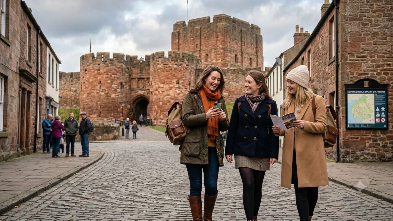
CARLISLE / LONDON — Public debate surrounding destination safety, emergency preparedness, and national resilience has reignited across the United Kingdom following the viral recirculation of a historical assessment that named the Cumbrian border city of Carlisle among the country’s safest locations in the event of an international nuclear conflict.
The renewed attention stems from the resurfacing of a 2017 real-estate analysis that compiled nineteen British settlements considered geographically detached from primary metropolitan target zones. As heightened geopolitical rhetoric between global powers—including the United States, the Russian Federation, France, and Britain—dominates international headlines in late 2026, the prospect of identifying regional sanctuaries has captured the popular imagination across digital platforms and international travel forums.
However, defense analysts, disaster management specialists, and public resilience officials caution that treating a decade-old commercial property survey as an authoritative national security document is fundamentally misguided. While Carlisle occupies a scenic position in North West England, detached from sprawling urban conurbations like London, Birmingham, and Manchester, geographical distance alone does not equal survival or societal resilience during a major civil emergency.
The discussion provides a timely opportunity to examine the complex realities of British emergency planning, the mechanics of modern national infrastructure, and how tourism destinations must communicate authentic travel safety without falling prey to sensationalist survivalist narratives.
       DEBUNKING THE "SAFEST PLACES" FALLACY: 2017 RANKING VS. REALITY

  Historical 2017 Property Claim         Verified 2026 Civil Resilience Reality
  -----------------------------------------------------------------------------
  Origin: eMoov online real estate blog  Status: Commercial marketing exercise;
                                                 zero official government standing

  Core Metric: Physical distance from    Flaw: Ignores prevailing wind patterns,
  major metropolitan urban centers       atmospheric fallout, and secondary risk

  Strategic Context: Assumes regional    Reality: Overlooks adjacent targets such
  isolation provides absolute defense    as Faslane / Coulport and Sellafield

  Resource Model: Treats towns as self-  Reality: Urban centers rely on national
  contained, autonomous survival havens  power grids, water, and supply chains

  Travel Meaning: Shared as a travel     Official Guidance: National Risk Register
  and relocation safety endorsement      directs public to civil resilience hubs
The Provenance of the 19-Location Assessment: Viral Myth vs Commercial Marketing
To evaluate the credibility of Carlisle’s supposed status as an emergency refuge, one must trace the origin of the ranking that has returned to public circulation.
The list was originally compiled in 2017 by eMoov, an online British estate agency that sought to leverage geopolitical headlines to generate brand visibility. The company’s marketing team cross-referenced property price indices with simple linear distances from Britain’s largest urban populations, producing a list of nineteen towns and rural districts labeled as potentially less vulnerable to direct blast damage during a hypothetical nuclear exchange.
Alongside Carlisle, the informal survey featured disparate settlements across England, Scotland, and Wales, including remote communities in North Yorkshire, parts of Devon and Cornwall, and rural pockets of the Scottish Borders.
EVOLUTION OF A VIRAL CLAIM: FROM PROPERTY BLOG TO HEADLINE
| Column 1 |
|---|
| 2017: Commercial Launch |
| - UK online estate agent eMoov drafts promotional property blog |
| - Ranks 19 UK towns based solely on mileage from major city centers |
| - Carlisle featured due to distance from London and English Midlands |
| 2022–2025: Episodic Social Media Resurfacing |
| - Content scraped by automated aggregators during Ukraine & Middle East peaks |
| - Repackaged as "scientific survival studies" without original context |
| November 2026: Broad National & International Retraction |
| - Mainstream media outlets and travel blogs recirculate Carlisle headlines |
| - Defense experts and Cumbria Local Resilience Forum clarify official facts |
| - UK Cabinet Office affirms National Risk Register as the sole authority |
The fundamental flaw of the 2017 document lies in its methodology. It did not incorporate nuclear yield simulations, atmospheric dispersion modeling, or critical infrastructure interdependency audits. No civil defense planners, military tacticians, or emergency management scientists contributed to its formulation. It was never submitted to, reviewed by, or acknowledged by the Ministry of Defence (MoD), the Home Office, or the Cabinet Office.
Over the intervening nine years, automated content aggregators, social media influencers, and survivalist forums periodically extracted the Carlisle citation, stripping away its promotional real-estate origins and repackaging it as an objective scientific study.
When international tensions flare, search queries regarding safe destinations inevitably surge, pulling historical blog posts to the surface of search algorithms and presenting outdated marketing content as contemporary news.
| Assessment Dimension | 2017 eMoov Property Survey | UK Government National Risk Register |
|---|---|---|
| Publishing Body | Commercial Online Estate Agency | UK Cabinet Office Resilience Directorate |
| Statutory Authority | None (Private Marketing Campaign) | Statutory National Emergency Standard |
| Methodological Rigor | Straight-line mileage from cities | Probabilistic modeling and expert consensus |
| Scope of Hazards | Single hypothetical conflict scenario | All-hazards matrix (pandemics, cyber, war) |
| Infrastructure Analysis | Completely omitted | Evaluates supply chain, energy, and water grids |
| Travel Recommendation | Speculative real-estate acquisition | Structured, actionable household preparedness |
The Critical Flaw: Conflating Physical Distance with Civil Resilience
The central weakness of asserting that any regional settlement is inherently safe during an international catastrophe is the failure to distinguish between immediate weapon effects and catastrophic systemic disruption.
Modern urban civilization operates through a complex, tightly synchronized web of critical national infrastructure. A community cannot survive simply because it stands fifty miles away from a primary blast perimeter if the national support structures that sustain human life collapse simultaneously.
                  THE COLLAPSE OF SYSTEMIC RESILIENCE

                 +--------------------------------+
                 |  Severe National Emergency /   |
                 |  Strategic Infrastructure Loss |
                 +--------------------------------+
                                  |
         +------------------------+------------------------+
         |                        |                        |
         v                        v                        v
  [ Power & Energy ]       [ Telecommunications ]   [ Food & Logistics ]
  National Grid blackout;  4G/5G mobile blackout;   Supermarkets exhausted
  substation shutdowns;    subsea cables disrupted; in 48 to 72 hours; fuel
  loss of domestic gas     banking and ATMs offline delivery stops
         |                        |                        |
         +------------------------+------------------------+
                                  |
                                  v
                 +--------------------------------+
                 |    Cascading Municipal Shock   |
                 | (Even in "Distant" Towns)      |
                 | - Clean water pumping halts    |
                 | - Hospital generators fail     |
                 | - Emergency services stranded  |
                 +--------------------------------+
Civil emergency planners emphasize several interlocking vulnerabilities that would impact regional centers like Carlisle during a severe national security crisis:
- Food Supply and Logistics Breakdown: Contemporary grocery supply chains operate on lean "just-in-time" logistics. Major supermarket distribution centers hold no more than three to four days of food stocks. If long-distance freight distribution across the M6, M1, or West Coast Main Line is halted due to fuel rationing, power failures, or damage to central depots, supermarket shelves in regional towns become empty within 72 hours, regardless of local population density.
- Electrical Grid Vulnerabilities: The British National Grid operates as an interconnected national system. A catastrophic event that knocks out key power stations, high-voltage substations, or interconnector terminals in the Midlands and South East triggers cascading frequency imbalances, plunging regional networks into blackout. Without electricity, municipal water treatment plants cannot pump potable water to residential taps, sewage pumping stations back up, and cellular telecommunication towers lose battery backup power within hours.
- Healthcare Overload: North Cumbria Integrated Care NHS Foundation Trust, which operates the Cumberland Infirmary in Carlisle, maintains emergency capacities scaled for local peacetime demographics. In a national crisis, regional hospitals would face severe shortages of pharmaceuticals, medical gases, anesthesia, and blood supplies—commodities manufactured and warehoused in central industrial corridors.
Strategic Geography: Why North West England and Cumbria Are Not Isolated
Beyond the systemic vulnerabilities common to all modern settlements, the assertion that Carlisle represents a tranquil geographical haven overlooks the strategic defense installations situated across North West England and western Scotland.
In analyzing regional safety claims, British historian and author Dr David Swift observed that individuals seeking security during severe international tension instinctively gravitate toward rural surroundings and smaller settlements. However, Dr Swift pointed out that proximity to strategic military installations fundamentally alters the risk calculus of any region.
       STRATEGIC DEFENSE & NUCLEAR VECTORS ACROSS THE IRISH SEA BASIN

  [ HMNB Clyde / Faslane & Coulport ]  <-- UK Vanguard / Trident Submarine Base
            |                              (Approx. 85-90 miles NW of Carlisle)
            |
            |     [ SOLWAY FIRTH / BORDER CORRIDOR ]
            |                      |
            +============> [ Carlisle (XAP Junction) ] <============+
                                   |                                |
                        [ Sellafield Reprocessing ]       [ Barrow-in-Furness ]
                        Nuclear Decommissioning Site      Astute & Dreadnought
                        (Approx. 45 miles SW)             Submarine Shipyards
Carlisle sits at the geographic center of a maritime corridor containing some of the most critical military and nuclear assets in Western Europe:
1. Her Majesty’s Naval Base Clyde (Faslane and Coulport)
Positioned on the Gare Loch and Loch Long in western Scotland, approximately 85 miles northwest of Carlisle, HMNB Clyde serves as the operational headquarters of the Royal Navy Submarine Service. Coulport houses the Royal Naval Armament Depot, where Britain's Trident D5 nuclear deterrent warheads are stored and processed.
Defense planners recognize that in an unrestricted conflict involving nuclear powers, Faslane and Coulport represent premier strategic targets. Prevailing north-westerly and westerly atmospheric currents over the North Channel and the Solway Firth could carry radioactive debris directly across the lowlands toward northern Cumbria.
2. The Sellafield Nuclear Complex
Located on the Cumbrian coast approximately 45 miles southwest of Carlisle, Sellafield is Europe’s largest and most complex nuclear materials handling and decommissioning facility. The site holds the world’s largest civilian stockpile of separated plutonium, alongside massive high-level radioactive waste storage tanks and spent fuel cooling ponds.
Any disruption to Sellafield’s external power supplies, cooling infrastructure, or physical integrity caused by sabotage, cyberwarfare, or military strikes would present extreme radiological contamination challenges for all of Cumbria, North Lancashire, and south-west Scotland.
3. Barrow-in-Furness Submarine Shipyards
Situated 55 miles south of Carlisle, the BAE Systems shipyard at Barrow-in-Furness is the sole facility in the United Kingdom capable of designing and constructing nuclear-powered attack submarines (Astute class) and ballistic missile submarines (Dreadnought class). As the industrial cradle of the Royal Navy's undersea warfare fleet, Barrow is recognized by defense strategists as a primary strategic infrastructure asset.
4. Critical Rail and Road Transit Chokepoints
Far from being an isolated sanctuary, Carlisle serves as the most important transport chokepoint between England and Scotland. The city hosts:
- The West Coast Main Line (WCML): Britain's most critical north-south rail trunk corridor, operated by Avanti West Coast and TransPennine Express, carrying essential passengers and cross-border rail freight.
- The M6 / M74 Motorway Nexus: The primary arterial highway connecting the industrial centers of northern England with the Scottish Central Belt.
- The A69 Trans-Pennine Corridor: Connecting Carlisle directly with the deep-water port facilities and commercial terminals of Newcastle upon Tyne and the North Sea coast.
In any national mobilization or major infrastructure crisis, transport hubs along vital logistics arteries face heightened security scrutiny, military traffic prioritization, and severe civilian travel restrictions.
The UK National Risk Register and Verified Civil Resilience Protocols
Rather than turning to outdated commercial rankings, travelers and residents seeking authentic emergency safety guidance must look to the United Kingdom’s statutory resilience frameworks.
The official benchmark for threat assessment in the UK is the National Risk Register (NRR), compiled biennially by the Cabinet Office Resilience Directorate under the provisions of the Civil Contingencies Act 2004. The register evaluates dozens of severe hazards facing the nation, categorizing risks based on objective mathematical likelihood and prospective societal impact.
              UK STATUTORY CIVIL CONTINGENCIES ARCHITECTURE

       +--------------------------------------------------------+
       |             CABINET OFFICE RESILIENCE DIRECTORATE      |
       |  - National Risk Register (NRR)                        |
       |  - UK Government Resilience Framework                  |
       +--------------------------------------------------------+
                                   |
                                   v
       +--------------------------------------------------------+
       |            CUMBRIA LOCAL RESILIENCE FORUM (LRF)        |
       |  Multi-Agency Emergency Coordination:                   |
       |  - Cumberland Council & Westmorland & Furness Council  |
       |  - Cumbria Constabulary & Civil Nuclear Constabulary   |
       |  - North West Ambulance Service & NHS Trust            |
       |  - Environment Agency (River Eden Flood Defenses)      |
       +--------------------------------------------------------+
                                   |
                                   v
       +--------------------------------------------------------+
       |             NATIONAL EMERGENCY ALERTS SYSTEM           |
       |  - Direct 4G/5G cell-broadcast emergency warnings      |
       |  - Real-time sirens and evacuation directives on phones|
       +--------------------------------------------------------+
The UK Government Resilience Framework emphasizes that individual and community resilience begins with practical, verified household readiness rather than geographic flight. Official guidance through the national "Prepare" campaign advises citizens and travelers to implement baseline preparedness measures:
- 72-Hour Sustenance Reserves: Maintaining non-perishable food supplies and clean bottled water (at least three liters per person per day) sufficient to sustain a household for three full days without external municipal services.
- Independent Communications Equipment: Keeping a battery-powered or wind-up AM/FM radio, along with spare batteries, to receive verified government broadcast updates if mobile telecommunication networks and broadband lines fail.
- Emergency Power and Lighting: Equipping homes and vehicles with high-lumen LED torches, portable power banks for mobile phones, and avoiding open candle flames during power outages to eliminate secondary fire hazards.
- Essential Medical Supplies: Securing a seven-day reserve of mandatory prescription medications, comprehensive first-aid kits, and critical hygiene supplies.
- Emergency Cellular Broadcast Monitoring: Familiarizing oneself with the UK National Emergency Alerts system, which transmits severe warning tones and actionable survival instructions directly to compatible 4G and 5G mobile handsets located within threatened geographical areas.
At the county level, emergency planning for Carlisle is managed by the Cumbria Local Resilience Forum (Cumbria LRF), a multi-agency partnership bringing together Cumberland Council, Cumbria Constabulary, Cumbria Fire and Rescue Service, the Environment Agency, and specialized bodies such as the Civil Nuclear Constabulary (CNC) guarding Sellafield.
The LRF maintains specialized Community Emergency Plans designed to address realistic, high-probability disruptions—such as severe river flooding along the River Eden basin, winter blizzard road blockages, and industrial supply interruptions.
How Tourism Boards and Destination Managers Must Communicate Safety
The recirculation of the Carlisle survival claim illustrates an important challenge confronting destination marketing organizations (DMOs) and municipal authorities: how to communicate travel safety responsibly without validating sensationalist rumors.
For tourism organizations such as Cumbria Tourism and Visit Britain, the resurfacing of the 2017 property list presents both an educational challenge and a reputational risk. If left unaddressed, speculative claims regarding "safe places" can distort public perceptions, setting unrealistic expectations for visitors and obscuring the genuine merits of the destination.
       RESPONSIBLE DESTINATION SAFETY COMMUNICATION MATRIX

  Communication Trap to Avoid            Responsible Marketing Strategy
  -----------------------------------------------------------------------------
  Validating clickbait claims of being   Ground all safety statements in verified
  an "officially protected refuge"       local authority and police standards

  Ignoring public safety queries when    Provide transparent links to official
  geopolitical headlines rise            emergency guidance (gov.uk / NHS 111)

  Relying on outdated 3rd-party blogs    Publish real-time travel status updates:
  and speculative real estate rankings   rail timetables, roads, weather alerts

  Presenting rural isolation as an       Promote well-managed visitor services,
  absolute barrier against emergencies   walkability, healthcare, and heritage
Responsible tourism communication demands strict adherence to four core principles:
- Reliance on Official Authority: Destination authorities must never endorse or amplify unofficial safety rankings compiled by commercial third parties. All destination security guidance must cite verified data from the Cabinet Office, the Foreign, Commonwealth & Development Office (FCDO), or local police constabularies.
- Transparent Operational Information: Rather than discussing hypothetical geopolitical scenarios, tourism boards should provide practical, actionable operational data that travelers need on a daily basis. This includes real-time rail service updates on the West Coast Main Line, highways conditions along the A69 and M6, river level data from the Environment Agency, and seasonal opening hours for heritage properties.
- Equitable International Messaging: International travelers—particularly visitors from the United States, Europe, and Asia—frequently evaluate UK destinations through foreign travel advisories issued by bodies like the US Department of State. Destination promoters must reassure visitors that the UK maintains one of the world's most stable, reliable civil policing and public health frameworks, rendering sensational survival debates entirely irrelevant to everyday vacation planning.
- Separating Heritage Marketing from Survivalism: Carlisle’s marketing strategy should focus entirely on its exceptional medieval architecture, Roman frontier heritage, culinary scene, and strategic gateway position to the Lake District National Park and the Scottish Borders.
Beyond Survivalist Speculation: Carlisle’s Authentic Heritage and Gateway Appeal
While speculative safety rankings capture temporary internet attention, Carlisle’s enduring significance lies in its multi-layered historical architecture, thriving cultural institutions, and strategic role as the historic guardian of England’s northern border.
Nicknamed the "Great Border City," Carlisle boasts more than two millennia of continuous recorded history, having served as a formidable Roman garrison outpost, a fiercely contested medieval fortress, and an influential Victorian railway junction.
                     CARLISLE'S CULTURAL & HERITAGE LANDSCAPE

               [ HADRIAN'S WALL UNESCO WORLD HERITAGE SITE ]
               - Birdoswald Roman Fort & Lanercost Priory
                                     |
                                     v
                       +---------------------------+
                       |    HISTORIC CITY CENTER   |
                       +---------------------------+
                                     |
         +---------------------------+---------------------------+
         |                           |                           |
         v                           v                           v
  [ Carlisle Castle ]     [ Carlisle Cathedral ]      [ Tullie House Museum ]
  Built 1092 by William   Founded 1122; famous        World-class Roman &
  Rufus; Mary Queen of    east window; Augustinian    Border Reiver artifact
  Scots imprisoned here   priory architecture         collections
         |                           |                           |
         +---------------------------+---------------------------+
                                     |
                                     v
                 [ LAKE DISTRICT NATIONAL PARK (UNESCO) ]
                 Northern gateway to Ullswater, Keswick & Derwentwater
1. Carlisle Castle: Guardian of the Border
Occupying a commanding sandstone ridge overlooking the River Eden, Carlisle Castle is one of Britain’s most historic military strongholds. Founded in 1092 by King William II (William Rufus) over the footprint of an earlier Roman timber fort, the stone fortress endured more sieges than any other castle in the British Isles.
During the centuries of fierce Anglo-Scottish border conflict, the castle defended northern England against Scottish incursions. It famously served as the royal prison for Mary, Queen of Scots, in 1568 following her flight from Scotland. Today managed by English Heritage, the castle houses the Cumbria’s Museum of Military Life, preserving centuries of regimental history belonging to the Border Regiment and The Duke of Lancaster’s Regiment.
2. Carlisle Cathedral: Architectural Splendor
Founded in 1122 as an Augustinian priory and designated a cathedral church by King Henry I in 1133, Carlisle Cathedral is the second-smallest ancient cathedral in England. Despite severe damage sustained during the English Civil War, the building remains an architectural jewel.
Its crowning glory is the magnificent fourteenth-century East Window, regarded by architectural historians as one of the finest examples of Decorated Gothic flowing tracery in Europe. The cathedral’s fourteenth-century barrel-vaulted ceiling, painted with a celestial canopy of gold stars against an azure background, offers visitors an extraordinary visual spectacle.
3. Tullie House Museum and Art Gallery
Situated adjacent to the castle and cathedral in Carlisle’s historic quarter, Tullie House Museum and Art Gallery is Cumbria’s premier cultural institution. The museum houses internationally acclaimed collections detailing Roman frontier life along Hadrian’s Wall, fine art collections featuring Pre-Raphaelite works, and immersive exhibits illuminating the violent, turbulent history of the sixteenth-century Border Reivers.
4. The Gateway to Hadrian’s Wall and the Lake District
For domestic and international vacationers, Carlisle serves as the ultimate logistical launchpad for exploring northern England:
- Hadrian’s Wall UNESCO World Heritage Site: Carlisle is the primary urban anchor for the western sector of the 73-mile Roman fortification. Travelers can easily reach Birdoswald Roman Fort, the historic ruins of Lanercost Priory, and the scenic walking paths of the Hadrian’s Wall Path National Trail.
- The Lake District National Park: Positioned just 30 minutes north of Penrith, Carlisle provides effortless rail and road access to the Northern Fells, Ullswater, and Keswick, offering an affordable, culturally rich alternative base for exploring England's premier national park.
- The Solway Coast Area of Outstanding Natural Beauty (AONB): Extending west from Carlisle, the Solway Firth marshlands provide world-class birdwatching, historic salt-marsh landscapes, and breathtaking coastal sunsets looking across to the Scottish hills of Dumfries and Galloway.
Operational Guidance for Travelers: Planning a Safe Visit to Cumbria in 2026/2027
For holidaymakers, cultural heritage enthusiasts, and corporate travelers planning journeys to Carlisle and the surrounding Cumbrian region, travel professionals recommend adhering to practical travel management practices rather than entertaining speculative emergency scenarios.
       ACTIONABLE TRAVEL PLAYBOOK: VISITING CARLISLE & CUMBRIA

  [ Rail & Transport Management ]
  * Book advance tickets via Avanti West Coast or TransPennine Express
  * Verify live departures via National Rail Enquiries (nationalrail.co.uk)
  * Utilize the Hadrian's Wall Country Bus (AD122) for Roman fort transit

  [ Weather & Environmental Safety ]
  * Monitor the Environment Agency River Eden flood monitoring gauges
  * Check Met Office mountain weather forecasts before fell walking in the Lakes
  * Pack waterproof outer layers and sturdy footwear year-round

  [ Health & Public Safety Infrastructure ]
  * Cumberland Infirmary (Newtown Road, Carlisle): Full 24/7 A&E emergency care
  * NHS 111: Dial 111 for non-emergency medical advice throughout the UK
  * Police non-emergency: Dial 101; Immediate life safety emergency: Dial 999
1. Managing Rail and Overland Transit
Carlisle Railway Station (Carlisle Citadel), designed in neo-Tudor Gothic style by renowned architect William Tite in 1847, is one of the busiest rail interchange hubs in northern Britain. Six distinct railway routes converge at Citadel station:
- Avanti West Coast: Fast, frequent intercity electric services connecting Carlisle directly to London Euston (approx. 3 hours 15 minutes) and Glasgow Central (approx. 1 hour 15 minutes).
- TransPennine Express: Direct connections across the Scottish border to Edinburgh Waverley, and south toward Manchester Airport and Liverpool Lime Street.
- Northern Trains: Operating scenic regional feeder routes, including the iconic Settle to Carlisle Railway across the Yorkshire Dales, the Tyne Valley Line to Newcastle, and the Cumbrian Coast Line through Whitehaven and Barrow-in-Furness.
Travelers are advised to purchase Advance rail tickets to secure substantial savings and download the National Rail Enquiries mobile application to track real-time platform changes and engineering work alerts.
2. Environmental and Weather Preparedness
The most realistic safety challenge confronting visitors to Cumbria is not international conflict, but Atlantic weather patterns. The Lake District and Eden Valley experience elevated seasonal rainfall, particularly during autumn and winter.
Following the severe winter floods of Storm Desmond in December 2015, the Environment Agency completed a R$35 million overhaul of Carlisle’s flood defense network, installing automated flood barriers, reinforced floodwalls, and elevated pumping stations along the River Eden, River Caldew, and River Petteril.
Travelers planning outdoor excursions or fell-walking expeditions in the nearby Lake District should consult the Met Office Mountain Weather Forecast daily, equip themselves with waterproof outerwear, and carry physical Ordnance Survey maps alongside charged navigation devices.
3. Navigating Healthcare and Emergency Services
Visitors to Carlisle benefit from the robust healthcare infrastructure of the National Health Service (NHS).
The Cumberland Infirmary, located on Newtown Road in western Carlisle, operates a comprehensive, 24-hour Emergency Department (A&E) equipped to handle trauma, acute medical crises, and pediatrics.
International visitors from countries with reciprocal healthcare agreements (including European Union residents holding a European Health Insurance Card / GHIC) can access emergency treatment under established bilateral protocols. All travelers are strongly encouraged to carry comprehensive travel medical insurance covering emergency medical transport and itinerary interruptions.
The resurgence of the Carlisle "safest places" claim highlights how easily speculative commercial content can become entangled with public anxieties during periods of international instability. Yet when examined through the lens of modern defense logistics, civil contingencies planning, and critical infrastructure dependencies, the notion of an isolated geographic haven in modern Britain dissolves.
For the discerning traveler, Carlisle should not be sought as a fortress against hypothetical global conflicts, but celebrated for what it truly is: a proud, historic border city offering an authentic gateway to the timeless landscapes and rich cultural heritage of northern England.
Related Travel Guides
- Brazil Tornado Shuts Chapecó Airport as GOL Cancels Flights and Southern Travel Faces Gridlock
- Aer Lingus Flight EI402 Diverts to French Air Base as Coordinated Bomb Threats Target 15 European Flights
- South Asia Mountain Travel Alert: Nepal, Bhutan, India, and Sri Lanka Disclose Distinct Flood and Landslide Risks
- Canada Ranked World's Safest Country for 2027 as US Travelers Prioritize Provincial Parks and Worry-Free Trails
This article is for informational purposes. Flight routes, passenger regulations, visa rules, and transit advisories are subject to change by airlines and aviation authorities. Readers are advised to verify schedules and travel documentation with relevant carriers and border agencies before departure.
Related Stories
Uniworld Unveils Mekong Mystique for 2028: New Luxury Vessel Redefines Cambodia and Vietnam River Cruises

Seattle-Tacoma and US Hubs Revolutionize Terminals: Guest Passes, Craft Dining, and Post-Security Retail Guide 2026