Winter Storm Paralyzes North and South Dakota: 6-Inch Snowfall Triggers Travel Emergency for Easter Travelers
A major winter weather advisory from the National Weather Service is grounding Easter travel across North and South Dakota. Up to six inches of snow, near-zero visibility, and highway closures on I-29 and I-90 are disrupting road travel, regional airports, and connecting hub flights through Minneapolis and Denver.
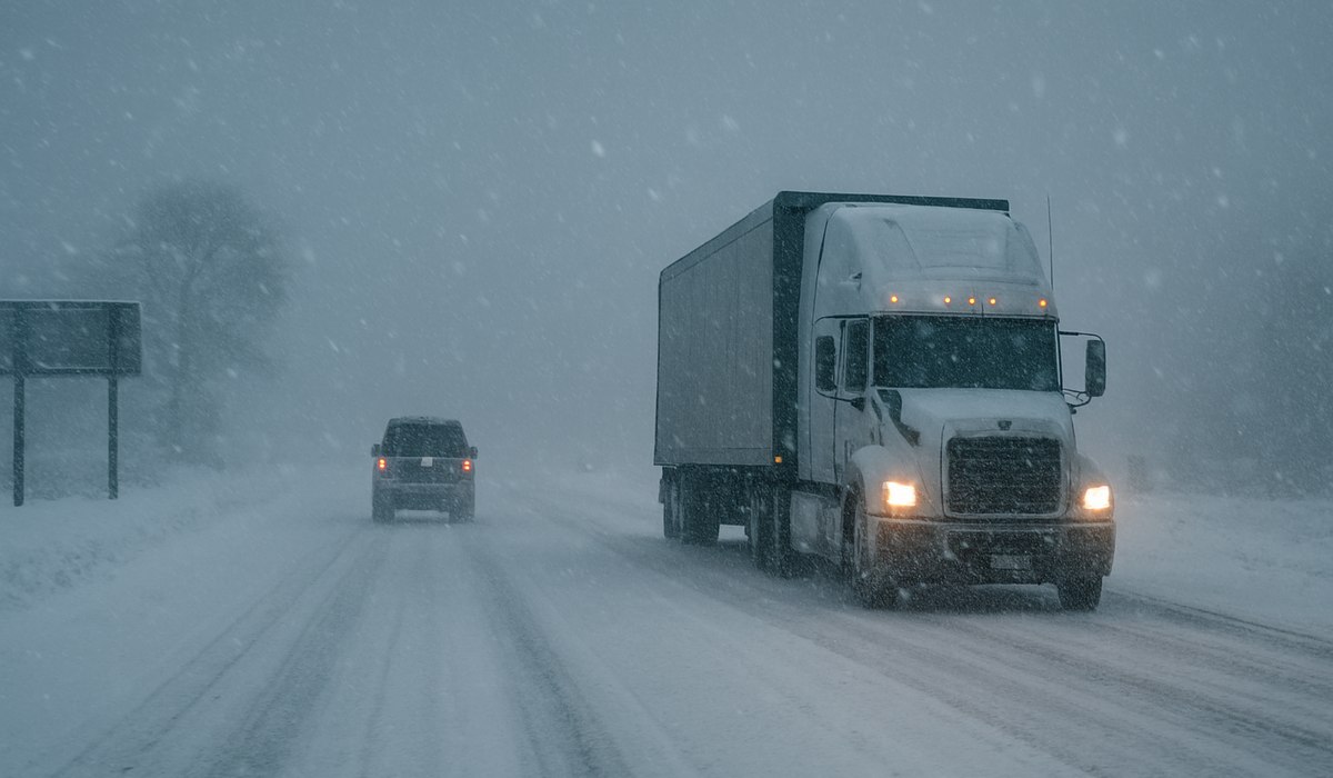
Image generated by AI
Winter Storm Shreds Easter Travel Plans Across the Dakotas
A sweeping winter weather advisory issued by the National Weather Service (NWS) is aggressively targeting massive swaths of both North and South Dakota just as Americans begin one of the year's busiest travel periods—the Easter holiday weekend. Up to six inches of snow, combined with powerful wind gusts generating white-out conditions and rapidly accumulating snowdrifts, is turning the region's road and air travel networks into a logistical nightmare.
The advisory blankets major population centers including Fargo, Bismarck, Sioux Falls, and Rapid City, trapping Easter travelers mid-journey and forcing transportation authorities into emergency response mode. The NWS has been unequivocal in its messaging: conditions are expected to intensify throughout the week, and non-essential travel should be abandoned entirely.
High-Risk Corridors: Interstate 29 and Interstate 90
The two arteries that sustain surface travel mobility across both Dakotas are squarely in the storm's crosshairs:
Interstate 29 — North America's longest north-south interstate, running through eastern North and South Dakota from the Canadian border toward Kansas City — is facing severe closures and snowdrift blockages. Traffic is nearly stationary in key segments.
Interstate 90 — The southern cross-state corridor connecting South Dakota's Black Hills and Rapid City with Sioux Falls — is experiencing rapidly deteriorating visibility, ice accumulation, and compounding accident-related closures.
The NWS is warning that snowplows cannot clear accumulation fast enough in the storm's most intense hours, creating dangerous windows where roads functionally become impassable. Even equipped vehicles face extreme risk during these windows.
Air Travel Disruptions: Regional Airports and Hub Ripple Effects
The winter storm is not just a road problem. Sioux Falls Regional Airport (FSD) and Bismarck Municipal Airport (BIS) have both begun reporting delays driven by runway ice accumulation, snow clearance operations, and reduced ground crew visibility.
For passengers connecting through major hubs, the disruption extends well beyond the Dakotas:
- Minneapolis-Saint Paul International Airport (MSP) — a critical Midwest hub through which most Dakota travelers route — faces cascading delays from reduced inbound traffic
- Denver International Airport (DEN) — the Western hub feeding Dakota connections via United, Southwest, and Frontier — may experience arrivals disruption from cross-state weather patterns
- International flights connecting onward through these hubs face compounded exposure to multiple disruption layers
What Guests Get
- Real-time road condition updates via North Dakota and South Dakota Departments of Transportation official portals
- NWS weather alert monitoring covering hourly snowfall rates, wind speed, and visibility forecasts
- Airline flexible rebooking — most major carriers have weather waivers in effect for the affected region during advisory periods
- Emergency roadside assistance — both state DOTs have deployed additional resources for stranded motorists
- Airport loop advisory — real-time gate and runway status updates at FSD and BIS
Travel Disruption Snapshot: Dakotas Winter Storm
| Impact Category | Detail | Severity |
|---|---|---|
| Snow Accumulation | Up to 6 inches in advisory zones | High |
| Wind Impact | Gusts causing reduced visibility and drifts | High |
| Road Risk (I-29) | Eastern ND/SD corridor — closures/ice | Critical |
| Road Risk (I-90) | Southern SD corridor — ice and closures | Critical |
| Airport Status (FSD) | Delays due to icing and snow clearance | Moderate–High |
| Airport Status (BIS) | Delays due to runway clearance operations | Moderate |
| Hub Impact (MSP) | Cascading inbound delays | Moderate |
| Hub Impact (DEN) | Potential ripple effects | Low–Moderate |
What This Means for Travelers
If you are planning Easter travel through North or South Dakota—whether driving or flying through regional airports—the calculus is simple: either delay your departure until after the storm's peak, or execute a comprehensive contingency plan before you leave. The NWS storm window is not brief; conditions are expected to persist and potentially worsen through the holiday weekend.
For drivers, the official advice from both state Departments of Transportation is to stay off the roads unless absolutely necessary. If you must drive, winter tires (not all-season) are essential—not recommended, essential. Carry blankets, drinking water, non-perishable food, a portable phone charger, and a paper map for segments where cellular coverage drops. Heed the flashing variable message signs on I-29 and I-90 implicitly; they reflect real-time closure and hazard data, not estimates.
For flyers, immediately activate flight status alerts via your carrier's mobile application, and check whether a weather waiver applies to your booking. Weather waivers typically permit a one-time free rebooking within a 3-5 day window around the storm disruption dates—act before capacity on alternate flights fills up.
FAQ: Dakotas Winter Storm Travel Advisory
Why is a major winter storm hitting in April? The Northern Great Plains regularly experiences powerful late-season winter storms through mid-April. Cold air masses from Canada can still penetrate the region with significant intensity, particularly when they collide with early spring moisture surges from the Gulf of Mexico.
How do I know if my highway is closed in North or South Dakota? North Dakota's DOT operates 511.nd.gov with live road closure maps. South Dakota DOT maintains sd511.org for real-time highway status, including closure alerts, travel advisories, and camera feeds.
Will my airline compensate me for a weather delay? US airlines are not required by federal law to provide monetary compensation for weather delays. However, most carriers issue weather waivers during major events, allowing free rebooking. Check your airline's travel advisory page and call or use the app rather than queuing at the airport.
Related Travel Guides
How to Drive Safely in Winter Storms: Emergency Vehicle Preparation Guide
Airport Weather Waivers Explained: How to Rebook for Free During Storms
Easter Road Trips in the US: Which Routes to Avoid This Year
Disclaimer
This article is for informational and educational purposes only. It does not constitute legal, financial, or professional advice. While we strive to provide accurate and up-to-date information, travel policies, regulations, and conditions change rapidly. Always verify information with official sources before making travel decisions. Nomad Lawyer makes no representations about the accuracy, reliability, completeness, or suitability of the information provided. Readers should consult qualified professionals for advice specific to their circumstances. The views expressed in this article are those of the author and do not necessarily reflect the views of Nomad Lawyer.

Raushan Kumar
Founder & Lead Developer
Full-stack developer with 11+ years of experience and a passionate traveller. Raushan built Nomad Lawyer from the ground up with a vision to create the best travel and law experience on the web.
Learn more about our team →