
Hawaii Teams Up With Arizona and More as Powerful Weather Threats Challenge United States Travel Plans: New Travel Alert
Multiple severe weather systems—including Category 4 Hurricane Nolo in Hawaii, an East Coast Nor'easter, and Polo-related moisture in the Southwest—disrupt US travel.

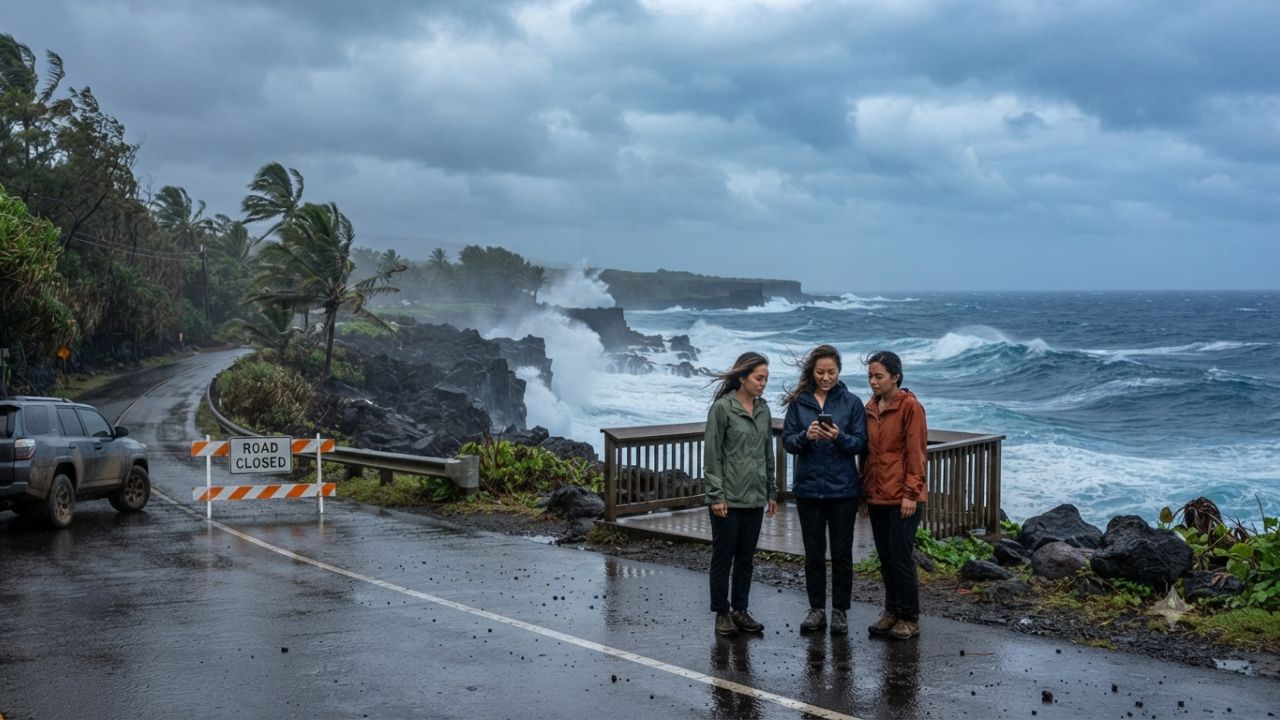
Image generated by AI
Simultaneous severe weather systems are disrupting United States travel networks in late September 2026, as Hawaii manages trailing ocean hazards from Category 4 Hurricane Nolo, an East Coast nor'easter brings coastal flooding to New York and New Jersey, and tropical moisture triggers flash flood watches across New Mexico, Arizona, and Texas.
Quick Summary
- Hawaii Hazards: While Category 4 Hurricane Nolo (145 mph winds, 939 mb pressure) moved west-northwest away from the islands, high-surf advisories (7–10 ft surf) and road closures remain active across Honolulu, Hawaii, Maui, and Kauai under a pre-landfall Presidential Emergency Declaration.
- Northeast Nor'easter: A coastal low-pressure system generated 1 to 2 feet of coastal inundation and heavy rainfall across New York, New Jersey (State of Emergency across 8 counties), Massachusetts (70+ mph wind gusts at Wellfleet), Rhode Island, Connecticut, and Virginia's Eastern Shore.
- Southwest Heavy Rain: Tropical moisture linked to Hurricane Polo and an upper-level low has prompted multi-day flood watches across New Mexico, Arizona, and the Texas Panhandle through September 30.
- Travel Impact: Highway closures (including Highway 11 and Hana Highway in Hawaii), ferry suspensions in the Northeast, and desert flash-flood warnings require travelers to verify local weather and transport conditions before departing.
Multi-System Severe Weather Overview: US Travel Impact
Travelers moving across the United States face three distinct, non-overlapping weather hazards in late September 2026. Meteorological agencies emphasize that these events stem from separate atmospheric drivers and require tailored safety precautions depending on the geographic region.
- Pacific Basin: Trailing swells and heavy rain bands from Hurricane Nolo continue to generate dangerous rip currents and high surf across Hawaii.
- Atlantic Coast: A persistent nor'easter is producing minor-to-moderate coastal flooding, high winds, and urban transit disruptions from Virginia through southern New England.
- Southwest Deserts: Tropical moisture interacting with upper-level atmospheric forcing is causing rapid runoff and flash-flood threats across high-desert roads in New Mexico, Arizona, and Texas.
System 1: Hurricane Nolo Leaves Continuing Coastal & Road Risks Across Hawaii
According to updates from the National Hurricane Center (NHC) and Central Pacific Hurricane Center, major Hurricane Nolo reached peak sustained winds of 145 mph (230 km/h) with a minimum central pressure of 939 millibars, classifying it as a powerful Category 4 hurricane on the Saffir-Simpson scale. At its advisory point, Nolo was centered approximately 380 miles south-southwest of Honolulu (16.3°N, 160.3°W), moving west-northwest at 12 mph.
While the storm center passed offshore, the federal government issued a pre-landfall Presidential Emergency Declaration covering Honolulu, Hawaii (Big Island), Maui, and Kauai counties, providing eligible emergency protective measures at a 75 percent federal cost share.
Coastal & Transportation Disruptions
- Surf Advisories: The National Weather Service (NWS) issued high-surf advisories featuring 7 to 10 foot breaking waves along south-facing shores and 6 to 8 foot surf along western Big Island shores.
- Highway Disruption: Emergency crews cleared debris along Highway 11 in Kaʻū. The Hawaii Department of Transportation strongly discouraged non-essential travel along East Maui's narrow Hāna Highway due to rockfalls and localized flooding.
- Public Closures: State authorities enacted precautionary closures for public schools, government facilities, and University of Hawaii campuses across Big Island and Maui County.
System 2: East Coast Nor'easter Triggers Coastal Flooding from New York to Virginia
Concurrently, an East Coast nor'easter system produced heavy rainfall, coastal inundation, and strong wind gusts across mid-Atlantic and New England coastal regions.
New York & New Jersey
- State of Emergency: New Jersey Governor Mikie Sherrill declared a State of Emergency covering eight counties (Atlantic, Burlington, Cape May, Cumberland, Middlesex, Monmouth, Ocean, and Salem) due to widespread shoreline flooding and wind damage.
- NYC Coastal Advisories: The NWS forecast up to 1 foot of ground-level inundation in low-lying waterfront sections of Manhattan, Brooklyn, and Staten Island, while southern Westchester, the Bronx, Long Island, and southern Connecticut faced 1 to 2 feet of inundation during peak high tides.
Massachusetts, Rhode Island & Connecticut
- Wind & Rain: NWS Boston/Norton maintained flood watches across Boston, Worcester, Plymouth, Barnstable, Dukes, and Nantucket counties. Wind gusts exceeded 70 mph at Wellfleet, Massachusetts.
- Island Transit: Island ferry routes connecting Block Island, Martha's Vineyard, and Nantucket experienced weather delays and operational monitoring.
- Connecticut Shoreline: Southern Fairfield and New Haven counties recorded coastal flood advisories with gusts up to 25 mph and 100 percent precipitation chances in Bridgeport and New Haven.
Virginia Eastern Shore
- Coastal flood advisories affected Accomack County and Chincoteague along Virginia's Eastern Shore due to elevated tidal water levels.
System 3: Southwest Tropical Moisture Drives Flash Flood Risk in New Mexico, Arizona, and Texas
In the Southwestern United States, tropical moisture associated with Hurricane Polo interacted with an incoming upper-level low-pressure system, triggering a multi-day excessive rainfall event across desert and mountain terrain.
New Mexico & Arizona
- Multi-Day Flood Watches: The NWS placed large sections of New Mexico under flood watches through September 30, warning of rapid runoff around Santa Fe and mountain passes.
- Desert Wash Warnings: Southeastern and northern Arizona faced moderate risks of excessive rainfall. Local authorities warned travelers that dry desert washes and normally dry creek beds can fill rapidly with fast-moving water following upstream downpours.
Texas Panhandle
- Heavy rain bands extended eastward into the Texas Panhandle and northwest Texas, creating hazardous driving conditions for long-distance highway commuters.
Side-by-Side System Comparison & Recorded Weather Statistics
The data table below summarizes the key metrics, official warnings, and primary traveler concerns across the three active weather systems.
| Region / System | Primary Weather Driver | Peak Intensity / Metric | Official Emergency Status | Primary Traveler Hazard |
|---|---|---|---|---|
| Hawaii | Hurricane Nolo | 145 mph winds / 939 mb pressure | Presidential Emergency Declaration | High surf (7–10 ft), rip currents, road debris |
| New York & NJ | East Coast Nor'easter | 1–2 ft coastal inundation | NJ State of Emergency (8 counties) | Waterfront flooding, urban transit delays |
| Massachusetts | East Coast Nor'easter | 70+ mph gusts (Wellfleet) | Flood Watch & Flood Warnings | Ferry cancellations, coastal island access |
| Rhode Island & CT | East Coast Nor'easter | Coastal flood advisories | NWS Coastal Flood Statements | Low-lying road inundation, beach erosion |
| Virginia | East Coast Nor'easter | Elevated tidal water | Eastern Shore Advisories | Chincoteague coastal road flooding |
| New Mexico & AZ | Polo Tropical Moisture | Multi-day excessive rain | Flood Watches through Sept 30 | Desert wash flash floods, mountain runoff |
| Texas | Southwest Tropical Low | Heavy rain bands | Regional Excessive Rain Risk | Highway hydroplaning, low-water crossings |
Official Traveler Safety Instructions & Emergency Guidance
Government emergency management agencies recommend strict adherence to local advisories:
- Hawaii Coastal Safety: Respect high-surf advisories; do not enter ocean waters along south-facing or west-facing shores during active warnings. Obey road closures on Highway 11 and Hāna Highway.
- East Coast Coastal Flooding: Do not drive around barricades or attempt to cross flooded coastal roadways. Allow extra travel time for public transit and check ferry schedules prior to departing for coastal islands.
- Southwest Flash Flood Safety: Never cross flooded washes or low-water crossings in desert regions ("Turn Around, Don't Drown"). Monitor NWS flash-flood watches when driving through New Mexico, Arizona, or Texas.
Practical Traveler Checklist Before Departures & Connections
[Check NWS & NHC Official Weather Updates] ---> [Verify Road Conditions & Highway Closures]
                                                        |
                                                        v
[Confirm Flight & Ferry Schedules] ------------> [Maintain Flexible Accommodation Booking]
- Official Weather Verification: Review active warnings from the National Hurricane Center and National Weather Service.
- Transport Status: Check state DOT websites for road closures (e.g., Hawaii DOT, NJ DOT).
- Airline & Ferry Waivers: Monitor airline change-fee waivers and ferry operational updates for coastal islands.
- Emergency Contact Preparedness: Save local emergency management contact numbers and maintain device charge.
Looking Ahead: Monitoring Official Channels and Weather Forecasts
As weather patterns evolve through late September 2026, forecast models indicate that the East Coast nor'easter will gradually move offshore, while tropical moisture over the Southwest will transition eastward into the central High Plains. Hawaii authorities will continue debris clearance and infrastructure inspections as ocean swells subside.
Travelers are strongly advised to base transit decisions strictly on real-time guidance provided by official government agencies and transportation departments.
Frequently Asked Questions (FAQ)
Did Hurricane Nolo make direct landfall in Hawaii?
No. Category 4 Hurricane Nolo remained offshore, passing approximately 380 miles south-southwest of Honolulu. However, trailing moisture and large swells generated high surf, heavy rain, and road disruptions across the main islands.
Which states were affected by the East Coast Nor'easter?
The nor'easter produced coastal flooding, wind, and heavy rain across New York, New Jersey, Massachusetts, Rhode Island, Connecticut, and Virginia.
Why is flash flooding a major risk for travelers in Arizona and New Mexico?
Tropical moisture associated with Hurricane Polo created heavy rainfall over desert and mountain terrain. Desert ground cannot absorb intense rainfall quickly, causing rapid water runoff into normally dry washes and highway crossings.
How can travelers check road closures in affected states?
Travelers should consult official state Department of Transportation websites, local NWS forecast offices, and state emergency management agency feeds before embarking on road trips.
Related Travel Guides
Disclaimer
This article is for informational and educational purposes only. It does not constitute legal, financial, or professional advice. While we strive to provide accurate and up-to-date information, travel policies, regulations, and conditions change rapidly. Always verify information with official sources before making travel decisions. Nomad Lawyer makes no representations about the accuracy, reliability, completeness, or suitability of the information provided. Readers should consult qualified professionals for advice specific to their circumstances. The views expressed in this article are those of the author and do not necessarily reflect the views of Nomad Lawyer.
Kunal K Choudhary
Co-Founder & Contributor
A passionate traveller and tech enthusiast. Kunal contributes to the vision and growth of Nomad Lawyer, bringing fresh perspectives and driving the community forward.
Learn more about our team →