
Nepal Invests Rs 4.5 Billion in Rupa Lake Tourism Expansion: Dam Construction, Island Temple, and Eco-Recreation Corridor in Pokhara

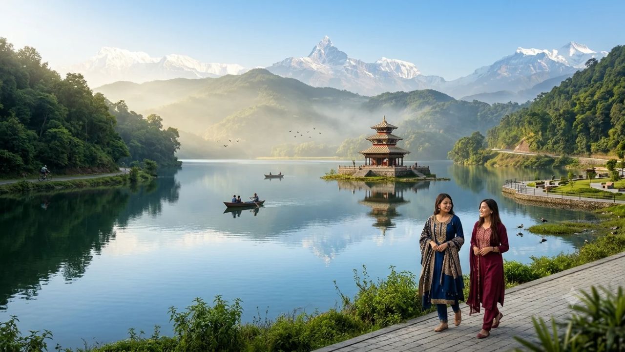
Nepal is executing an ambitious Rs 4.5288 billion infrastructure and environmental rehabilitation initiative at Rupa Lake in Kaski District, expanding the water body's surface area by 50 percent, constructing a multi-purpose dam and landscaped public park, erecting an offshore island temple, and establishing dedicated pedestrian and cycling circuits to decentralize tourism across the Pokhara Valley.
The comprehensive engineering and ecotourism project, implemented under the Irrigation and Water Resources Management Project in Pokhara, represents one of the largest state-funded water resource and recreational transformations in Gandaki Province. Spanning the geographic boundary between Pokhara Metropolitan City and Rupa Rural Municipality, the initiative is designed to relieve severe visitor pressure on Pokhara's central Phewa Lake by transforming Rupa Lake—traditionally a quiet, community-managed wetland—into a premier secondary hub for sustainable adventure, cultural heritage, and nature-based tourism.
With overall construction reaching approximately 70 percent completion, the project combines civil hydraulic engineering with community-based economic empowerment. Central to the development is the construction of a 590-metre earthen embankment coupled with a 45-metre concrete spillway, engineered to elevate water retention and expand the lake's surface area from 122 hectares to roughly 183 hectares. Beyond environmental stabilization, the project incorporates an island temple inspired by the famed Tal Barahi shrine, dedicated walking and cycling corridors along forested ridges, and sporting facilities, while navigating complex shoreline zoning regulations and forest clearance approvals.
Engineering Architecture: Dam Infrastructure and Waterbody Expansion
The primary physical objective of the Rupa Lake Project is the stabilization of seasonal water fluctuations and the long-term expansion of the lake basin. For decades, unchecked sedimentation carried by upstream feeder streams, coupled with agricultural encroachment along peripheral wetlands, caused Rupa Lake's open-water area to shrink, threatening aquatic habitats and limiting recreational navigation.
To reverse this ecological degradation and build a permanent water reservoir, engineers designed a composite dam structure spanning the lake's southern outflow. The barrier comprises two distinct yet structurally integrated components:
- Earthen Embankment Section: A 590-metre engineered earth-fill dam constructed from compacted clay, silt, and protective riprap rock armor, designed to absorb hydraulic loads and prevent peripheral seepage.
- Concrete Spillway Section: A 45-metre reinforced concrete control structure equipped with regulated sluice gates designed to manage seasonal monsoon discharge, discharge excess floodwaters into the Talbesi river corridor, and maintain an optimal water elevation year-round.
========================================================================================
RUPA LAKE INFRASTRUCTURE & EXPANSION SPECIFICATIONS
========================================================================================
Engineering & Spatial Indicator      Pre-Project Metric         Post-Completion Metric
----------------------------------------------------------------------------------------
Total Water Surface Area             122 Hectares (1.22 sq km)  183 Hectares (1.83 sq km)
Net Surface Area Expansion           --                         +61 Hectares (+50.0%)
Total Dam Structure Length           --                         635 Metres Combined
- Earthen Embankment Length          --                         590 Metres
- Concrete Spillway Section          --                         45 Metres
Maximum Dam Height                   --                         6.0 Metres
Maximum Dam Crest Width              --                         Up to 45 Metres
Total Approved Project Budget        --                         Rs. 4.5288 Billion NPR
Current Construction Progress        --                         Approximately 70% Complete
Targeted Final Commissioning         FY 2024/25 (Original)      2028 (Revised Target)
========================================================================================
Managing Authority: Irrigation and Water Resources Management Project, Pokhara.
========================================================================================
The dam structure rises to a maximum height of six metres above the original stream bed. In selected sections, the dam crest expands to a width of up to 45 metres. Rather than leaving this wide crest as utilitarian gravel, project planners have incorporated an expansive landscaped recreational park directly atop the structure. This elevated public concourse provides unhindered panoramic viewpoints overlooking the expanded lake waters, the forested hills of Pachbhaiya, and the snow-capped summits of the Annapurna and Manaslu mountain ranges.
The resulting 61-hectare expansion in open-water spread expands the aquatic reservoir to approximately 183 hectares. This expanded volume provides flood retention capacity during the intense South Asian summer monsoon, recharges regional groundwater tables, and establishes continuous navigability for recreational rowing, electric tour boats, and traditional wooden canoes throughout the year.
Cultural Architecture: The Mid-Lake Island Temple
A central cultural attraction of the Rupa Lake redevelopment is the planned construction of an offshore island temple positioned within the northern basin of the waterbody. The architectural design takes direct aesthetic and spiritual inspiration from the renowned Tal Barahi Temple situated on an island in Pokhara's Phewa Lake, which stands as one of western Nepal's most revered Hindu pilgrimage sites.
Erecting a monumental stone and wood pagoda temple within a dynamic lake environment requires specialized underwater civil engineering:
- Submerged Foundation Piling: The structure is anchored upon heavy reinforced concrete pillars driven approximately 12 metres through water and sedimentary mud down to solid bedrock.
- Elevated Concrete Plinth: The submerged foundation supports an expansive artificial island platform elevated safely above maximum projected monsoon flood levels.
- Traditional Pagoda Architecture: The temple sanctuary will showcase traditional Nepali tiered pagoda roofing, carved wooden struts, copper-gilt finials (gajur), and perimeter stone walkways designed to accommodate circulating religious processions and sightseeing visitors.
- Landscaped Public Island: In addition to the central shrine, the offshore platform will feature stone benches, shaded arbor pergolas, and native aquatic plantings, accessible exclusively via eco-friendly electric passenger ferries and traditional non-motorized rowboats.
========================================================================================
ISLAND TEMPLE STRUCTURAL & VISITOR PROFILE
========================================================================================
Architectural Component              Engineering Specification         Cultural Intent
----------------------------------------------------------------------------------------
Foundation Substructure              Concrete pillars extending 12 m   Seismic stability and
                                     below the surface to bedrock      underwater anchoring.
----------------------------------------------------------------------------------------
Surface Platform                     Reinforced concrete deck with     Accommodates pilgrims,
                                     flagstone perimeter terraces      sightseers, and gardens.
----------------------------------------------------------------------------------------
Sanctuary Design                     Two-tiered Nepali pagoda styled   Dedicated Hindu shrine
                                     after Tal Barahi on Phewa Lake    honoring feminine divinity.
----------------------------------------------------------------------------------------
Access Methodology                   Electric passenger ferries &      Zero-emission maritime
                                     traditional wooden rowboats       transport preserving water.
========================================================================================
By introducing a dedicated religious and heritage landmark into Rupa Lake, regional tourism authorities seek to attract domestic and international pilgrims who traditionally limit their devotional visits to Pokhara’s central Bindhyabasini, World Peace Pagoda, Pumdikot Shiva Statue, and Tal Barahi temples, drawing them into the eastern rim of the valley.
Recreational Infrastructure: Walkways, Cycling Trails, and Sports Facilities
To position Rupa Lake as an active outdoor recreational hub, the project incorporates extensive peripheral sports and active-transport infrastructure designed to immerse visitors in the surrounding subtropical lake basin.
========================================================================================
RECREATIONAL & MOBILITY INFRASTRUCTURE ACROSS RUPA LAKE
========================================================================================
Infrastructure Asset                 Alignment & Corridor              Operational Purpose
----------------------------------------------------------------------------------------
Scenic Shoreline Walkways            Southern & western perimeters     Pedestrian nature strolls,
                                     along natural contours            birdwatching, and photography.
----------------------------------------------------------------------------------------
Dedicated Forest Cycling Track       Western forested shoreline        Mountain biking and leisure
                                     bordering community woodlands     cycling separated from traffic.
----------------------------------------------------------------------------------------
Lakeside Beach Volleyball Court      Flat sandy southern lakeshore     Youth sports, beach games,
                                                                       and regional competitions.
----------------------------------------------------------------------------------------
Eastern Peripheral Highway           8-kilometre paved access road     Motor vehicular access connecting
                                     along the eastern hillside        Pokhara highway to rural hamlets.
========================================================================================
The Western Forest Cycling Corridor
A key recreational highlight is a dedicated cycling path planned along the western shoreline of the lake. Segregated from motorized vehicles, the cycle route skirts the base of indigenous sal and chilaune forests, providing a shaded, low-gradient trail suitable for family cycling excursions, gravel biking, and cross-country mountain bike enthusiasts. The trail connects directly with regional hiking routes leading toward Begnas Lake and the scenic ridge settlements of Sundari Danda.
Pedestrian Shoreline Trails and Waterfront Sports
Along the southern and western waterfronts, contractors are carving stone-paved walking promenades that follow the lake’s natural shoreline. These trails incorporate wooden footbridges crossing inlet streams, elevated bird-viewing hides, and native stone resting pavilions. At a designated level expanse near the southern embankment, the project has designated land for a regulation outdoor beach volleyball court, establishing an open-air venue for youth athletics, casual community matches, and regional sports tournaments.
The Eastern Arterial Access Highway
Complementing the non-motorized trails, the project has completed the construction of an eight-kilometre paved arterial roadway tracing the eastern shoreline of Rupa Lake. Historically, communities along the eastern bank depended on unpaved dirt tracks that became impassable mud during the monsoon season. The paved roadway provides smooth, year-round access for passenger cars, tourist minibuses, and local transport, connecting the lake directly to the Prithvi Highway at Talchowk and significantly reducing transit times from central Pokhara.
Project Timeline, Implementation Status, and Construction Hurdles
While the project has achieved major visible milestones, structural and bureaucratic complexities have delayed the overall commissioning timeline beyond initial projections.
Originally launched with an anticipated completion target aligned with Nepal’s 2024/25 fiscal year, the project currently stands at roughly 70 percent physical progress. Project engineers from the Irrigation and Water Resources Management Project estimate that an additional two years of construction and administrative clearances will be required, moving the realistic operational commissioning window toward 2028.
| Project Component | Current Completion % | Outstanding Construction Tasks | Key Bureaucratic / Field Hurdles |
|---|---|---|---|
| Main Dam Embankment | ~85% Complete | Final crest paving, riprap placement, and park landscaping. | Heavy seasonal monsoon rains limiting earth compaction windows. |
| Spillway Structure | ~75% Complete | Mechanical gate installation, hydraulic testing, and apron work. | Specialized mechanical equipment procurement and electrical hookup. |
| Island Temple Platform | ~40% Complete | Concrete deck completion, architectural pagoda construction. | High-water construction challenges; specialized stone carvers. |
| Peripheral Trails & Tracks | ~60% Complete | Surface paving, drainage culverts, signage, and barriers. | Resolving forest department clearances along western fringe. |
| Eastern Shoreline Road | ~95% Complete | Final safety barriers, drainage completion, and road markings. | Land compensation negotiations for minor right-of-way spurs. |
The primary factors contributing to the extended construction schedule include:
- Forest Land Clearances and Tree-Felling Approvals: Portions of the western cycle trail and reservoir inundation zone require traversing protected community forest land under the jurisdiction of the Department of Forests and Soil Conservation. Securing formal cabinet-level approvals for tree removal and statutory compensatory afforestation has involved prolonged inter-ministerial reviews.
- Monsoon Hydrology: The Pokhara Valley receives some of the highest annual precipitation volumes in Nepal, frequently exceeding 3,500 millimetres annually. Intense rainfall between June and September restricts earth-moving operations, complicates concrete curing on submerged structures, and necessitates temporary dewatering of foundation sites.
- Complex Land Valuation and Settlement Compensation: Expanding the lake’s static footprint by 61 hectares alters the shoreline topography, requiring formal boundary surveys, private land acquisition, and financial compensation for displaced agricultural plots.
The Shoreline Setback Controversy: Harmonizing Metropolises and Rural Municipalities
A critical legal and planning challenge confronting the Rupa Lake expansion involves conflicting shoreline setback regulations enforced by the two adjoining local government jurisdictions that administer the lake basin.
Geographically, Rupa Lake sits on the administrative boundary between Pokhara Metropolitan City to the west and Rupa Rural Municipality to the east. Each local government maintains fundamentally different urban planning criteria regarding permitted construction distances from the shoreline:
- Pokhara Metropolitan City: Mandates a strict 100-metre environmental conservation setback measured from the lake's high water mark, within which all permanent construction is prohibited to prevent commercial overdevelopment and sewage contamination.
- Rupa Rural Municipality: Enforces a 50-metre construction setback, reflecting its more rural character and lower baseline development density.
========================================================================================
SHORELINE BUFFER REGULATORY CONFLICT & COMMUNITY IMPACT
========================================================================================
Jurisdiction                 Mandated Setback Distance         Administrative Challenge
----------------------------------------------------------------------------------------
Pokhara Metropolitan City    100 Metres from High Water Line   Strict environmental zoning;
                                                               potential conflict with existing plots.
----------------------------------------------------------------------------------------
Rupa Rural Municipality      50 Metres from High Water Line    Lower buffer allowance; creates
                                                               regulatory disparity across borders.
----------------------------------------------------------------------------------------
Expansion Impact (61 ha)     Pushes high water mark outward    Directly inundates agricultural
                             by dozens of metres laterally     edges and approaches residences.
----------------------------------------------------------------------------------------
Immediate Displacement Risk  4 to 5 homes facing relocation    Under 50-metre rule; dozens more
                             in Rupa Rural Municipality        affected if 100-metre rule applied.
========================================================================================
The physical expansion of the lake by 61 hectares shifts the permanent water margin outward, in some places extending dozens of metres into formerly dry pasture and agricultural terraces. Under the current 50-metre boundary enforced by Rupa Rural Municipality, project assessments indicate that approximately four to five residential houses will be rendered uninhabitable and require full government relocation and compensation.
However, if environmental authorities insist on harmonizing the entire lake perimeter under Pokhara’s 100-metre setback rule, the number of affected structures, ancestral farmsteads, and commercial homestay sites would escalate dramatically. A high-level joint coordination committee comprising municipal officials, provincial planning authorities, and community representatives is currently formulating an integrated Shoreline Master Plan to establish equitable compensation rates, preserve traditional settlement rights, and guarantee uniform environmental protection around the expanded circumference.
Community Stewardship: The Role of Fisheries and Cooperative Economics
Unlike conventional top-down infrastructure projects that frequently marginalize local populations, the development of Rupa Lake builds upon an established tradition of community-led environmental stewardship and cooperative enterprise.
At the core of the local economy stands the Rupa Lake Restoration and Fisheries Cooperative, a grassroots collective formed by local residents to combat wetland siltation, control invasive water hyacinth, and establish sustainable aquaculture. The cooperative represents an exceptional model of community resource management:
- Shareholder Inclusivity: The cooperative boasts 1,154 household shareholders drawn from neighboring settlements across both Pokhara Metropolitan City and Rupa Rural Municipality, ensuring that economic benefits are dispersed directly among local families.
- Commercial Aquaculture Revenue: Through structured pen and cage aquaculture—farming indigenous and commercial fish species including silver carp, bighead carp, rohu, mrigal, and the prized local sahar—the cooperative generates approximately Rs. 14 million (over $105,000 USD) in annual gross revenue.
- Aquatic Weed Harvesting and Nutrient Control: Cooperative members regularly mobilize community boats to manually extract invasive aquatic weeds, turning harvested biomass into agricultural compost while preventing the rapid eutrophication that previously choked the lake bed.
========================================================================================
RUPA LAKE RESTORATION AND FISHERIES COOPERATIVE PROFILE
========================================================================================
Operational Parameter                Cooperative Performance Metric    Community Significance
----------------------------------------------------------------------------------------
Total Household Shareholders         1,154 Member Families             Equitable local ownership
Annual Gross Commercial Revenue      Approximately Rs. 14 Million NPR  Direct fishing & fingerling sales
Primary Commercial Species           Carp (Silver, Bighead), Rohu, SaharSustainable protein harvesting
Environmental Mandate                Invasive weed removal & patrol    Preserves open water clarity
Tourism Transition Potential         Agro-tourism, boat guiding,       Diversification into hospitality
                                     community homestay management     and visitor services
========================================================================================
The expansion of Rupa Lake’s surface area by 50 percent presents significant commercial upside for the cooperative by substantially increasing the available water volume for fish cultivation. In addition, the cooperative is actively preparing to transition members into eco-tourism operators, establishing regulated recreational fishing excursions, traditional rowing services, lakeside fish-culinary stalls, and village homestays to capture tourism spending.
Ecological Conservation in the Ramsar Wetland Complex
While economic expansion and visitor infrastructure dominate project headlines, environmental conservation remains an essential statutory priority of the Rupa Lake redevelopment.
In 2016, Rupa Lake—together with Phewa, Begnas, Khaste, Dipang, Maidi, Gunde, Neureni, and Kamalpokhari lakes—was collectively designated as the Lake Cluster of Pokhara Valley, inscribed as a wetland of international importance under the global Ramsar Convention (Ramsar Site No. 2257). The lake basin represents a biodiversity sanctuary within the mid-hill bio-climatic zone of the Himalayas.
========================================================================================
ECOLOGICAL & BIODIVERSITY PROFILE: RUPA LAKE RAMSAR SITE
========================================================================================
Biodiversity Category        Documented Flora & Fauna          Conservation Status
----------------------------------------------------------------------------------------
Avian Fauna                  Over 36 documented wetland        Vital stopover on Central Asian
                             bird species; migratory waterfowl Flyway; hosts endangered vultures.
----------------------------------------------------------------------------------------
Aquatic Species              Indigenous fish: Sahar, Katle;    Critical breeding grounds;
                             freshwater eels and macro-fauna   vulnerable to invasive species.
----------------------------------------------------------------------------------------
Mammalian Wildlife           Eurasian otter (Lutra lutra),     Protected under national wildlife
                             masked palm civet, barking deer   legislation; dependent on wetlands.
----------------------------------------------------------------------------------------
Floral Communities           Subtropical broadleaf forest,     Prevents erosion and stabilizes
                             wild rice (Oryza nivara), lotus   steep peripheral catchment slopes.
========================================================================================
Rupa Lake is noted for harboring wild relatives of cultivated rice (Oryza nivara), an endangered genetic resource vital for agricultural research and climate resilience. The expanded reservoir creates expanded open-water feeding zones for migratory waterbirds traveling along the Central Asian Flyway across the Himalayan mountain chain, including mallards, common teals, ferruginous ducks, and great crested grebes.
To protect this fragile ecosystem, the redevelopment project incorporates strict ecological safeguards:
- Sediment Retention Basins: Upstream check dams constructed along tributary torrents trap silt, gravel, and agricultural runoff before it reaches the main lake body.
- Prohibition of Fossil-Fueled Watercraft: Regulations prohibit the commercial deployment of internal-combustion speedboats on Rupa Lake, restricting all water transit to human-powered rowboats, kayaks, and solar-electric passenger vessels.
- Riparian Buffer Reforestation: Thousands of native broadleaf saplings are being planted along cleared slopes to stabilize soil and prevent landslide slippage into the lake.
Regional Tourism Strategy: Decentralizing the Pokhara Valley
The strategic investment of Rs. 4.5288 billion into Rupa Lake must be understood within the broader context of Nepal’s national tourism decentralization policy.
For decades, international and domestic tourism in the Pokhara Valley has suffered from intense geographic overconcentration. The Lakeside and Dam Side districts of Phewa Lake have absorbed the overwhelming majority of hotels, restaurants, bars, and travel agencies, leading to severe urban congestion, soaring commercial rents, noise pollution, and visual degradation. Meanwhile, the eastern lakes of Begnas and Rupa—despite offering equally dramatic mountain vistas and far superior ecological tranquility—have historically received only a modest fraction of day-trip excursionists.
========================================================================================
POKHARA VALLEY DUAL-POLE TOURISM DIVERSIFICATION
========================================================================================
Tourism Dynamic              Western Hub (Phewa Lake)          Eastern Corridor (Begnas & Rupa)
----------------------------------------------------------------------------------------
Primary Character            High-density urban nightlife,     Low-density ecotourism, nature,
                             boutique shopping, & mass tourism cultural walks, & authentic village life.
----------------------------------------------------------------------------------------
Environmental Atmosphere     Congested urban waterfront;       Tranquil forested surroundings;
                             heavy boat traffic & commercialismquiet rowing and pristine birdsong.
----------------------------------------------------------------------------------------
Target Demographics          Backpackers, party travelers,     Ecotourists, birdwatchers, yoga
                             short-stay leisure groups         retreats, & cultural pilgrims.
----------------------------------------------------------------------------------------
Infrastructure Anchor        Lakeside strip, Phewa Lake,       Rupa Lake Dam & Park, Begnas Lake,
                             and Sarangkot viewpoint           Tal Barahi replica, & Sundari Danda.
========================================================================================
The expansion of Rupa Lake creates a powerful eastern tourism pole. Positioned adjacent to Begnas Lake, Rupa Lake allows travelers to explore a connected "Twin Lakes" circuit. Visitors can lodge at boutique eco-resorts or community homestays on Sundari Danda—the scenic mountain ridge that separates Begnas from Rupa—and spend multiple days hiking, birdwatching, cycling, and visiting organic coffee farms without entering the urban core of Pokhara.
This decentralization aligns with the operational opening of Pokhara International Airport (PIA). Located on the eastern fringe of the metropolitan area, PIA places arriving international and domestic travelers within a 25-minute drive of Rupa Lake, bypassing central city traffic bottlenecks entirely.
Strategic Outlook: Balancing Infrastructure with Heritage
The Rs. 4.5288 billion transformation of Rupa Lake stands as an important case study in modern South Asian destination planning. By utilizing civil hydraulic infrastructure to simultaneously solve water retention issues, expand wetland surface area, and generate community-scale recreation, Nepal is pioneering an integrated model of environmental engineering.
However, the eventual success of the Rupa Lake transformation will depend entirely on how authorities manage the remaining 30 percent of construction over the next two years. Resolving forest land clearances with ecological sensitivity, reaching equitable, transparent compensation agreements for families affected by the shifting shoreline boundary, and rigorously protecting water purity against commercial encroachment will determine whether Rupa Lake fulfills its potential.
If executed according to its master plan, the Rupa Lake development will not merely provide Pokhara with another scenic postcard view. It will deliver a resilient, community-owned, ecologically sound destination that preserves the natural heritage of Kaski District while generating sustainable economic livelihoods for generations of local residents.
Related Travel Guides
- Italy and European Destinations Expand Summer 2027 Travel: New Ryanair Shannon–Milan Flights, Mediterranean Cruises, and Top Hotel Rankings
- Madrid Expands Christmas Tourism for 2026–2027: 14 Million Lights, Giant Snowman, and International Visitor Growth from UK, US, and Mexico
- U.S. Virgin Islands Earn Dual Industry Accolades: St. Thomas and St. John Secure Fora 2027 Hot List and Porthole Cruise Honours
- Alaska Airlines Launches Nonstop Anchorage–Tokyo Flights: Boeing 737 MAX 8 Transpacific Operations and Pacific Gateway Strategy
This article is for informational purposes. Flight routes, passenger regulations, visa rules, and transit advisories are subject to change by airlines and aviation authorities. Readers are advised to verify schedules and travel documentation with relevant carriers and border agencies before departure.
Related Stories
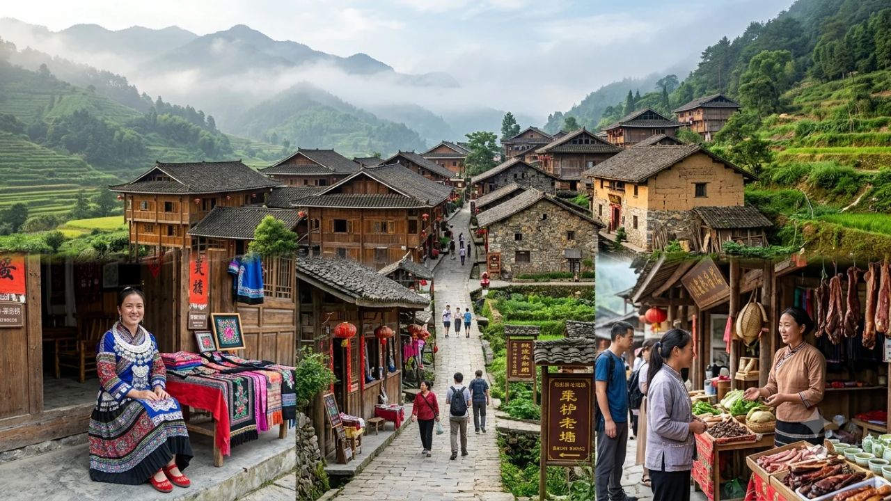
China Drives Rural Tourism Revitalisation: How Shibadong and Simola Wa Village Transform Local Economies Through Cultural Heritage and Cooperatives

U.S. Virgin Islands Earn Dual Industry Accolades: St. Thomas and St. John Secure Fora 2027 Hot List and Porthole Cruise Honours