
Nepal Reopens Langtang Valley and Restores Manaslu Trekking Access as Infrastructure Repairs Clear Autumn Routes While Tsum Valley Remains Closed
TAAN confirms Langtang, Kyanjin, and Gosaikunda are open following Betrawati Bailey bridge repairs, Manaslu resumes partial access, and Tsum Valley remains closed.

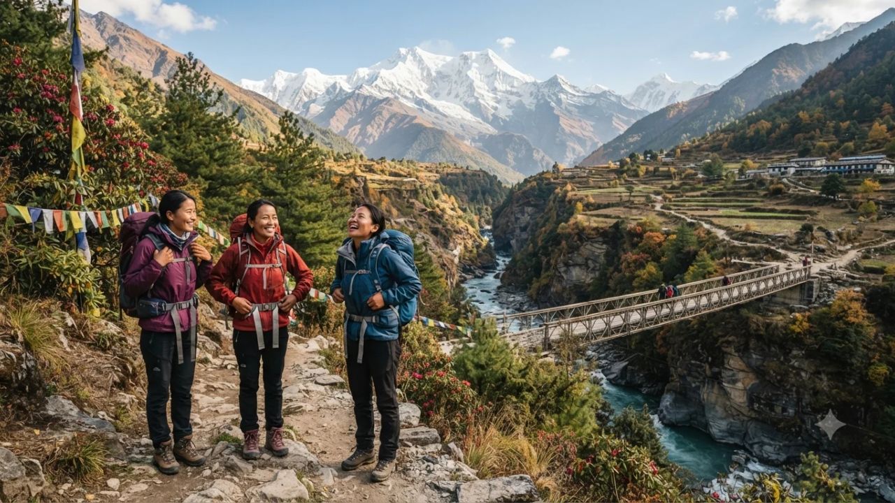
Image generated by AI
Nepal's Langtang Valley, Kyanjin, and Gosaikunda trekking routes have officially reopened for the autumn season following the installation of a Bailey bridge at Betrawati, while the Manaslu Larke Pass corridor has resumed partial operations and Tsum Valley remains closed due to a collapsed cantilever bridge. According to a comprehensive safety advisory issued by the Trekking Agencies Association of Nepal (TAAN) on 22 October 2026, overland access to Rasuwa district and vehicular links to Machhakhola have restored connectivity across the central Himalayas after severe monsoon flooding.
The infrastructure recovery provides a significant boost for adventure travel operators and international hikers embarking on autumn Himalayan expeditions. Transport links across Rasuwa and northern Gorkha suffered severe damage during late-monsoon flash floods, cutting off key mountain communities and forcing trail closures. With temporary river crossings and pedestrian diversions now in place, mountaineers can navigate designated transit corridors while municipal engineering teams continue rehabilitating damaged bridges.
Langtang Valley Reopening: Betrawati Bailey Bridge Restores Rasuwa Road Corridor
The full reopening of Langtang Valley marks the restoration of one of Nepal's most popular teahouse trekking circuits. The region, situated within Langtang National Park north of the Kathmandu Valley, had faced severe overland transit disruptions following catastrophic flooding along the Bhotekoshi River basin in Rasuwa on 26 August 2026.
Overland vehicular connectivity has been re-established through the rapid assembly of a temporary modular Bailey bridge at Betrawati. This river crossing restores the arterial highway corridor linking Kathmandu with Trishuli, Betrawati, and the primary trekking trailheads at Dhunche and Thulo Syabru.
The opening allows tourist buses, private 4WD jeeps, and supply logistics convoys to access Rasuwa district safely. TAAN has formally certified that the core trekking destinations—including Langtang Village, Kyanjin Gompa, and the high-altitude pilgrimage site at Gosaikunda—are safe, structurally accessible, and equipped to host international visitors.
Dual Transit Approaches: TAAN Outlines Primary Routes to Langtang and Kyanjin
To facilitate expedition planning and distribute trail density, TAAN's updated assessment confirms two distinct trekking approaches for travelers accessing Langtang and Kyanjin:
Option 1: The Classic Trishuli–Betrawati Highway Approach
- Vehicular Route: Kathmandu to Trishuli and Betrawati via the Pasang Lhamu Highway, terminating at Dhunche or Thulo Syabru.
- Trekking Sequence: Thulo Syabru (or Syabrubesi) $\rightarrow$ Bamboo $\rightarrow$ Lama Hotel $\rightarrow$ Langtang Village $\rightarrow$ Kyanjin Gompa.
- Logistical Advantage: Represents the fastest overland route, requiring a single day of driving from Kathmandu followed by three to four days of gradual ascent to Kyanjin Gompa (3,870 meters).
Option 2: The High-Altitude Helambu–Gosaikunda Ridge Approach
- Vehicular Route: Short drive from Kathmandu to Sundarijal trailhead.
- Trekking Sequence: Sundarijal $\rightarrow$ Chisapani $\rightarrow$ Helambu $\rightarrow$ Tharepati $\rightarrow$ Ghopte $\rightarrow$ Gosaikunda Lake (4,380 meters) $\rightarrow$ Thulo Syabru $\rightarrow$ Bamboo $\rightarrow$ Lama Hotel $\rightarrow$ Langtang Village $\rightarrow$ Kyanjin Gompa.
- Logistical Advantage: Provides an extended alpine traverse that bypasses early valley floor roads entirely, offering comprehensive acclimatization before descending to join the Langtang trail at Thulo Syabru.
Both routes converge at Thulo Syabru and continue along the Langtang Khola canyon, where teahouses and trail sections have been inspected and cleared for seasonal operations.
Manaslu Larke Pass Corridor: Partial Reopening and the Yaru Bagar Bypass
The Manaslu Circuit, which encircles the world's eighth-highest peak (Mount Manaslu, 8,163 meters), has resumed restricted trekking operations following intense flash floods along the Budhi Gandaki River on 11 October 2026. The deluge damaged riverbanks, suspension bridges, stone masonry trails, and riverside lodges across northern Gorkha.
Emergency reconstruction campaigns conducted jointly by Dharche Rural Municipality and Chumnuwri Rural Municipality have successfully cleared vehicular access along the river valley up to Machhakhola. From this roadhead, trekkers can commence foot travel through Jagat and Nyak Phedi toward the high crossing at Larke Pass (5,106 meters).
A vital trail modification has been established at Yaru Bagar, where floodwaters completely washed away the original stone path. Local trail crews have engineered a temporary alternative pedestrian diversion that requires approximately 10 minutes of walking along higher ground. TAAN stresses that hikers must strictly follow the signposted detour and avoid navigating damaged lower river ledges.
Tsum Valley Remains Suspended Pending Cantilever Bridge Reconstruction
In contrast to the operational recoveries in Langtang and Manaslu, the remote Tsum Valley trek remains officially closed to all commercial and independent trekking.
The suspension is caused by the structural collapse of a critical cantilever bridge mounted on the sheer rock cliffs along the Shiar Khola gorge. Because the dramatic canyon topography prevents an immediate overland detour, access into Upper and Lower Tsum Valley is physically severed.
Civil engineers and local municipality workers are actively carrying out repairs on the damaged crossing. TAAN has indicated that reopening could become possible within approximately one week, though officials emphasize that this timeline remains strictly provisional. Trekking operators are instructed not to dispatch guided groups toward Tsum Valley until municipal authorities formally certify the crossing as secure.
Regional Trekking Infrastructure Status and Access Parameters
The table below details current operational statuses, transport trailheads, and structural conditions across the central Himalayan circuits as validated by TAAN:
| Trekking Circuit / Region | Operational Status | Key Access Highway / Trailhead | Primary Infrastructure Challenge | Active Transit Advisory |
|---|---|---|---|---|
| Langtang Valley & Kyanjin | Fully Open & Safe | Trishuli–Betrawati road to Dhunche / Thulo Syabru | Bhotekoshi flood damage repaired; Bailey bridge active | Standard teahouse trekking operating normally via Lama Hotel |
| Gosaikunda Pilgrimage Circuit | Fully Open & Safe | Dhunche trailhead or Helambu high traverse | Alpine pass weather volatility; steep rocky terrain | Open via both Dhunche direct ascent and Helambu–Tharepati route |
| Manaslu Larke Pass Circuit | Partially Open (Restricted) | Overland 4WD road to Machhakhola roadhead | Budhi Gandaki flood impact; trail washouts | Open from Machhakhola via Jagat; mandatory 10-minute Yaru Bagar bypass |
| Tsum Valley Cultural Trek | Closed (Suspended) | Diverges from Manaslu route past Jagat / Lokpa | Cantilever bridge collapse along cliff face | Closed; provisional reopening estimated within one week pending repairs |
Traveler Logistics Guide: Permits, Transportation Hubs, and High-Altitude Preparation
Trekkers organizing autumn itineraries across Langtang and Manaslu must incorporate specific transit and safety measures into their planning:
- Kathmandu Overland Transit Staging: For Langtang, shared 4WD jeeps and local express buses depart daily from the Machha Pokhari (New Bus Park / Gongabu) terminal in Kathmandu between 06:00 and 08:00. The 120-kilometer drive to Dhunche or Syabrubesi requires 6 to 8 hours due to winding mountain roads and unpaved sections. For Manaslu, jeeps depart Kathmandu early morning for the 7 to 9-hour journey to Machhakhola via Dhading Besi and Arughat.
- Mandatory Permits and Checkpoints:
- Langtang/Gosaikunda: Requires the Langtang National Park Entry Permit (NPR 3,000 for foreign nationals) and a Trekker's Information Management System (TIMS) card, verified at police checkpoints in Dhunche.
- Manaslu: Requires a Restricted Area Permit (RAP) issued by Nepal Immigration (minimum two trekkers accompanied by a licensed government guide), alongside the Manaslu Conservation Area Project (MCAP) and Annapurna Conservation Area Project (ACAP) permits.
- Navigating Trail Detours: Trekkers on the Manaslu circuit must heed instructions from registered guides at Yaru Bagar. Do not attempt to cross makeshift timber spans over swollen river channels; use the designated 10-minute upland detour. Carry trekking poles for stability on loose scree slopes created by recent landslide clearing.
- Altitude and Acclimatization Discipline: On the Langtang route, maintain a conservative pacing schedule: ascend from Syabrubesi (1,460m) to Lama Hotel (2,470m), then Langtang Village (3,430m), before reaching Kyanjin Gompa (3,870m). Plan an acclimatization rest day in Kyanjin before hiking to Kyanjin Ri (4,773m) or Tserko Ri (4,984m). On the Manaslu Circuit, ensure at least two nights at Samagaon (3,530m) or Samdo (3,860m) prior to crossing Larke Pass (5,106m).
- Communications and Emergency Contingencies: Mountain cell service (Ncell and Nepal Telecom) can be intermittent in narrow river gorges. Trekking parties should carry satellite communicators (such as Garmin inReach) or registered local SIM cards with pre-loaded offline digital mapping applications. Verify that travel insurance specifically covers high-altitude emergency helicopter evacuation up to 5,500 meters without altitude exclusion clauses.
Safety Directives for Adventure Travel Operators
With dynamic mountain weather patterns characterizing the late autumn season, the Trekking Agencies Association of Nepal has directed all affiliated agencies, mountain guides, and independent travelers to adhere strictly to local municipal advisories.
While the reopening of Langtang and partial restoration of Manaslu provide vital economic relief to Himalayan communities, trail conditions remain subject to rapid change. Trekkers planning trips to Manaslu must factor in potential delays around repair zones, while visitors with bookings for Tsum Valley must actively reroute toward Langtang, Manaslu, or the Annapurna foothills until the collapsed cantilever bridge is certified safe for pedestrian traffic.
FAQ: Nepal Himalayan Trekking Reopenings and Trail Updates
Is Langtang Valley open for trekking right now?
Yes. The Trekking Agencies Association of Nepal (TAAN) confirmed that Langtang Valley, Kyanjin Gompa, and Gosaikunda are open and safe for trekking following the installation of the Betrawati Bailey bridge.
How do travelers get to the Langtang trailhead from Kathmandu?
Travelers can drive via the Trishuli–Betrawati highway corridor to Dhunche or Thulo Syabru using regular buses or 4WD jeeps, or take the alternative trekking approach through Sundarijal, Helambu, and Gosaikunda.
What is the current status of the Manaslu Circuit trek?
The Manaslu Larke Pass route is partially open with restrictions. Vehicles can reach Machhakhola, and a temporary 10-minute pedestrian detour has been built to bypass a flood-damaged trail section at Yaru Bagar.
Why is Tsum Valley closed to tourists?
Tsum Valley remains closed due to the collapse of a cantilever bridge along a cliff-edge river crossing. Reconstruction is underway, with a provisional reopening expected within approximately one week.
Related Travel Guides
European and American Trekkers Drive Autumn Tourism Boom Across Nepal’s Kanchenjunga Circuit
Nepal Tourist Arrivals Surge 12.1% in September 2026 Led by 114% Jump in Chinese Visitors
The 10 Best Himalayan Trekking Circuits and Teahouse Routes in Nepal, According to Reddit
Disclaimer
This article is for informational and educational purposes only. It does not constitute legal, financial, or professional advice. While we strive to provide accurate and up-to-date information, travel policies, regulations, and conditions change rapidly. Always verify information with official sources before making travel decisions. Nomad Lawyer makes no representations about the accuracy, reliability, completeness, or suitability of the information provided. Readers should consult qualified professionals for advice specific to their circumstances. The views expressed in this article are those of the author and do not necessarily reflect the views of Nomad Lawyer.
Naina Thakur
Contributor & Travel Specialist
Travel enthusiast and legal writer covering visa regulations, responsible tourism, and cultural journeys across global destinations.
Learn more about our team →