
Mexico Pacific Coast Faces Compounded Cyclone Threats: Hurricane Simon Residuals and Tropical Storm Trudy Menace Resorts

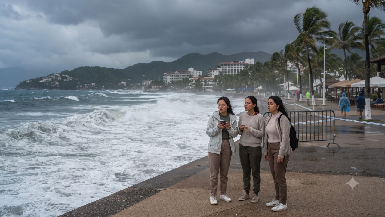
With Category 4 Hurricane Simon unleashing peak wind gusts of 295 kilometers per hour and generating destructive eight-to-ten-meter ocean swells along Jalisco’s coast, Mexico’s Pacific tourism corridor faces compounded maritime volatility as Tropical Storm Trudy churns 600 kilometers south of Acapulco with central atmospheric pressure deepening to 998 millibars. Spanning more than 250 millimeters of forecast 24-hour rainfall accumulations across Colima, Michoacán, and western Jalisco, the successive cyclonic disturbances have prompted heightened emergency alerts across Puerto Vallarta, Manzanillo, and Cabo Corrientes. For international holidaymakers and maritime operators navigating autumn getaways along the western seaboard, distinguishing the physical aftermath of Simon from the forward track of Trudy is essential for managing flight disruptions, hotel shelter protocols, and coastal tour cancellations.
Official technical bulletins released by Mexico's National Water Commission (CONAGUA) and track forecasts from the National Hurricane Center (NHC) indicate that sea surface temperatures in the eastern Pacific continue to foster rapid storm development. While Simon tracked parallel to the central coast before weakening, Trudy’s position 980 kilometers southeast of Manzanillo threatens a secondary wave of torrential precipitation and beach erosion stretching from Guerrero through southern Sinaloa.
Meteorological Evolution: Comparing Simon's Track and Trudy's Development
Understanding the operational threat requires separating two independent weather systems that developed in close succession over identical littoral zones:
- Category 4 Hurricane Simon: At its peak intensity on 10 October, CONAGUA located Simon approximately 185 kilometers south-southwest of Manzanillo, packing sustained winds of 240 km/h and peak gusts of 295 km/h. Earlier at 00:00 local time, the cyclone tracked 225 kilometers south of the port with 220 km/h sustained winds. By 11 October, Simon had shifted to approximately 70 kilometers west of Playa Pérula and 90 kilometers south of Cabo Corrientes, maintaining destructive sustained winds of 215 km/h and gusts of 260 km/h while driving an onshore storm tide of one to two meters.
- Tropical Storm Trudy: Emerging south of the Gulf of Tehuantepec, the NHC positioned Trudy approximately 600 kilometers south of Acapulco on the morning of 14 October, with sustained forward winds of 95 km/h and a central barometric pressure of 998 millibars. Moving northwestward, early forecast discussions indicated potential for the system to intensify into a major hurricane prior to approaching the west-central Mexican coastline.
While Simon produced verified high-velocity wind fields and destructive coastal surf across Jalisco and Colima, Trudy represents a forward forecast threat whose ultimate severity hinges on its steering currents and speed of intensification over subsequent reporting cycles.
Coastal Vulnerability Spectrum Across Western Mexican States
The cyclonic systems generated vastly disparate regional precipitation, wave heights, and structural wind hazards across Mexico's Pacific states. The table below details official government weather measurements and coastal hazards:
| Coastal Entity | Simon Rainfall Projections | Recorded Coastal Winds & Gusts | Peak Wave Heights & Coastal Surges | Primary Tourism Hazard Profile |
|---|---|---|---|---|
| Jalisco (Puerto Vallarta / Pérula) | >250 mm torrential accumulation | 210–230 km/h sustained; gusts to 260 km/h | 8–10 meter waves; rough surf | Beachfront inundation; boat excursion cancellations |
| Colima (Manzanillo Port) | >250 mm (10 Oct); 150–250 mm (11 Oct) | 90–110 km/h sustained; gusts to 130 km/h | 6–8 meter waves; 1–2m storm tide | Commercial port closures; urban roadway flooding |
| Michoacán Coastline | >250 mm concentrated precipitation | 60–80 km/h sustained; gusts to 110 km/h | 4–6 meter breaker swells | Mountain highway washouts; eco-lodge isolation |
| Guerrero (Acapulco Coast) | 75–150 mm regional precipitation | Variable coastal squalls | 2–3 meter swells (Simon); Trudy monitoring | High surf warnings; close monitoring of Trudy's approach |
| Nayarit (Southern Beaches) | 75–150 mm localized rainfall | 100–120 km/h sustained; gusts to 140 km/h | Rough coastal seas; hazardous rip currents | Small-craft navigation bans; surf school shutdowns |
| Sinaloa (Southern Periphery) | 50–75 mm rain bands | Gusty coastal gale bursts | Elevated sea chop; strong shorebreak | Precautionary monitoring for sportfishing fleets |
Sources: Compiled from official CONAGUA meteorological press bulletins, National Meteorological Service (SMN) advisories, and National Hurricane Center public releases.
Regional Hotspots: Puerto Vallarta, Manzanillo, and Playa Pérula
The operational impact across prominent Pacific destinations requires localized assessment:
Puerto Vallarta and Cabo Corrientes
As Jalisco’s primary international resort engine, Puerto Vallarta’s location inside the sheltered Banderas Bay provided partial geographic buffering against direct eyewall winds. However, Simon’s close bypass 90 kilometers south of Cabo Corrientes generated torrential rains exceeding 250 millimeters across the sierra, channeling fast-moving floodwaters down the Cuale and Pitillal rivers. The Protección Civil México network established strict red-flag prohibitions across hotel beaches, barring all recreational swimming and maritime charters.
Manzanillo and Colima's Commercial Port
In Colima, Manzanillo took the brunt of Simon’s Category 4 core passing within 185 kilometers of its harbor. Severe storm tides reaching two meters breached low-lying coastal avenues and forced the temporary suspension of commercial cargo handling and sportfishing charters. While basic infrastructure remained intact, residual beach erosion requires substantial recovery outlays ahead of the winter holiday rush.
Playa Pérula and the Costalegre
The southern Jalisco coastline around Playa Pérula represents a quieter eco-tourism enclave characterized by boutique villas and fishing hamlets. When Simon tracked just 70 kilometers to the west on 11 October, these exposed communities endured sustained tropical-storm-force coastal winds and eight-meter breakers, demonstrating that secondary rural destinations experience longer utility restoration timelines than fortified hotel zones in major cities.
Expert Analysis: Flight Scheduling Buffers, Force Majeure Policies, and Resort Contingencies
The compounding nature of back-to-back tropical systems places severe logistical stress on airlines operating into Puerto Vallarta’s Licenciado Gustavo Díaz Ordaz International Airport (PVR) and Manzanillo’s Playa de Oro International Airport (ZLO). For travelers booking this route, the direct consequence is rolling air traffic delays, ground hold programs initiated during torrential downpours, and frequent aircraft diversions back to Guadalajara or Mexico City when wind shear exceeds operating thresholds.
Simultaneously, the threat of Tropical Storm Trudy intensifying into a major hurricane complicates resort operational planning. The pricing pressure this creates means coastal hoteliers must balance revenue retention against guest safety, often delaying formal invocation of hurricane guarantee policies until official government watches are posted. Independent travelers who booked non-refundable room rates through third-party aggregators face frustrating negotiation hurdles, as corporate hotel policies strictly restrict fee waivers to dates covered by mandatory civil protection evacuation orders.
To mitigate physical risk, international visitors must adhere to safety protocols issued by municipal authorities. Convective rain bands passing over mountainous coastal topography trigger flash flooding and rockslides along Federal Highway 200, the primary vehicular link connecting Puerto Vallarta with the Costalegre and Manzanillo. Vacationers should avoid intercity road transfers during active storm advisories and verify that private charter boats remain berthed until port captains formally lift small-craft navigation bans.
Key Takeaways
- Back-to-Back Cyclone Threats: Category 4 Hurricane Simon produced 295 km/h gusts and 10-meter waves along Jalisco, followed immediately by Tropical Storm Trudy developing south of Acapulco.
- Heavy Rainfall Footprint: CONAGUA recorded 24-hour rainfall projections exceeding 250 millimeters across coastal zones in Jalisco, Colima, and Michoacán.
- Severe Maritime Prohibitions: Port captains across Manzanillo and Puerto Vallarta enforced small-craft sailing bans and red-flag beach closures to protect tourists.
- Forward Uncertainty on Trudy: Positioned 600 kilometers south of Acapulco with 998 millibars central pressure, Trudy carries forecast potential to strengthen toward the mainland.
- Arterial Highway Vulnerabilities: Coastal routes, particularly Federal Highway 200, face elevated risks of mudslides and river washouts during prolonged precipitation events.
FAQ: Mexico Pacific Coast Hurricane Season 2026
What is the current threat from Hurricane Simon and Tropical Storm Trudy?
Hurricane Simon passed parallel to Jalisco and Colima as a Category 4 storm, generating 10-meter waves and heavy rain. Tropical Storm Trudy is currently developing south of Acapulco, with meteorologists monitoring its potential strengthening.
Is Puerto Vallarta safe for tourists during these storms?
Puerto Vallarta remains functional, but municipal civil protection authorities have closed beaches and cancelled boat excursions due to dangerous high surf, river runoff, and intermittent squalls.
How do airlines handle flights to Puerto Vallarta and Manzanillo during hurricanes?
Airlines monitor airport conditions closely. When winds and visibility exceed safety limits, carriers initiate ground stops, divert flights to Guadalajara or Mexico City, and issue flexible change-fee waivers.
Where can travelers find official, verified weather updates for Mexico?
Travelers should consult real-time alerts from the National Hurricane Center at nhc.noaa.gov and Mexico’s National Meteorological Service at smn.conagua.gob.mx.
[Along Mexico's storm-swept Pacific coast, the smartest travel strategy is respecting the ocean's power and letting official weather bulletins dictate your itinerary.]
Related Travel Guides
- US Reissues Uncompromising Level 4 Yemen Travel Warning: Extreme Hostage, DNA, and Socotra Protocols Enforced
- Severe Flooding Paralyzes Rhodes and Aegean Transit: UK Foreign Office Issues Emergency Warning for Stranded Tourists
- Kenya Approves $350M Shareholder Loan for Kenya Airways: Fleet Groundings and Balance-Sheet Restructuring Unfold
Disclaimer
This article is for informational and educational purposes only. It does not constitute legal, financial, or professional advice. While we strive to provide accurate and up-to-date information, travel policies, regulations, and conditions change rapidly. Always verify information with official sources before making travel decisions. Nomad Lawyer makes no representations about the accuracy, reliability, completeness, or suitability of the information provided. Readers should consult qualified professionals for advice specific to their circumstances. The views expressed in this article are those of the author and do not necessarily reflect the views of Nomad Lawyer.
Preeti Gunjan
Contributor & Community Manager
A passionate traveller and community builder. Preeti helps grow the Nomad Lawyer community, fostering engagement and bringing the reader experience to life.
Learn more about our team →