
Mexico Pacific Coast Travel Alert: Hurricane Simon and Tropical Storm Trudy Menace Puerto Vallarta and Manzanillo

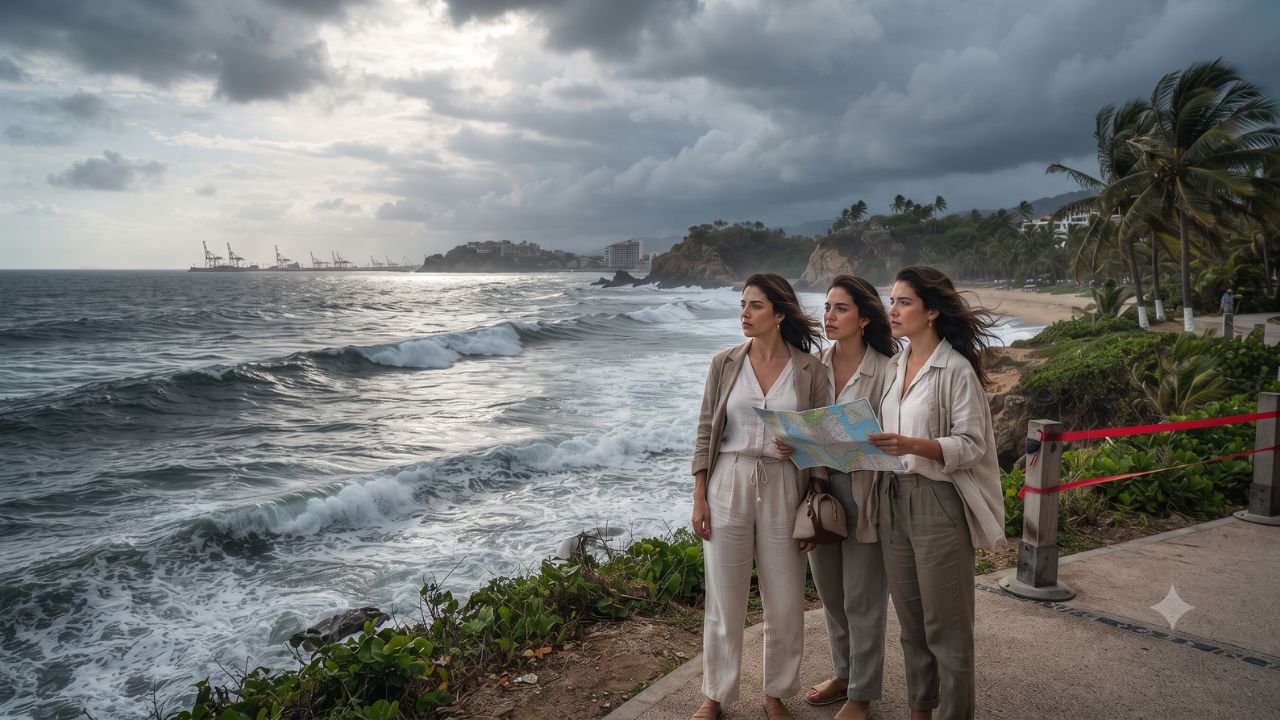
Generating peak gusts of 295 kilometers per hour and triggering towering waves between 8 and 10 meters along the Jalisco coastline, back-to-back tropical systems have placed Mexico's Pacific resort corridor on high operational alert in October 2026. Following Category 4 Hurricane Simon’s close offshore passage—which dumped over 250 millimeters of rainfall across Colima, Michoacán, and southern Jalisco—international travelers now face emerging maritime disruption as Tropical Storm Trudy tracks 600 kilometers south of Acapulco with forecast potential to rapidly intensify into a major hurricane.
Official bulletins released by Mexico's National Water Commission (CONAGUA) and advisories from the National Hurricane Center (NHC) indicate an exceptionally volatile meteorological corridor stretching from Guerrero to Sinaloa. For vacationers bound for Puerto Vallarta, Manzanillo, and surrounding Pacific beaches, the convergence of residual hurricane swells and forward cyclone formation demands rigorous attention to port closures, flight schedules, and civil protection directives.
Atmospheric Dynamics: Category 4 Hurricane Simon and the Genesis of Trudy
The dual weather threat reflects two distinct cyclonic mechanisms operating in close succession over the warm waters of the eastern Pacific Ocean.
The first system, Hurricane Simon, underwent rapid intensification to achieve Category 4 intensity on October 10 and 11. At its peak on the morning of October 10, CONAGUA located the cyclone approximately 185 kilometers south-southwest of Manzanillo, Colima, packing sustained winds of 240 km/h and extreme gusts reaching 295 km/h. Earlier that day at midnight, the storm had churned 225 kilometers south of Manzanillo with sustained winds of 220 km/h and gusts of 270 km/h.
By the afternoon of October 11, Simon tracked approximately 70 kilometers west of Playa Pérula and 90 kilometers south of Cabo Corrientes, moving north-northwest at 9 km/h. Although maximum sustained winds had moderated to 215 km/h with gusts of 260 km/h, the storm remained a destructive Category 3 force parallel to the Jalisco coast, driving extreme coastal winds of 210 to 230 km/h, gusts of 240 to 250 km/h, and torrential rainfall exceeding 250 millimeters.
As Simon weakened, Tropical Storm Trudy materialized further south. In its October 14 morning advisory, the NHC positioned Trudy approximately 600 kilometers south of Acapulco and 980 kilometers southeast of Manzanillo, charting sustained winds of 95 km/h and a central atmospheric pressure of 998 millibars. While no coastal watches or warnings were officially posted on October 14, the NHC’s meteorological discussions emphasized that Trudy could approach southwestern and west-central Mexico as a major hurricane later in the week, creating renewed exposure for destinations recovering from Simon's heavy surf.
Regional Threat Geography: From Puerto Vallarta's Hotel Strip to Acapulco Bay
The physical impact of these storms varies sharply across Mexico's western states, necessitating localized travel evaluations:
In Jalisco, home to Puerto Vallarta's sprawling resort zone, Simon delivered its most dangerous marine threat. CONAGUA elevated wave forecasts from an initial 6 to 8 meters to an extraordinary 8 to 10 meters off the coast of Cabo Corrientes and Playa Pérula. In smaller eco-tourism outposts like Playa Pérula, heavy localized runoff and sea surges threaten unpaved coastal roads, small beachfront palapas, and municipal drainage. While major resorts in Puerto Vallarta feature reinforced concrete structures, beach concessions and private boat tours into Banderas Bay faced immediate suspension.
In Colima, the major cargo and cruise hub of Manzanillo took the initial brunt of Simon's northern quadrant. CONAGUA’s October 10 bulletin forecast over 250 millimeters of rain, sustained coastal winds between 90 and 110 km/h (gusts of 120 to 130 km/h), 6 to 8-meter waves, and a storm tide of 1 to 2 meters above normal sea level. While rainfall projections eased to 150 to 250 millimeters by October 11, harbor authorities halted vessel movements to prevent shoreline grounding.
Further south, Michoacán’s coastline experienced severe precipitation exceeding 250 millimeters on October 10, accompanied by sustained winds of 60 to 80 km/h, gusts of 90 to 110 km/h, and waves of 4 to 6 meters. In steep coastal mountains, excessive rainfall triggers rapid flash flooding and mudslides across secondary highway corridors. In Guerrero, Simon triggered 75 to 150 millimeters of rain and 2 to 3-meter waves, but Acapulco now serves as the primary observation point for Trudy's northward progression.
To the north, southern Nayarit logged 75 to 150 millimeters of forecast rain on October 11 alongside sustained winds of 100 to 120 km/h and gusts of 130 to 140 km/h, impacting boutique surf havens. In southern Sinaloa, rainfall projections of 50 to 75 millimeters brought rough surf to coastal recreation corridors.
Pacific Mexico Cyclonic Threat Matrix: Hurricane Simon and Tropical Storm Trudy Compared
To assist travelers in navigating disparate agency bulletins and timing windows, the following table compares key meteorological metrics and operational travel impacts:
| Meteorological Metric & Indicator | Hurricane Simon (October 10–11 Peak) | Tropical Storm Trudy (October 14 Status) | Operational Impact on Travelers |
|---|---|---|---|
| Peak Storm Classification | Category 4 Hurricane (Saffir-Simpson Scale) | Tropical Storm (Forecast to strengthen) | Simon caused direct damage; Trudy poses forward risk |
| Maximum Sustained Winds | 240 km/h (Oct 10); 215 km/h (Oct 11) | 95 km/h (Oct 14 Morning Advisory) | Structural hazard vs. developing marine disruption |
| Highest Reported Wind Gusts | 295 km/h (Oct 10); 260 km/h (Oct 11) | Not specified in Oct 14 snapshot | Severe damage to outdoor resort infrastructure |
| Minimum Central Pressure | Unspecified comparable single value | 998 millibars (Oct 14 Advisory) | Demonstrates organized cyclonic circulation |
| Closest Approach to Shoreline | 70 km W of Playa Pérula; 90 km S of Cabo Corrientes | 600 km S of Acapulco; 980 km SE of Manzanillo | Simon battered beaches; Trudy tracks in open ocean |
| Peak Coastal Wave Heights | 8 to 10 meters (Jalisco); 6 to 8 meters (Colima) | Swell generation building offshore | All marine excursions, snorkeling, and diving cancelled |
| Extreme Rainfall Projections | >250 mm (Jalisco, Colima, Michoacán) | Heavy rain threat across SW Mexico | Inland highway washouts, urban street flooding |
| Storm Surge & Tidal Inundation | 1 to 2-meter storm tide forecast for Colima | Dependent on future coastal track | Flooding of low-lying coastal roads and boardwalks |
Maritime Safety Protocols: Port Closures, Swell Hazards, and Highway Infrastructure
Federal maritime regulations in Mexico mandate strict operational closures during significant weather events. Administered by local Port Captaincies (Capitanía de Puerto), small vessels—including water taxis, sportfishing charters, and catamaran excursion fleets—are prohibited from leaving harbor whenever waves exceed safe operating thresholds. In Puerto Vallarta and Manzanillo, red flag warning systems restrict swimming across all public beaches to protect tourists from lethal rip currents and heavy shorebreak.
On land, the greatest logistical hazard involves ground transportation. Federal Highway 200 (Carretera Federal 200), the primary coastal artery linking Puerto Vallarta to Manzanillo and coastal Michoacán, traverses rugged mountainous topography susceptible to rockslides, fallen trees, and washed-out bridges following 250-millimeter downpours. Tourists embarking on rental car road trips between resorts face sudden highway closures and extensive detours.
Travelers should coordinate closely with the Secretaría de Turismo de México (SECTUR) and State Civil Protection units, which establish temporary emergency shelters and coordinate transport recovery when cyclonic systems make landfall.
Expert Analysis: Port Captaincy Restrictions, Force Majeure, and Resort Contingency Planning
The sequence of back-to-back Pacific storms exposes the complex contractual mechanisms governing international resort vacations during hurricane season. While travelers frequently assume that severe weather alerts trigger automatic refunds, hospitality and aviation cancellation rights are strictly defined by operational milestones.
For travelers booking this route, the direct consequence is that full flight and hotel refunds are rarely granted until airlines issue formal travel waivers or local civil protection authorities order mandatory hotel evacuations. At Licenciado Gustavo Díaz Ordaz International Airport (PVR) in Puerto Vallarta and Playa de Oro International Airport (ZLO) in Manzanillo, flight cancellations remain at airline discretion unless crosswinds exceed safe operating tolerances or airport infrastructure suffers direct flood damage.
The pricing pressure this creates means that independent travelers who voluntarily cancel reservations prior to official government declarations often forfeit non-refundable deposits, while those forced to extend stays due to grounded flights face unexpected lodging expenses during emergency peak periods. Comprehensive travel insurance policies provide compensation only if common carriers cease operations for a specified duration (typically 24 hours) or accommodations become physically uninhabitable.
Furthermore, tour operators managing catamaran cruises, snorkeling expeditions, and deep-sea fishing charters invoke standard maritime force majeure clauses. While excursion operators routinely issue vouchers for port captaincy closures, land-based dining and hotel bookings remain contractually active unless local infrastructure collapses, requiring visitors to maintain financial contingency reserves.
Key Takeaways
- Severe Dual Weather Threat: Mexico's Pacific coast faces back-to-back disruption from Category 4 Hurricane Simon and developing Tropical Storm Trudy in October 2026.
- Extreme Wind and Wave Peaks: Simon generated sustained winds up to 240 km/h, gusts of 295 km/h, and coastal waves reaching 8 to 10 meters along Jalisco.
- Torrential Rainfall Forecasts: CONAGUA projected rainfall exceeding 250 millimeters across coastal Jalisco, Colima, and Michoacán, creating severe landslide risks on Federal Highway 200.
- Trudy's Advancing Track: Situated 600 kilometers south of Acapulco on October 14 with 95 km/h winds, Trudy poses a forward threat as a potential major hurricane.
- Strict Port Restrictions: Capitanía de Puerto authorities enforce mandatory harbor closures, prohibiting small craft navigation, sportfishing, and beach swimming.
FAQ: Mexico Pacific Coast Hurricane Threats and Travel Safety 2026
Is Puerto Vallarta safe for tourists during these storms?
Puerto Vallarta's modern resort structures provide solid shelter, but ocean swimming, boat tours, and beach activities are suspended during red flag alerts. Visitors should confirm flight statuses and avoid mountain roads during heavy rain.
What coastal hazards did Hurricane Simon produce in Manzanillo?
Hurricane Simon generated winds up to 240 km/h, gusts of 295 km/h, waves of 6 to 8 meters, and a 1 to 2-meter storm tide, alongside rainfall exceeding 250 millimeters.
How does Tropical Storm Trudy threaten Mexico's Pacific resorts?
Trudy is forecast by the NHC to strengthen as it tracks toward southwestern and west-central Mexico, potentially bringing major hurricane winds, heavy surf, and flooding rains to Guerrero, Michoacán, Colima, and Jalisco.
Will airlines refund tickets due to Pacific hurricane alerts?
Airlines issue fee waivers allowing flight date changes without penalty once a storm directly threatens airport operations, but cash refunds are typically granted only if the airline cancels the flight entirely.
[Along the edge of the Pacific, the beauty of the coast is matched only by its power; when the ocean speaks, the only safe strategy is to listen.]
Related Travel Guides
- Breeze Airways Unlocks Tampa to St. Thomas Route: Catalyzing USVI Island-Hopping and Winter Escapes
- US Reissues Level 4 Yemen Travel Warning: Extreme Hostage Protocols Explicitly Encompass Socotra Island
- Virginia Tourism Mobilizes $1.3 Million in Matching Grants to Ignite Off-Season Travel and VA250 Heritage
Disclaimer
This article is for informational and educational purposes only. It does not constitute legal, financial, or professional advice. While we strive to provide accurate and up-to-date information, travel policies, regulations, and conditions change rapidly. Always verify information with official sources before making travel decisions. Nomad Lawyer makes no representations about the accuracy, reliability, completeness, or suitability of the information provided. Readers should consult qualified professionals for advice specific to their circumstances. The views expressed in this article are those of the author and do not necessarily reflect the views of Nomad Lawyer.
Preeti Gunjan
Contributor & Community Manager
A passionate traveller and community builder. Preeti helps grow the Nomad Lawyer community, fostering engagement and bringing the reader experience to life.
Learn more about our team →