
Los Angeles 2028 Olympics Designates 369 Miles of Roads for Dedicated Games Route Network
Caltrans and LA Metro unveil a 369-mile Games Route Network across Southern California, setting priority lanes and transit hubs for the 2028 Olympics.

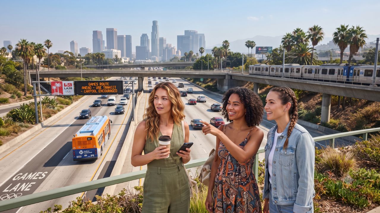
Image generated by AI
Southern California transportation authorities have finalized operational blueprints for a 369-mile Games Route Network across Los Angeles, Orange, and San Diego counties, designating dedicated priority lanes and permit-only corridors to transport athletes and officials during the 2028 Olympic and Paralympic Games.
Unveiled in strategic planning updates on September 5, 2026, the sweeping traffic-management framework engineered by the California Department of Transportation (Caltrans) and the Southern California Association of Governments (SCAG) spans 236 miles of key freeways and 134 miles of major urban arterials. Designed to guarantee predictable transit times between the Olympic Village at UCLA and geographically dispersed competition venues, the specialized road hierarchy will operate under temporary physical and digital controls from June 1 through September 1, 2028, reshaping everyday vehicle movements across the metropolitan region.
The Local Trend Revealed: A Managed Mobility Hierarchy Across Southern California Freeways
Rather than enforcing blanket highway closures across the region's 19 million residents, Caltrans is reallocating existing roadway capacity. Authorities will temporarily convert high-occupancy vehicle (HOV) lanes, express toll lanes, and select general-purpose lanes into dedicated, permit-controlled corridors reserved for accredited Olympic vehicles, official delegations, and high-capacity athlete shuttles.
The network spans Southern California's primary transport arteries, including:
- Los Angeles County Freeways: Interstate 405 (San Diego Freeway), Interstate 5 (Golden State/Santa Ana Freeway), Interstate 10 (Santa Monica/San Bernardino Freeway), Interstate 101 (Hollywood/Ventura Freeway), Interstate 105 (Century Freeway), Interstate 110 (Harbor Freeway), and Interstate 210 (Foothill Freeway).
- Orange and San Diego County Corridors: Routes including I-5, I-405, State Route 55, State Route 57, State Route 73, and State Route 91 in Orange County, extending south along I-5 into San Diego County.
- Urban Surface Arterials: Major local boulevards, led by Sunset Boulevard adjacent to the UCLA campus, which will house thousands of international competitors within the athlete Olympic Village.
To enforce compliance, Caltrans is deploying a distinctive visual language featuring light-blue LA28 overhead signs, digital message boards, and specialized pavement markings emblazoned with "PERMIT ONLY" designations. Unauthorized private motorists straying into restricted Olympic lanes face automated camera enforcement and moving-violation fines approaching $300.
| Network Dimension | Verified Operational Specification |
|---|---|
| Total Route Network | Approximately 369 miles |
| Freeway Component | About 236 miles |
| Surface Street Component | About 134 miles |
| Olympic Competition Window | July 14–30, 2028 |
| Paralympic Competition Window | August 15–27, 2028 |
| Active Traffic Control Window | June 1 to September 1, 2028 |
| Enforcement Penalty | Fines approaching $300 for unauthorized lane access |
| Participating Jurisdictions | Los Angeles, Orange, and San Diego Counties |
Cultural & Environmental Value: Transitioning From Car Dominance to Transit-First Mobility
The LA28 transportation model marks an essential turning point in the cultural evolution of Los Angeles, challenging the city's century-old reputation as an exclusively automobile-dominated metropolis.
With the Los Angeles County Metropolitan Transportation Authority (LA Metro) projecting roughly one million additional trips per day during peak competition days, regional leaders are leveraging the Games to accelerate public transit adoption. Backing this vision is Metro’s $20 billion capital improvement program comprising 28 major infrastructure projects—currently reported as 39 percent completed, 25 percent under construction, and 36 percent in active design.
To absorb spectator demand, Metro is rolling out the Games Enhanced Transit Service (GETS), deploying hundreds of zero-emission shuttle buses to link rail termini, regional park-and-ride facilities, and venue perimeters. This multimodal shift builds on practical experience gained during the 2026 FIFA World Cup, where dedicated Metro express shuttles carried 212,865 passenger rides directly between Los Angeles Stadium and 15 parking hubs across eight tournament matches.
Historical precedent proves Southern California's ability to adapt. During the 1984 Summer Olympics, Los Angeles successfully averted gridlock despite having zero miles of urban passenger rail or bus-only lanes. Today, the metropolitan region boasts an extensive light rail and subway grid alongside nearly 50 miles of dedicated bus-only lanes, supported by $94.3 million in approved federal transit funding and a $163.388 million Caltrans highway technology contract advertised in July 2026.
Visitor Insider Tips: Navigating Los Angeles During the 2028 Games
Spectators and independent tourists visiting Southern California in summer 2028 must adopt a transit-first approach to avoid severe road delays:
- Leave the Rental Car Behind: Navigating restricted corridors like the I-405 or Sunset Boulevard by car will involve severe congestion and expensive venue parking restrictions. Instead, purchase a reusable digital TAP card on your smartphone to access Metro's expanding rail network, including the direct automated people mover link connecting Los Angeles International Airport (LAX) to the regional rail grid.
- Master the Venue Rail Connections: The E Line (Expo) provides direct light-rail connectivity from downtown hotels to Exposition Park (Los Angeles Memorial Coliseum) and the beachside attractions of Santa Monica. The B Line (Red) connects Downtown LA with Hollywood and Universal City, while the newly expanded D Line (Purple) subway will deliver spectators directly beneath Wilshire Boulevard toward Westwood and UCLA.
- Explore Neighborhood Culinary Hubs on Foot: While venue districts will feature temporary security checkpoints, neighboring districts offer world-class independent dining without car hassles. In Westwood, walk along Westwood Boulevard to experience Persian Square’s authentic saffron pistachio ice cream and charcoal-grilled koobideh kabobs. In Downtown LA, visit Grand Central Market for artisan pupusas and Mexican carnitas before walking to the Broad museum.
- Shoulder-Hour Travel Planning: Schedule non-Olympic sightseeing during early morning hours (06:00 to 08:30) or late evenings to avoid peak spectator departure waves. If visiting coastal towns like Malibu or Laguna Beach, utilize scenic coastal highway links during mid-day gaps between morning and evening medal sessions.
- Respect "Permit Only" Blue Signage: If you must drive a personal vehicle, strictly heed the light-blue LA28 overhead gantries. Lane access is continuously monitored by automated license plate recognition cameras; merging into an Olympic lane to pass stopped traffic will result in immediate automated citations.
Tourism Outlook: A Long-Term Urban Mobility Legacy
The implementation of the 369-mile Games Route Network represents more than temporary traffic engineering; it is an active real-time test of modern demand-management technology that will reshape California travel for decades.
Permanent investments in synchronized smart traffic signals, wireless gantry communications, expanded pedestrian greenways, and high-frequency bus corridors will remain functional long after the closing ceremonies conclude. By encouraging millions of domestic and international visitors to navigate Southern California via rail, electric shuttles, and active walking routes, Los Angeles is proving that global mega-events can catalyze sustainable, community-centered urban transport.
Related Travel Guides
Disclaimer
This article is for informational and educational purposes only. It does not constitute legal, financial, or professional advice. While we strive to provide accurate and up-to-date information, travel policies, regulations, and conditions change rapidly. Always verify information with official sources before making travel decisions. Nomad Lawyer makes no representations about the accuracy, reliability, completeness, or suitability of the information provided. Readers should consult qualified professionals for advice specific to their circumstances. The views expressed in this article are those of the author and do not necessarily reflect the views of Nomad Lawyer.
Kunal K Choudhary
Co-Founder & Contributor
A passionate traveller and tech enthusiast. Kunal contributes to the vision and growth of Nomad Lawyer, bringing fresh perspectives and driving the community forward.
Learn more about our team →