
Hurricane Isaias Hits 100 MPH Winds Threatening Gulf Coast Travel Across Florida, Alabama, and Mississippi
Category 2 Hurricane Isaias bears down on the northern Gulf Coast with 100 mph winds, triggering mandatory evacuations, flight cancellations, and emergency declarations across four states.

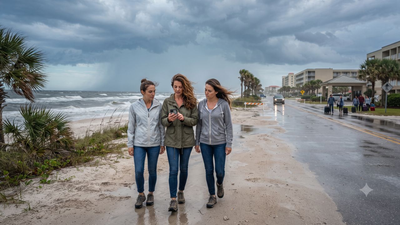
In a year where powerful El Niño wind shear kept the Atlantic basin quiet for months, Hurricane Isaias rapidly strengthened on October 8 to become the season's first major storm near a historical record for the latest hurricane formation. Packing maximum sustained winds of 100 mph as a Category 2 system, the storm is driving life-threatening storm surge, flight cancellations, and mandatory evacuations across premier autumn vacation corridors along the northern United States Gulf Coast.
Positioned approximately 325 miles south of the mouth of the Mississippi River and tracking northeast at 12 mph, the hurricane is forecast to make landfall late Friday, October 9, or early Saturday, October 10, 2026. The official advisory from the National Hurricane Center places the Hurricane Warning from Ocean Springs, Mississippi, eastward to the Bay/Gulf County line in Florida, with storm surge warnings extending west into southeastern Louisiana.
State Emergencies, Coastal Evacuations, and Regional Airport Shutdowns
The impending arrival of Isaias has prompted immediate emergency mobilizations across municipal, county, and state governments:
- Florida Panhandle & Big Bend: Governor Ron DeSantis declared a formal state of emergency spanning 25 counties. Okaloosa County initiated mandatory evacuations for vulnerable low-lying coastal zones on Thursday. Pensacola International Airport (PNS) confirmed the suspension of all commercial flight operations beginning Friday morning, while Destin–Fort Walton Beach Airport (VPS) and surrounding regional airfields enacted severe weather contingency protocols.
- Coastal Alabama: Governor Kay Ivey issued an emergency declaration covering 40 counties. Municipal authorities in Gulf Shores and Orange Beach directed visiting tourists to evacuate beachfront rentals and condominiums. Dauphin Island officials urged immediate departures from exposed areas, particularly across the low-lying western end of the barrier island where bridge links face closure as gale-force winds intensify.
- Mississippi Sound and Louisiana: Coastal communities in Biloxi, Gulfport, Ocean Springs, and Jackson County face extreme inundation risks. In southeastern Louisiana, emergency teams are monitoring levee systems as onshore winds push ocean water into estuaries and bays.
Storm Surge Inundation, Flash Floods, and Interstate 10 Travel Hazards
Meteorologists warn that storm surge remains the most lethal component of Hurricane Isaias. Ocean water is projected to rise 5 to 7 feet above normally dry ground along vulnerable coastal stretches. Heavy tropical rainfall will deliver widespread totals of 3 to 7 inches across the central Gulf Coast, with localized downpours reaching up to 15 inches, creating severe flash flooding and river cresting risks alongside isolated tornadoes.
Ground transportation across the region faces severe disruption along Interstate 10, the primary east-west arterial linking New Orleans, Mobile, and Pensacola. As emergency evacuation traffic peaks, law enforcement and departments of transportation are monitoring causeways and bridges. Motorists are urged to consult live state traffic intelligence through Florida 511, Alabama ALGO Traffic, Mississippi Traffic, and Louisiana 511 before attempting highway travel.
Regional Breakdown: Warnings, Evacuations, and Infrastructure Status
The table below summarizes the operational impact, warnings, and emergency declarations across the threatened Gulf Coast tourism corridor:
| State / Region | Emergency Status & Scope | Evacuation Directives | Critical Infrastructure & Airport Impacts | Primary Storm Threat |
|---|---|---|---|---|
| Florida Panhandle (Okaloosa, Escambia, Santa Rosa) | State of Emergency (25 Counties) | Mandatory for vulnerable coastal strips in Okaloosa County | Pensacola Airport (PNS) flights suspended Friday morning; VPS on standby | 5–7 ft storm surge; 100 mph wind gusts; beach erosion |
| Alabama Coast (Baldwin & Mobile Counties) | State of Emergency (40 Counties) | Evacuations urged in Gulf Shores, Orange Beach & Dauphin Island | Dauphin Island bridge closure risk; Mobile Regional (MOB) flight delays | Severe barrier island flooding; surge inundation on coastal roads |
| Mississippi Coast (Jackson, Harrison, Hancock) | Hurricane Warning (Ocean Springs to FL line) | Voluntary evacuations in low-lying Jackson County coastal zones | Gulfport-Biloxi International (GPT) schedule reductions; power cuts | Prolonged electrical grid failures; 3–7 inches heavy rainfall |
| Southeastern Louisiana | Storm Surge Warning active | Coastal parish emergency teams mobilized | Causeway traffic restrictions; localized canal flooding | Elevated tidal surge; isolated tornado threats along outer bands |
| Interstate 10 Corridor | Regional Travel Alert | Evacuation traffic active across LA, MS, AL, and FL | Bridge closures possible under sustained tropical storm winds | Flash flooding over low-lying highway sections; debris hazards |
Visitor Insider Tips for Emergency Weather Navigation
- Heed Local Evacuation Orders Immediately: If you are staying in a beachfront resort, vacation condo, or rental house in Okaloosa County, Gulf Shores, or Dauphin Island, do not delay departure. When local emergency managers order an evacuation, hospitality staff and emergency services will not be available during peak storm conditions.
- Monitor Bridge Closure Triggers: Coastal drawbridges and causeways across coastal Alabama and the Florida Panhandle automatically lock down once sustained wind speeds exceed 40 to 45 mph. Ensure you cross mainland connectors hours before the outer tropical storm bands arrive.
- Utilize Airline Severe Weather Waivers: Major commercial carriers operating at PNS, VPS, MOB, and GPT have issued flexible travel waivers. Rebook flights out of inland airports such as Atlanta (ATL) or Birmingham (BHM) rather than waiting at shuttered coastal terminals.
- Never Drive Through Standing Water: Turn Around, Don't Drown. Surge water and overflowing drainage canals conceal washed-out pavement and strong undercurrents. Keep emergency supplies, mobile power banks, and physical maps ready if GPS networks fail during power blackouts.
Environmental Vulnerability and Coastal Barrier Island Dynamics
The rapid intensification of Hurricane Isaias underscores the fragile environmental dynamics of the northern Gulf Coast. The region's white-sand barrier islands—including Santa Rosa Island and Dauphin Island—serve as vital natural shock absorbers that blunt storm energy before it reaches mainland cities.
However, repeated hurricane strikes and intense storm surge accelerate beach erosion and compromise maritime dune vegetation that takes decades to recover. Understanding the environmental physics of hurricane strikes highlights why municipal authorities strictly limit access to barrier island highways during major tropical events, protecting human life while allowing delicate coastal ecosystems to absorb ocean energy.
FAQ: Hurricane Isaias Travel Impacts October 2026
When and where is Hurricane Isaias expected to make landfall?
Hurricane Isaias is forecast to make landfall late Friday, October 9, or early Saturday, October 10, 2026, along the northern Gulf Coast between Mississippi and the western Florida Panhandle.
Is Pensacola International Airport open?
Commercial flight operations at Pensacola International Airport (PNS) are suspended beginning Friday morning due to Category 2 hurricane-force winds.
What should tourists in Gulf Shores and Orange Beach do?
Visitors in coastal Alabama should follow local emergency directives, vacate beachfront accommodations, and move inland before barrier island bridges close.
How high is the projected storm surge?
The National Hurricane Center projects seawater will rise 5 to 7 feet above ground level in low-lying coastal zones across the warning area.
In the face of powerful coastal storms, the smartest travel decision is knowing when to yield to the ocean and move to safety.
Related Travel Guides
Disclaimer
This article is for informational and educational purposes only. It does not constitute legal, financial, or professional advice. While we strive to provide accurate and up-to-date information, travel policies, regulations, and conditions change rapidly. Always verify information with official sources before making travel decisions. Nomad Lawyer makes no representations about the accuracy, reliability, completeness, or suitability of the information provided. Readers should consult qualified professionals for advice specific to their circumstances. The views expressed in this article are those of the author and do not necessarily reflect the views of Nomad Lawyer.
Kunal K Choudhary
Co-Founder & Contributor
A passionate traveller and tech enthusiast. Kunal contributes to the vision and growth of Nomad Lawyer, bringing fresh perspectives and driving the community forward.
Learn more about our team →