Haiti Issues Marine Weather Warning as Six-Foot Waves and Thunderstorms Threaten Northern and Coastal Waters

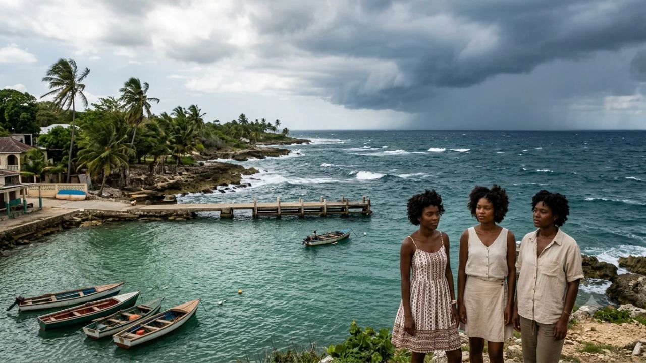
PORT-AU-PRINCE / CAP-HAÏTIEN — Haiti’s National Meteorological Centre has issued urgent marine weather advisories across the country’s maritime jurisdictions, forecasting wave heights reaching up to six feet along the northern coastline, accompanied by squall-force wind gusts, shifting currents, and severe offshore thunderstorms. The meteorological guidance, issued by the Unité Hydrométéorologique d'Haïti (UHM) and extending through November 6, 2026, identifies widespread atmospheric instability sweeping across the Hispaniola landmass and adjacent marine corridors. While the most turbulent conditions are concentrated along the Atlantic-facing northern littoral—encompassing Cap-Haïtien, the Labadee peninsula, and Port-de-Paix—disturbed sea states and localized squalls are also impacting the Gulf of Gonâve and the southern Caribbean coastline, raising immediate safety concerns for artisanal fishermen, inter-island ferry operators, commercial cabotage skippers, and coastal travelers.
The deteriorating marine conditions arrive amid a broader weather pattern characterized by persistent tropical moisture, unseasonably warm sea-surface temperatures, and diurnal orographic uplift that generates intense afternoon and evening thunderstorms across the Grand Sud and Ouest departments. Although the national meteorological bureau has not declared formal port closures or suspended scheduled maritime transport routes, maritime safety specialists caution that four-to-six-foot open-water swells represent a severe operational hazard for Haiti's informal and small-craft fleet. In a nation where maritime cabotage serves as an indispensable lifeline between coastal communities cut off by roadway security challenges, changing sea states compound logistical risks, requiring meticulous journey planning and strict adherence to civil protection directives.
       HAITI REGIONAL MARINE WEATHER & MARITIME RISK ARCHITECTURE (2026)
       ================================================================

       [ NORTHERN LITTORAL: ATLANTIC EXPOSURE ]
       * Locations: Cap-Haïtien, Labadee, Port-de-Paix, Fort-Liberté
       * Marine Parameters: Waves 4–6 Feet (1.2–1.8m) | Winds S to ESE 10–15 kts
       * Hazard: Breaking shoal surf, reduced visibility, squall downbursts
                                       |
                 +---------------------+---------------------+
                 |                                           |
                 v                                           v
       [ GULF OF GONÂVE BASIN ]                    [ SOUTHERN CARIBBEAN COAST ]
       * Locations: Port-au-Prince, Saint-Marc     * Locations: Jacmel, Les Cayes,
       * Waves: 2–4 Feet (0.6–1.2m)                * Waves: 3–5 Feet (0.9–1.5m)
       * Winds: ESE 5–10 kts shifting WNW          * Winds: E to SE 10–15 kts
       * Hazard: Rapid convective thunderstorms     * Hazard: Exposed oceanic chop,
         trapped within semi-enclosed gulf           coastal current shear
                 |                                           |
                 +---------------------+---------------------+
                                       |
                                       v
       [ MARITIME OPERATIONS & COMPOUNDING INFRASTRUCTURE REALITIES ]
       * Cabotage Lifelines: Small wooden chaloupes vulnerable to swamping
       * Search-and-Rescue Constraints: Limited naval patrol & medevac capacity
       * Security Context: Road blockades forcing reliance on maritime bypass
       * Cruise Operations: Labadee private enclave sheltered but monitoring
Meteorological Dynamics: Tropical Instability and Orographic Convection Over Hispaniola
The elevated wave activity and squall lines impacting Haitian waters stem from a complex interaction between synoptic tropical troughing and local topography. In early November, the transition between late-season Atlantic tropical disturbances and early winter atmospheric dynamics frequently sets up stationary moisture convergence zones across the central Caribbean. Elevated sea surface temperatures—hovering near 29°C across the Windward Passage and the Gulf of Gonâve—provide abundant thermal energy and moisture to feed convective storm cells.
As prevailing easterly and southeasterly trade winds push this moist tropical air mass against the rugged terrain of Hispaniola, extreme orographic lifting occurs. The island’s dramatic mountain ranges, including the Massif du Nord in the north and the Massif de la Hotte in the southwest peninsula (rising to elevations over 2,300 meters), act as physical ramps that force humid air upward. When heated by midday solar radiation, this forced ascent triggers rapid condensation and explosive vertical development of cumulonimbus storm clouds.
These massive convective cloud towers generate severe localized downbursts, sudden wind shear, and blinding tropical downpours that spill off the mountainous landmass and push several dozen nautical miles out to sea during late afternoon and evening hours.
HAITI MARINE WEATHER FORECAST: OFFICIAL REGIONAL PARAMETERS
| Entity / Facility | Delays | Cancellations | Details |
|---|---|---|---|
| Coastal Marine Zone | Wind Direction & | Significant Wave | Forecast Sea State & |
| Sustained Speed | Height Profile | Atmospheric Hazard | |
| Northern Coastline | South to East- | 4.0 to 6.0 Feet | Rough offshore seas; |
| (Cap-Haïtien / Nord) | Southeast, 10–15 kt | (1.2 to 1.8 m) | convective squalls and |
| localized downbursts | |||
| Gulf of Gonâve | East-Southeast to | 2.0 to 4.0 Feet | Slightly disturbed seas |
| (Ouest / Artibonite) | West-Northwest, 5–10 | (0.6 to 1.2 m) | afternoon thunderstorms |
| within enclosed basin | |||
| Southern Coastline | East to East- | 3.0 to 5.0 Feet | Moderately rough chop; |
| (Sud / Sud-Est) | Southeast, 10–15 kt | (0.9 to 1.5 m) | heavy Caribbean swells |
| and offshore lightning |
Along the northern coastline, the oceanic environment is shaped by exposure to the open North Atlantic and the narrow bathymetric confines of the Windward Passage separating Haiti from eastern Cuba. South to east-southeast winds blowing across the northern coastal waters at ten to fifteen knots oppose the underlying Atlantic swell trains entering the passage, creating steep, short-period chop. When these opposing wave systems encounter shallow coastal shoals and fringing barrier reefs outside Cap-Haïtien and Fort-Liberté, wave heights compress and amplify, producing unpredictable breaking waves between four and six feet that pose severe navigation challenges for vessels entering or departing coastal harbor mouths.
In contrast, the Gulf of Gonâve operates as a semi-enclosed marine basin sheltered by the northern and southern peninsulas. While forecast wave heights remain lower at two to four feet, the basin experiences complex diurnal wind shifts. Winds initially blowing from the east-southeast at five to ten knots tend to back or veer toward the west-northwest by late afternoon as sea-breeze circulations interact with descending mountain katabatic winds. This directional oscillation creates disorganized cross-chop, while isolated supercell thunderstorms drifting westward from the Plaine du Cul-de-Sac can abruptly drop localized gale-force gusts exceeding thirty knots, transforming calm water into turbulent, white-capped chop within fifteen minutes.
Across the southern coastline, extending from Jacmel westward along the Tiburon Peninsula through Les Cayes and Île-à-Vache, waves are projected to maintain three to five feet with sustained east-to-southeast winds of ten to fifteen knots. The southern coast lacks extensive protective barrier reef systems in many stretches, leaving harbor approaches directly exposed to open Caribbean swell energy that can cause severe surging along concrete jetties and sandy landing ramps.
Maritime Vulnerabilities: The Physics of Small-Craft Swamping in Coastal Waters
While modern steel-hulled merchant vessels and ocean liners navigate four-to-six-foot waves with complete stability, such conditions represent a critical threshold for the artisanal and informal vessels that dominate Haitian coastal transit. The overwhelming majority of maritime traffic between regional villages, fishing settlements, and offshore islands consists of wooden chaloupes (motorized open launches), dugout canoes (pirogues), and retrofitted wooden cargo sloops (bâtiments).
These traditional vessels are constructed with low freeboard—frequently less than fifty to sixty centimeters of vertical clearance between the waterline and the gunwale. When heavily loaded with market produce, charcoal bags, building materials, and standing passengers, their effective reserve buoyancy is severely degraded, and the vessel's center of gravity shifts dangerously upward.
       ARTISANAL VESSEL HYDRODYNAMIC FAILURE MODES IN ROUGH SEAS
       =========================================================

       [ FREEBOARD DEGRADATION: HEAVILY LADEN CABOTAGE CRAFT ]
       Waterline clearance compressed to < 50 cm under cargo/passenger load
                                       |
                                       v
       [ STEEP WAVE ENCOUNTER (4–6 FT SHORT-PERIOD SWELL) ]
       Wave frequency matches hull length ===> Bow plows through crest
       Green water washes over unsealed open gunwale into cargo hold
                                       |
                                       v
       [ FREE-SURFACE EFFECT & INTERNAL FLOODING ]
       Accumulated bilge water sloshes laterally across open deck floor
       Mass shifting amplifies rolling motion ===> Dynamic stability lost
                                       |
                 +---------------------+---------------------+
                 |                                           |
                 v                                           v
       [ COMPLETE SWAMPING / ROLLING ]             [ CAPSIZING & STRUCTURAL FAILURE ]
       Engine flooded; propulsion lost             Vessel rolls on beam ends;
       Hull submerges below waterline              passengers thrown into open water
The hydrodynamic mechanism of swamping in four-to-six-foot seas is driven by short wave periods. In coastal waters where waves are generated by local wind chop rather than deep-ocean long-period swells, the distance between successive wave crests matches or is slightly shorter than the overall length of an eight-to-twelve-meter chaloupe. When navigating against oncoming waves, the bow cannot pitch upward quickly enough to ride over the crest, causing solid "green water" to crash directly over the unsealed open bow into the passenger compartment.
Once water enters an open wooden boat, the dangerous physical phenomenon known as the free-surface effect is immediately initiated. Unlike commercial vessels equipped with watertight transverse bulkheads, traditional cabotage craft possess open, continuous bilges. As the boat rolls in heavy seas, accumulated internal water rushes to the low side of the hull, severely magnifying the listing angle.
Because most artisanal craft rely exclusively on manual bailers or single small electric bilge pumps powered by fragile motorcycle batteries, incoming water rapidly outpaces discharge capacity. The weight of the water drags the gunwales deeper into the sea, extinguishing outboard motors or drowning inboard diesel engines. Deprived of forward steerage, the dead vessel turns broadside into the wave troughs (broaching), where a single succeeding four-foot wave is sufficient to roll the craft on its beam ends and capsize it.
VESSEL CLASS HYDRODYNAMIC RISK MATRIX IN 4–6 FOOT SEAS
| Entity / Facility | Delays | Cancellations | Details |
|---|---|---|---|
| Vessel Category | Typical Freeboard | Primary Failure | Recommended Operational |
| & Construction Type | & Drainage System | Mechanism in Waves | Action Under Advisory |
| Artisanal Pirogues & | Extremely Low | Green water wash | Strictly suspend all |
| Open Wooden Chaloupes | (< 40–50 cm); | over bow; free- | open-water transit; |
| (6–10 meters) | Manual bailing only | surface capsizing | remain inside bays |
| Inter-Island Wooden | Low to Moderate | Cargo shifting; | Restrict passenger |
| Cabotage Sloops | (50–80 cm); Single | broaching in | manifests; delay trips |
| (12–18 meters) | electric pump | breaking harbor surf | until winds moderate |
| Twin-Engine Modern | Moderate | Slamming damage; | Postpone recreational |
| Fiberglass Catamarans | (> 100 cm); Self- | passenger injury | charters; operate only |
| & Center Consoles | bailing deck drains | from severe pitch | with certified skippers |
| Cruise Ships & Large | High (> 600 cm); | Tender operations | Normal operations; |
| Steel Cargo Vessels | Closed watertight | disrupted; slight | suspend tender boat |
| (100+ meters) | bulkheads & pumps | roll on anchorage | disembarkations if rough |
Compounding this hydrodynamic risk is the near-total absence of standardized marine safety equipment aboard informal vessels. Investigations into past maritime incidents in Haitian waters have repeatedly demonstrated that small cabotage craft routinely operate without marine VHF radios, distress flares, satellite emergency position-indicating radio beacons (EPIRBs), or adequate certified life jackets (gilets de sauvetage) for all souls on board. In the event of a sudden swamping, passengers find themselves cast into open waters without flotation, several kilometers offshore, during deteriorating visibility and offshore thunderstorms.
Cruise Enclaves, Commercial Ports, and Tourism Operations
The issuance of marine weather warnings along Haiti's northern coastline naturally draws scrutiny toward the country’s high-profile international tourism gateway: the private resort destination of Labadee. Situated on a protected, mountainous peninsula approximately ten kilometers northwest of Cap-Haïtien, Labadee is leased and operated by Royal Caribbean Group as a private port of call for its international cruise brands, welcoming hundreds of thousands of cruise passengers annually.
From an engineering perspective, modern mega-cruise ships—including Royal Caribbean’s Oasis-class and Icon-class vessels measuring over 360 meters in length—are engineered to handle deep-ocean storm systems and are entirely unaffected by four-to-six-foot coastal waves while underway. In addition, Labadee features a purpose-built deep-water concrete pier that allows ships to dock directly alongside, eliminating the need for tender boats to shuttle passengers ashore across open water. The peninsula’s geographic orientation, nestled beneath the northern ridgeline of the Massif du Nord, provides significant natural shielding against southeasterly wind chop.
       LABADEE CRUISE PENINSULA: SHIELDED VS. EXPOSED MARINE ZONES
       ===========================================================

       [ NORTH ATLANTIC OPEN OCEAN ] ===> 4–6 Ft Swells / SE Winds 10–15 kts
                                       |
                 +---------------------+---------------------+
                 |                                           |
                 v                                           v
       [ EXPOSED OUTER BREAKERS ]                  [ SHELTERED INNER PENINSULA ]
       * Barefoot Beach & Dragon's Rock            * Buccaneer's Bay & Columbus Cove
       * High crashing surf on outer coral shelf   * Deep-water docking pier (No tenders)
       * Offshore watersports: Parasailing,        * Sheltered lagoon swimming; calm
         jet-skis, and speedboats SUSPENDED          inshore water conditions maintained
However, elevated waves and squall activity do impose operational restrictions on shoreside marine excursions within the Labadee enclave. High-energy surf breaking along outer coral reefs frequently forces resort managers to temporarily suspend water-based guest excursions, including coastal catamaran charters, offshore snorkeling tours, parasailing operations, and personal watercraft (jet-ski) rentals. While swimming remains accessible within protected lagoons such as Columbus Cove and Buccaneer's Bay, outer-facing shorelines such as Dragon's Rock and Barefoot Beach experience dangerous shorebreak and rip currents that require enhanced lifeguard vigilance.
Beyond private enclaves, commercial port authorities at Cap-Haïtien, Port-au-Prince, and Miragoâne continue to monitor weather updates without declaring formal harbor suspensions. The Service Maritime et de Navigation d'Haïti (SEMANAH)—the national regulatory agency overseeing maritime safety—routinely distinguishes between cautionary weather advisories and statutory navigation bans (interdictions d'appareiller).
As of the current meteorological cycle, SEMANAH has not issued a blanket prohibition on commercial shipping or scheduled passenger ferry movements. Nevertheless, the absence of a legal ban does not imply that conditions are benign. Port captains and independent skippers bear the legal and professional responsibility to assess local sea states, check barometric pressure trends, and verify that their specific vessel classification can safely navigate the prevailing sea state before authorizing departure.
The Convergence of Meteorological Risk and Geopolitical Security Vulnerabilities
The hazards of four-to-six-foot seas along Haiti’s coast cannot be analyzed in isolation from the country’s broader security and humanitarian environment. Over the past three years, the escalation of civil unrest, gang territorial control, and violent armed conflict has transformed national transportation networks. Armed criminal coalitions have established fortified blockades and checkpoints along key overland highway corridors, notably Route Nationale 1 (connecting Port-au-Prince to Cap-Haïtien and the north) and Route Nationale 2 (connecting the capital through Martissant to the southern peninsula).
Because commercial trucking, public transit buses, and private vehicular traffic on primary roadways face acute risks of armed robbery, vehicle hijacking, and kidnapping for ransom, coastal communities and merchant cooperatives have increasingly turned to the sea as an alternative transit corridor. Small wooden freighters and passenger chaloupes have become vital bypass corridors, transporting food staples, medical supplies, fuel drums, and civilian travelers between coastal enclaves that are otherwise isolated by land.
       HAITI TRANSPORTATION REALITY: THE MARITIME BYPASS DILEMMA
       ========================================================

       [ OVERLAND HIGHWAYS (RN1 & RN2) ]
       * Armed checkpoints & gang territorial control
       * Severe risk of vehicle hijacking, kidnapping & extortion
       * Overland freight and passenger transport frequently paralyzed
                                       |
                                       v
       [ DIVERSION TO COASTAL CABOTAGE ]
       * Merchants & travelers forced onto informal wooden chaloupes
       * Small vessels overloaded with cargo, fuel drums & passengers
                                       |
                                       v
       [ METEOROLOGICAL CONVERGENCE (4–6 FT SEAS & THUNDERSTORMS) ]
       * Overloaded boats encounter rough seas & squalls offshore
       * Extreme risk of swamping, capsizing, and drowning
       * Search-and-Rescue (SAR) capabilities severely compromised
This heavy reliance on coastal cabotage creates a severe humanitarian dilemma whenever marine weather deteriorates. When four-to-six-foot waves and convective squalls sweep the coastline, operators of informal vessels face an agonizing economic choice: postpone journeys and leave perishable food to rot while stranding passengers in vulnerable staging areas, or take to the rough seas in structurally compromised, overloaded craft. Tragically, this economic compulsion to push forward in hazardous weather has repeatedly resulted in catastrophic mass-casualty maritime disasters along the Haitian coastline.
Compounding this vulnerability is the acute limitation of Haiti’s maritime search-and-rescue (SAR) infrastructure. The Haitian Coast Guard (Garde-Côtes d'Haïti), while staffed by courageous personnel, possesses a severely constrained fleet of operational patrol craft, limited aviation support for aerial searches, and inadequate radar surveillance along remote coastlines. Additionally, civilian emergency medical services, trauma treatment facilities, and hyperbaric or medevac resources are virtually nonexistent outside the capital, and even those within Port-au-Prince face catastrophic operational constraints.
In recognition of these overlapping vulnerabilities, international governments maintain rigorous travel warnings. The United States Department of State maintains a Level 4 "Do Not Travel" advisory for Haiti—the highest warning category—citing widespread kidnapping, violent crime, civil unrest, and an inability of the US government to provide emergency consular or evacuation services to citizens outside central Port-au-Prince. Parallel travel warnings are enforced by Global Affairs Canada, the British Foreign, Commonwealth & Development Office (FCDO), and European foreign ministries.
For international travelers, journalists, and humanitarian personnel currently deployed or planning movements within Haiti, the marine weather advisory serves as a stark reminder that environmental hazards directly amplify existing security challenges. An emergency at sea does not merely involve contending with cold water and large waves; it risks stranding survivors along isolated, unpoliced coastal territory where emergency medical extraction is extraordinarily difficult to coordinate.
Actionable Preparedness Protocols for Maritime Operators and Coastal Communities
To navigate the current period of marine instability safely, coastal operators, domestic travelers, and humanitarian logistics coordinators must adopt disciplined operational protocols through November 6:
       MARITIME SAFETY & RISK-MITIGATION PROTOCOLS (HAITI WATERS)
       =========================================================

       [ 1. PRE-DEPARTURE METEOROLOGICAL VERIFICATION ]
       * Monitor UHM daily bulletins (06:00 and 16:00 cycles)
       * Cross-reference with NOAA Marine VHF broadcasts & radar imagery
       * Refuse departure if local squall lines or lightning active within 20 nm
                                       |
                                       v
       [ 2. MANDATORY VESSEL LOAD & FREEBOARD CONTROL ]
       * Enforce minimum 75 cm freeboard clearance under maximum load
       * Ban standing passengers; enforce seated, low-center-of-gravity seating
       * Reject overloaded cargo, loose fuel barrels, or livestock on open decks
                                       |
                                       v
       [ 3. LIFE-SAFETY EQUIPMENT VERIFICATION ]
       * 100% certified life jacket (PFD) compliance BEFORE untying lines
       * Test marine VHF radio on Channel 16; confirm GPS mobile tracking
       * Carry waterproof emergency lighting, bailers, and manual back-up oars
                                       |
                                       v
       [ 4. COASTAL NAVIGATION RESTRICTIONS ]
       * Avoid exposed Atlantic headlands and outer reef passes during ebb tide
       * Establish inland harbor moorings using double-bridle anchor systems
       * Maintain visual contact with coastline; do not attempt night passages
- Verify Official Bulletins Prior to Boarding: Never assume that sunny morning skies indicate a safe maritime passage. Convective instability across Hispaniola typically peaks between 14:00 and 21:00. Consult updated releases from the Unité Hydrométéorologique d'Haïti (UHM) and the Direction de la Protection Civile (DPC). If a planned journey involves small open craft, schedule departures for early morning hours when mountain breezes are gentler and convective clouds have not yet formed.
- Enforce Absolute Vessel Passenger Caps: Boat operators must reject the common practice of overloading vessels to maximize trip revenue. Every passenger must be provided with a certified personal flotation device (PFD) before the craft departs the shoreline. Passengers should refuse to board any craft that displays obvious signs of overloading, hull leakage, structural wood rot, or an absence of functional bailing buckets and emergency oars.
- Avoid Hazardous Shoal Inlets and Reef Openings: Skippers operating along the northern coast around Cap-Haïtien, Port-de-Paix, and the Bay of Fort-Liberté must exercise extreme caution when navigating tidal channels. When a four-to-six-foot Atlantic swell encounters an outgoing ebb tide across a shallow sandbar, wave steepness doubles, producing violent breaking rollers that can flip even experienced crews. Vessels should hold off outside the breaking zone until tidal slack water or divert to deeper, sheltered harbor entrances.
- Prepare Secure Moorings in Protected Coves: Artisanal fishing communities should haul smaller pirogues completely above the high-water spring tide mark, securing hulls to coconut palms or ground anchors. Owners of larger wooden sloops anchored in the Gulf of Gonâve or southern roadsteads should deploy double-bridle anchors with heavy chain leads to prevent anchor dragging when sudden thunderstorm downbursts generate 35-knot offshore wind gusts.
- Establish Redundant Shoreline Communications: Because mobile phone cellular towers along remote Haitian peninsulas frequently suffer from power blackouts, maritime operators should establish a formal trip plan with shore contacts before departure, specifying exact coordinates, planned transit speed, and expected arrival times. If a vessel fails to arrive within two hours of its scheduled window, shore teams can alert local SEMANAH representatives and civil protection volunteers without delay.
The four-to-six-foot wave forecast issued for Haiti’s northern coastline, alongside unsettled seas across the Gulf of Gonâve and the southern coast, highlights the volatile relationship between Caribbean maritime weather and coastal travel. While commercial cruise infrastructure at Labadee remains capable of managing these regional swells, the safety of informal domestic transport and fishing livelihoods depends entirely on operational discipline, respect for meteorological thresholds, and an unwavering commitment to personal maritime safety.
Related Travel Guides
- Kyoto Sagano Romantic Train Enters Final Season as Historic Rolling Stock Retires Ahead of 2027 Modernization
- Global Travel Spending to Hit $1.8 Trillion in 2026 as International Arrivals Reach 1.57 Billion
- Australia and Oceania Shift Regional Tourism and Major Events Into Twilight to Beat Diurnal Heatwaves
- Asia Road Travel Expansion: How Rising Flight Costs Drive Overland Journeys in Vietnam & Thailand
- Texas Cruise Market Shift: Why 76 Percent of Travellers Choose Human Advisors Over Digital Platforms
This article is for informational purposes. Flight routes, passenger regulations, visa rules, and transit advisories are subject to change by airlines and aviation authorities. Readers are advised to verify schedules and travel documentation with relevant carriers and border agencies before departure.
Related Stories
US Embassy Issues Dominican Republic Travel Security Alert Over Dating App Drugging and Robbery Risks
Haiti Marine Weather Alert 2026: Navigating 6-Foot Waves and Storm Risks on Northern Coast